Remer | |
---|---|
Coordinates: 47°3′21″N93°54′50″W / 47.05583°N 93.91389°W | |
Country | United States |
State | Minnesota |
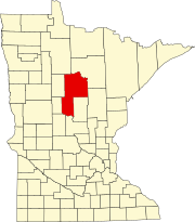
County | Cass |
Area | |
• Total | 1.33 sq mi (3.44 km2) |
• Land | 1.33 sq mi (3.44 km2) |
• Water | 0.00 sq mi (0.00 km2) |
Elevation | 1,342 ft (409 m) |
Population (2020) | |
• Total | 391 |
• Density | 294.21/sq mi (113.62/km2) |
Time zone | UTC-6 (Central (CST)) |
• Summer (DST) | UTC-5 (CDT) |
ZIP code | 56672 |
Area code | 218 |
FIPS code | 27-53782 [2] |
GNIS feature ID | 0658015 [3] |
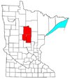
Remer is a city in Cass County, Minnesota, United States. The population was 370 at the 2010 census. [4] It is part of the Brainerd Micropolitan Statistical Area.
Minnesota State Highways 6 and 200 are two of the main arterial routes in the community.
A post office called Remer has been in operation since 1904. [5] The city was named for its first postmaster, William P. Remer. [6]
Remer is also the location of the Thunder Lake Lodge, where Al Capone stayed on his vacations to Minnesota. The room he stayed in was named McCleary Cabin, which was originally built in 1912. [7] In 2009, a motion-activated camera captured a picture of what some consider Bigfoot in an area near Remer. [8]
Late in World War II, a logging camp manned by prisoners of war was at the site of an old CCC camp near Remer. [9]
Up until 1959, the Soo Line provided passenger rail service at Remer station.
The town claims to have had Bigfoot sightings since the late 1800s, and holds a Bigfoot Days celebration each summer. The All Gas No Brakes series released a video documenting the 2020 festival.
According to the United States Census Bureau, the city has an area of 1.38 square miles (3.57 km2), all land. [10] The elevation is 1,342 ft (409 m) above sea level.
Historical population | |||
---|---|---|---|
Census | Pop. | %± | |
1920 | 290 | — | |
1930 | 263 | −9.3% | |
1940 | 407 | 54.8% | |
1950 | 412 | 1.2% | |
1960 | 492 | 19.4% | |
1970 | 403 | −18.1% | |
1980 | 396 | −1.7% | |
1990 | 342 | −13.6% | |
2000 | 372 | 8.8% | |
2010 | 370 | −0.5% | |
2020 | 391 | 5.7% | |
U.S. Decennial Census [11] |
As of the census [12] of 2010, there were 370 people, 175 households, and 95 families living in the city. The population density was 268.1 inhabitants per square mile (103.5/km2). There were 208 housing units at an average density of 150.7 per square mile (58.2/km2). The racial makeup of the city was 96.8% White, 1.9% Native American, and 1.4% from two or more races. Hispanic or Latino of any race were 1.6% of the population.
There were 175 households, of which 25.7% had children under the age of 18 living with them, 34.3% were married couples living together, 17.1% had a female householder with no husband present, 2.9% had a male householder with no wife present, and 45.7% were non-families. 38.9% of all households were made up of individuals, and 18.3% had someone living alone who was 65 years of age or older. The average household size was 2.11 and the average family size was 2.85.
The median age in the city was 43.5 years. 22.2% of residents were under the age of 18; 8.3% were between the ages of 18 and 24; 21.1% were from 25 to 44; 26.5% were from 45 to 64; and 21.9% were 65 years of age or older. The gender makeup of the city was 46.8% male and 53.2% female.
As of the census [2] of 2000, there were 372 people, 178 households, and 95 families living in the city. The population density was 327.8 inhabitants per square mile (126.6/km2). There were 198 housing units at an average density of 174.5 per square mile (67.4/km2). The racial makeup of the city was 95.97% White, 0.27% African American, 2.69% Native American, and 1.08% from two or more races.
There were 178 households, out of which 29.8% had children under the age of 18 living with them, 39.3% were married couples living together, 10.1% had a female householder with no husband present, and 46.6% were non-families. 41.0% of all households were made up of individuals, and 28.1% had someone living alone who was 65 years of age or older. The average household size was 2.09 and the average family size was 2.87.
In the city, the population was spread out, with 25.5% under the age of 18, 5.9% from 18 to 24, 19.4% from 25 to 44, 26.3% from 45 to 64, and 22.8% who were 65 or older. The median age was 44. For every 100 females, there were 83.3 males. For every 100 females age 18 and over, there were 84.7 males.
The median income for a household in the city was $19,583, and the median income for a family was $27,500. Males had a median income of $28,000 versus $20,536 for females. The per capita income for the city was $11,674. About 25.9% of families and 34.5% of the population were below the poverty line, including 52.9% of those under age 18 and 22.2% of those age 65 or over.
As of 2007, Remer claimed to have the world's largest eagle statue. [13]
Moran is a city in Allen County, Kansas, United States. As of the 2020 census, the population of the city was 466.
Hamlin is a city in Brown County, Kansas, United States. As of the 2020 census, the population of the city was 25.
Inguadona Township is a township in Cass County, Minnesota, United States. The population was 190 as of the 2000 census. Inguadona is a name probably derived from an unidentified Native American language.
Lima Township is a township in Cass County, Minnesota, United States. The population was 111 as of the 2000 census. Lima Township was probably named after Lima, Ohio.
Remer Township is a township in Cass County, Minnesota, United States. The population was 183 as of the 2000 census. Remer Township was named for two brothers, E. N. and William P. Remer.
Rogers Township is a township in Cass County, Minnesota, United States. The population was 43 as of the 2000 census. Rogers Township was named for William A. Rogers, an early settler.
Slater Township is a township in Cass County, Minnesota, United States. The population was 249 as of the 2000 census. Slater Township was named for David H. Slater, a farmer who settled there.
Trelipe Township is a township in Cass County, Minnesota, United States. The population was 174 as of the 2000 census. Trelipe Township was named for the freshwater fish Coregonus artedi, commonly known as the tullibee.
Lilydale is a city in Dakota County, Minnesota, United States. The population was 623 at the 2010 census.
Alden is a city in Freeborn County, Minnesota, United States. The population was 661 at the 2010 census.
Calumet is a city in Itasca County, Minnesota, United States. The population was 367 at the 2010 census.
Hillman is a city in Morrison County, Minnesota, United States. The population was 23 at the 2020 census.
Bluffton is a city in Otter Tail County, Minnesota, United States, along the Leaf River. The population was 210 at the 2020 census.
Finlayson is a city in Pine County, Minnesota, United States. The population was 315 at the 2010 census. The city's area was incorporated from Finlayson Township, the remainder of which is still adjacent to it.
Orr is a city in Saint Louis County, Minnesota, United States. The population was 211 at the 2020 census.
Minnesota City is a city in Winona County, Minnesota, United States. The population was 202 at the 2020 census.
Rollingstone is a city in Winona County, Minnesota, United States. The population was 664 at the 2010 census.
Genola is a city in Morrison County, Minnesota, United States. The population was 70 at the 2020 census.
Minnesota Lake is a city in Blue Earth and Faribault counties in the State of Minnesota. The population was 661 at the 2020 census. The bulk of the city is in Faribault County; a small part extends into Blue Earth County.
North Mankato is a city in Nicollet and Blue Earth counties in the State of Minnesota. The population was 14,275 at the 2020 census.