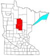
Crosslake, Minnesota

Last updated

Crosslake
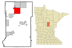
Crow Wing County Minnesota Incorporated and Unincorporated areas Crosslake Highlighted.svg
Location of Crosslake
within Crow Wing County, Minnesota
Coordinates: 46°40′14″N94°6′25″W / 46.67056°N 94.10694°W / 46.67056; -94.10694
Country United States
State Minnesota
County Crow Wing
Government
   Mayor David Nevin [1]
Area
[2]
  Total36.90 sq mi (95.58 km2)
  Land25.76 sq mi (66.72 km2)
  Water11.14 sq mi (28.86 km2)
Elevation
[3]
1,240 ft (380 m)
Population
 (2020)
  Total2,394
  Density92.93/sq mi (35.88/km2)
Time zone UTC-6 (Central (CST))
  Summer (DST) UTC-5 (CDT)
ZIP code
56442
Area code 218
FIPS code 27-13978 [4]
GNIS feature ID0642486 [3]
Website www.cityofcrosslake.org
Sunset over Daggett Lake in Crosslake, MN. Nfta%25W4NQKa7yCmcdNLHsA.jpg
Sunset over Daggett Lake in Crosslake, MN.

Crosslake is a city in Crow Wing County, Minnesota, United States. The population was 2,141 at the 2010 census. [5] It is part of the Brainerd Micropolitan Statistical Area.

Contents

Geography

According to the United States Census Bureau, the city has a total area of 36.89 square miles (95.54 km2), of which 25.74 square miles (66.67 km2) is land and 11.15 square miles (28.88 km2) is water. [6] Main routes include County Roads 3, 16, 36, 66, and 103.

Crosslake is part of the Brainerd Lakes Area, [7] consisting of nearly 460 lakes within a 25-mile radius of Brainerd.

Climate

Climate data for Crosslake, Minnesota, 1991–2020 normals, extremes 1896present
MonthJanFebMarAprMayJunJulAugSepOctNovDecYear
Record high °F (°C)57
(14)
59
(15)
82
(28)
96
(36)
103
(39)
100
(38)
104
(40)
101
(38)
99
(37)
88
(31)
76
(24)
60
(16)
104
(40)
Mean maximum °F (°C)40.3
(4.6)
44.1
(6.7)
60.0
(15.6)
74.3
(23.5)
84.1
(28.9)
89.0
(31.7)
90.6
(32.6)
89.2
(31.8)
85.0
(29.4)
76.8
(24.9)
57.5
(14.2)
41.7
(5.4)
92.7
(33.7)
Average high °F (°C)18.9
(−7.3)
24.8
(−4.0)
37.9
(3.3)
51.9
(11.1)
65.5
(18.6)
75.1
(23.9)
79.7
(26.5)
77.8
(25.4)
69.2
(20.7)
54.3
(12.4)
37.9
(3.3)
24.2
(−4.3)
51.4
(10.8)
Daily mean °F (°C)9.1
(−12.7)
13.9
(−10.1)
27.2
(−2.7)
40.9
(4.9)
54.5
(12.5)
64.8
(18.2)
69.7
(20.9)
67.5
(19.7)
58.7
(14.8)
45.0
(7.2)
29.9
(−1.2)
16.2
(−8.8)
41.4
(5.2)
Average low °F (°C)−0.8
(−18.2)
3.0
(−16.1)
16.4
(−8.7)
29.8
(−1.2)
43.6
(6.4)
54.4
(12.4)
59.7
(15.4)
57.3
(14.1)
48.1
(8.9)
35.7
(2.1)
21.9
(−5.6)
8.1
(−13.3)
31.4
(−0.3)
Mean minimum °F (°C)−23.5
(−30.8)
−19.3
(−28.5)
−8.0
(−22.2)
15.0
(−9.4)
30.1
(−1.1)
41.6
(5.3)
49.1
(9.5)
47.3
(8.5)
34.0
(1.1)
22.6
(−5.2)
4.6
(−15.2)
−15.3
(−26.3)
−26.2
(−32.3)
Record low °F (°C)−53
(−47)
−51
(−46)
−41
(−41)
−8
(−22)
4
(−16)
24
(−4)
32
(0)
29
(−2)
17
(−8)
0
(−18)
−26
(−32)
−47
(−44)
−53
(−47)
Average precipitation inches (mm)0.77
(20)
0.73
(19)
1.37
(35)
2.10
(53)
3.66
(93)
4.49
(114)
4.30
(109)
3.17
(81)
2.84
(72)
2.88
(73)
1.43
(36)
1.02
(26)
28.76
(731)
Average snowfall inches (cm)7.3
(19)
8.0
(20)
5.9
(15)
3.0
(7.6)
0.1
(0.25)
0.0
(0.0)
0.0
(0.0)
0.0
(0.0)
0.0
(0.0)
1.0
(2.5)
4.1
(10)
9.8
(25)
39.2
(99.35)
Average precipitation days (≥ 0.01 in)6.96.46.87.812.613.511.810.511.510.57.07.1112.4
Average snowy days (≥ 0.1 in)4.74.83.01.20.00.00.00.00.00.33.05.522.5
Source 1: NOAA [8]
Source 2: National Weather Service [9]

History

The area of what is now Crosslake, Minnesota gained traction near the late 1800s, after the construction of the Pine River Dam in 1885. The Logging Industry in upper Minnesota at the time was flourishing, attracting many of the first early residents of Crosslake.

Originally, the area was part of Watertown Township of Cass County. This township was annexed to Crow Wing County in 1887. In 1951, the south half of this township became Crosslake Village with the remainder becoming North Crosslake Village in 1964. They became Crosslake Village in 1972 and the City of Crosslake in 1974.

Demographics

Historical population
CensusPop.Note
1960 165
1970 358117.0%
1980 1,064197.2%
1990 1,1326.4%
2000 1,89367.2%
2010 2,14113.1%
2020 2,39411.8%
U.S. Decennial Census

2010 census

As of the census [10] of 2010, there were 2,141 people, 1,027 households, and 651 families living in the city. The population density was 83.2 inhabitants per square mile (32.1/km2). There were 2,799 housing units at an average density of 108.7 per square mile (42.0/km2). The racial makeup of the city was 98.5% White, 0.3% African American, 0.3% Native American, 0.1% Asian, 0.1% from other races, and 0.7% from two or more races. Hispanic or Latino of any race were 0.2% of the population.

There were 1,027 households, of which 17.1% had children under the age of 18 living with them, 56.9% were married couples living together, 3.6% had a female householder with no husband present, 2.9% had a male householder with no wife present, and 36.6% were non-families. 31.9% of all households were made up of individuals, and 16.6% had someone living alone who was 65 years of age or older. The average household size was 2.08 and the average family size was 2.59.

The median age in the city was 56.1 years. 16.1% of residents were under the age of 18; 3.3% were between the ages of 18 and 24; 15.7% were from 25 to 44; 30.9% were from 45 to 64; and 34% were 65 years of age or older. The gender makeup of the city was 49.9% male and 50.1% female.

2000 census

As of the census [4] of 2000, there were 1,893 people, 899 households, and 623 families living in the city. The population density was 73.8 inhabitants per square mile (28.5/km2). There were 2,477 housing units at an average density of 96.6 per square mile (37.3/km2). The racial makeup of the city was 99.52% White, 0.05% African American, 0.05% Native American, 0.05% Asian, 0.05% from other races, and 0.26% from two or more races. Hispanic or Latino of any race were 0.69% of the population. 29.6% were of German, 19.8% Norwegian, 15.9% Swedish, 5.8% English and 5.0% American ancestry according to Census 2000.

There were 899 households, out of which 15.9% had children under the age of 18 living with them, 64.0% were married couples living together, 3.3% had a female householder with no husband present, and 30.6% were non-families. 27.8% of all households were made up of individuals, and 12.3% had someone living alone who was 65 years of age or older. The average household size was 2.11 and the average family size was 2.52.

In the city, the population was spread out, with 14.7% under the age of 18, 3.1% from 18 to 24, 18.9% from 25 to 44, 32.0% from 45 to 64, and 31.4% who were 65 years of age or older. The median age was 56 years. For every 100 females, there were 102.0 males. For every 100 females age 18 and over, there were 100.9 males.

The median income for a household in the city was $41,125, and the median income for a family was $45,990. Males had a median income of $40,345 versus $23,636 for females. The per capita income for the city was $27,227. About 2.7% of families and 4.5% of the population were below the poverty line, including 7.5% of those under age 18 and 4.8% of those age 65 or over.
Education

Most of Crosslake is in Pequot Lakes Public Schools. Portions are in the Crosby-Ironton Public School District and the Pine River-Backus Public School District. [11] Pequot Lakes High School is the Pequot Lakes district's high school.

Crosslake also has a K-12th Institution, Crosslake Community Schools. [12]

Related Research Articles

<span class="mw-page-title-main">Crow Wing County, Minnesota</span> County in Minnesota, United States

Crow Wing County is a county in the East Central part of the U.S. state of Minnesota. As of the 2020 census, the population was 66,123. Its county seat is Brainerd. The county was formed in 1857, and was organized in 1870.

<span class="mw-page-title-main">East Gull Lake, Minnesota</span> City in Minnesota, United States

East Gull Lake is a city in Cass County, Minnesota, United States. The population was 986 at the 2020 census. The nearest semi-urban area is that of Brainerd and Baxter. It is part of the Brainerd Micropolitan Statistical Area. East Gull Lake is in Central Minnesota's Brainerd Lakes Area and takes its name from the largest lake within its borders, Gull Lake.

<span class="mw-page-title-main">Hackensack, Minnesota</span> City in Minnesota, United States

Hackensack is a city in Cass County, Minnesota, United States. The population was 313 at the 2010 census. It is part of the Brainerd Micropolitan Statistical Area.

<span class="mw-page-title-main">Pine River, Minnesota</span> City in Minnesota, United States

Pine River is a city in Cass County, Minnesota, United States. The population was 911 at the 2020 census. It is part of the Brainerd Micropolitan Statistical Area.

<span class="mw-page-title-main">Baxter, Minnesota</span> City in Minnesota, United States

Baxter is a city in Crow Wing County, Minnesota, United States. The population was 8,612 at the 2020 census. It is part of the Brainerd Micropolitan Statistical Area.

<span class="mw-page-title-main">Brainerd, Minnesota</span> City in Minnesota, United States

Brainerd is a city in Crow Wing County, Minnesota, United States. Its population was 14,395 at the 2020 census. It is the county seat of Crow Wing County. Brainerd straddles the Mississippi River several miles upstream from its confluence with the Crow Wing River, having been founded as a site for a railroad crossing above the confluence. Brainerd is the principal city of the Brainerd Micropolitan Area, a micropolitan area covering Cass and Crow Wing counties and with a combined population of 96,189 at the 2020 census. The city is well known for being the partial setting of the 1996 film Fargo.

<span class="mw-page-title-main">Breezy Point, Minnesota</span> City in Minnesota, United States

Breezy Point is a city in Crow Wing County, Minnesota, United States. It is part of the Brainerd Micropolitan Statistical Area. The population was 2,346 at the 2010 census.

<span class="mw-page-title-main">Crosby, Minnesota</span> City in Minnesota, United States

Crosby is a city in Crow Wing County, Minnesota, United States. The population was 2,386 at the 2010 census. It is part of the Brainerd Micropolitan Statistical Area. Crosby is adjacent to its twin city of Ironton, in the Cuyuna iron range.

<span class="mw-page-title-main">Emily, Minnesota</span> City in Minnesota, United States

Emily is a city in Crow Wing County, Minnesota, United States. The population was 813 at the 2010 census. It is part of the Brainerd Micropolitan Statistical Area.

<span class="mw-page-title-main">Fort Ripley, Minnesota</span> City in Minnesota, United States

Fort Ripley is a city in Crow Wing County, Minnesota, United States, near the confluence of the Mississippi and Nokasippi Rivers. The population was 69 at the 2010 census. It is part of the Brainerd Micropolitan Statistical Area.

<span class="mw-page-title-main">Garrison, Minnesota</span> City in Minnesota, United States

Garrison is a city in Crow Wing County, Minnesota, United States, along Mille Lacs Lake. The population was 210 at the 2010 census. It is part of the Brainerd Micropolitan Statistical Area. U.S. Highway 169 and Minnesota State Highway 18 are the main routes in the community.

<span class="mw-page-title-main">Jenkins, Minnesota</span> City in Minnesota, United States

Jenkins is a city in Crow Wing County, Minnesota, United States. The population was 430 at the 2010 census. It is part of the Brainerd Micropolitan Statistical Area.

<span class="mw-page-title-main">Manhattan Beach, Minnesota</span> City in Minnesota, United States

Manhattan Beach is a small city in Crow Wing County, Minnesota, United States, near Crosslake. The population was 57 at the 2010 census. It is part of the Brainerd Micropolitan Statistical Area.

<span class="mw-page-title-main">Nisswa, Minnesota</span> City in Minnesota, United States

Nisswa is a city in Crow Wing County, Minnesota, United States. The population was 1,971 at the 2010 census. Nisswa is part of the Brainerd Micropolitan Statistical Area, near Gull Lake.

<span class="mw-page-title-main">Pequot Lakes, Minnesota</span> City in Minnesota, United States

Pequot Lakes is a city in Crow Wing County, Minnesota, United States. The population was 2,162 at the 2010 census. It is part of the Brainerd Micropolitan Statistical Area.

<span class="mw-page-title-main">Riverton, Minnesota</span> City in Minnesota, United States

Riverton is a city in Crow Wing County, Minnesota, United States. The population was 117 at the 2010 census. It is part of the Brainerd Micropolitan Statistical Area.

<span class="mw-page-title-main">Hallock, Minnesota</span> City in Minnesota, United States

Hallock is a city in and the county seat of Kittson County, Minnesota, United States. The population was 906 at the 2020 census.

<span class="mw-page-title-main">Bena, Minnesota</span> City in Minnesota, United States

Bena is a city in Cass County, Minnesota, United States. The population was 116 at the 2010 census. It is part of the Brainerd Micropolitan Statistical Area.

<span class="mw-page-title-main">Federal Dam, Minnesota</span> City in Minnesota, United States

Federal Dam is a city in Cass County, Minnesota, United States, near Leech Lake. The population was 110 at the 2010 census. It is part of the Brainerd Micropolitan Statistical Area.

<span class="mw-page-title-main">Fifty Lakes, Minnesota</span> City in Minnesota, United States

Fifty Lakes is a city in Crow Wing County, Minnesota, United States. The population was 387 at the 2010 census. It is part of the Brainerd Micropolitan Statistical Area.

References

  1. "City Officials - City of Crosslake, Minnesota". cityofcrosslake.org. Retrieved January 2, 2020.
  2. "2020 U.S. Gazetteer Files". United States Census Bureau. Retrieved July 24, 2022.
  3. 1 2 U.S. Geological Survey Geographic Names Information System: Crosslake, Minnesota
  4. 1 2 "U.S. Census website". United States Census Bureau . Retrieved January 31, 2008.
  5. "2010 Census Redistricting Data (Public Law 94-171) Summary File". American FactFinder. U.S. Census Bureau, 2010 Census. Retrieved April 23, 2011.[ dead link ]
  6. "US Gazetteer files 2010". United States Census Bureau. Archived from the original on January 12, 2012. Retrieved November 13, 2012.
  7. "Explore Brainerd Lakes – Brainerd, Crosslake, Pequot Lakes" . Retrieved April 24, 2019.
  8. "U.S. Climate Normals Quick Access – Station: Pine RVR Dam, MN". National Oceanic and Atmospheric Administration. Retrieved May 12, 2023.
  9. "NOAA Online Weather Data – NWS Duluth". National Weather Service. Retrieved May 12, 2023.
  10. "U.S. Census website". United States Census Bureau . Retrieved November 13, 2012.
  11. "2020 CENSUS - SCHOOL DISTRICT REFERENCE MAP: Crow Wing County, MN" (PDF). U.S. Census Bureau. Archived (PDF) from the original on July 7, 2021. Retrieved July 7, 2021.
  12. crosslakekids.org Crosslakes Community Schools

Crosslake History