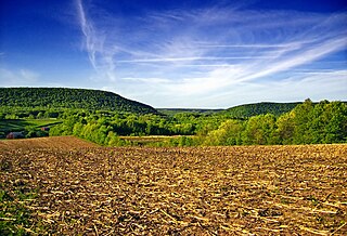
Polkton Charter Township is a charter township of Ottawa County in the U.S. state of Michigan. The population was 2,335 at the 2000 census. It was organized in 1845.

Millington Township is a civil township of Tuscola County in the U.S. state of Michigan. The population was 4,354 as of the 2010 Census. The Village of Millington is located within the township.

Delavan Township is a township in Faribault County, Minnesota, United States. The population was 275 at the 2000 census.

Carpenter Township is a township in Itasca County, Minnesota, United States. The population was 179 at the 2010 census.

Island Lake Township is a township in Mahnomen County, Minnesota, United States. The population was 218 at the 2000 census.

Hale Township is a township in McLeod County, Minnesota, United States. The population was 957 at the 2000 census.

Lafayette Township is a township in Nicollet County, Minnesota, United States. The population was 724 at the 2000 census.

Elmer Township is a township in Pipestone County, Minnesota, United States. The population was 275 at the 2000 census.

Hyde Park Township is a township in Wabasha County, Minnesota, United States. The population was 275 at the 2000 census.

Coopersville is a city located in north central Ottawa County in the U.S. state of Michigan. The population was 4,275 at the 2010 census. It is primarily a farming community.

Upper Yoder Township is a township in Cambria County, Pennsylvania, United States. The population was 5,449 at the 2010 census. It is part of the Johnstown, Pennsylvania Metropolitan Statistical Area.

Howard Township is a township in Centre County, Pennsylvania, United States. It is part of the State College, Pennsylvania Metropolitan Statistical Area. The population was 964 at the 2010 census. Part of Bald Eagle State Park is in Howard Township.

Gulich Township is a township in Clearfield County, Pennsylvania, United States. The population was 1,235 at the 2010 census.

Strasburg Township is a township in south central Lancaster County, Pennsylvania, United States. The population was 4,182 at the 2010 census.

Howe Township is a township in Perry County, Pennsylvania, United States. The population was 393 at the 2010 census.

Barry Township is a township in Schuylkill County, Pennsylvania, United States. Formed in 1822, it is named for American Revolutionary War Commander John Barry and was formed from parts of Norwegian and Schuylkill Townships.

West Mahanoy Township is a township in Schuylkill County, Pennsylvania, United States. The population was 6,166 at the 2000 census.

East Bethlehem Township is a township in Washington County, Pennsylvania, United States. The population was 2,354 at the 2010 census. The township contains the Frederickstown-Millsboro census-designated place.

Robinson Township is a township in Washington County, Pennsylvania, United States. The population was 1,931 at the 2010 census. It was formerly an area of interest concerning coal mining. A portion of the Montour Trail passes through Robinson Township.

Elk Township is a civil township of Lake County in the U.S. state of Michigan. As of the 2000 census, the township population was 900.


