East Gull Lake | |
---|---|
Coordinates: 46°23′49″N94°21′49″W / 46.39694°N 94.36361°W | |
Country | United States |
State | Minnesota |
County | Cass |
Area | |
• Total | 9.86 sq mi (25.55 km2) |
• Land | 7.88 sq mi (20.41 km2) |
• Water | 1.98 sq mi (5.13 km2) |
Elevation | 1,253 ft (382 m) |
Population (2020) | |
• Total | 986 |
• Density | 125.10/sq mi (48.30/km2) |
Time zone | UTC-6 (CST) |
• Summer (DST) | UTC-5 (CDT) |
ZIP code | 56401 |
Area code | 218 |
FIPS code | 27-17630 [2] |
GNIS feature ID | 0643080 [3] |
Website | eastgulllake.govoffice.com |
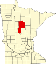
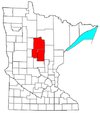
East Gull Lake is a city in Cass County, Minnesota, United States. The population was 986 at the 2020 census. [4] The nearest semi-urban area is that of Brainerd and Baxter. It is part of the Brainerd Micropolitan Statistical Area. East Gull Lake is in Central Minnesota's Brainerd Lakes Area and takes its name from the largest lake within its borders, Gull Lake. [5]
East Gull Lake Airport (FAA code 9Y2 [6] ) is a small two-runway airport. [7]
East Gull Lake was incorporated in 1947. [8]
According to the United States Census Bureau, the city has an area of 14.82 square miles (38.38 km2), of which 7.86 square miles (20.36 km2) is land and 6.96 square miles (18.03 km2) is water. [9] County Roads 18, 70, and 77 are the community's main routes.
Much of the activity in East Gull Lake is tourism, recreation, and vacationing. Residents of Minnesota and Iowa maintain summer homes in the area. Houses on Gull Lake's shores are the most prized and expensive, and have attracted residents such as Kristi Yamaguchi and her husband Bret Hedican. [10] There are several high-end resorts in the city, including Cragun's Resort, Madden's Resort, Kavanaugh's Resort, and Gull Lake Resort. Several of the resorts have golf courses. [11]
The population has greatly increased in recent years, and as of 2008 was more than 2,000 all year.
Census | Pop. | Note | %± |
---|---|---|---|
1940 | 125 | — | |
1950 | 238 | 90.4% | |
1960 | 311 | 30.7% | |
1970 | 440 | 41.5% | |
1980 | 586 | 33.2% | |
1990 | 687 | 17.2% | |
2000 | 978 | 42.4% | |
2010 | 1,004 | 2.7% | |
2020 | 986 | −1.8% | |
U.S. Decennial Census [12] 2020 Census [4] |
As of the census [13] of 2010, there were 1,004 people, 407 households, and 310 families living in the city. The population density was 127.7 inhabitants per square mile (49.3/km2). There were 792 housing units at an average density of 100.8 per square mile (38.9/km2). The racial makeup of the city was 98.6% White, 0.2% Native American, 0.5% Asian, 0.3% from other races, and 0.4% from two or more races. Hispanic or Latino people of any race were 1.8% of the population.
There were 407 households, of which 23.8% had children under the age of 18 living with them, 69.3% were married couples living together, 3.9% had a female householder with no husband present, 2.9% had a male householder with no wife present, and 23.8% were non-families. 18.9% of all households were made up of individuals, and 8.4% had someone living alone who was 65 years of age or older. The average household size was 2.46 and the average family size was 2.78.
The median age in the city was 47.7 years. 21.2% of residents were under the age of 18; 4.4% were between the ages of 18 and 24; 21% were from 25 to 44; 32.7% were from 45 to 64; and 21% were 65 years of age or older. The gender makeup of the city was 53.3% male and 46.7% female.
As of the census [2] of 2000, there were 978 people, 370 households, and 294 families living in the city. The population density was 123.6 people per square meter (47.7/km2). There were 709 housing units at an average density of 89.6 per square mile (34.6/km2). The racial makeup of the city was 98.16% White, 0.31% African American, 0.10% Native American, 0.72% Asian, 0.20% from other races, and 0.51% from two or more races. Hispanic or Latino people of any race were 1.43% of the population.
There were 370 households, out of which 30.3% had children under the age of 18 living with them, 73.2% were married couples living together, 3.0% had a female householder with no husband present, and 20.3% were non-families. 17.6% of all households were made up of individuals, and 6.5% had someone living alone who was 65 years of age or older. The average household size was 2.64 and the average family size was 2.97.
In the city, the population was spread out, with 26.0% under the age of 18, 6.5% from 18 to 24, 26.5% from 25 to 44, 28.1% from 45 to 64, and 12.9% who were 65 years of age or older. The median age was 39 years. For every 100 females, there were 107.2 males. For every 100 females age 18 and over, there were 108.6 males.
The median income for a household in the city was $55,750, and the median income for a family was $62,813. Males had a median income of $40,809 versus $28,750 for females. The per capita income for the city was $27,329. About 6.6% of families and 8.7% of the population were below the poverty line, including 12.0% of those under age 18 and 8.3% of those age 65 or over.
Port Hope Township is a township in Beltrami County, Minnesota, United States. The population was 590 as of the 2000 census.
Taylor Township is a township in Beltrami County, Minnesota, United States. The population was 108 as of the 2000 census.
Hackensack is a city in Cass County, Minnesota, United States. The population was 313 at the 2010 census. It is part of the Brainerd Micropolitan Statistical Area.
Lake Shore is a city in Cass County, Minnesota, United States. The population was 1,056 at the 2020 census. It is part of the Brainerd Micropolitan Statistical Area.
Baxter is a city in Crow Wing County, Minnesota, United States. The population was 8,612 at the 2020 census. It is part of the Brainerd Micropolitan Statistical Area.
Brainerd is a city in Crow Wing County, Minnesota, United States. Its population was 14,395 at the 2020 census. It is the county seat of Crow Wing County. Brainerd straddles the Mississippi River several miles upstream from its confluence with the Crow Wing River, having been founded as a site for a railroad crossing above the confluence. Brainerd is the principal city of the Brainerd Micropolitan Area, a micropolitan area covering Cass and Crow Wing counties and with a combined population of 96,189 at the 2020 census. The city is well known for being the partial setting of the 1996 film Fargo.
Breezy Point is a city in Crow Wing County, Minnesota, United States. It is part of the Brainerd Micropolitan Statistical Area. The population was 2,346 at the 2010 census.
Crosby is a city in Crow Wing County, Minnesota, United States. The population was 2,386 at the 2010 census. It is part of the Brainerd Micropolitan Statistical Area. Crosby is adjacent to its twin city of Ironton, in the Cuyuna iron range.
Crosslake is a city in Crow Wing County, Minnesota, United States. The population was 2,141 at the 2010 census. It is part of the Brainerd Micropolitan Statistical Area.
Emily is a city in Crow Wing County, Minnesota, United States. The population was 813 at the 2010 census. It is part of the Brainerd Micropolitan Statistical Area.
Fort Ripley is a city in Crow Wing County, Minnesota, United States, near the confluence of the Mississippi and Nokasippi Rivers. The population was 69 at the 2010 census. It is part of the Brainerd Micropolitan Statistical Area.
Garrison is a city in Crow Wing County, Minnesota, United States, along Mille Lacs Lake. The population was 210 at the 2010 census. It is part of the Brainerd Micropolitan Statistical Area. U.S. Highway 169 and Minnesota State Highway 18 are the main routes in the community.
Jenkins is a city in Crow Wing County, Minnesota, United States. The population was 430 at the 2010 census. It is part of the Brainerd Micropolitan Statistical Area.
Nisswa is a city in Crow Wing County, Minnesota, United States. The population was 1,971 at the 2010 census. Nisswa is part of the Brainerd Micropolitan Statistical Area, near Gull Lake.
Pequot Lakes is a city in Crow Wing County, Minnesota, United States. The population was 2,162 at the 2010 census. It is part of the Brainerd Micropolitan Statistical Area.
Riverton is a city in Crow Wing County, Minnesota, United States. The population was 117 at the 2010 census. It is part of the Brainerd Micropolitan Statistical Area.
Hallock is a city in and the county seat of Kittson County, Minnesota, United States. The population was 906 at the 2020 census.
Federal Dam is a city in Cass County, Minnesota, United States, near Leech Lake. The population was 110 at the 2010 census. It is part of the Brainerd Micropolitan Statistical Area.
Fifty Lakes is a city in Crow Wing County, Minnesota, United States. The population was 387 at the 2010 census. It is part of the Brainerd Micropolitan Statistical Area.
Dean Lake is an unorganized territory in Crow Wing County, Minnesota, United States. The population was 89 at the 2000 census. It is part of the Brainerd Micropolitan Statistical Area. This territory took its name from Dean Lake.
{{cite web}}
: CS1 maint: archived copy as title (link)