Milton Township is a civil township of Cass County in the U.S. state of Michigan. The population was 3,878 at the 2010 census, up from 2,646 at the 2000 census.

Greenleaf Township is a civil township of Sanilac County in the U.S. state of Michigan. As of the 2000 census, the township population was 804.

Redtop is an unincorporated community in Dallas County, Missouri, United States. It is located west of U.S. Route 65, approximately 9 mi (14 km) south of Buffalo.

Fairbanks is an unincorporated community in Fairbanks Township, Saint Louis County, Minnesota, United States; located within the Superior National Forest.

Cusson is an unincorporated community in Leiding Township, Saint Louis County, Minnesota, United States; located in the Arrowhead Region of Minnesota.

Downer is an unincorporated community in Clay County, Minnesota, United States.

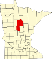
Ryan Village is an unincorporated community in Cass County, Minnesota, United States, within the Bowstring State Forest and the Chippewa National Forest. It is located between Cass Lake and Bena along U.S. Highway 2. The village is within the Leech Lake Indian Reservation.

High Forest is an unincorporated community in High Forest Township, Olmsted County, Minnesota, United States, near Rochester and Stewartville. The community is located near the junction of Olmsted County Roads 6 and 8, and Covill Street SW.

Gheen is an unincorporated community in Gheen Territory, Saint Louis County, Minnesota, United States, located one mile east of Gheen Corner on Willow River Road.

Gotha is an unincorporated community in Carver County, Minnesota, United States. The community lies on the boundary line between Benton Township and Hancock Township. Gotha is located four miles south of Cologne at the junction of Carver County Roads 50 and 53.

Augusta is an unincorporated community in Carver County, Minnesota, United States.

Oshawa is an unincorporated community in Cass County, Minnesota, United States, near Backus. The community is located near the junction of Cass County Road 41 and State Highway 87. Oshawa is located within Bull Moose Township and Deerfield Township. The Badoura State Forest and the Foot Hills State Forest are both nearby.
Cuba is a ghost town in Cass County, in the U.S. state of Minnesota. Cuba was named after the island of Cuba, a location in the Spanish–American War.

Mildred is an unincorporated community in Pine River Township, Cass County, Minnesota, United States, near Pine River and Backus.

Gordonsville is an unincorporated community in Shell Rock Township, Freeborn County, Minnesota, United States. It is southeast of Albert Lea, along U.S. Highway 65.

Farris is an unincorporated community in Hubbard County, in the U.S. state of Minnesota.

Nary is an unincorporated community in Hubbard County, in the U.S. state of Minnesota.

Luce is an unincorporated community in Otter Tail County, in the U.S. state of Minnesota.

Schley is an unincorporated community in Huff Township, Spencer County, in the U.S. state of Indiana.

Raboin is an unincorporated community in Wilkinson Township, Cass County, Minnesota, United States, near Cass Lake and Walker. It is located along State Highway 371 near 134th Street NW.


