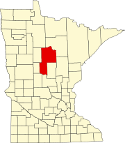
Crow Wing County is a county in the East Central part of the U.S. state of Minnesota. As of the 2020 census, the population was 66,123. Its county seat is Brainerd. The county was formed in 1857, and was organized in 1870.

Cass County is a county in the central part of the U.S. state of Minnesota. As of the 2020 census, the population was 30,066. Its county seat is Walker. The county was formed in 1851, and was organized in 1897.

Bemidji is a city and the county seat of Beltrami County, in northern Minnesota, United States. The population was 14,574 at the 2020 census. According to 2021 census estimates, the city is estimated to have a population of 15,279, making it the largest commercial center between Grand Forks, North Dakota and Duluth.

Cass Lake is a city in Cass County, Minnesota, United States, located within the boundaries of the Leech Lake Indian Reservation. It is surrounded by Pike Bay Township. Cass Lake had a population of 675 in the 2020 census. It is notable as the headquarters location of Minnesota Chippewa Tribe and Leech Lake Band of Ojibwe, as well as the Chippewa National Forest.
Wilkinson Township is a township in Cass County, Minnesota, United States. The population was 270 as of the 2000 census.

Cass Lake is a lake in north central Minnesota in the United States. It is approximately 10 mi (16 km) long and 7 mi (11 km) wide, located in Cass and Beltrami counties, within the Chippewa National Forest and the Leech Lake Indian Reservation, adjacent to its namesake city of Cass Lake. It is the 11th largest lake in Minnesota, and the 8th largest lake lying entirely within the borders of the state.

The Leech Lake Reservation is an Indian reservation located in the north-central Minnesota counties of Cass, Itasca, Beltrami, and Hubbard. The reservation forms the land base for the federally recognized Leech Lake Band of Ojibwe, one of six bands comprising the Minnesota Chippewa Tribe, organized in 1934. The Leech Lake Reservation has the second highest population of any reservation in Minnesota with White Earth Nation being the largest Minnesota Ojibwe tribe, Leech Lake Nation has a resident population of 11,388 indicated by the 2020 census.

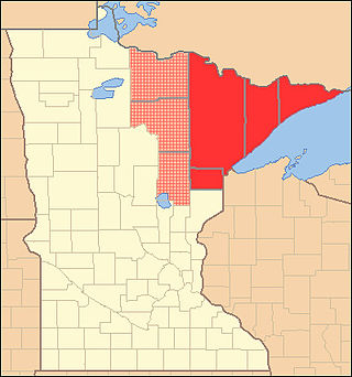
The Arrowhead Region is located in the northeastern part of the U.S. state of Minnesota, so called because of its pointed shape. The predominantly rural region encompasses 10,635.26 square miles (27,545.2 km2) of land area and includes Carlton, Cook, Lake and Saint Louis counties. Its population at the 2000 census was 248,425 residents. The region is loosely defined, and Aitkin, Itasca, and Koochiching counties are sometimes considered as part of the region, increasing the land area to 18,221.97 square miles (47,194.7 km2) and the population to 322,073 residents. Primary industries in the region include tourism and iron mining.

Savanna Portage State Park is a state park of Minnesota, USA, established in 1961 to preserve the historic Savanna Portage, a difficult 6-mile (9.7 km) trail connecting the watersheds of the Mississippi River and Lake Superior. The portage trail crosses a drainage divide separating the West Savanna River, which drains to the Mississippi River and the Gulf of Mexico, from the East Savanna River, which flows in an opposite direction to the Saint Louis River, Lake Superior and the Great Lakes, and the Saint Lawrence River to the Atlantic Ocean.

Chippewa National Forest is a National Forest located in north central Minnesota, United States, in the counties of Itasca, Cass and Beltrami. Forest headquarters are located in Cass Lake, Minnesota. There are local ranger district offices in Blackduck, Deer River and Walker.
Lake Windigo is a small lake on Star Island in northern Minnesota, United States. The lake covers a total of 199 acres and reaches a maximum depth of 25 feet (7.6 m). The littoral zone is 129 acres. Due to its shallow depth and subsequent abundant plant and algae growth, water clarity extends 6 feet (1.8 m). The lake hosts small populations of northern pike and walleye and large communities of panfish. Access to Lake Windigo is by a short portage from Cass Lake on the north side of the island. The lake is best navigated by canoe, rowboat, or other small watercraft.
Outing is an unincorporated community in Crooked Lake Township, Cass County, Minnesota, United States, near Emily. It is between North Roosevelt Lake, South Roosevelt Lake, and Lawrence Lake.
Pine Point Research Natural Area is a natural area that is protected by the United States Department of Agriculture, specifically through the branch of the Forest Service. It was established in 1932 and consists of 1,375 acres (5.56 km2) of land. It is located in Cass County, Minnesota and is part of the Chippewa National Forest. The natural area is bounded on the north, east, and west sides by Lake Leech. To the south is Onigum, an unincorporated community that had been an Indian agency.
The Battleground State Forest is a state forest located near Gould Township in Cass County, Minnesota. It is managed by the Minnesota Department of Natural Resources. It lies entirely within the boundaries of the Chippewa National Forest, additionally, and a portion of the forest falls within the borders of the Leech Lake Indian Reservation.
The Bowstring State Forest is a state forest located in Itasca and Cass Counties in Minnesota. It is located entirely within the boundaries of the federally managed Chippewa National Forest, and is managed by the Minnesota Department of Natural Resources.
The Land o' Lakes State Forest is a state forest located primarily in Cass County, Minnesota, with portions extending into adjacent Aitkin and Crow Wing counties. The forest has small shared borders with the Chippewa National Forest to the north, and the Hill River State Forest to east. Over half of the forest's land is managed by the Minnesota Department of Natural Resources; the remaining land is managed by Cass County or is privately held.
Onigum is an unincorporated community in Shingobee Township, Cass County, Minnesota, United States, near Walker, along Cass County Road 13. The name Onigum means "portage" in the Ojibwe language.
Oshawa is an unincorporated community in Cass County, Minnesota, United States, near Backus. The community is located near the junction of Cass County Road 41 and State Highway 87. Oshawa is located within Bull Moose Township and Deerfield Township. The Badoura State Forest and the Foot Hills State Forest are both nearby.
Schley is an unincorporated community in Cass County, Minnesota, United States, within the Bowstring State Forest and the Chippewa National Forest. It is located between Cass Lake and Bena along U.S. Highway 2 near Forest Road 2958.

The Northern Lakes and Forests are an ecoregion in northern Minnesota, northern Wisconsin, and northern Michigan in the United States. It is a Level III ecoregion in the United States Environmental Protection Agency's (EPA's) classification system, where it is designated as ecoregion number 50. The ecoregion is characterized by coniferous and northern hardwoods forests, morainal hills, large lake basins, and broad areas of sandy outwash plains, with numerous lakes and wetlands. The Northern Lakes and Forests are less well-suited to agriculture than ecoregions to the south, owing to shorter growing seasons, lower temperatures, and soils formed mainly from nutrient-poor sandy and loamy glacial drift material.


