Buckman, Minnesota | |
---|---|
Coordinates: 45°53′50″N94°05′38″W / 45.89722°N 94.09389°W | |
Country | United States |
State | Minnesota |
County | Morrison |
Area | |
• Total | 1.01 sq mi (2.62 km2) |
• Land | 1.01 sq mi (2.62 km2) |
• Water | 0.00 sq mi (0.00 km2) |
Elevation | 1,221 ft (372 m) |
Population | |
• Total | 307 |
• Density | 303.06/sq mi (117.03/km2) |
Time zone | UTC-6 (Central (CST)) |
• Summer (DST) | UTC-5 (CDT) |
ZIP code | 56317 (P.O. boxes only) 56364 (Pierz) |
Area code | 320 |
FIPS code | 27-08416 [4] |
GNIS feature ID | 2393450 [2] |
Buckman is a city in Morrison County, Minnesota, United States. The population was 307 at the 2020 Census. [5]
A post office called Buckman was established in 1877. [6] The city was named for Clarence B. Buckman, an early settler and member of the U.S. House of Representatives. [7]
Buckman is in southeastern Morrison County, surrounded by the northern part of Buckman Township. Minnesota State Highway 25 and Morrison County Road 34 are two of the main routes in the community. Highway 25 leads north 7 miles (11 km) to Pierz and southeast 23 miles (37 km) to Foley. County Road 34 (93rd Street) leads west 11 miles (18 km) to U.S. Route 10, which in turn leads 6 miles (10 km) north to Little Falls, the Morrison county seat.
According to the U.S. Census Bureau, the city of Buckman has a total area of 1.01 square miles (2.62 km2), all of it recorded as land. [1] Buckman Creek, a west-flowing tributary of the Platte River, crosses the northern part of the city.
Census | Pop. | Note | %± |
---|---|---|---|
1910 | 137 | — | |
1920 | 227 | 65.7% | |
1930 | 212 | −6.6% | |
1940 | 186 | −12.3% | |
1950 | 173 | −7.0% | |
1960 | 166 | −4.0% | |
1970 | 158 | −4.8% | |
1980 | 171 | 8.2% | |
1990 | 201 | 17.5% | |
2000 | 208 | 3.5% | |
2010 | 270 | 29.8% | |
2020 | 307 | 13.7% | |
U.S. Decennial Census [8] |
As of the census [9] of 2010, there were 270 people, 95 households, and 72 families living in the city. The population density was 264.7 inhabitants per square mile (102.2/km2). There were 105 housing units at an average density of 102.9 per square mile (39.7/km2). The racial makeup of the city was 98.9% White and 1.1% African American. Hispanic or Latino of any race were 2.6% of the population.
There were 95 households, of which 43.2% had children under the age of 18 living with them, 58.9% were married couples living together, 8.4% had a female householder with no husband present, 8.4% had a male householder with no wife present, and 24.2% were non-families. 18.9% of all households were made up of individuals, and 9.5% had someone living alone who was 65 years of age or older. The average household size was 2.84 and the average family size was 3.25.
The median age in the city was 30.3 years. 31.9% of residents were under the age of 18; 7.6% were between the ages of 18 and 24; 36.7% were from 25 to 44; 14.4% were from 45 to 64; and 9.3% were 65 years of age or older. The gender makeup of the city was 50.7% male and 49.3% female.
As of the census [4] of 2000, there were 208 people, 73 households, and 57 families living in the city. The population density was 202.5 inhabitants per square mile (78.2/km2). There were 75 housing units at an average density of 73.0 per square mile (28.2/km2). The racial makeup of the city was 100.00% White.
There were 73 households, out of which 45.2% had children under the age of 18 living with them, 60.3% were married couples living together, 9.6% had a female householder with no husband present, and 21.9% were non-families. 20.5% of all households were made up of individuals, and 12.3% had someone living alone who was 65 years of age or older. The average household size was 2.85 and the average family size was 3.26.
In the city, the population was spread out, with 30.3% under the age of 18, 13.0% from 18 to 24, 30.8% from 25 to 44, 11.1% from 45 to 64, and 14.9% who were 65 years of age or older. The median age was 28 years. For every 100 females, there were 100.0 males. For every 100 females age 18 and over, there were 116.4 males.
The median income for a household in the city was $32,500, and the median income for a family was $44,583. Males had a median income of $27,500 versus $22,857 for females. The per capita income for the city was $13,700. About 3.9% of families and 6.9% of the population were below the poverty line, including 9.1% of those under the age of eighteen and 17.1% of those 65 or over.
Morrison Township is a township in Aitkin County, Minnesota, United States. The population was 200 as of the 2010 census.
Alberta Township is a township in Benton County, Minnesota, United States. The population was 818 as of the 2010 census.
Graham Township is a township in Benton County, Minnesota, United States. The population was 582 as of the 2010 census.
Langola Township is a township in Benton County, Minnesota, United States. The population was 906 as of the 2010 census. Langola Township was organized in 1858.
Sylvan Township is a township in Cass County, Minnesota, United States. The population was 1,965 as of the 2000 census. This township took its name from Sylvan Lake.
Agram Township is a township in Morrison County, Minnesota, United States. The population was 534 at the 2000 census.
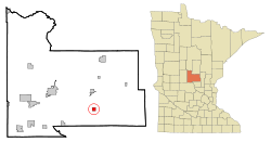
Bowlus ( BOH-ləss is a city in Morrison County, Minnesota, United States. The population was 279 at the 2020 census.
Buckman Township is a township in Morrison County, Minnesota, United States. The population was 717 at the 2000 census.
Cushing Township is a township in Morrison County, Minnesota, United States. The population was 632 at the 2000 census. The unincorporated community of Cushing is located within the township.
Elmdale is a city in Morrison County, Minnesota, United States. The population was 114 at the 2020 census.
Green Prairie Township is a township in Morrison County, Minnesota, United States. The population was 665 at the 2000 census.
Harding is a city in Morrison County, Minnesota, United States, along the Platte River. The population was 123 at the 2020 census.
Hillman is a city in Morrison County, Minnesota, United States. The population was 23 at the 2020 census.
Ripley Township is a township in Morrison County, Minnesota, United States. The population was 692 at the 2000 census.
Swan River Township is a township in Morrison County, Minnesota, United States. The population was 755 at the 2000 census.
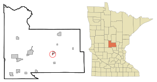
Upsala is a city in Morrison County, Minnesota, United States. The population was 487 at the 2020 census.
Maplewood is a city in Ramsey County, Minnesota, United States. The population was 42,088 at the 2020 census. Maplewood is ten minutes' drive from downtown Saint Paul. It stretches along the northern and eastern borders of Saint Paul.
Genola is a city in Morrison County, Minnesota, United States. The population was 70 at the 2020 census.
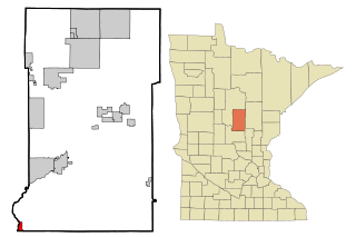
Minnesota Lake is a city in Blue Earth and Faribault counties in the State of Minnesota. The population was 661 at the 2020 census. The bulk of the city is in Faribault County; a small part extends into Blue Earth County.
Motley is a city in Cass and Morrison counties in the U.S. state of Minnesota. The population was 680 at the 2020 census. The main part of Motley is located within Morrison County; only a minor part of the city extends into Cass County