Flensburg, Minnesota

Last updated

Flensburg, Minnesota
Morrison County Minnesota Incorporated and Unincorporated areas Flensburg Highlighted.svg
Location in Morrison County and the state of Minnesota
Coordinates: 45°56′53″N94°31′48″W / 45.94806°N 94.53000°W / 45.94806; -94.53000
CountryUnited States
State Minnesota
County Morrison
PlattedMarch 1890
Incorporated June 17, 1911
Government
   Mayor Jim Gorka
Area
[1]
  Total7.022 sq mi (18.187 km2)
  Land6.979 sq mi (18.077 km2)
  Water0.043 sq mi (0.111 km2)
Elevation
[2]
1,230 ft (375 m)
Population
 (2020) [3]
  Total216
  Estimate 
(2022) [4]
214
  Density30.95/sq mi (11.95/km2)
Time zone UTC–6 (Central (CST))
  Summer (DST) UTC–5 (CDT)
ZIP code
56328
Area code 320
FIPS code 27-21266
GNIS feature ID2394770 [2]
Sales tax 7.375% [5]

Flensburg is a city in Morrison County, Minnesota, United States. The population was 216 at the 2020 census. [3]

Contents

History

After the Little Falls and Dakota Railroad was completed in 1882, there was a sidetrack to a mill at the site which later became Flensburg Village. The mill was called "Flen's Landing" or "Flynn's Siding", with a depot, and named for J. C. Flynn of Little Falls. Flynn was a teacher in the Little Falls schools in the late 1870s. Later, Flynn was an inspector for the Northern Pacific Railroad and a representative in the state legislature. He was also instrumental in developing the Little Falls & Dakota (L.F.& D.) railroad which ran through the future town of Flensburg.

Flensburg was platted in March 1890 by Olaf and Dagmar Searle. The post office began in 1892, and Flensburg was incorporated on June 17, 1911. [6] Flensburg received its name in 1892, and the local newspapers, the Little Falls Weekly Tribune and Little Falls Herald, began using that name about that time. However, a brief item in the April 7, 1893, edition of the Little Falls Transcript states, "The name of Flynn station, on the L.F.& D., has been changed to Flensburg, to take effect on April 1, 1893."[ citation needed ] No further explanation was given.

One theory is that Flensburg may have been named after the German town of Flensburg, a seaport in the German state of Schleswig-Holstein. [7] However, many land owner surnames were Polish in the 1892 Culdrum Township Plat Book of the Flensburg area, and it seems unlikely they would have chosen the name of a distant German seaport for their new town. Since burg simply means "castle" it would be reasonable to name the new town Flynnsburg, or the shorter version Flensburg, since the name "Flen's Landing" was also in use for Flynn Station.[ citation needed ]

Geography

Flensburg is in western Morrison County. It is bordered to the south by Swanville Township, to the north and west by Culdrum Township, to the north and east by Pike Creek Township, and to the southeast by the city of Sobieski. Flensburg is 9 miles (14 km) west-southwest of Little Falls, the Morrison county seat.

According to the United States Census Bureau, Flensburg has a total area of 7.022 square miles (18.19 km2), of which 6.979 square miles (18.08 km2) are land and 0.043 square miles (0.11 km2), or 0.61%, are water. [1] Several small natural lakes, including Prowect Lake, Kuhl Lake, and Larson Lake, are in the southwest part of the city limits.

Demographics

Historical population
CensusPop.Note
1920 210
1930 28435.2%
1940 275−3.2%
1950 2812.2%
1960 280−0.4%
1970 259−7.5%
1980 256−1.2%
1990 213−16.8%
2000 24414.6%
2010 225−7.8%
2020 216−4.0%
2022 (est.)214 [4] −0.9%
U.S. Decennial Census [8]
2020 Census [3]

2010 census

As of the 2010 census, there were 225 people, 84 households, and 53 families living in the city. The population density was 32.3 inhabitants per square mile (12.5/km2). There were 94 housing units at an average density of 13.5 per square mile (5.2/km2). The racial makeup of the city was 97.3% White, 0.4% Native American, 0.4% Asian, and 1.8% from two or more races.

There were 84 households, of which 39.3% had children under the age of 18 living with them, 52.4% were married couples living together, 8.3% had a female householder with no husband present, 2.4% had a male householder with no wife present, and 36.9% were non-families. 33.3% of all households were made up of individuals, and 15.5% had someone living alone who was 65 years of age or older. The average household size was 2.64 and the average family size was 3.43.

The median age in the city was 37.3 years. 29.3% of residents were under the age of 18; 5.8% were between the ages of 18 and 24; 22.6% were from 25 to 44; 24.5% were from 45 to 64; and 17.8% were 65 years of age or older. The gender makeup of the city was 50.2% male and 49.8% female.

2000 census

As of the 2000 census, there were 244 people, 89 households, and 63 families living in the city. The population density was 35.2 inhabitants per square mile (13.6/km2). There were 92 housing units at an average density of 13.3 per square mile (5.1/km2). The racial makeup of the city was 97.95% White, 0.82% Asian, and 1.23% from two or more races.

There were 89 households, out of which 33.7% had children under the age of 18 living with them, 56.2% were married couples living together, 10.1% had a female householder with no husband present, and 28.1% were non-families. 28.1% of all households were made up of individuals, and 15.7% had someone living alone who was 65 years of age or older. The average household size was 2.71 and the average family size was 3.33.

In the city, the population was spread out, with 31.1% under the age of 18, 8.6% from 18 to 24, 23.4% from 25 to 44, 19.7% from 45 to 64, and 17.2% who were 65 years of age or older. The median age was 35 years. For every 100 females, there were 100.0 males. For every 100 females age 18 and over, there were 100.0 males.

The median income for a household in the city was $34,107, and the median income for a family was $43,125. Males had a median income of $28,750 versus $21,750 for females. The per capita income for the city was $15,652. About 4.4% of families and 8.2% of the population were below the poverty line, including 5.2% of those under the age of eighteen and 25.6% of those 65 or over.

Related Research Articles

Ball Bluff Township is a township in Aitkin County, Minnesota, United States. The population was 270 as of the 2020 census. The 2021 population estimate is 274.

Spalding Township is a township in Aitkin County, Minnesota, United States. The population was 329 as of the 2010 census.

<span class="mw-page-title-main">Fort Ripley, Minnesota</span> City in Minnesota, United States

Fort Ripley is a city in Crow Wing County, Minnesota, United States, near the confluence of the Mississippi and Nokasippi Rivers. The population was 69 at the 2010 census. It is part of the Brainerd Micropolitan Statistical Area.

Bellevue Township is a township in Morrison County, Minnesota, United States. The population was 1,115 at the 2000 census.

<span class="mw-page-title-main">Buckman, Minnesota</span> City in Minnesota, United States

Buckman is a city in Morrison County, Minnesota, United States. The population was 307 at the 2020 Census.

Culdrum Township is a township in Morrison County, Minnesota, United States. The population was 505 at the 2000 census.

<span class="mw-page-title-main">Elmdale, Minnesota</span> City in Minnesota, United States

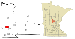
Elmdale is a city in Morrison County, Minnesota, United States. The population was 114 at the 2020 census.

<span class="mw-page-title-main">Harding, Minnesota</span> City in Minnesota, United States

Harding is a city in Morrison County, Minnesota, United States. The population was 123 at the 2020 census.

<span class="mw-page-title-main">Hillman, Minnesota</span> City in Minnesota, United States

Hillman is a city in Morrison County, Minnesota, United States. The population was 23 at the 2020 census.
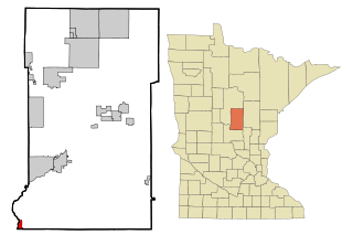
Little Falls Township is a township in Morrison County, Minnesota, United States. The population was 1,624 at the 2000 census.

<span class="mw-page-title-main">Sobieski, Minnesota</span> City in Minnesota, United States

Sobieski is a city in Morrison County, Minnesota, United States. The population was 210 at the 2020 census.

<span class="mw-page-title-main">Swanville, Minnesota</span> City in Minnesota, United States

Swanville is a city in Morrison County, Minnesota, United States. A very small portion of the city extends into Todd County. The population was 326 at the 2020 census.

<span class="mw-page-title-main">Two Rivers Township, Morrison County, Minnesota</span> Township in Minnesota, United States

Two Rivers Township is a township in Morrison County, Minnesota, United States. The population was 780 at the 2020 census.

<span class="mw-page-title-main">Upsala, Minnesota</span> City in Minnesota, United States

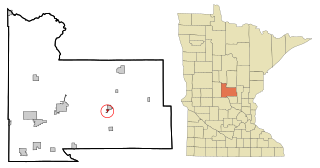
Upsala is a city in Morrison County, Minnesota, United States. The population was 487 at the 2020 census, up from 427 in 2010.

<span class="mw-page-title-main">Chippewa Falls Township, Pope County, Minnesota</span> Township in Minnesota, United States

Chippewa Falls Township is a township in Pope County, Minnesota, United States. The population was 231 at the 2000 census. It includes the unincorporated community of Terrace, Minnesota.

<span class="mw-page-title-main">Delhi Township, Redwood County, Minnesota</span> Township in Minnesota, United States

Delhi Township is one of the twenty-six townships of Redwood County, Minnesota, United States. The population was 298 at the 2000 census.

<span class="mw-page-title-main">Redwood Falls Township, Redwood County, Minnesota</span> Township in Minnesota, United States

Redwood Falls Township is one of the twenty-six townships of Redwood County, Minnesota, United States. The population was 256 at the 2000 census.

Little Elk Township is a township in Todd County, Minnesota, United States. The population was 340 at the 2000 census and was 266 at the time of the 2020 Census.

<span class="mw-page-title-main">Genola, Minnesota</span> City in Minnesota, United States

Genola is a city in Morrison County, Minnesota, United States. The population was 70 at the 2020 census.

<span class="mw-page-title-main">Motley, Minnesota</span> City in Minnesota, United States

Motley is a city in Morrison and Cass counties in the U.S. state of Minnesota. The population was 680 at the 2020 census. The main part of Motley is located within Morrison County; only a minor part of the city extends into Cass County.

References

  1. 1 2 "2023 U.S. Gazetteer Files". United States Census Bureau. Retrieved January 30, 2024.
  2. 1 2 U.S. Geological Survey Geographic Names Information System: Flensburg, Minnesota
  3. 1 2 3 "Explore Census Data". United States Census Bureau . Retrieved April 10, 2024.
  4. 1 2 "City and Town Population Totals: 2020–2022". United States Census Bureau. April 10, 2024. Retrieved April 10, 2024.
  5. "Flensburg (MN) sales tax rate" . Retrieved April 10, 2024.
  6. "Minnesota Placenames - Township and Village Information". Minnesota Historical Society. Archived from the original on August 22, 2011. Retrieved April 20, 2011.
  7. Upham, Warren (1920). Minnesota Geographic Names: Their Origin and Historic Significance. Minnesota Historical Society. p.  352.
  8. "Census of Population and Housing". United States Census Bureau. Retrieved June 4, 2015.