Royalton, Minnesota

Last updated

Royalton, Minnesota
Royalton, Minnesota.jpg
Downtown Royalton
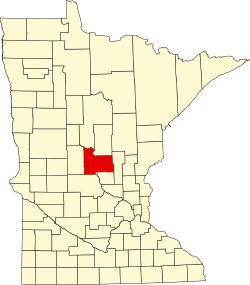
Morrison County Minnesota Incorporated and Unincorporated areas Royalton Highlighted.svg
Location in Morrison County and the state of Minnesota
Coordinates: 45°49′49″N94°17′33″W / 45.83028°N 94.29250°W / 45.83028; -94.29250
Country United States
State Minnesota
Counties Morrison, Benton
Area
[1]
  Total2.01 sq mi (5.20 km2)
  Land2.01 sq mi (5.20 km2)
  Water0.00 sq mi (0.00 km2)
Elevation
[2]
1,083 ft (330 m)
Population
 (2020) [3]
  Total1,281
  Density638.58/sq mi (246.51/km2)
Time zone UTC-6 (Central (CST))
  Summer (DST) UTC-5 (CDT)
ZIP code
56373
Area code 320
FIPS code 27-56176 [4]
GNIS feature ID2396444 [2]
Website www.royaltonmn.com

Royalton is a city in Morrison and Benton counties in the U.S. state of Minnesota, along the Platte River. The population was 1,281 at the 2020 census. [3] The city is located mainly within Morrison County.

Contents

The Benton County portion of Royalton is part of the St. Cloud Metropolitan Statistical Area.

History

Royalton was platted in 1878, and named after Royalton, Vermont, the native home of a share of the early settlers. [5] Royalton was incorporated in 1887. [5]

Royalton has been a participant with Green Step Cities since its inception in 2010 and became the first municipal building in Minnesota to install solar PV panels with a 7 kW array on the roof of City Hall. [6]

Geography

Royalton is in southern Morrison County and extends south into the northwest corner of Benton County. The city is bordered to the north, east and west by Bellevue Township in Morrison County and to the south by Langola Township in Benton County. U.S. Highway 10 is the main route in the community, leading north 11 miles (18 km) to Little Falls, the Morrison county seat, and southeast 19 miles (31 km) to Sauk Rapids.

According to the U.S. Census Bureau, Royalton has a total area of 2.01 square miles (5.21 km2), all of it recorded as land. [1] The Platte River passes through the east side of the city, flowing south 5 miles (8 km) to the Mississippi River.

Demographics

Historical population
CensusPop.Note
1890 582
1900 66414.1%
1910 6761.8%
1920 6902.1%
1930 518−24.9%
1940 5180.0%
1950 500−3.5%
1960 58016.0%
1970 534−7.9%
1980 66023.6%
1990 80221.5%
2000 8161.7%
2010 1,24252.2%
2020 1,2813.1%
U.S. Decennial Census

2010 census

As of the census [7] of 2010, there were 1,242 people, 455 households, and 324 families living in the city. The population density was 624.1 inhabitants per square mile (241.0/km2). There were 487 housing units at an average density of 244.7 per square mile (94.5/km2). The racial makeup of the city was 99.0% White, 0.4% Asian, and 0.6% from two or more races. Hispanic or Latino of any race were 0.9% of the population.

There were 455 households, of which 42.9% had children under the age of 18 living with them, 56.7% were married couples living together, 8.6% had a female householder with no husband present, 5.9% had a male householder with no wife present, and 28.8% were non-families. 23.3% of all households were made up of individuals, and 7.7% had someone living alone who was 65 years of age or older. The average household size was 2.70 and the average family size was 3.18.

The median age in the city was 30.6 years. 31.6% of residents were under the age of 18; 7.9% were between the ages of 18 and 24; 30.1% were from 25 to 44; 20.8% were from 45 to 64; and 9.4% were 65 years of age or older. The gender makeup of the city was 50.1% male and 49.9% female.

2000 census

As of the census [4] of 2000, there were 816 people, 322 households, and 209 families living in the city. The population density was 473.7 inhabitants per square mile (182.9/km2). There were 328 housing units at an average density of 190.4 per square mile (73.5/km2). The racial makeup of the city was 98.77% White, 0.25% Native American, 0.49% Pacific Islander, and 0.49% from two or more races. Hispanic or Latino of any race were 0.86% of the population.

There were 322 households, out of which 34.8% had children under the age of 18 living with them, 51.2% were married couples living together, 8.7% had a female householder with no husband present, and 34.8% were non-families. 27.0% of all households were made up of individuals, and 13.7% had someone living alone who was 65 years of age or older. The average household size was 2.53 and the average family size was 3.14.

In the city, the population was spread out, with 26.8% under the age of 18, 10.8% from 18 to 24, 30.9% from 25 to 44, 17.9% from 45 to 64, and 13.6% who were 65 years of age or older. The median age was 34 years. For every 100 females, there were 101.5 males. For every 100 females age 18 and over, there were 94.5 males.

The median income for a household in the city was $33,173, and the median income for a family was $42,188. Males had a median income of $31,167 versus $20,446 for females. The per capita income for the city was $15,926. About 6.3% of families and 9.0% of the population were below the poverty line, including 8.4% of those under age 18 and 15.9% of those age 65 or over.

Education

The Royalton school district operates one elementary school and one high school. As with other Minnesota school districts, Royalton schools offer open enrollment. The athletic team's moniker for the high school is the Royals with the Mascot being a Lion. Royalton offers sports through both schools and extra activities. In elementary school, there are community ed activities including playing other teams in sports.

Royalton Elementary School is located next to Holy Trinity Church and Lutheran church. Children may go to religion classes during the day when scheduled (normally Wednesdays before lunch). With approximately 3-4 teachers per grade and 22 students in each class, it is a moderately small-sized school.

Royalton offers "M.A.P." (My Afterschool Place) to children who are not picked up right away after school.

The Royalton Football has a history in excellence since coach Jamie Morford took over, winning approximately 78% of their games since he took over. The Varsity girls basketball team won the Prairie Conference Championship in 1998–99, 2017–18 and 2018–19 and the Central Minnesota Conference Championship in 2019–20.

Notable people

Infrastructure

Transportation

Rail transport

Energy

Related Research Articles

<span class="mw-page-title-main">Morrison County, Minnesota</span> County in Minnesota, United States

Morrison County is a county in the U.S. state of Minnesota. As of the 2020 census, the population was 34,010. Its county seat is Little Falls. Camp Ripley Military Reservation occupies a significant area in north-central Morrison County.

<span class="mw-page-title-main">Benton County, Minnesota</span> County in Minnesota, United States

Benton County is a county in the East Central part of the U.S. state of Minnesota. As of the 2020 census, the population was 41,379. Its county seat is Foley.

<span class="mw-page-title-main">Mount Auburn, Iowa</span> City in Iowa, United States

Mount Auburn is a city in Benton County, Iowa, United States. The population was 162 at the time of the 2020 census. It is part of the Cedar Rapids Metropolitan Statistical Area.

<span class="mw-page-title-main">Royalton Township, Michigan</span> Civil township in Michigan, United States

Royalton Township is a civil township of Berrien County in the U.S. state of Michigan, a few miles southeast of the city of St. Joseph. The population was 4,766 at the 2010 census, up from 3,888 at the 2000 census. There are no incorporated municipalities in the township, but portions are considered to be part of the Benton Harbor/St. Joseph urban area. The unincorporated communities of Hollywood, Scottdale, Arden, and Buckhorn are within the township.

Alberta Township is a township in Benton County, Minnesota, United States. The population was 818 as of the 2010 census.

Graham Township is a township in Benton County, Minnesota, United States. The population was 582 as of the 2010 census.

Langola Township is a township in Benton County, Minnesota, United States. The population was 906 as of the 2010 census. Langola Township was organized in 1858.

<span class="mw-page-title-main">Rice, Minnesota</span> City in Minnesota, United States

Rice is a city in Benton County, Minnesota, United States. The population was 1,275 at the 2010 census. Its zip code also encompasses Graham, Langola, and Watab townships.

<span class="mw-page-title-main">Fort Ripley, Minnesota</span> City in Minnesota, United States

Fort Ripley is a city in Crow Wing County, Minnesota, United States, near the confluence of the Mississippi and Nokasippi Rivers. The population was 69 at the 2010 census. It is part of the Brainerd Micropolitan Statistical Area.

<span class="mw-page-title-main">Bowlus, Minnesota</span> City in Minnesota, United States

Bowlus ( BOH-ləss is a city in Morrison County, Minnesota, United States. The population was 279 at the 2020 census.

<span class="mw-page-title-main">Elmdale, Minnesota</span> City in Minnesota, United States

Elmdale is a city in Morrison County, Minnesota, United States. The population was 114 at the 2020 census.

<span class="mw-page-title-main">Flensburg, Minnesota</span> City in Minnesota, United States

Flensburg is a city in Morrison County, Minnesota, United States. The population was 216 at the 2020 census.

<span class="mw-page-title-main">Little Falls, Minnesota</span> City in Minnesota, United States

Little Falls is a city in Morrison County, Minnesota, United States, near the geographic center of the state. Established in 1848, Little Falls is one of the oldest European-American cities in Minnesota. It is the county seat of Morrison County. The population was 9,140 at the 2020 census, up from 8,343 in 2010. Little Falls was the boyhood home of noted aviator Charles Lindbergh. Just across from his former home is Charles A. Lindbergh State Park, named after Lindbergh's father, prominent Minnesota lawyer and U.S. Congressman Charles August Lindbergh.

<span class="mw-page-title-main">Sobieski, Minnesota</span> City in Minnesota, United States

Sobieski is a city in Morrison County, Minnesota, United States. The population was 210 at the 2020 census.

<span class="mw-page-title-main">Upsala, Minnesota</span> City in Minnesota, United States

Upsala is a city in Morrison County, Minnesota, United States. The population was 487 at the 2020 census, up from 427 in 2010.

<span class="mw-page-title-main">Kerkhoven, Minnesota</span> City in Minnesota, United States

Kerkhoven is a city in Swift County, Minnesota, United States, located roughly 100 miles (160 km) west of the Twin Cities region of Minneapolis/St. Paul along U.S. Route 12. The population was 759 as per the 2010 census.

<span class="mw-page-title-main">Lake Benton, Minnesota</span> City in Minnesota, United States

Lake Benton is a city in Lincoln County, Minnesota, United States. The population was 683 at the 2010 census.

<span class="mw-page-title-main">Genola, Minnesota</span> City in Minnesota, United States

Genola is a city in Morrison County, Minnesota, United States. The population was 70 at the 2020 census.

<span class="mw-page-title-main">North Royalton, Ohio</span> City in Ohio, United States

North Royalton is a city in Cuyahoga County, Ohio, United States. It is a suburb of Cleveland. The population was 31,322 as of the 2020 census. Originally incorporated as a village in 1927, it achieved the status of city in 1961.

<span class="mw-page-title-main">Motley, Minnesota</span> City in Minnesota, United States

Motley is a city in Morrison and Cass counties in the U.S. state of Minnesota. The population was 680 at the 2020 census. The main part of Motley is located within Morrison County; only a minor part of the city extends into Cass County.

References

  1. 1 2 "2023 U.S. Gazetteer Files: Minnesota". United States Census Bureau. Retrieved February 1, 2024.
  2. 1 2 U.S. Geological Survey Geographic Names Information System: Royalton, Minnesota
  3. 1 2 "P1. Race – Royalton city, Minnesota: 2020 DEC Redistricting Data (PL 94-171)". U.S. Census Bureau. Retrieved February 1, 2024.
  4. 1 2 "U.S. Census website". United States Census Bureau . Retrieved January 31, 2008.
  5. 1 2 Upham, Warren (1920). Minnesota Geographic Names: Their Origin and Historic Significance. Minnesota Historical Society. p.  355.
  6. "Royalton, MN website - Green Step Cities" . Retrieved August 23, 2016.
  7. "U.S. Census website". United States Census Bureau . Retrieved November 13, 2012.

45°50′N94°18′W / 45.833°N 94.300°W / 45.833; -94.300