Waite Park, Minnesota

Last updated
Waite Park
Motto: 
"The City With A Smile"
Stearns County Minnesota Incorporated and Unincorporated areas Waite Park Highlighted.svg
Location of Waite Park
within Stearns County and state of Minnesota
Coordinates: 45°33′53″N94°15′10″W / 45.56472°N 94.25278°W / 45.56472; -94.25278
CountryUnited States
State Minnesota
County Stearns
Incorporated1893
Government
  MayorRick Miller
Area
[1]
  Total12.71 sq mi (32.92 km2)
  Land12.63 sq mi (32.71 km2)
  Water0.08 sq mi (0.22 km2)
Elevation
[2]
1,089 ft (332 m)
Population
 (2020) [3]
  Total8,341
  Estimate 
(2021) [4]
8,360
  Density660.52/sq mi (255.02/km2)
Time zone UTC-6 (CST)
  Summer (DST) UTC-5 (CDT)
ZIP codes
56387, 56388
Area code 320
FIPS code 27-67612 [5]
GNIS feature ID2397165 [2]
Website ci.waitepark.mn.us

Waite Park is a city in Stearns County, Minnesota, United States. The population was 8,341 at the 2020 census. [3]

Contents

History

Waite Park was incorporated in 1893. [6] It was named for Henry Chester Waite, a state legislator. [6] A post office was established at Waite Park in 1897, and remained in operation until 1972. [7]

Geography

Quarry Park, 2006 Quarry Park-20060819.jpg
Quarry Park, 2006

According to the United States Census Bureau, the city has an area of 8.94 square miles (23.15 km2); 8.90 square miles (23.05 km2) is land and 0.04 square miles (0.10 km2) is water. [8]

Minnesota State Highway 23 and County 75 are two of Waite Park's main routes.

Minnesota Highway 15 skirts Waite Park's southeastern border. Interstate Highway 94 is immediately southwest of Waite Park.

Waite Park borders the west side of St. Cloud. Stearns County Quarry Park, a former granite quarry, is on Waite Park's south side. [9]

"The Ledge", a city-owned 6,000-seat outdoor amphitheater, opened in Waite Park in 2021. It hosts national acts, smaller concerts, and community events. [10]

Demographics

Historical population
CensusPop.Note
1900 317
1910 40628.1%
1920 953134.7%
1930 1,31838.3%
1940 1,4278.3%
1950 1,63914.9%
1960 2,01623.0%
1970 2,82440.1%
1980 3,49623.8%
1990 5,02043.6%
2000 6,56830.8%
2010 6,7152.2%
2020 8,34124.2%
2021 (est.)8,360 [4] 0.2%
U.S. Decennial Census [11]
2020 Census [3]

2020 census

Waite Park, Minnesota - Demographic Profile
(NH = Non-Hispanic)
Race / EthnicityPop 2000 [12] Pop 2010 [13] Pop 2020 [14] % 2000% 2010% 2020
White alone (NH)6,0475,5314,80992.07%82.37%57.66%
Black or African American alone (NH)464352,1990.70%6.48%26.36%
Native American or Alaska Native alone (NH)3235400.49%0.52%0.48%
Asian alone (NH)2302402023.50%3.57%2.42%
Pacific Islander alone (NH)3130.05%0.02%0.04%
Some Other Race alone (NH)210230.03%0.15%0.28%
Mixed Race/Multi-Racial (NH)761612511.16%2.40%3.01%
Hispanic or Latino (any race)1323028142.01%4.50%9.76%
Total6,5686,7158,341100.00%100.00%100.00%

Note: the US Census treats Hispanic/Latino as an ethnic category. This table excludes Latinos from the racial categories and assigns them to a separate category. Hispanics/Latinos can be of any race.

2010 census

As of the census of 2010, there were 6,715 people, 3,127 households, and 1,538 families living in the city. The population density was 754.5 inhabitants per square mile (291.3/km2). There were 3,424 housing units at an average density of 384.7 per square mile (148.5/km2). The racial makeup of the city was 83.6% White, 6.6% African American, 0.7% Native American, 3.6% Asian, 2.7% from other races, and 2.9% from two or more races. Hispanic or Latino of any race were 4.5% of the population.

There were 3,127 households, of which 22.7% had children under the age of 18 living with them, 32.9% were married couples living together, 10.9% had a female householder with no husband present, 5.4% had a male householder with no wife present, and 50.8% were non-families. 38.0% of all households were made up of individuals, and 14.6% had someone living alone who was 65 years of age or older. The average household size was 2.12 and the average family size was 2.83.

The median age in the city was 32.6 years. 19.8% of residents were under the age of 18; 16.3% were between the ages of 18 and 24; 26.6% were from 25 to 44; 20.1% were from 45 to 64; and 17.4% were 65 years of age or older. The gender makeup of the city was 47.6% male and 52.4% female.

2000 census

As of the census of 2000, there were 6,568 people, 2,967 households, and 1,536 families living in the city. The population density was 841.0 inhabitants per square mile (324.7/km2). There were 3,065 housing units at an average density of 392.5 per square mile (151.5/km2). The racial makeup of the city was 92.74% White, 0.72% African American, 0.56% Native American, 3.50% Asian, 0.05% Pacific Islander, 1.20% from other races, and 1.23% from two or more races. Hispanic or Latino of any race were 2.01% of the population.

There were 2,967 households, out of which 23.8% had children under the age of 18 living with them, 36.5% were married couples living together, 10.1% had a female householder with no husband present, and 48.2% were non-families. 32.1% of all households were made up of individuals, and 10.4% had someone living alone who was 65 years of age or older. The average household size was 2.19 and the average family size was 2.80.

In the city, the population was spread out, with 19.6% under the age of 18, 21.2% from 18 to 24, 30.1% from 25 to 44, 16.0% from 45 to 64, and 13.1% who were 65 years of age or older. The median age was 29 years. For every 100 females, there were 94.9 males. For every 100 females age 18 and over, there were 93.0 males.

The median income for a household in the city was $33,803, and the median income for a family was $43,415. Males had a median income of $27,066 versus $21,481 for females. The per capita income for the city was $17,796. About 7.9% of families and 12.1% of the population were below the poverty line, including 20.8% of those under age 18 and 4.7% of those age 65 or over.

Government

In the 2020 presidential election, Joe Biden won a 3% majority of Waite Park votes. In 2016, Donald Trump won by a 13% margin. [15]

Education

Waite Park is in the St. Cloud Area School District. [16]

Most residents are zoned to Discovery Elementary School, [17] while some blocks north of 3rd Street are zoned to Westwood Elementary School. [18] The zoned middle school is North Middle School, [19] and the zoned high school is Apollo High School. [20]

Waite Park is home to the St. Cloud area campus of Globe University/Minnesota School of Business, a private career college.

Related Research Articles

<span class="mw-page-title-main">Stearns County, Minnesota</span> County in Minnesota, United States

Stearns County is a county in the U.S. state of Minnesota. As of the 2020 census, the population was 158,292. Its county seat and largest city is St. Cloud.

<span class="mw-page-title-main">Sherburne County, Minnesota</span> County in Minnesota, United States

Sherburne County is a county in Central Minnesota. At the 2020 census, the population was 97,183. The county seat is Elk River.

<span class="mw-page-title-main">Clear Lake, Minnesota</span> City in Minnesota, United States

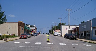
Clear Lake is a city in Sherburne County, Minnesota, United States. The population was 641 at the 2020 census.

<span class="mw-page-title-main">Albany, Minnesota</span> City in Minnesota, United States

Albany is a city in Stearns County, Minnesota, United States. The population was 2,561 at the 2010 census. It is part of the St. Cloud Metropolitan Statistical Area.

<span class="mw-page-title-main">Avon, Minnesota</span> City in Minnesota, United States

Avon is a city in Stearns County, Minnesota, United States. The population was 1,396 at the 2010 census. It is part of the St. Cloud Metropolitan Statistical Area.

<span class="mw-page-title-main">Kimball, Minnesota</span> City in Minnesota, United States

Kimball is a city in Stearns County, Minnesota, United States. The population was 799 at the 2020 census. It is part of the St. Cloud Metropolitan Statistical Area.

<span class="mw-page-title-main">Melrose, Minnesota</span> City in Minnesota, United States

Melrose is a city in Stearns County, Minnesota, United States. The population was 3,598 at the 2010 census. It is part of the St. Cloud Metropolitan Statistical Area.

<span class="mw-page-title-main">Rockville, Minnesota</span> City in Minnesota, United States

Rockville is a city in Stearns County, Minnesota, United States. The population was 2,448 as of the 2010 census. It is part of the St. Cloud Metropolitan Statistical Area.

<span class="mw-page-title-main">St. Joseph, Minnesota</span> City in Minnesota, United States

St. Joseph or Saint Joseph is a city in Stearns County, Minnesota, United States. The population was 7,029 at the 2020 census. It is home to the College of Saint Benedict.

St. Joseph Township is a township in Stearns County, Minnesota, United States. The population was 1,924 at the 2010 census. The township borders the western side of the cities of St. Cloud and Waite Park, and completely surrounds the city of St. Joseph. All are components of the St. Cloud Metropolitan Statistical Area.

<span class="mw-page-title-main">St. Martin, Minnesota</span> City in Minnesota, United States

St. Martin or Saint Martin, Smartin to locals, is a city in Stearns County, Minnesota, United States. The population was 308 at the 2010 census. It is part of the St. Cloud Metropolitan Statistical Area.

<span class="mw-page-title-main">Holdingford, Minnesota</span> City in Minnesota, United States

Holdingford is a city in Stearns County, Minnesota, United States. The population was 708 at the 2010 census. It claims to be "The Gateway to Lake Wobegon", the fictional central Minnesota town created by author Garrison Keillor.

<span class="mw-page-title-main">St. Stephen, Minnesota</span> City in Minnesota, United States

Saint Stephen is a city in Stearns County, Minnesota, United States. The population was 851 at the 2010 census.

<span class="mw-page-title-main">St. Anthony, Stearns County, Minnesota</span> City in Minnesota, United States

St. Anthony or Saint Anthony is a city in Stearns County, Minnesota, United States. The population was 86 at the 2010 census. It is part of the St. Cloud Metropolitan Statistical Area. Main routes include Minnesota State Highway 238, Stearns County Road 153, and Trobec Street.

<span class="mw-page-title-main">Sartell, Minnesota</span> City in Minnesota, United States

Sartell is a city in Benton and Stearns Counties in the U.S. state of Minnesota that straddles the Mississippi River. It is part of the St. Cloud Metropolitan Statistical Area. The population was 19,351 at the 2020 census, making it St. Cloud's most populous suburb and the fourth-largest city in central Minnesota, after St. Cloud, Elk River, and Willmar.

<span class="mw-page-title-main">St. Cloud, Minnesota</span> City in Minnesota, United States

St. Cloud or Saint Cloud is a city in the U.S. state of Minnesota and the largest population center in the state's central region. The population was 68,881 at the 2020 census, making it Minnesota's 12th-largest city. St. Cloud is the county seat of Stearns County and was named after the city of Saint-Cloud, France, which was named after the 6th-century French monk Clodoald.

<span class="mw-page-title-main">Eden Valley, Minnesota</span> City in Minnesota, United States

Eden Valley is a city in Meeker and Stearns counties in the U.S. state of Minnesota. The population was 1,042 at the 2010 census. Most of Eden Valley is in Meeker County; the Stearns County portion is part of the St. Cloud Metropolitan Statistical Area.

<span class="mw-page-title-main">Brooten, Minnesota</span> City in Minnesota, United States

Brooten is a city in Stearns and Pope counties in the U.S. state of Minnesota, United States. The population was 626 as of the 2020 census. Almost the entire city is within Stearns County, with a small portion in Pope County.

<span class="mw-page-title-main">Clearwater, Minnesota</span> City in Minnesota, United States

Clearwater is a city in Stearns and Wright counties in the U.S. state of Minnesota. The population was 1,922 at the 2020 census.Most of the city lies within Wright County.

<span class="mw-page-title-main">St. Augusta, Minnesota</span> City in Minnesota, United States

Saint Augusta or St. Augusta, formerly named Ventura, is a city in Stearns County, Minnesota, United States, directly south of the city of St. Cloud. The population was 3,497 at the 2020 census.

References

  1. "2020 U.S. Gazetteer Files". United States Census Bureau. Retrieved July 24, 2022.
  2. 1 2 U.S. Geological Survey Geographic Names Information System: Waite Park, Minnesota
  3. 1 2 3 "Explore Census Data". United States Census Bureau . Retrieved July 4, 2022.
  4. 1 2 "City and Town Population Totals: 2020-2021". United States Census Bureau. July 4, 2022. Retrieved July 4, 2022.
  5. "U.S. Census website". United States Census Bureau . Retrieved January 31, 2008.
  6. 1 2 Upham, Warren (1920). Minnesota Geographic Names: Their Origin and Historic Significance. Minnesota Historical Society. p.  528.
  7. "Stearns County". Jim Forte Postal History. Retrieved August 8, 2015.
  8. "US Gazetteer files 2010". United States Census Bureau . Retrieved November 13, 2012.
  9. Kelly Smith, "Quarry Park near St. Cloud celebrates 20 years this month as it grows in popularity It draws an estimated 150,000 visitors each year, a turnout that keeps growing.", Star Tribune, June 9, 2018.
  10. The Ledge Amphitheatre website
  11. United States Census Bureau. "Census of Population and Housing" . Retrieved January 7, 2014.
  12. "HISPANIC OR LATINO, AND NOT HISPANIC OR LATINO BY RACE - 2000-Minnesota". Google Books .
  13. "P2 HISPANIC OR LATINO, AND NOT HISPANIC OR LATINO BY RACE - 2010: DEC Redistricting Data (PL 94-171) - Waite Park, Minnesota". United States Census Bureau .
  14. "P2 HISPANIC OR LATINO, AND NOT HISPANIC OR LATINO BY RACE - 2020: DEC Redistricting Data (PL 94-171) - Waite Park, Minnesota". United States Census Bureau .
  15. |"Which St. Cloud suburb went for Democrat Joe Biden? And other election take-aways", Nora Hertel, Government Watchdog Report, St Cloud Times, November 14, 2020
  16. "2020 CENSUS - SCHOOL DISTRICT REFERENCE MAP: Stearns County, MN" (PDF). U.S. Census Bureau . Retrieved 2022-11-07. - Waite Park detail map
  17. "Elementary Attendance Areas" (PDF). St. Cloud Area School District . Retrieved 2022-11-08. - Detail map which is linked from here - Compare to census maps.
  18. "WESTWOOD Versatrans Base Map" (PDF). St. Cloud Area School District . Retrieved 2022-11-08. - Linked from here - Compare to census maps.
  19. "NORTH Versatrans Base Map" (PDF). St. Cloud Area School District . Retrieved 2022-11-08. - Linked from here - Compare to census maps.
  20. "APOLLO Versatrans Base Map" (PDF). St. Cloud Area School District . Retrieved 2022-11-08. - Linked from here - Compare to census maps.