Pleasant Lake, Minnesota

Last updated
Pleasant Lake, Minnesota
Neighborhood
Stearns County Minnesota Incorporated and Unincorporated areas Pleasant Lake Highlighted.svg
Location of the neighborhood of Pleasant Lake
within the city of Rockville, Stearns County
Coordinates: 45°29′46″N94°17′24″W / 45.49611°N 94.29000°W / 45.49611; -94.29000
Country United States
State Minnesota
County Stearns County
Area
  Total0.8 sq mi (2.0 km2)
  Land0.8 sq mi (2.0 km2)
  Water0.0 sq mi (0.0 km2)
Elevation
1,106 ft (337 m)
Population
 (2000)
  Total504
  Density641.2/sq mi (247.6/km2)
Time zone UTC-6 (Central (CST))
  Summer (DST) UTC-5 (CDT)
FIPS code 27-51586 [1]
GNIS feature ID0649561 [2]

Pleasant Lake is a neighborhood of the city of Rockville in Stearns County, Minnesota, United States. The population was 504 at the 2000 census. Pleasant Lake was settled about 1890 and incorporated on July 11, 1938. [3] On 1 June 2002, the city of Pleasant Lake and Rockville Township were merged into the city of Rockville. [4] At the center of the community, lies the 400 Supper Club which lines the lakefront of Pleasant Lake. Most notable for its venue in weddings, conferences, and banquets, the 400 Supper Club also hosts the annual Polar bear plunge to raise money for the Special Olympics. [5]

Contents

The 400 Supper Club The 400 Supper Club.jpg
The 400 Supper Club

Geography

According to the United States Census Bureau, the city had a total area of 0.8 square miles (2.1 km2), all land.

Demographics

As of the census [1] of 2000, there were 504 people, 174 households, and 137 families residing in the city. The population density was 641.2 inhabitants per square mile (247.6/km2). There were 179 housing units at an average density of 227.7 per square mile (87.9/km2). The racial makeup of the city was 97.42% White, 0.79% African American, 0.20% Native American, 0.40% Asian, 0.20% from other races, and 0.99% from two or more races. Hispanic or Latino of any race were 0.40% of the population.

There were 174 households, out of which 47.7% had children under the age of 18 living with them, 73.0% were married couples living together, 4.0% had a female householder with no husband present, and 20.7% were non-families. 17.2% of all households were made up of individuals, and 4.0% had someone living alone who was 65 years of age or older. The average household size was 2.90 and the average family size was 3.30.

In the city the population was spread out, with 31.9% under the age of 18, 5.4% from 18 to 24, 35.3% from 25 to 44, 20.8% from 45 to 64, and 6.5% who were 65 years of age or older. The median age was 36 years. For every 100 females, there were 107.4 males. For every 100 females age 18 and over, there were 103.0 males.

The median income for a household in the city was $56,346, and the median income for a family was $63,750. Males had a median income of $44,167 versus $26,579 for females. The per capita income for the city was $28,811. None of the families and 1.4% of the population were living below the poverty line, including no under eighteens and 4.9% of those over 64.

Related Research Articles

Ceresco Township is a township in Blue Earth County, Minnesota, United States. The population was 255 as of the 2000 census.

Pleasant Mound Township is a township in Blue Earth County, Minnesota, United States. The population was 235 as of the 2000 census.

<span class="mw-page-title-main">Hackensack, Minnesota</span> City in Minnesota, United States

Hackensack is a city in Cass County, Minnesota, United States. The population was 313 at the 2010 census. It is part of the Brainerd Micropolitan Statistical Area.

Home Brook Township is a township in Cass County, Minnesota, United States. The population was 191 as of the 2000 census.

<span class="mw-page-title-main">Longville, Minnesota</span> City in Minnesota, United States

Longvillepronunciation  is a city in Cass County, Minnesota, United States. The population was 156 at the 2010 census. The city was named after its founder, Jim Long. It is roughly four hours north of the Twin Cities. It is part of the Brainerd Micropolitan Statistical Area. Minnesota State Highway 84 serves as a main route in the community, and Minnesota State Highway 200 is nearby. Longville is home to Longville Municipal Airport.

<span class="mw-page-title-main">Baxter, Minnesota</span> City in Minnesota, United States

Baxter is a city in Crow Wing County, Minnesota, United States. The population was 7,610 at the 2010 census. It is part of the Brainerd Micropolitan Statistical Area.

<span class="mw-page-title-main">Independence, Minnesota</span> City in Minnesota, United States

Independence is a rural city in Hennepin County, Minnesota, United States. Most of the city is agricultural land with dense woods and numerous lakes. It is named after Lake Independence, a large lake on the community's eastern boundary.

<span class="mw-page-title-main">Cottonwood, Minnesota</span> City in Minnesota, United States

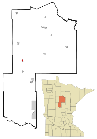
Cottonwood is a city in Lyon County, Minnesota, United States. The population was 1,212 at the 2010 census.

<span class="mw-page-title-main">Elmdale, Minnesota</span> City in Minnesota, United States

Elmdale is a city in Morrison County, Minnesota, United States. The population was 114 at the 2020 census.

Pleasant Valley Township is a township in Mower County, Minnesota, United States. The population was 308 at the 2000 census. There are no recognized cities or towns and the township is entirely an unincorporated area.

<span class="mw-page-title-main">Sturgeon Lake, Minnesota</span> City in Minnesota, United States

Sturgeon Lake is a city in Pine County, Minnesota, United States. The population was 439 at the 2010 census.

<span class="mw-page-title-main">Buffalo Lake, Minnesota</span> City in Minnesota, United States

Buffalo Lake is a city in Renville County, Minnesota, United States. The population was 733 at the 2010 census.

<span class="mw-page-title-main">Avon, Minnesota</span> City in Minnesota, United States

Avon is a city in Stearns County, Minnesota, United States. The population was 1,396 at the 2010 census. It is part of the St. Cloud Metropolitan Statistical Area.

<span class="mw-page-title-main">Richmond, Minnesota</span> City in Minnesota, United States

Richmond is a city in Stearns County, Minnesota, United States. The population was 1,422 at the 2010 census. Richmond is part of the St. Cloud, Minnesota metropolitan area.

<span class="mw-page-title-main">Rockville, Minnesota</span> City in Minnesota, United States

Rockville is a city in Stearns County, Minnesota, United States. The population was 2,448 as of the 2010 census. It is part of the St. Cloud Metropolitan Statistical Area.

Rockville Township was a township in Stearns County, Minnesota, United States. The population was 1,254 at the 2000 census. On 1 June 2002, Rockville Township and the city of Pleasant Lake were merged into the city of Rockville.

<span class="mw-page-title-main">Maple Lake, Minnesota</span> City in Minnesota, United States

Maple Lake is a city in Wright County, Minnesota, United States. The population was 2,159 at the 2020 census. Minnesota State Highway 55 serves as a main route in the city.

<span class="mw-page-title-main">Rockville, Missouri</span> City in Missouri, United States

Rockville is a city in Bates County, Missouri, and is part of the Kansas City metropolitan area within the United States. The population was 166 at the 2010 census.

<span class="mw-page-title-main">Fifty Lakes, Minnesota</span> City in Minnesota, United States

Fifty Lakes is a city in Crow Wing County, Minnesota, United States. The population was 387 at the 2010 census. It is part of the Brainerd Micropolitan Statistical Area.

<span class="mw-page-title-main">Silver Lake, Minnesota</span> City in Minnesota, United States

Silver Lake is a city in McLeod County, Minnesota, United States. The population was 866 at the 2020 census.

References

  1. 1 2 "U.S. Census website". United States Census Bureau . Retrieved 2008-01-31.
  2. "US Board on Geographic Names". United States Geological Survey. 2007-10-25. Retrieved 2008-01-31.
  3. Upham, Warren (2001) Minnesota Place Names, A Geographical Encyclopedia, Third Edition, p571; MHS Press; ISBN   0-87351-396-7
  4. Population Estimates Geographic Change Notes: Minnesota Archived 2008-05-02 at the Wayback Machine , 2006-05-19. Accessed 2008-05-28.
  5. "The 400 Supper Club".{{cite web}}: Missing or empty |url= (help)

Coordinates: 45°29′52″N94°17′12″W / 45.49778°N 94.28667°W / 45.49778; -94.28667