Lyon County, Minnesota

Last updated

Lyon County
SMSU student center 2.JPG
Map of Minnesota highlighting Lyon County.svg
Location within the U.S. state of Minnesota
Minnesota in United States.svg
Minnesota's location within the U.S.
Coordinates: 44°25′N95°50′W / 44.41°N 95.84°W / 44.41; -95.84
CountryFlag of the United States.svg United States
StateFlag of Minnesota.svg  Minnesota
FoundedMarch 6, 1868
March 2, 1869
Named for Nathaniel Lyon
Seat Marshall
Largest cityMarshall
Area
  Total722 sq mi (1,870 km2)
  Land715 sq mi (1,850 km2)
  Water7.1 sq mi (18 km2)  1.0%
Population
 (2020)
  Total25,269
  Estimate 
(2023)
25,427 Increase2.svg
  Density35.3/sq mi (13.6/km2)
Time zone UTC−6 (Central)
  Summer (DST) UTC−5 (CDT)
Congressional district 7th
Website www.lyonco.org

Lyon County is a county in the U.S. state of Minnesota. As of the 2020 census, the population was 25,269. [1] Its county seat is Marshall. [2]

Contents

Lyon County comprises the Marshall, MN Micropolitan Statistical Area.

History

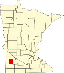
The county was established by two acts of the Minnesota state legislature, dated March 6, 1868, and March 2, 1869. The county seat was designated as Marshall. The county was named for Nathaniel Lyon, an Army officer who served in the Dakota and Minnesota territories before being killed in the Civil War in 1861. He had achieved the rank of general by his death. [3] [4] The county was much larger until an act passed on March 6, 1873, made the western 43% the new Lincoln County.

Geography

The Yellow Medicine River flows northeast through the upper portion of the county, the Redwood River flows northeast through the central part, and the Cottonwood River flows northeast through the lower part. The county's terrain consists of low rolling hills, etched by drainages and gullies. [5] It slopes to the north and east, with its highest point near its southwest corner, at 1,729 ft (527 m) ASL. [6] The county has a total area of 722 square miles (1,870 km2), of which 715 square miles (1,850 km2) is land and 7.1 square miles (18 km2) (1.0%) is water. [7]

Soils of Lyon County Lyon Co Pie Chart No Text Version.pdf
Soils of Lyon County

Lakes [5]

  • Clear Lake
  • Cottonwood Lake
  • East Twin Lake
  • Goose Lake
  • Island Lake
  • Lady Slipper Lake
  • Lake Marshall
  • Lake of the Hill
  • Lake Yankton
  • Lone Tree Lake (part)
  • Long Lake (part)
  • McKay Lake
  • North Twin Lake
  • Rock Lake
  • School Grove Lake (part)
  • Sham Lake
  • South Twin Lake
  • Swift Lake
  • West Twin Lake
  • Wood Lake

Major highways

Airports [5]

Adjacent counties

Protected areas [5]

  • Camden State Park
  • Gadwall State Wildlife Management Area
  • Garvin State Park
  • Grandview State Wildlife Management Area
  • Greenhead State Wildlife Management Area
  • Glynn Prairie Scientific and Natural Area
  • Shelburne State Wildlife Management Area
  • Vallers State Wildlife Management Area

Demographics

Historical population
CensusPop.Note
1880 6,257
1890 9,50151.8%
1900 14,59153.6%
1910 15,7227.8%
1920 18,83719.8%
1930 19,3282.6%
1940 21,56911.6%
1950 22,2533.2%
1960 22,6551.8%
1970 24,2737.1%
1980 25,2073.8%
1990 24,789−1.7%
2000 25,4252.6%
2010 25,8571.7%
2020 25,269−2.3%
2023 (est.)25,427 [9] 0.6%
U.S. Decennial Census [10]
1790-1960 [11] 1900-1990 [12]
1990-2000 [13] 2010-2020 [1]

2020 Census

Lyon County Racial Composition [14]
RaceNum.Perc.
White (NH)20,53581.26%
Black or African American (NH)9063.6%
Native American (NH)840.3%
Asian (NH)1,2635%
Pacific Islander (NH)30.01%
Other/Mixed (NH)7342.9%
Hispanic or Latino 1,7447%

2000 census

Age pyramid of county residents based on 2000 census data USA Lyon County, Minnesota age pyramid.svg
Age pyramid of county residents based on 2000 census data

As of the 2000 census, there were 25,425 people, 9,715 households, and 6,334 families in the county. The population density was 35.6 per square mile (13.7/km2). There were 10,298 housing units at an average density of 14.4 per square mile (5.6/km2). The racial makeup of the county was 93.58% White, 1.49% Black or African American, 0.31% Native American, 1.67% Asian, 0.02% Pacific Islander, 1.89% from other races, and 1.04% from two or more races. 3.97% of the population were Hispanic or Latino of any race. 33.9% were of German, 15.5% Norwegian and 10.5% Belgian ancestry.

There were 9,715 households, out of which 33.00% had children under the age of 18 living with them, 55.10% were married couples living together, 7.10% had a female householder with no husband present, and 34.80% were non-families. 27.90% of all households were made up of individuals, and 12.40% had someone living alone who was 65 years of age or older. The average household size was 2.49 and the average family size was 3.09.

The county population contained 26.20% under the age of 18, 13.30% from 18 to 24, 26.50% from 25 to 44, 19.50% from 45 to 64, and 14.60% who were 65 years of age or older. The median age was 34 years. For every 100 females there were 95.70 males. For every 100 females age 18 and over, there were 93.20 males.

The median income for a household in the county was $38,996, and the median income for a family was $48,512. Males had a median income of $32,102 versus $21,445 for females. The per capita income for the county was $18,013. About 6.30% of families and 10.10% of the population were below the poverty line, including 10.00% of those under age 18 and 12.70% of those age 65 or over.

Communities

Cities

Unincorporated communities

Townships

Politics

Lyon County has been a traditional Republican stronghold. In only one national election since 1980 has the county selected the Democratic Party candidate (as of 2020).

United States presidential election results for Lyon County, Minnesota [15]
Year Republican Democratic Third party
No.%No.%No.%
2020 7,97961.89%4,63435.94%2802.17%
2016 7,25659.40%3,82531.31%1,1349.28%
2012 6,59453.23%5,46544.12%3292.66%
2008 6,31549.69%6,11048.08%2832.23%
2004 7,20356.84%5,29241.76%1781.40%
2000 6,08752.98%4,73741.23%6655.79%
1996 4,93242.97%5,06244.11%1,48312.92%
1992 4,59137.25%4,48136.36%3,25226.39%
1988 5,96950.86%5,65748.20%1100.94%
1984 7,17056.64%5,38942.57%1000.79%
1980 5,85245.33%5,62643.58%1,43311.10%
1976 5,03640.42%7,12257.17%3002.41%
1972 5,82050.04%5,61448.27%1961.69%
1968 4,33143.46%5,31753.35%3183.19%
1964 3,16532.22%6,64967.69%80.08%
1960 4,74046.00%5,55053.86%150.15%
1956 5,18855.27%4,19044.64%80.09%
1952 6,01559.74%4,03040.02%240.24%
1948 3,05432.89%6,14466.16%880.95%
1944 3,61743.60%4,64055.94%380.46%
1940 4,30544.96%5,23454.66%360.38%
1936 2,55130.28%5,16361.29%7108.43%
1932 2,26430.67%4,98967.57%1301.76%
1928 4,05854.93%3,27444.32%560.76%
1924 3,51953.70%3345.10%2,70041.20%
1920 4,55773.16%1,23219.78%4407.06%
1916 1,38938.97%1,89353.11%2827.91%
1912 46015.65%1,06836.34%1,41148.01%
1908 1,61856.69%1,04336.55%1936.76%
1904 2,39481.82%33011.28%2026.90%
1900 1,84464.61%87930.80%1314.59%
1896 1,62352.83%1,35143.98%983.19%
1892 1,06850.88%48623.15%54525.96%

See also

Related Research Articles

<span class="mw-page-title-main">Yellow Medicine County, Minnesota</span> County in Minnesota, United States

Yellow Medicine County is a county in the southwestern part of the U.S. state of Minnesota. Its eastern border is formed by the Minnesota River. As of the 2020 census, the population was 9,528. Its county seat is Granite Falls.

<span class="mw-page-title-main">Watonwan County, Minnesota</span> County in Minnesota, United States

Watonwan County is a county in the U.S. state of Minnesota. As of the 2020 census, the population was 11,253. Its county seat is St. James.

<span class="mw-page-title-main">Waseca County, Minnesota</span> County in Minnesota, United States

Waseca County is a county in the U.S. state of Minnesota. As of the 2020 census, the population was 18,968. Its county seat is Waseca.

<span class="mw-page-title-main">Redwood County, Minnesota</span> County in Minnesota, United States

Redwood County is a county in the U.S. state of Minnesota. As of the 2020 census the population was 15,425. Its county seat is Redwood Falls, along the Redwood River near its confluence with the Minnesota River.

<span class="mw-page-title-main">Pope County, Minnesota</span> County in Minnesota, United States

Pope County is a county in the U.S. state of Minnesota. As of the 2020 census, the population was 11,308. Its county seat is Glenwood. The county was formed in 1862 and organized in 1866.

<span class="mw-page-title-main">Polk County, Minnesota</span> County in Minnesota, United States

Polk County is a county in the northwestern part of the U.S. state of Minnesota. Its population was 31,192 at the 2020 census. Its county seat is Crookston, and the largest community is East Grand Forks.

<span class="mw-page-title-main">Pipestone County, Minnesota</span> County in Minnesota, United States

Pipestone County is a county in the U.S. state of Minnesota. As of the 2020 census, the population was 9,424. Its county seat is Pipestone.

<span class="mw-page-title-main">Otter Tail County, Minnesota</span> County in Minnesota, United States

Otter Tail County is a county in the U.S. state of Minnesota. As of the 2020 census, its population was 60,081. Its county seat is Fergus Falls. Otter Tail County comprises the Fergus Falls micropolitan statistical area. With 1,048 lakes in its borders, Otter Tail County has more lakes than any other county in the United States.

<span class="mw-page-title-main">Nobles County, Minnesota</span> County in Minnesota, United States

Nobles County is a county in the U.S. state of Minnesota. As of the 2020 census, the population was 22,290. Its county seat is Worthington. Nobles County comprises the Worthington, MN Micropolitan Statistical Area.

<span class="mw-page-title-main">Murray County, Minnesota</span> County in Minnesota, United States

Murray County is a county in the U.S. state of Minnesota. The population was 8,179 at the 2020 census. Its county seat is Slayton.

<span class="mw-page-title-main">Marshall County, Minnesota</span> County in Minnesota, United States

Marshall County is a county in the northwestern part of the U.S. state of Minnesota. As of the 2020 census, the population was 9,040. Its county seat is Warren.

<span class="mw-page-title-main">Lincoln County, Minnesota</span> County in Minnesota, United States

Lincoln County is a county in the U.S. state of Minnesota. As of the 2020 census, the population was 5,640. Its county seat is Ivanhoe.

<span class="mw-page-title-main">Lac qui Parle County, Minnesota</span> County in Minnesota, United States

Lac qui Parle County is a county in the southwestern part of the U.S. state of Minnesota. As of the 2020 census, the population was 6,719. Its county seat is Madison. The largest city in the county is Dawson.

<span class="mw-page-title-main">Kandiyohi County, Minnesota</span> County in Minnesota, United States

Kandiyohi County is a county in the U.S. state of Minnesota. As of the 2020 census, its population is 43,732. As of November 20, 1871, its county seat is Willmar.

<span class="mw-page-title-main">Jackson County, Minnesota</span> County in Minnesota, United States

Jackson County is a county in the U.S. state of Minnesota. As of the 2020 census, the population was 9,989. Its county seat is Jackson.

<span class="mw-page-title-main">Grant County, Minnesota</span> County in Minnesota, United States

Grant County is a county in the U.S. state of Minnesota. As of the 2020 census, the population was 6,074. Its county seat is Elbow Lake.

<span class="mw-page-title-main">Cottonwood County, Minnesota</span> County in Minnesota, United States

Cottonwood County is a county in the U.S. state of Minnesota. As of the 2020 census, the population was 11,517. Its county seat is Windom.

<span class="mw-page-title-main">Brown County, Minnesota</span> County in Minnesota, United States

Brown County is a county in the U.S. state of Minnesota. As of the 2020 census, the population was 25,912. Its county seat is New Ulm. The county was formed in 1855 and organized in 1856.

Cottonwood Township is a township in Brown County, Minnesota, United States. The population was 938 as of the 2000 census.

Lucas Township is a township in Lyon County, Minnesota, United States. The population was 260 at the 2000 census.

References

  1. 1 2 "State & County QuickFacts". United States Census Bureau. Retrieved April 20, 2023.
  2. "Find a County". National Association of Counties. Retrieved June 7, 2011.
  3. Upham, Warren. Minnesota Geographical Names, p. 311 (1920). Accessed March 13, 2019
  4. Gannett, Henry (1905). The Origin of Certain Place Names in the United States. U.S. Government Printing Office. p.  193.
  5. 1 2 3 4 Lyon County MN Google Maps (accessed March 13, 2019)
  6. ""Find an Altitude/Lyon County MN" Google Maps (accessed March 13, 2019)". Archived from the original on May 21, 2019. Retrieved March 13, 2019.
  7. "2010 Census Gazetteer Files". United States Census Bureau. August 22, 2012. Archived from the original on September 21, 2013. Retrieved October 21, 2014.
  8. Nelson, Steven (2011). Savanna Soils of Minnesota. Minnesota: Self. pp. 69-70. ISBN   978-0-615-50320-2.
  9. "Annual Estimates of the Resident Population for Counties: April 1, 2020 to July 1, 2023". United States Census Bureau. Retrieved March 18, 2024.
  10. "U.S. Decennial Census". United States Census Bureau. Retrieved October 21, 2014.
  11. "Historical Census Browser". University of Virginia Library. Retrieved October 21, 2014.
  12. "Population of Counties by Decennial Census: 1900 to 1990". United States Census Bureau. Retrieved October 21, 2014.
  13. "Census 2000 PHC-T-4. Ranking Tables for Counties: 1990 and 2000" (PDF). United States Census Bureau. Archived (PDF) from the original on March 27, 2010. Retrieved October 21, 2014.
  14. "P2: Hispanic or Latino, and Not Hispanic or Latino by Race – 2020: DEC Redistricting Data (PL 94-171) – Lyon County, Minnesota". United States Census Bureau.
  15. Leip, David. "Atlas of US Presidential Elections". uselectionatlas.org. Retrieved October 9, 2018.

44°25′N95°50′W / 44.41°N 95.84°W / 44.41; -95.84