Renville County, Minnesota

Last updated

Renville County
Renville County Courthouse MN.jpg
Map of Minnesota highlighting Renville County.svg
Location within the U.S. state of Minnesota
Minnesota in United States.svg
Minnesota's location within the U.S.
Coordinates: 44°43′N94°58′W / 44.72°N 94.96°W / 44.72; -94.96
CountryFlag of the United States.svg United States
StateFlag of Minnesota.svg  Minnesota
FoundedFebruary 20, 1855 (created)
November 8, 1866 (organized)
Named for Joseph Renville
Seat Olivia
Largest cityOlivia
Area
  Total987 sq mi (2,560 km2)
  Land983 sq mi (2,550 km2)
  Water4.2 sq mi (11 km2)  0.4%
Population
 (2020)
  Total14,723
  Estimate 
(2023)
14,348 Decrease2.svg
  Density15.0/sq mi (5.8/km2)
Time zone UTC−6 (Central)
  Summer (DST) UTC−5 (CDT)
Congressional district 7th
Website www.renvillecountymn.com

Renville County is a county in the U.S. state of Minnesota. As of the 2020 census the population was 14,723. [1] Its county seat is Olivia. [2]

Contents

History

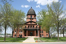
The Minnesota Territory legislature created the county on February 20, 1855. It was named for Joseph Renville, a fur trapper, trader, British officer in the War of 1812, and interlocutor with local Native American groups. Organization of the county's governing structure was completed on November 8, 1866, with Beaver Falls as county seat. Beginning in 1885, citizens in and around Olivia began pressing for the seat to be moved to Olivia, which happened in 1900. [3]

1862 Dakota War

Renville County, located directly across the Minnesota River from the Lower Sioux Agency, was the site of extensive combat during the Dakota War of 1862. The U.S. army's defeats at the Battle of Redwood Ferry and the Battle of Birch Coulee at the hands of the Dakota both occurred in Birch Cooley Township, in addition to numerous Dakota raids on white homesteads in the county. The burned-out Joseph Brown House Ruins still stand, and various monuments throughout the County memorialize settlers killed in the conflict. [4]

Geography

The Minnesota River flows southeast along the county's southwestern border. Hawk Creek flows south through the county's western end, discharging into the Minnesota. Beaver Creek drains the central part of the county, flowing southeast before turning southwest to discharge into the Minnesota. The county terrain consists of rolling hills etched by drainages and sprinkled with lakes and ponds. The area is devoted to agriculture. [5] The county terrain slopes to the south, with its highest point near the midpoint of the northern border, at 1,122 ft (342 m) ASL. [6] The county has a total area of 987 square miles (2,560 km2), of which 983 square miles (2,550 km2) is land and 4.2 square miles (11 km2) (0.4%) is water. [7]

Soils of Renville County Renville Co Pie Chart No Text Version.pdf
Soils of Renville County

Major highways

Adjacent counties

Renville, Beltrami, and Stearns are Minnesota's only counties that abut nine other counties.

Lakes [5]

  • Beckendorf Lake
  • Boon Lake
  • Hodgson Lake
  • Lake Allie
  • Mud Lake
  • Phare Lake
  • Preston Lake
  • Round Grove Lake (part)
  • Round Lake

Protected areas [5]

Demographics

Historical population
CensusPop.Note
1860 245
1870 3,2191,213.9%
1880 10,791235.2%
1890 17,09958.5%
1900 23,69338.6%
1910 23,123−2.4%
1920 23,6342.2%
1930 23,6450.0%
1940 24,6254.1%
1950 23,954−2.7%
1960 23,249−2.9%
1970 21,139−9.1%
1980 20,401−3.5%
1990 17,673−13.4%
2000 17,154−2.9%
2010 15,730−8.3%
2020 14,723−6.4%
2023 (est.)14,348 [9] −2.5%
U.S. Decennial Census [10]
1790-1960 [11] 1900-1990 [12]
1990-2000 [13] 2010-2020 [1]

2020 Census

Renville County Racial Composition [14]
RaceNum.Perc.
White (NH)12,76686.7%
Black or African American (NH)600.41%
Native American (NH)1030.7%
Asian (NH)610.41%
Pacific Islander (NH)50.03%
Other/Mixed (NH)4092.8%
Hispanic or Latino 1,3199%

2000 census

Age pyramid of county residents based on 2000 census data USA Renville County, Minnesota age pyramid.svg
Age pyramid of county residents based on 2000 census data

As of the census of 2000, there were 17,154 people, 6,779 households, and 4,623 families in the county. The population density was 17.5 per square mile (6.8/km2). There were 7,413 housing units at an average density of 7.54 per square mile (2.91/km2). The racial makeup of the county was 95.72% White, 0.06% Black or African American, 0.51% Native American, 0.20% Asian, 0.02% Pacific Islander, 2.77% from other races, and 0.73% from two or more races. 5.11% of the population were Hispanic or Latino of any race. 50.9% were of German, 16.3% Norwegian and 5.1% Swedish ancestry.

There were 6,779 households, out of which 31.50% had children under the age of 18 living with them, 59.10% were married couples living together, 5.60% had a female householder with no husband present, and 31.80% were non-families. 28.50% of all households were made up of individuals, and 15.10% had someone living alone who was 65 years of age or older. The average household size was 2.48 and the average family size was 3.05.

The county population contained 26.50% under the age of 18, 6.60% from 18 to 24, 25.30% from 25 to 44, 21.70% from 45 to 64, and 19.80% who were 65 years of age or older. The median age was 40 years. For every 100 females there were 99.30 males. For every 100 females age 18 and over, there were 98.50 males.

The median income for a household in the county was $37,652, and the median income for a family was $45,065. Males had a median income of $30,473 versus $22,179 for females. The per capita income for the county was $17,770. About 6.30% of families and 8.80% of the population were below the poverty line, including 10.80% of those under age 18 and 8.10% of those age 65 or over.

Communities

Cities

Unincorporated communities

Ghost town

Townships

Politics

Before 1996, Renville County was a fairly balanced precinct. Since 1996, only Republican Party candidates have received the county vote in national elections (as of 2020).

United States presidential election results for Renville County, Minnesota [15]
Year Republican Democratic Third party
No.%No.%No.%
2020 5,46767.26%2,49630.71%1652.03%
2016 4,89064.29%2,11727.83%5997.88%
2012 4,14953.81%3,39444.02%1672.17%
2008 3,95648.63%3,90447.99%2753.38%
2004 4,43053.06%3,78745.36%1321.58%
2000 4,03649.69%3,53343.50%5536.81%
1996 2,88735.04%3,95648.02%1,39516.93%
1992 2,85231.97%3,41438.27%2,65429.75%
1988 4,35648.80%4,45449.89%1171.31%
1984 5,57157.86%3,97241.25%860.89%
1980 5,54453.08%4,05838.85%8428.06%
1976 4,48242.50%5,76254.64%3012.85%
1972 5,32953.06%4,49944.79%2162.15%
1968 4,82148.67%4,53545.78%5505.55%
1964 4,34041.58%6,07258.18%250.24%
1960 5,88554.20%4,95845.67%140.13%
1956 5,72857.52%4,21342.31%170.17%
1952 6,74263.45%3,82836.02%560.53%
1948 4,29744.40%5,22754.00%1551.60%
1944 5,16057.49%3,74741.74%690.77%
1940 6,19657.15%4,58842.32%580.53%
1936 3,04932.25%5,34456.53%1,06011.21%
1932 2,63130.03%5,96768.11%1631.86%
1928 5,10757.18%3,73141.77%941.05%
1924 3,40542.66%6418.03%3,93549.30%
1920 5,99573.64%1,28315.76%86310.60%
1916 2,43255.25%1,66037.71%3107.04%
1912 70318.02%1,31033.57%1,88948.41%
1908 2,27560.22%1,36436.10%1393.68%
1904 2,92577.94%63917.03%1895.04%
1900 2,80964.77%1,32630.57%2024.66%
1896 2,55355.16%1,97842.74%972.10%
1892 1,37039.95%98428.70%1,07531.35%

See also

Related Research Articles

<span class="mw-page-title-main">Yellow Medicine County, Minnesota</span> County in Minnesota, United States

Yellow Medicine County is a county in the southwestern part of the U.S. state of Minnesota. Its eastern border is formed by the Minnesota River. As of the 2020 census, the population was 9,528. Its county seat is Granite Falls.

<span class="mw-page-title-main">Sibley County, Minnesota</span> County in Minnesota, United States

Sibley County is a county in the South Central part of the U.S. state of Minnesota. As of the 2020 census, the population was 14,836. Its county seat is Gaylord.

<span class="mw-page-title-main">Redwood County, Minnesota</span> County in Minnesota, United States

Redwood County is a county in the U.S. state of Minnesota. As of the 2020 census the population was 15,425. Its county seat is Redwood Falls, along the Redwood River near its confluence with the Minnesota River.

<span class="mw-page-title-main">Nicollet County, Minnesota</span> County in Minnesota, United States

Nicollet County is a county in the U.S. state of Minnesota. As of the 2020 census, the population was 34,454. Its county seat is St. Peter.

<span class="mw-page-title-main">Chippewa County, Minnesota</span> County in Minnesota, United States

Chippewa County is a county in the U.S. state of Minnesota. As of the 2020 census, the population was 12,598. Its county seat is Montevideo. The county was formed in 1862, and was organized in 1868.

Hazelton Township is a township in Aitkin County, Minnesota, United States. The population was 844 as of the 2010 census.

<span class="mw-page-title-main">Millward Township, Aitkin County, Minnesota</span> Township in Minnesota, United States

Millward Township is a township in Aitkin County, Minnesota, United States. The population was 72 as of the 2010 census.

Birch Township is a township in Beltrami County, Minnesota, United States. The population was 116 as of the 2000 census.

Eden Township is a township in Brown County, Minnesota, United States. The population was 321 as of the 2000 census.

Silver Township is a township in Carlton County, Minnesota, United States. The population was 389 as of the 2000 census. Silver Township took its name from Silver Creek.

Birch Lake Township is a township in Cass County, Minnesota, United States. The population was 573 as of the 2000 census. This township took its name from Birch Lake.

Ponto Lake Township is a township in Cass County, Minnesota, United States. The population was 530 as of the 2000 census. The etymology of the name Ponto is obscure.

Beaver Falls Township is a township in Renville County, Minnesota, United States. The population was 331 at the 2000 census.

Birch Cooley Township is a township in Renville County, Minnesota, United States. The population was 257 at the 2000 census.

<span class="mw-page-title-main">Morton, Minnesota</span> City in Minnesota, United States

Morton is a city in Renville County, Minnesota, United States. This city is ninety-five miles southwest of Minneapolis. It is the administrative headquarters of the Lower Sioux Indian Reservation. The population was 411 at the 2010 census.

<span class="mw-page-title-main">Olivia, Minnesota</span> City in Minnesota, United States

Olivia is the county seat of Renville County, Minnesota, United States. Its population was 2,484 at the 2010 census.

Fayal Township is an urban township in Saint Louis County, Minnesota, United States. The population was 1,809 at the 2010 census.

Fredenberg Township is a township in Saint Louis County, Minnesota, United States. The population was 1,337 at the 2010 census.

Morse Township is a township in Saint Louis County, Minnesota, United States. The population was 1,213 at the 2010 census.

New Independence Township is a township in Saint Louis County, Minnesota, United States. The population was 299 at the 2010 census.

References

  1. 1 2 "State & County QuickFacts". United States Census Bureau. Retrieved April 15, 2023.
  2. "Find a County". National Association of Counties. Retrieved June 7, 2011.
  3. Upham, Warren. Minnesota Place Names (1920) p. 455 (accessed April 5, 2019)
  4. "Historical Markers and War Memorials in Renville County, Minnesota". www.hmdb.org. Retrieved May 11, 2023.
  5. 1 2 3 Renville County MN Google Maps (accessed April 5, 2019)
  6. "Find an Altitude/Renville County MN" Google Maps (accessed April 5, 2019)
  7. "2010 Census Gazetteer Files". United States Census Bureau. August 22, 2012. Archived from the original on September 21, 2013. Retrieved October 24, 2014.
  8. Nelson, Steven (2011). Savanna Soils of Minnesota. Minnesota: Self. pp. 65-67. ISBN   978-0-615-50320-2.
  9. "Annual Estimates of the Resident Population for Counties: April 1, 2020 to July 1, 2023" . Retrieved March 18, 2024.
  10. "U.S. Decennial Census". United States Census Bureau. Retrieved October 24, 2014.
  11. "Historical Census Browser". University of Virginia Library. Retrieved October 24, 2014.
  12. "Population of Counties by Decennial Census: 1900 to 1990". United States Census Bureau. Retrieved October 24, 2014.
  13. "Census 2000 PHC-T-4. Ranking Tables for Counties: 1990 and 2000" (PDF). United States Census Bureau. Archived (PDF) from the original on March 27, 2010. Retrieved October 24, 2014.
  14. "P2 HISPANIC OR LATINO, AND NOT HISPANIC OR LATINO BY RACE – 2020: DEC Redistricting Data (PL 94-171) – Renville County, Minnesota".
  15. Leip, David. "Atlas of US Presidential Elections". uselectionatlas.org. Retrieved October 10, 2018.

44°43′N94°58′W / 44.72°N 94.96°W / 44.72; -94.96