Bird Island, Minnesota

Last updated

Bird Island
Downtown Bird Island Minnesota 2008.jpg
Downtown Bird Island, August 2008
Renville County Minnesota Incorporated and Unincorporated areas Bird Island Highlighted.svg
Location of Bird Island, Minnesota
Coordinates: 44°45′54″N94°53′39″W / 44.76500°N 94.89417°W / 44.76500; -94.89417
CountryUnited States
State Minnesota
County Renville
Founded1878
Incorporated1881
Government
  TypeMayor — Council
  MayorJulie Sander
Area
[1]
  Total
1.52 sq mi (3.95 km2)
  Land1.52 sq mi (3.95 km2)
  Water0.00 sq mi (0.00 km2)
Elevation
[2]
1,093 ft (333 m)
Population
 (2020) [3]
  Total
1,005
  Estimate 
(2022) [4]
989
  Density659.02/sq mi (254.53/km2)
Time zone UTC-6 (Central)
  Summer (DST) UTC-5 (CDT)
ZIP code
55310
Area code 320
FIPS code 27-06076 [5]
GNIS feature ID2394173 [2]
Website birdislandcity.com

Bird Island is a town located on U.S. Route 212 in Renville County, Minnesota, United States. The population was 1,005 at the 2020 census. [3]

Contents

History

Bird Island was platted in 1878, and named for a nearby bird sanctuary in a marsh. [6] After the installation of ditches and tile, the area was converted to farmland, erasing the town's namesake.

A post office has been in operation at Bird Island since 1878. [7] Bird Island was incorporated in 1881. [6]

Geography

According to the United States Census Bureau, the city has a total area of 1.53 square miles (3.96 km2), all land. [8]

Demographics

Historical population
CensusPop.Note
1880 289
1890 44152.6%
1900 84691.8%
1910 93110.0%
1920 9764.8%
1930 1,0042.9%
1940 1,20119.6%
1950 1,33311.0%
1960 1,3843.8%
1970 1,309−5.4%
1980 1,3724.8%
1990 1,326−3.4%
2000 1,195−9.9%
2010 1,042−12.8%
2020 1,005−3.6%
2022 (est.)989 [4] −1.6%
U.S. Decennial Census [9]
2020 Census [3]

2010 census

As of the census of 2010, there were 1,042 people, 487 households, and 274 families living in the city. The population density was 681.0 inhabitants per square mile (262.9/km2). There were 547 housing units at an average density of 357.5 per square mile (138.0/km2). The racial makeup of the city was 97.2% White, 0.4% African American, 0.2% Asian, 0.2% Pacific Islander, 1.2% from other races, and 0.9% from two or more races. Hispanic or Latino of any race were 3.2% of the population.

There were 487 households, of which 21.6% had children under the age of 18 living with them, 44.8% were married couples living together, 8.0% had a female householder with no husband present, 3.5% had a male householder with no wife present, and 43.7% were non-families. 38.6% of all households were made up of individuals, and 17.7% had someone living alone who was 65 years of age or older. The average household size was 2.11 and the average family size was 2.77.

The median age in the city was 48.4 years. 20.2% of residents were under the age of 18; 6.1% were between the ages of 18 and 24; 18.9% were from 25 to 44; 34.3% were from 45 to 64; and 20.5% were 65 years of age or older. The gender makeup of the city was 49.8% male and 50.2% female.

2000 census

As of the census of 2000, there were 1,195 people, 499 households, and 303 families living in the city. The population density was 773.6 inhabitants per square mile (298.7/km2). There were 530 housing units at an average density of 343.1 per square mile (132.5/km2). The racial makeup of the city was 96.82% White, 0.25% Native American, 0.33% Asian, 0.08% Pacific Islander, 1.09% from other races, and 1.42% from two or more races. Hispanic or Latino of any race were 2.59% of the population.

There were 499 households, out of which 28.5% had children under the age of 18 living with them, 52.5% were married couples living together, 5.4% had a female householder with no husband present, and 39.1% were non-families. 35.5% of all households were made up of individuals, and 19.6% had someone living alone who was 65 years of age or older. The average household size was 2.31 and the average family size was 3.03.

In the city, the population was spread out, with 24.6% under the age of 18, 5.9% from 18 to 24, 25.1% from 25 to 44, 20.4% from 45 to 64, and 23.9% who were 65 years of age or older. The median age was 42 years. For every 100 females, there were 101.9 males. For every 100 females age 18 and over, there were 95.0 males.

The median income for a household in the city was $38,092, and the median income for a family was $48,750. Males had a median income of $31,063 versus $23,056 for females. The per capita income for the city was $18,700. About 4.8% of families and 8.1% of the population were below the poverty line, including 6.7% of those under age 18 and 12.5% of those age 65 or over.

Arts and culture

This town is where the Renville County Fair is held every August.

Notable people

Related Research Articles

<span class="mw-page-title-main">Renville County, Minnesota</span> County in Minnesota, United States

Renville County is a county in the U.S. state of Minnesota. As of the 2020 census the population was 14,723. Its county seat is Olivia.

Eden Township is a township in Brown County, Minnesota, United States. The population was 321 as of the 2000 census.

Lynn Township is a township in McLeod County, Minnesota, United States. The population was 519 at the 2020 census.

<span class="mw-page-title-main">Stewart, McLeod County, Minnesota</span> City in Minnesota, United States

Stewart is a city in McLeod County, Minnesota, United States. The population was 489 at the 2020 census, down from 571 in 2010.

Bird Island Township is a township in Renville County, Minnesota, United States. The population was 269 at the 2000 census.

Boon Lake Township is a township in Renville County, Minnesota, United States. The population was 400 at the 2000 census.

<span class="mw-page-title-main">Buffalo Lake, Minnesota</span> City in Minnesota, United States

Buffalo Lake is a city in Renville County, Minnesota, United States. The population was 733 at the 2010 census.

Cairo Township is a township in Renville County, Minnesota, United States. The population was 271 at the 2000 census.

Camp Township is a township in Renville County, Minnesota, United States. The population was 207 at the time of the 2000 census. Camp Township was organized in 1867.

<span class="mw-page-title-main">Danube, Minnesota</span> City in the United States

Danube is a city in Renville County, Minnesota, United States. The population was 505 at the 2010 census.

<span class="mw-page-title-main">Fairfax, Minnesota</span> City in Minnesota, United States

Fairfax is a city in Renville County, Minnesota, United States. The population was 1,250 at the 2020 census.

<span class="mw-page-title-main">Franklin, Minnesota</span> City in Minnesota, United States

Franklin is a city in Renville County, Minnesota, United States. The population was 510 at the 2010 census.
<span class="mw-page-title-main">Morton, Minnesota</span> City in Minnesota, United States

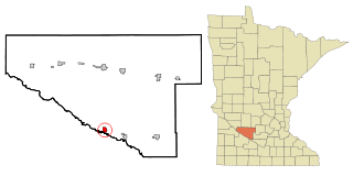
Morton is a city in Renville County, Minnesota, United States. This city is ninety-five miles southwest of Minneapolis. It is the administrative headquarters of the Lower Sioux Indian Reservation. The population was 411 at the 2010 census.

<span class="mw-page-title-main">Olivia, Minnesota</span> City in Minnesota, United States

Olivia is the county seat of Renville County, Minnesota, United States. Its population was 2,484 at the 2010 census.
<span class="mw-page-title-main">Renville, Minnesota</span> City in Minnesota, United States

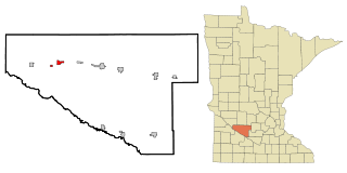
Renville is a city in Renville County, Minnesota, United States. The population was 1,301 at the 2020 census.

<span class="mw-page-title-main">Sacred Heart, Minnesota</span> City in Minnesota, United States

Sacred Heart is a city in Renville County, Minnesota, United States. The population was 548 at the 2010 census.

Sacred Heart Township is a township in Renville County, Minnesota, United States. The population was 277 at the 2000 census.

Troy Township is a township in Renville County, Minnesota, United States. The population was 325 at the 2000 census.

Wellington Township is a township in Renville County, Minnesota, United States. The population was 242 at the 2000 census.

<span class="mw-page-title-main">Mohall, North Dakota</span> City in North Dakota, United States

Mohall is a city in Renville County, North Dakota, United States. It is the county seat of Renville County. The population was 694 at the 2020 census. Mohall is part of the Minot Micropolitan Statistical Area.

References

  1. "2020 U.S. Gazetteer Files". United States Census Bureau. Retrieved July 24, 2022.
  2. 1 2 U.S. Geological Survey Geographic Names Information System: Bird Island, Minnesota
  3. 1 2 3 "Explore Census Data". United States Census Bureau . Retrieved July 4, 2022.
  4. 1 2 "City and Town Population Totals: 2020-2022". United States Census Bureau. June 25, 2023. Retrieved June 25, 2023.
  5. "U.S. Census website". United States Census Bureau . Retrieved January 31, 2008.
  6. 1 2 Upham, Warren (1920). Minnesota Geographic Names: Their Origin and Historic Significance. Minnesota Historical Society. p. 456.
  7. "Renville County". Jim Forte Postal History. Archived from the original on January 21, 2016. Retrieved August 5, 2015.
  8. "US Gazetteer files 2010". United States Census Bureau. Archived from the original on January 25, 2012. Retrieved November 13, 2012.
  9. "Census of Population and Housing". Census.gov. Retrieved June 4, 2015.