Birch Cooley Township, Renville County, Minnesota

Last updated

Birch Cooley Township, Minnesota
USA Minnesota location map.svg
Red pog.svg
Birch Cooley Township, Minnesota
Location within the state of Minnesota
Usa edcp location map.svg
Red pog.svg
Birch Cooley Township, Minnesota
Birch Cooley Township, Minnesota (the United States)
Coordinates: 44°34′10″N94°55′23″W / 44.56944°N 94.92306°W / 44.56944; -94.92306
Country United States
State Minnesota
County Renville
Area
  Total41.5 sq mi (107.4 km2)
  Land41.5 sq mi (107.4 km2)
  Water0.0 sq mi (0.0 km2)
Elevation
1,030 ft (314 m)
Population
 (2000)
  Total257
  Density6.2/sq mi (2.4/km2)
Time zone UTC-6 (Central (CST))
  Summer (DST) UTC-5 (CDT)
FIPS code 27-05968 [1]
GNIS feature ID0663594 [2]

Birch Cooley Township is a township in Renville County, Minnesota, United States. The population was 257 at the 2000 census.

Contents

Birch Cooley Township was organized in 1867, and named after Birch Coulee Creek. [3]

History

Birch Cooley Township was the site of some of the heaviest fighting of the 1862 Dakota Wa r due to its location directly across the Minnesota River from the Lower Sioux Agency. The Battle of Redwood Ferry and Battle of Birch Coulee both took place within the township. [4] [5] The Birch Coulee Battlefield historic site is located in the township. [6]

Geography

Birch Coulee Battlefield Birch coulee battlefield.jpg
Birch Coulee Battlefield

According to the United States Census Bureau, the township has a total area of 41.5 square miles (107 km2), of which 41.5 square miles (107 km2) is land and 0.02% is water.

Demographics

As of the census [1] of 2000, there were 257 people, 95 households, and 68 families residing in the township. The population density was 6.2 inhabitants per square mile (2.4/km2). There were 98 housing units at an average density of 2.4 per square mile (0.93/km2). The racial makeup of the township was 95.33% White, 1.56% Native American, 0.39% Asian, 2.33% from other races, and 0.39% from two or more races. Hispanic or Latino of any race were 2.33% of the population.

There were 95 households, out of which 35.8% had children under the age of 18 living with them, 67.4% were married couples living together, 3.2% had a female householder with no husband present, and 28.4% were non-families. 23.2% of all households were made up of individuals, and 12.6% had someone living alone who was 65 years of age or older. The average household size was 2.71 and the average family size was 3.29.

In the township the population was spread out, with 31.9% under the age of 18, 4.7% from 18 to 24, 30.0% from 25 to 44, 19.8% from 45 to 64, and 13.6% who were 65 years of age or older. The median age was 36 years. For every 100 females, there were 104.0 males. For every 100 females age 18 and over, there were 103.5 males.

The median income for a household in the township was $46,111, and the median income for a family was $45,893. Males had a median income of $27,292 versus $21,364 for females. The per capita income for the township was $15,827. About 11.3% of families and 10.9% of the population were below the poverty line, including 10.3% of those under the age of eighteen and 21.4% of those 65 or over.

Related Research Articles

<span class="mw-page-title-main">Renville County, Minnesota</span> County in Minnesota, United States

Renville County is a county in the U.S. state of Minnesota. As of the 2020 census the population was 14,723. Its county seat is Olivia.

<span class="mw-page-title-main">Redwood County, Minnesota</span> County in Minnesota, United States

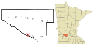
Redwood County is a county in the U.S. state of Minnesota. As of the 2020 census the population was 15,425. Its county seat is Redwood Falls, along the Redwood River near its confluence with the Minnesota River.

Eden Township is a township in Brown County, Minnesota, United States. The population was 321 as of the 2000 census.

North Star Township is a township in Brown County, Minnesota, United States. The population was 325 as of the 2000 census.

Hiram Township is a township in Cass County, Minnesota, United States. The population was 334 as of the 2000 census. Hiram Township was named for Hiram Wilson, a pioneer settler.

<span class="mw-page-title-main">Charlestown Township, Redwood County, Minnesota</span> Township in Minnesota, United States

Charlestown Township is one of the twenty-six townships of Redwood County, Minnesota, United States. The population was 217 at the 2000 census.

<span class="mw-page-title-main">Delhi Township, Redwood County, Minnesota</span> Township in Minnesota, United States

Delhi Township is one of the twenty-six townships of Redwood County, Minnesota, United States. The population was 298 at the 2000 census.

<span class="mw-page-title-main">Gales Township, Redwood County, Minnesota</span> Township in Minnesota, United States

Gales Township is one of the twenty-six townships of Redwood County, Minnesota, United States. The population was 144 at the 2000 census.

<span class="mw-page-title-main">Granite Rock Township, Redwood County, Minnesota</span> Township in Minnesota, United States

Granite Rock Township is one of the twenty-six townships of Redwood County, Minnesota, United States. The population was 241 at the 2000 census.

<span class="mw-page-title-main">Honner Township, Redwood County, Minnesota</span> Township in Minnesota, United States

Honner Township was previously one of the twenty-six townships of Redwood County, Minnesota, United States. The population was 86 at the 2000 census.

<span class="mw-page-title-main">Johnsonville Township, Redwood County, Minnesota</span> Township in Minnesota, United States

Johnsonville Township is one of the twenty-six townships of Redwood County, Minnesota, United States.

<span class="mw-page-title-main">Lamberton Township, Redwood County, Minnesota</span> Township in Minnesota, United States

Lamberton Township is one of the twenty-six townships of Redwood County, Minnesota, United States. The population was 235 at the 2000 census.

<span class="mw-page-title-main">Paxton Township, Redwood County, Minnesota</span> Township in Minnesota, United States

Paxton Township is one of the twenty-six townships of Redwood County, Minnesota, United States. The population was 577 at the 2000 census.

<span class="mw-page-title-main">Redwood Falls Township, Redwood County, Minnesota</span> Township in Minnesota, United States

Redwood Falls Township is one of the twenty-six townships of Redwood County, Minnesota, United States. The population was 256 at the 2000 census.

<span class="mw-page-title-main">Springdale Township, Redwood County, Minnesota</span> Township in Minnesota, United States

Springdale Township is one of the twenty-six townships of Redwood County, Minnesota, United States. The population was 215 at the 2000 census.

<span class="mw-page-title-main">Swedes Forest Township, Redwood County, Minnesota</span> Township in Minnesota, United States

Swedes Forest Township is one of the twenty-six townships of Redwood County, Minnesota, United States. The population was 121 at the 2000 census.

<span class="mw-page-title-main">Underwood Township, Redwood County, Minnesota</span> Township in Minnesota, United States

Underwood Township is one of the twenty-six townships of Redwood County, Minnesota, United States. The population was 215 at the 2000 census.

<span class="mw-page-title-main">Vesta Township, Redwood County, Minnesota</span> Township in Minnesota, United States

Vesta Township is one of the twenty-six townships of Redwood County, Minnesota, United States. The population was 206 at the 2000 census.

<span class="mw-page-title-main">Morton, Minnesota</span> City in Minnesota, United States

Morton is a city in Renville County, Minnesota, United States. This city is ninety-five miles southwest of Minneapolis. It is the administrative headquarters of the Lower Sioux Indian Reservation. The population was 411 at the 2010 census.

Pepin Township is a township in Wabasha County, Minnesota, United States. The population was 471 at the 2000 census. The unincorporated communities of Maple Springs, Camp Lacupolis and Reads Landing are located within the township.

References

  1. 1 2 "U.S. Census website". United States Census Bureau . Retrieved January 31, 2008.
  2. "US Board on Geographic Names". United States Geological Survey. October 25, 2007. Retrieved January 31, 2008.
  3. Upham, Warren (1920). Minnesota Geographic Names: Their Origin and Historic Significance. Minnesota Historical Society. p.  456.
  4. "Redwood Ferry Historical Marker". www.hmdb.org. Retrieved May 11, 2023.
  5. "The Battle of Birch Coulee Historical Marker". www.hmdb.org. Retrieved May 11, 2023.
  6. "Birch Coulee Battlefield | Minnesota Historical Society". www.mnhs.org. Retrieved May 11, 2023.