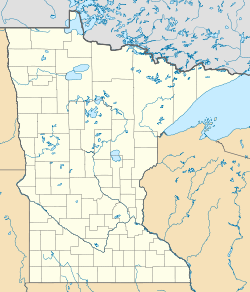
Beaver Falls, Minnesota

Last updated

Beaver Falls
USA Minnesota location map.svg
Red pog.svg
Beaver Falls
Usa edcp location map.svg
Red pog.svg
Beaver Falls
Coordinates: 44°34′59″N95°02′50″W / 44.58306°N 95.04722°W / 44.58306; -95.04722
Country United States
State Minnesota
County Renville
Elevation
922 ft (281 m)
Time zone UTC-6 (Central (CST))
 • Summer (DST) UTC-5 (CDT)
Area code 320
GNIS feature ID639830 [1]

Beaver Falls is an unincorporated community in Renville County, in the U.S. state of Minnesota. [1]

History

Beaver Falls was platted in 1866, and named for nearby Beaver Creek. [2] A post office was established at Beaver Falls in 1867, and remained in operation until 1904. [3] Beaver Falls was the original county seat of Renville County. [2]

Beaver Falls was listed as incorporated in the 1900 United States census. [4]

Historical population
CensusPop.Note%±
1880 185—
1900 189—
U.S. Decennial Census [5]

References

  1. 1 2 U.S. Geological Survey Geographic Names Information System: Beaver Falls, Minnesota
  2. 1 2 Upham, Warren (1920). Minnesota Geographic Names: Their Origin and Historic Significance. Minnesota Historical Society. p.  455.
  3. ↑ "Renville County". Jim Forte Postal History. Archived from the original on January 21, 2016. Retrieved August 5, 2015.
  4. ↑ "Twelfth Census of the United States." 1970 to 1900.
  5. ↑ United States Census Bureau. "Census of Population and Housing".