Wilkin County, Minnesota

Last updated

Wilkin County
Wilkin County Courthouse.jpg
Wilkin County Courthouse in Breckenridge
Map of Minnesota highlighting Wilkin County.svg
Location within the U.S. state of Minnesota
Minnesota in United States.svg
Minnesota's location within the U.S.
Coordinates: 46°22′N96°28′W / 46.36°N 96.47°W / 46.36; -96.47
CountryFlag of the United States.svg United States
StateFlag of Minnesota.svg  Minnesota
FoundedMarch 8, 1858 (created as Toombs)
1863 (renamed)
March 6, 1868 (renamed)
Named for Alexander Wilkin
Seat Breckenridge
Largest cityBreckenridge
Area
  Total751 sq mi (1,950 km2)
  Land751 sq mi (1,950 km2)
  Water0.69 sq mi (1.8 km2)  0.03%
Population
 (2020)
  Total6,506
  Estimate 
(2023)
6,306 Decrease2.svg
  Density8.7/sq mi (3.4/km2)
Time zone UTC−6 (Central)
  Summer (DST) UTC−5 (CDT)
Congressional district 7th
Website www.co.wilkin.mn.us

Wilkin County is a county in the U.S. state of Minnesota. As of the 2020 census, the population of Wilkin County was 6,506. [1] Its county seat is Breckenridge. [2] The county is named for Colonel Alexander Wilkin, a lawyer who served as Minnesota's U.S. marshal and was later killed in the Civil War.

Contents

Wilkin County is part of the Wahpeton, ND—MN Micropolitan Statistical Area, which is included in the Fargo-Wahpeton, ND-MN Combined Statistical Area.

History

In 1849, the newly organized Minnesota Territory legislature authorized the creation of nine large counties across the territory. One of those, Pembina (later renamed as Kittson), contained areas that were partitioned off on 8 March 1858 to create Toombs County, named after Robert Toombs (1810–85) of Georgia. Toombs had been a member of the US House of Representatives (1845-1853), and US Senate (1853-1861). He became the Confederate secretary of state in 1861; this disloyalty to the Union displeased county residents, who petitioned for a name change. Accordingly, in 1863, the county was renamed Andy Johnson County for Andrew Johnson, who was serving as the military governor of Tennessee at the time. However, Johnson's actions and positions as US President (1865-1869) also displeased county residents, so on 6 March 1868 the county name was again changed, to Wilkin County. It was named for Colonel Alexander Wilkin, a Minnesota attorney and secretary to the Minnesota Territory governor.
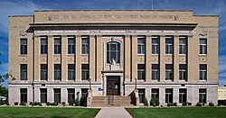
The future Breckenridge, Minnesota, was settled beginning in the 1850s, and a town was platted there in the spring of 1857. Thus when Toombs County was authorized in 1858, Breckenridge was listed as the county seat. It continued as the county seat through the subsequent county name changes. [3]

Geography

Soils of Wilkin County Wilkin Co Pie Chart No Text Version.pdf
Soils of Wilkin County

Wilkin County lies on the west side of Minnesota. Its west border abuts the east border of the state of North Dakota (across a river). The Bois de Sioux River flows northward along the county's west border. The Rabbit River flows westward through the lower part of the county and discharges into the Bois de Sioux on the county's lower west border. The Otter Tail River flows west-northwestward through the central part of the county and merges with the Bois de Sioux at Breckenridge to form the Red River, which continues to flow along the county's west line northward toward the Hudson Bay in Canada.

Wilkin County terrain consists of low rolling hills, completely devoted to agriculture. [5] The terrain slopes to the west and north, with its highest point on the upper east border at 1,250 ft (380 m) ASL. [6] The county has a total area of 751 square miles (1,950 km2), of which 751 square miles (1,950 km2) is land and 0.2 square miles (0.52 km2) (0.03%) is water. [7]

Major highways

Adjacent counties

Protected areas [5]

  • Akron State Wildlife Management Area
  • Atherton State Wildlife Management Area
  • Richard M. and Mathilde Rice Elliot Scientific and Natural Area
  • Rothsay State Wildlife Management Area
  • Sunnyside Township State Game Refuge
  • Western Prairie Scientific and Natural Area

Lakes

Demographics

Historical population
CensusPop.Note
1860 40
1870 295637.5%
1880 1,906546.1%
1890 4,346128.0%
1900 8,08085.9%
1910 9,06312.2%
1920 10,18712.4%
1930 9,791−3.9%
1940 10,4757.0%
1950 10,5670.9%
1960 10,6500.8%
1970 9,389−11.8%
1980 8,454−10.0%
1990 7,516−11.1%
2000 7,138−5.0%
2010 6,576−7.9%
2020 6,506−1.1%
2023 (est.)6,306 [8] −3.1%
U.S. Decennial Census [9]
1790-1960 [10] 1900-1990 [11]
1990-2000 [12] 2010-2020 [1]

2020 Census

Wilkin County Racial Composition [13]
RaceNum.Perc.
White (NH)5,91891%
Black or African American (NH)410.63%
Native American (NH)871.34%
Asian (NH)80.12%
Pacific Islander (NH)10.02%
Other/Mixed (NH)2403.7%
Hispanic or Latino 2113.24%

2000 census

Age pyramid of county residents based on 2000 census data USA Wilkin County, Minnesota age pyramid.svg
Age pyramid of county residents based on 2000 census data

As of the census of 2000, there were 7,138 people, 2,752 households, and 1,926 families in the county. The population density was 9.50 per square mile (3.67/km2). There were 3,105 housing units at an average density of 4.13 per square mile (1.59/km2). The racial makeup of the county was 97.77% White, 0.15% Black or African American, 0.42% Native American, 0.15% Asian, 0.01% Pacific Islander, 0.49% from other races, and 0.99% from two or more races. 1.54% of the population were Hispanic or Latino of any race. 41.8% were of German and 29.2% Norwegian ancestry.

There were 2,752 households, out of which 35.2% had children under the age of 18 living with them, 59.5% were married couples living together, 7.0% had a female householder with no husband present, and 30.0% were non-families. 25.9% of all households were made up of individuals, and 13.40% had someone living alone who was 65 years of age or older. The average household size was 2.54 and the average family size was 3.09.

The county population contained 27.8% under the age of 18, 7.0% from 18 to 24, 27.7% from 25 to 44, 21.5% from 45 to 64, and 16.1% who were 65 years of age or older. The median age was 38 years. For every 100 females there were 95.3 males. For every 100 females age 18 and over, there were 96.1 males.

The median income for a household in the county was $38,093, and the median income for a family was $46,220. Males had a median income of $31,273 versus $20,925 for females. The per capita income for the county was $16,873. About 6.2% of families and 8.1% of the population were below the poverty line, including 8.9% of those under age 18 and 8.3% of those age 65 or over.

Communities

Cities

Unincorporated communities

Townships

Politics

Wilkin County voters have traditionally voted Republican. In no national election since 1976 has the county selected the Democratic Party candidate (as of 2020).

United States presidential election results for Wilkin County, Minnesota [14] [15]
Year Republican Democratic Third party
No.%No.%No.%
2020 2,32867.87%1,02629.91%762.22%
2016 2,12964.48%89327.04%2808.48%
2012 1,88458.47%1,25839.04%802.48%
2008 1,78652.31%1,55045.40%782.28%
2004 2,30365.30%1,16933.14%551.56%
2000 2,03261.48%1,04631.65%2276.87%
1996 1,50846.83%1,31940.96%39312.20%
1992 1,62646.32%1,12231.97%76221.71%
1988 1,93356.08%1,48643.11%280.81%
1984 2,36762.36%1,41037.14%190.50%
1980 2,22454.15%1,49636.43%3879.42%
1976 1,88245.79%2,10351.17%1253.04%
1972 2,29256.00%1,73942.49%621.51%
1968 2,03748.91%1,94646.72%1824.37%
1964 1,63637.26%2,75162.65%40.09%
1960 2,34050.14%2,31949.69%80.17%
1956 2,33555.36%1,88144.59%20.05%
1952 2,97965.39%1,56434.33%130.29%
1948 1,70041.87%2,29156.43%691.70%
1944 1,94551.51%1,81948.17%120.32%
1940 2,06748.65%2,17651.21%60.14%
1936 1,27832.45%2,42861.66%2325.89%
1932 1,12630.75%2,48867.94%481.31%
1928 1,87453.90%1,57845.38%250.72%
1924 1,34247.17%2458.61%1,25844.22%
1920 2,10675.19%56120.03%1344.78%
1916 69044.20%80851.76%634.04%
1912 20914.47%58640.58%64944.94%
1908 77953.03%61441.80%765.17%
1904 1,10377.30%24617.24%785.47%
1900 81252.05%66342.50%855.45%
1896 63141.30%85555.96%422.75%
1892 43442.67%36335.69%22021.63%
County Board of Commissioners [16]
PositionNameDistrict
Commissioner and Vice ChairEric KlindtDistrict 1
CommissionerJonathan GreenDistrict 2
Commissioner and ChairpersonLyle HovlandDistrict 3
CommissionerRick BuskoDistrict 4
CommissionerDennis LarsonDistrict 5
State Legislature (2021-2023)
PositionNameAffiliationDistrict
 Senate Torrey Westrom [17] Republican District 12
 House of Representatives Jeff Backer [18] Republican District 12A
U.S Congress (2021-2023)
PositionNameAffiliationDistrict
  House of Representatives Michelle Fischbach Republican 7th
  Senate Amy Klobuchar [19] Democrat N/A
  Senate Tina Smith [20] Democrat N/A

See also

Related Research Articles

<span class="mw-page-title-main">Clay County, Minnesota</span> County in Minnesota, United States

Clay County is a county in the U.S. state of Minnesota. As of the 2020 census, the population was 65,318. Its county seat is Moorhead.

<span class="mw-page-title-main">Yellow Medicine County, Minnesota</span> County in Minnesota, United States

Yellow Medicine County is a county in the southwestern part of the U.S. state of Minnesota. Its eastern border is formed by the Minnesota River. As of the 2020 census, the population was 9,528. Its county seat is Granite Falls.

<span class="mw-page-title-main">Wright County, Minnesota</span> County in Minnesota, United States

Wright County is a county in the East Central part of the U.S. state of Minnesota. As of the 2020 census, the population was 141,337. Its county seat is Buffalo. The county was founded in 1855. Wright County is part of the Minneapolis-St. Paul-Bloomington, MN-WI Metropolitan Statistical Area. In terms of population, Wright County is the tenth-largest county in Minnesota and the fastest growing.

<span class="mw-page-title-main">Waseca County, Minnesota</span> County in Minnesota, United States

Waseca County is a county in the U.S. state of Minnesota. As of the 2020 census, the population was 18,968. Its county seat is Waseca.

<span class="mw-page-title-main">Traverse County, Minnesota</span> County in Minnesota, United States

Traverse County is a county in the U.S. state of Minnesota. As of the 2020 census, the population was 3,360, making it the least-populous county in Minnesota. Its county seat is Wheaton. The county was founded in 1862 and organized in 1881.

<span class="mw-page-title-main">Todd County, Minnesota</span> County in Minnesota, United States

Todd County is a county in the central part of the U.S. state of Minnesota. As of the 2020 census, the population was 25,262. Its county seat is Long Prairie.

<span class="mw-page-title-main">Otter Tail County, Minnesota</span> County in Minnesota, United States

Otter Tail County is a county in the U.S. state of Minnesota. As of the 2020 census, its population was 60,081. Its county seat is Fergus Falls. Otter Tail County comprises the Fergus Falls micropolitan statistical area. With 1,048 lakes in its borders, Otter Tail County has more lakes than any other county in the United States.

<span class="mw-page-title-main">Nicollet County, Minnesota</span> County in Minnesota, United States

Nicollet County is a county in the U.S. state of Minnesota. As of the 2020 census, the population was 34,454. Its county seat is St. Peter.

<span class="mw-page-title-main">McLeod County, Minnesota</span> County in Minnesota, United States

McLeod County is a county in the U.S. state of Minnesota. At the 2020 census, the population was 36,771. Its county seat is Glencoe.

<span class="mw-page-title-main">Jackson County, Minnesota</span> County in Minnesota, United States

Jackson County is a county in the U.S. state of Minnesota. As of the 2020 census, the population was 9,989. Its county seat is Jackson.

<span class="mw-page-title-main">Grant County, Minnesota</span> County in Minnesota, United States

Grant County is a county in the U.S. state of Minnesota. As of the 2020 census, the population was 6,074. Its county seat is Elbow Lake.

<span class="mw-page-title-main">Douglas County, Minnesota</span> County in Minnesota, United States

Douglas County is a county in the U.S. state of Minnesota. As of the 2020 census, the population was 39,006. Its county seat is Alexandria.

<span class="mw-page-title-main">Cass County, Minnesota</span> County in Minnesota, United States

Cass County is a county in the central part of the U.S. state of Minnesota. As of the 2020 census, the population was 30,066. Its county seat is Walker. The county was formed in 1851, and was organized in 1897.

<span class="mw-page-title-main">Carver County, Minnesota</span> County in Minnesota, United States

Carver County is a county in the U.S. state of Minnesota. The county is mostly farmland and wilderness with many unincorporated townships. As of the 2020 census, the population was 106,922. Its county seat is Chaska. Carver County is named for explorer Jonathan Carver, who in 1766–67, traveled from Boston to the Minnesota River and wintered among the Sioux near the site of New Ulm. Carver County is part of the Minneapolis-St. Paul-Bloomington, MN-WI Metropolitan Statistical Area.

<span class="mw-page-title-main">Breckenridge, Minnesota</span> City in Minnesota, United States

Breckenridge is a city and county seat of Wilkin County, Minnesota, United States. The population was 3,430 at the 2020 census.

<span class="mw-page-title-main">Foxhome, Minnesota</span> City in Minnesota, United States

Foxhome is a city in Wilkin County, Minnesota, United States. The population was 126 at the 2020 census. It is part of the Wahpeton, ND—MN Micropolitan Statistical Area.

<span class="mw-page-title-main">Nashua, Minnesota</span> City in Minnesota, United States

Nashua is a city in Wilkin County, Minnesota, United States. The population was 67 at the 2020 census. It is part of the Wahpeton, ND-MN Micropolitan Statistical Area.

<span class="mw-page-title-main">Wahpeton, North Dakota</span> City in North Dakota, United States

Wahpeton is a city in Richland County, in southeast North Dakota along the Bois de Sioux River at its confluence with the Otter Tail River, which forms the Red River of the North. Wahpeton is the county seat of Richland County. The population was 8,007 at the 2020 census.

<span class="mw-page-title-main">Rothsay, Minnesota</span> City in Minnesota, United States

Rothsay is a city in Otter Tail and Wilkin counties in the State of Minnesota. The population was 498 at the 2020 census. One of Rothsay's major tourist attractions is the large prairie chicken statue near the northwest outskirts of the town.

The Wahpeton Micropolitan Statistical Area, as defined by the United States Census Bureau, is an area consisting of two counties – one in southeast North Dakota and one in west central Minnesota, anchored by the city of Wahpeton, North Dakota. As of the 2010 census, the μSA had a population of 22,897.

References

  1. 1 2 "State & County QuickFacts". United States Census Bureau. Retrieved April 10, 2023.
  2. "Find a County". National Association of Counties. Retrieved June 7, 2011.
  3. Upham, Warren. Minnesota Geographic Names (1920), p. 577 (accessed April 21, 2019)
  4. Nelson, Steven (2011). Savanna Soils of Minnesota. Minnesota: Self. pp. 57 - 60. ISBN   978-0-615-50320-2.
  5. 1 2 Wilkin County MN Google Maps (accessed April 21, 2019)
  6. "Find an Elevation/Wilkin County MN" Google Maps (accessed April 21, 2019)
  7. "2010 Census Gazetteer Files". United States Census Bureau. August 22, 2012. Archived from the original on October 6, 2014. Retrieved October 25, 2014.
  8. "Annual Estimates of the Resident Population for Counties: April 1, 2020 to July 1, 2023" . Retrieved March 18, 2024.
  9. "U.S. Decennial Census". United States Census Bureau. Retrieved October 25, 2014.
  10. "Historical Census Browser". University of Virginia Library. Retrieved October 25, 2014.
  11. "Population of Counties by Decennial Census: 1900 to 1990". United States Census Bureau. Retrieved October 25, 2014.
  12. "Census 2000 PHC-T-4. Ranking Tables for Counties: 1990 and 2000" (PDF). United States Census Bureau. Archived (PDF) from the original on March 27, 2010. Retrieved October 25, 2014.
  13. "P2 HISPANIC OR LATINO, AND NOT HISPANIC OR LATINO BY RACE – 2020: DEC Redistricting Data (PL 94-171) – Wilkin County, Minnesota".
  14. Leip, David. "Atlas of US Presidential Elections". uselectionatlas.org. Retrieved October 10, 2018.
  15. The leading "other" candidate, Progressive Theodore Roosevelt, received 561 votes, while Socialist candidate Eugene Debs received 56 votes, Prohibition candidate Eugene Chafin received 30 votes, and Socialist Labor candidate Arthur Reimer received 2 votes.
  16. "County Board of Commissioners". www.co.wilkin.mn.us. Retrieved April 25, 2023.
  17. "MN State Senate". www.senate.mn. Retrieved June 24, 2020.
  18. "Rep. Jeff Backer (12A) - Minnesota House of Representatives". www.house.leg.state.mn.us. Retrieved June 24, 2020.
  19. "U.S. Senator Amy Klobuchar". www.klobuchar.senate.gov. Retrieved June 24, 2020.
  20. "Home". Senator Tina Smith. Retrieved June 24, 2020.

46°22′N96°28′W / 46.36°N 96.47°W / 46.36; -96.47