Deerhorn Township, Wilkin County, Minnesota

Last updated

Deerhorn Township, Minnesota
USA Minnesota location map.svg
Red pog.svg
Deerhorn Township, Minnesota
Location within the state of Minnesota
Usa edcp location map.svg
Red pog.svg
Deerhorn Township, Minnesota
Deerhorn Township, Minnesota (the United States)
Coordinates: 46°35′54″N96°36′15″W / 46.59833°N 96.60417°W / 46.59833; -96.60417
Country United States
State Minnesota
County Wilkin
Area
  Total36.0 sq mi (93.2 km2)
  Land36.0 sq mi (93.2 km2)
  Water0.0 sq mi (0.0 km2)
Elevation
948 ft (289 m)
Population
 (2000)
  Total111
  Density3.1/sq mi (1.2/km2)
Time zone UTC-6 (Central (CST))
  Summer (DST) UTC-5 (CDT)
FIPS code 27-15274 [1]
GNIS feature ID0663945 [2]

Deerhorn Township is a township in Wilkin County, Minnesota, United States. The population was 111 at the 2000 census.

Contents

Deerhorn Township took its name from Deerhorn Creek. [3]

Geography

According to the United States Census Bureau, the township has a total area of 36.0 square miles (93 km2), all land. The township contains one property listed on the National Register of Historic Places, the early-20th-century David N. Peet Farmstead. [4]

Demographics

As of the census [1] of 2000, there were 111 people, 40 households, and 36 families residing in the township. The population density was 3.1 inhabitants per square mile (1.2/km2). There were 48 housing units at an average density of 1.3 per square mile (0.50/km2). The racial makeup of the township was 95.50% White, 0.90% Asian, and 3.60% from two or more races. Hispanic or Latino of any race were 3.60% of the population.

There were 40 households, out of which 37.5% had children under the age of 18 living with them, 80.0% were married couples living together, 5.0% had a female householder with no husband present, and 10.0% were non-families. 10.0% of all households were made up of individuals, and 5.0% had someone living alone who was 65 years of age or older. The average household size was 2.78 and the average family size was 2.94.

In the township the population was spread out, with 25.2% under the age of 18, 7.2% from 18 to 24, 34.2% from 25 to 44, 24.3% from 45 to 64, and 9.0% who were 65 years of age or older. The median age was 37 years. For every 100 females, there were 105.6 males. For every 100 females age 18 and over, there were 107.5 males.

The median income for a household in the township was $45,625, and the median income for a family was $50,625. Males had a median income of $31,250 versus $21,250 for females. The per capita income for the township was $16,329. There were no families and 1.7% of the population living below the poverty line, including no under eighteens and none of those over 64.

Related Research Articles

Lima Township is a township in Cass County, Minnesota, United States. The population was 111 as of the 2000 census. Lima Township was probably named after Lima, Ohio.

Cromwell Township is a township in Clay County, Minnesota, United States. The population was 323 at the 2000 census.

Rabbit Lake Township is a township in Crow Wing County, Minnesota, United States. The population was 348 at the 2000 census. The township took its name from Rabbit Lake.

Kandiyohi Township is a township in Kandiyohi County, Minnesota, United States. The population was 600 at the 2000 census.

St. Joseph Township is a township in Kittson County, Minnesota, United States. The population was 57 at the 2000 census.

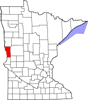
Manfred Township is a township in Lac qui Parle County, Minnesota, United States. The population was 111 at the 2000 census.

Kasota Township is a township in Le Sueur County, Minnesota, United States. The population was 1,487 at the 2000 census.

<span class="mw-page-title-main">Diamond Lake Township, Lincoln County, Minnesota</span> Township in Minnesota, United States

Diamond Lake Township is a township in Lincoln County, Minnesota, United States. The population was 231 at the 2000 census.

Oak Park Township is a township in Marshall County, Minnesota, United States. The population was 165 as of the 2000 census.

Wanger Township is a township in Marshall County, Minnesota, United States. The population was 95 at the 2000 census.

Fairmont Township is a township in Martin County, Minnesota, United States. The population was 298 at the 2000 census.

Bellevue Township is a township in Morrison County, Minnesota, United States. The population was 1,115 at the 2000 census.

Rosing Township is a township in Morrison County, Minnesota, United States. The population was 135 at the 2000 census.

Pine City Township is a township in Pine County, Minnesota, United States, located south and east of the city of Pine City. The township population was 1,249 at the 2000 census.

Eden Township is a township in Pipestone County, Minnesota, United States. The population was 294 at the 2000 census.

Belgium Township is a township in Polk County, Minnesota, United States. The population was 111 at the 2000 census. It is part of the Grand Forks-ND-MN Metropolitan Statistical Area.

Jadis Township is a township in Roseau County, Minnesota, United States. The population was 564 at the 2000 census.

Skagen Township is a township in Roseau County, Minnesota, United States. The population was 235 at the 2000 census.

Hegbert Township is a township in Swift County, Minnesota, United States. The population was 118 at the 2000 census.

Kandota Township is a township in Todd County, Minnesota, United States. The population was 679 at the 2000 census and in the 2020 census it was 805.

References

  1. 1 2 "U.S. Census website". United States Census Bureau . Retrieved January 31, 2008.
  2. "US Board on Geographic Names". United States Geological Survey. October 25, 2007. Retrieved January 31, 2008.
  3. Upham, Warren (1920). Minnesota Geographic Names: Their Origin and Historic Significance. Minnesota Historical Society. p.  578.
  4. "Minnesota National Register Properties Database". Minnesota Historical Society. 2009. Retrieved December 26, 2017.