Pine County, Minnesota

Last updated

Pine County
PineCountyMNcourthouse.JPG
Pine County Courthouse, Pine City
Map of Minnesota highlighting Pine County.svg
Location within the U.S. state of Minnesota
Minnesota in United States.svg
Minnesota's location within the U.S.
Coordinates: 46°08′N92°44′W / 46.14°N 92.74°W / 46.14; -92.74
CountryFlag of the United States.svg United States
StateFlag of Minnesota.svg  Minnesota
FoundedMarch 1, 1856 (created)
1872 (organized) [1]
Named for The abundant pine trees in the area
Seat Pine City
Largest cityPine City
Area
  Total1,435 sq mi (3,720 km2)
  Land1,411 sq mi (3,650 km2)
  Water23 sq mi (60 km2)  1.6%
Population
 (2020)
  Total28,876
  Estimate 
(2023)
30,197 Increase2.svg
  Density20.5/sq mi (7.9/km2)
Time zone UTC−6 (Central)
  Summer (DST) UTC−5 (CDT)
Congressional district 8th
Website www.co.pine.mn.us

Pine County is a county in the U.S. state of Minnesota. As of the 2020 census, the population was 28,876. [2] Its county seat is Pine City. [3] The county was formed in 1856 and organized in 1872. Today, Pine County is the fastest growing county in the state [4] . [5]

Contents

Part of the Mille Lacs Indian Reservation is in Pine County.

History

Pine County was organized on March 1, 1856, with territory partitioned from Chisago and Ramsey counties. The original county seat was Chengwatana. It was named for its abundant pine tree growth. [6]

In 1857, Buchanan County in full and southern parts of Aitkin and Carlton Counties were formed from the original Pine County, with Kanabec County organized a year later. In 1861, Buchanan County was dissolved and folded into Pine County. Pine County was reorganized in 1872, with Pine City named as the county seat for the remaining smaller area. [7]

Pine County has been featured in a series of mysteries by Dean Hovey. [8] [9]

Geography

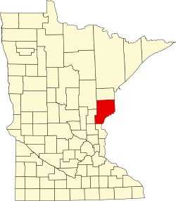
Pine County lies on the east side of Minnesota. Its southeast border abuts Wisconsin (across the St. Croix River). The St. Croix flows southerly along its border. The Kettle River flows southeastward through central Pine County, discharging into the St. Croix on the county's east border, and the Snake River flows eastward through the lower part of the county toward its discharge point into the St. Croix. The county terrain consists of low rolling hills, carved with drainages, partly wooded and otherwise devoted to agriculture. [10] The terrain slopes to the south and east, with its highest point near its northeast corner, at 1,319 ft (402 m) ASL. [11] The county has an area of 1,435 square miles (3,720 km2), of which 1,411 square miles (3,650 km2) is land and 23 square miles (60 km2) (1.6%) is water. [12]

Major highways

Adjacent counties

Protected areas

Demographics

Historical population
CensusPop.Note
1860 92
1870 648604.3%
1880 1,365110.6%
1890 4,052196.8%
1900 11,546184.9%
1910 15,87837.5%
1920 21,11733.0%
1930 20,264−4.0%
1940 21,4786.0%
1950 18,223−15.2%
1960 17,004−6.7%
1970 16,821−1.1%
1980 19,87118.1%
1990 21,2647.0%
2000 26,53024.8%
2010 29,75012.1%
2020 28,876−2.9%
2023 (est.)30,197 [13] 4.6%
U.S. Decennial Census [14]
1790-1960 [15] 1900-1990 [16]
1990-2000 [17] 2010-2020 [2]

2020 census

Pine County, Minnesota - Demographic Profile
(NH = Non-Hispanic)
Race / EthnicityPop 2010 [18] Pop 2020 [19] % 2010% 2020
White alone (NH)26,92425,11990.50%86.99%
Black or African American alone (NH)5764701.94%1.63%
Native American or Alaska Native alone (NH)8909662.99%3.35%
Asian alone (NH)1292640.43%0.91%
Pacific Islander alone (NH)810.03%0.00%
Some Other Race alone (NH)4980.01%0.34%
Mixed Race/Multi-Racial (NH)4961,2451.67%4.31%
Hispanic or Latino (any race)7237132.43%2.47%
Total29,75028,876100.00%100.00%

Note: the US Census treats Hispanic/Latino as an ethnic category. This table excludes Latinos from the racial categories and assigns them to a separate category. Hispanics/Latinos can be of any race.

2000 census

Age pyramid of county residents based on 2000 census data USA Pine County, Minnesota age pyramid.svg
Age pyramid of county residents based on 2000 census data

As of the census of 2000, there were 26,530 people, 9,939 households, and 6,917 families in the county. The population density was 18.8 per square mile (7.3/km2). There were 15,353 housing units at an average density of 10.9 per square mile (4.2/km2). The racial makeup of the county was 91.9% White, 2.0% Black or African American, 3.1% Native American, 0.30% Asian, 0.03% Pacific Islander, 0.4% from other races, and 1.9% from two or more races. 2.4% of the population were Hispanic or Latino of any race. 32.3% were of German, 11.6% Swedish, 11.1% Norwegian and 5.5% American ancestry.

There were 17,276 households, out of which 31.20% had children under the age of 18 living with them, 56.50% were married couples living together, 8.70% had a female householder with no husband present, and 30.40% were non-families. 25.10% of all households were made up of individuals, and 10.90% had someone living alone who was 65 years of age or older. The average household size was 2.53 and the average family size was 3.02.

The county population contained 25.50% under the age of 18, 7.70% from 18 to 24, 27.90% from 25 to 44, 23.90% from 45 to 64, and 15.00% who were 65 years of age or older. The median age was 38 years. For every 100 females there were 108.80 males. For every 100 females age 18 and over, there were 108.30 males.

The median income for a household in the county was $37,379, and the median income for a family was $44,058. Males had a median income of $31,600 versus $22,675 for females. The per capita income for the county was $17,445. About 7.80% of families and 11.30% of the population were below the poverty line, including 14.60% of those under age 18 and 10.00% of those age 65 or over.

Communities

Cities

Unincorporated communities

Ghost towns

Townships

Politics

Pine County was once a Democratic stronghold. Between 1932 and 2008, Democrats won the county all but twice, with the two exceptions being nationwide Republican landslide victories in 1952 by Dwight D. Eisenhower and in 1972 by Richard Nixon (by only 87 votes). The tides began to turn in Pine County in 2012, when Republican challenger Mitt Romney barely won the county over incumbent Democrat Barack Obama by less than 1% and a margin of just 95 votes, becoming the first Republican to win the county in 40 years. The 2016 election saw a dramatic rightward turn, as Donald Trump won the county by a margin of over 26%, and he further increased his margin of victory to over 30% in 2020, as Trump became the first Republican to win over 60% of the vote in Pine County since Warren G. Harding a century earlier.

United States presidential election results for Pine County, Minnesota [20]
Year Republican Democratic Third party
No.%No.%No.%
2020 10,25664.10%5,41933.87%3262.04%
2016 8,19159.31%4,58033.16%1,0407.53%
2012 6,84549.02%6,75048.34%3702.65%
2008 6,86247.71%7,08449.25%4373.04%
2004 7,03348.44%7,22849.79%2571.77%
2000 5,85444.80%6,14847.05%1,0668.16%
1996 3,08029.88%5,43252.70%1,79617.42%
1992 2,84126.27%4,92945.58%3,04328.14%
1988 3,85740.54%5,54058.24%1161.22%
1984 4,49345.95%5,22353.41%630.64%
1980 3,89940.25%5,12152.86%6676.89%
1976 3,05734.40%5,44261.24%3884.37%
1972 3,88148.41%3,79447.32%3424.27%
1968 2,59136.41%4,04456.82%4826.77%
1964 2,27930.71%5,12369.04%180.24%
1960 3,45044.88%4,21154.78%260.34%
1956 3,20445.50%3,82954.38%80.11%
1952 4,25552.94%3,69245.93%911.13%
1948 3,06936.51%4,97859.21%3604.28%
1944 3,43343.85%4,33255.33%640.82%
1940 4,10643.10%5,26355.25%1571.65%
1936 2,45228.39%5,79767.11%3894.50%
1932 2,30429.53%4,86262.33%6358.14%
1928 4,27856.53%3,18542.09%1051.39%
1924 2,70642.03%4697.28%3,26350.68%
1920 3,87966.83%1,12719.42%79813.75%
1916 1,53144.38%1,50743.68%41211.94%
1912 51317.04%77725.81%1,72057.14%
1908 1,54856.43%80229.24%39314.33%
1904 1,74374.23%46319.72%1426.05%
1900 1,12159.06%72638.25%512.69%
1896 1,15255.46%87542.13%502.41%
1892 53848.42%45841.22%11510.35%

See also

Related Research Articles

<span class="mw-page-title-main">Washington County, Minnesota</span> County in Minnesota, United States

Washington County is a county in the U.S. state of Minnesota. As of the 2020 census, the population was 267,568, making it the fifth-most populous county in Minnesota. Its county seat is Stillwater. The largest city in the county is Woodbury, the eighth-largest city in Minnesota and the fourth-largest Twin Cities suburb.

<span class="mw-page-title-main">Kanabec County, Minnesota</span> County in Minnesota, United States

Kanabec County is a county in the East Central part of U.S. state of Minnesota. As of the 2020 census, the population was 16,032. Its county seat is Mora.

<span class="mw-page-title-main">Itasca County, Minnesota</span> County in Minnesota, United States

Itasca County is a county located in the Iron Range region of the U.S. state of Minnesota. As of the 2020 census, the population was 45,014. Its county seat is Grand Rapids. The county is named after Lake Itasca, which is in turn a shortened version of the Latin words veritas caput, meaning 'truth' and 'head', a reference to the source of the Mississippi River. Portions of the Bois Forte and Leech Lake Indian reservations are in the county.

<span class="mw-page-title-main">Isanti County, Minnesota</span> County in the United States

Isanti County is a county in the east-central part of the U.S. state of Minnesota. As of the 2020 census, the population was 41,135. Its county seat is Cambridge.

<span class="mw-page-title-main">Houston County, Minnesota</span> County in Minnesota, United States

Houston County is a county in the U.S. state of Minnesota. At the 2020 census, the population was 18,843. Its county seat is Caledonia.

<span class="mw-page-title-main">Crow Wing County, Minnesota</span> County in Minnesota, United States

Crow Wing County is a county in the East Central part of the U.S. state of Minnesota. As of the 2020 census, the population was 66,123. Its county seat is Brainerd. The county was formed in 1857, and was organized in 1870.

<span class="mw-page-title-main">Chisago County, Minnesota</span> County in Minnesota, United States

Chisago County is a county in the east-central part of the U.S. state of Minnesota. The county covers an area of 442 square miles and, as of the 2020 Census, had a population of 56,621 people. It is part of the Minneapolis-St. Paul-Bloomington Metropolitan Statistical Area.

<span class="mw-page-title-main">Carlton County, Minnesota</span> County in Minnesota, United States

Carlton County is a county in the State of Minnesota, formed in 1857. As of the 2020 census, the population was 36,207. Its county seat is Carlton. Part of the Fond du Lac Indian Reservation lies in northeastern Carlton County.

<span class="mw-page-title-main">Aitkin County, Minnesota</span> County in Minnesota, United States

Aitkin County is a county in the U.S. state of Minnesota. As of the 2020 census, the population was 15,697. Its county seat is Aitkin. Part of the Mille Lacs Indian Reservation is in the county. The county was created in 1857 and organized in 1871.

Wagner Township is a township in Aitkin County, Minnesota, United States. The population was 332 as of the 2010 census.

Moose Lake Township is a township in Carlton County, Minnesota, United States. The population was 956 as of the 2000 census. Moose Lake Township was named from Moose Lake and Moose Head Lake.

Silver Township is a township in Carlton County, Minnesota, United States. The population was 389 as of the 2000 census. Silver Township took its name from Silver Creek.

Twin Lakes Township is a township in Carlton County, Minnesota, United States. The population was 1,912 as of the 2000 census.

Amador Township is a township in Chisago County, Minnesota, United States. The population was 885 at the 2010 census. The unincorporated community of Almelund is located within the township.

Chisago Lake Township is a township in Chisago County, Minnesota, United States. The population was 4,656 at the 2010 census, up from 3,276 in 2000.

<span class="mw-page-title-main">Franconia Township, Chisago County, Minnesota</span> Township in Minnesota, United States

Franconia Township is a township in Chisago County, Minnesota, United States. The population was 1,805 at the 2010 census, up from 1,128 in 2000. The township is home to the Franconia Sculpture Park.

Shafer Township is a township in Chisago County, Minnesota, United States. The population was 1,048 as of the 2010 census, up from 646 in 2000.

Chengwatana Township is a township in Pine County, Minnesota, United States. The population was 809 at the 2000 census. Chengwatana Township was organized in 1874. Its name is derived from the Ojibwe Zhingwaadena, applied originally to an Ojibwe village located at the confluence of the Snake River with the St. Croix River. Neighbouring Pine City Township and the City of Pine City get their names from the English translation of Chengwatana.

<span class="mw-page-title-main">Hinckley, Minnesota</span> City in Minnesota, United States

Hinckley is a city in Pine County, Minnesota, United States, located at the junction of Interstate 35 and Minnesota State Highway 48. The population was 1,800 at the 2010 census.

References

  1. "Minnesota Place Names". Minnesota Historical Society. Archived from the original on October 28, 2014. Retrieved March 19, 2014.
  2. 1 2 "State & County QuickFacts". United States Census Bureau. Retrieved April 15, 2023.
  3. "Find a County". National Association of Counties. Archived from the original on May 3, 2015. Retrieved June 7, 2011.
  4. https://www.mprnews.org/story/2024/03/14/census-pine-county-growing-fastest-dakota-county-gaining-most
  5. https://www.startribune.com/minnesota-state-population-census/600351539/
  6. Upham, Warren (1920). Minnesota Geographic Names: Their Origin and Historic Significance. Minnesota Historical Society. p.  410.
  7. Keillor, Steven J. "Speculation, politics, fraud and controversy: The short, colorful history of 'Buchanan County'". Press Publications. Retrieved January 3, 2023.
  8. Dean L. Hovey (amazon.com): "Dean Hovey is the award-winning author of Family Trees: A Pine County Mystery. His books are set in rural Northeastern Minnesota communities and tap into local history, politics, and current events."
  9. Hovey, Dean (2012). Create Space Independent Publishing Platform. ISBN   1475052545
  10. 1 2 3 4 Pine County MN Google Maps (accessed April 16, 2019)
  11. ""Find an Altitude/Pine County MN" Google Maps (accessed April 16, 2019)". Archived from the original on May 21, 2019. Retrieved April 17, 2019.
  12. "2010 Census Gazetteer Files". United States Census Bureau. August 22, 2012. Archived from the original on September 21, 2013. Retrieved October 24, 2014.
  13. "Annual Estimates of the Resident Population for Counties: April 1, 2020 to July 1, 2023" . Retrieved March 18, 2024.
  14. "U.S. Decennial Census". United States Census Bureau. Archived from the original on April 26, 2015. Retrieved October 24, 2014.
  15. "Historical Census Browser". University of Virginia Library. Retrieved October 24, 2014.
  16. "Population of Counties by Decennial Census: 1900 to 1990". United States Census Bureau. Retrieved October 24, 2014.
  17. "Census 2000 PHC-T-4. Ranking Tables for Counties: 1990 and 2000" (PDF). United States Census Bureau. Archived (PDF) from the original on March 27, 2010. Retrieved October 24, 2014.
  18. "P2 HISPANIC OR LATINO, AND NOT HISPANIC OR LATINO BY RACE - 2010: DEC Redistricting Data (PL 94-171) - Pine County, Minnesota". United States Census Bureau .
  19. "P2 HISPANIC OR LATINO, AND NOT HISPANIC OR LATINO BY RACE - 2020: DEC Redistricting Data (PL 94-171) - Pine County, Minnesota". United States Census Bureau .
  20. Leip, David. "Atlas of US Presidential Elections". uselectionatlas.org. Retrieved October 10, 2018.

46°08′N92°44′W / 46.14°N 92.74°W / 46.14; -92.74