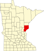
Pine County is a county in the U.S. state of Minnesota. As of the 2020 census, the population was 28,876. Its county seat is Pine City. The county was formed in 1856 and organized in 1872.
Vermilion Lake Township is a township in Saint Louis County, Minnesota, United States. The population was 278 at the 2010 census.

Braham is a city in Isanti and Kanabec counties in the U.S. state of Minnesota. The population was 1,769 at the 2020 census.

U.S. Route 65 is a north–south United States highway in the southern and midwestern United States. The southern terminus of the route is at U.S. Route 425 in Clayton, Louisiana. The northern terminus is at Interstate 35 just south of Interstate 90 in Albert Lea, Minnesota. Parts of its modern route in Iowa and historic route in Minnesota follow the old Jefferson Highway.

Minnesota State Highway 107 is a 17.571-mile-long (28.278 km) highway in east-central Minnesota, which runs from its intersection with State Highway 65 in Stanchfield Township near Braham and continues north to its northern terminus at its intersection with State Highway 23 in Pine County near Brook Park.
Pengilly is an unincorporated community in eastern Itasca County, Minnesota, United States.
Britt is an unincorporated area in Saint Louis County, Minnesota, United States.
Keenan is an unincorporated community in Clinton Township, Saint Louis County, Minnesota, United States.
Brunswick is an unincorporated community in Brunswick Township, Kanabec County, Minnesota, United States. The community is located between Mora and Rock Creek at the junction of State Highway 65 and State Highway 70.
West Rock is an unincorporated community in Royalton Township, Pine County, Minnesota, United States.
Coin is an unincorporated community in Brunswick Township, Kanabec County, Minnesota, United States.
Margie is an unincorporated community in Koochiching County, Minnesota, United States; located near Big Falls.
Cloverton is an unincorporated community in New Dosey Township, Pine County, Minnesota, United States.
Gemmell is an unincorporated community in Koochiching County, Minnesota, United States; located near Mizpah and Northome.
Wildwood is an unincorporated community in Koochiching County, Minnesota, United States; located within the Pine Island State Forest.
Pinetop is an unincorporated community in Koochiching County, Minnesota, United States; located within the Pine Island State Forest. The community is located east of Mizpah; and south of Gemmell; along Koochiching County Road 6.
Kingsdale is an unincorporated community in New Dosey Township, Pine County, Minnesota, United States.
Ellson is an unincorporated community in Bremen Township, Pine County, Minnesota, United States.
Mission Creek is an unincorporated community in Mission Creek Township, Pine County, Minnesota, United States.


