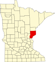
Pine County is a county in the U.S. state of Minnesota. As of the 2010 United States Census, the population was 29,750. Its county seat is Pine City. The county was formed in 1856 and organized in 1872.

Arna Township is a township in Pine County, Minnesota, United States. The population was 86 at the 2000 census.

The St. Croix River is a tributary of the Mississippi River, approximately 169 miles (272 km) long, in the U.S. states of Wisconsin and Minnesota. The lower 125 miles (201 km) of the river form the border between Wisconsin and Minnesota. The river is a National Scenic Riverway under the protection of the National Park Service. A hydroelectric plant at St. Croix Falls supplies power to the Minneapolis–St. Paul metropolitan area.

Alborn is an unincorporated community in Alborn Township, Saint Louis County, Minnesota, United States.

St. Croix State Park is a state park in Pine County, Minnesota, USA. The park follows the shore of the St. Croix River for 21 miles (34 km) and contains the last 7 miles (11 km) of the Kettle River. At 33,895 acres (13,717 ha) it is the largest Minnesota state park. It was developed as a Recreational Demonstration Area in the 1930s, and is one of the finest surviving properties of this type in the nation. 164 structures built by the Civilian Conservation Corps and the Works Progress Administration survive, the largest collection of New Deal projects in Minnesota. As a historic district they were listed on the National Register of Historic Places and proclaimed a National Historic Landmark in 1997.

Lake Lena is an unincorporated community and Native American village in Ogema Township, Pine County, Minnesota, United States, located along the Lower Tamarack River. It currently is the administrative center for the Mille Lacs Indian Reservation, District III.

Greaney is an unincorporated community in Saint Louis County, Minnesota, United States. Greaney is located within ZIP code 55771, based in Orr.

Bear River is an unincorporated community in Itasca and Saint Louis counties in the U.S. state of Minnesota.

Nickerson is an unincorporated community in Nickerson Township, Pine County, Minnesota, United States.

Cloverdale is an unincorporated community in Arlone Township, Pine County, Minnesota, United States.

Ray is an unincorporated community in Koochiching County, Minnesota, United States.

Swan River is an unincorporated community in southeast Itasca County, Minnesota, United States.

Goodland is an unincorporated community in Goodland Township, Itasca County, Minnesota, United States.

Cloverton is an unincorporated community in New Dosey Township, Pine County, Minnesota, United States.

Wildwood is an unincorporated community in Koochiching County, Minnesota, United States; located within the Pine Island State Forest.

Pinetop is an unincorporated community in Koochiching County, Minnesota, United States; located within the Pine Island State Forest. The community is located east of Mizpah; and south of Gemmell; along Koochiching County Road 6.

Duxbury is an unincorporated community in Wilma Township, Pine County, Minnesota, United States.

Kingsdale is an unincorporated community in New Dosey Township, Pine County, Minnesota, United States.

Ellson is an unincorporated community in Bremen Township, Pine County, Minnesota, United States.

Greeley is an unincorporated community in Royalton Township, Pine County, Minnesota, United States.


