

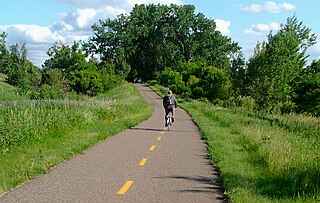
The Gandy Dancer State Trail is a 98-mile recreational trail spanning through Wisconsin and Minnesota. The trail is managed by Polk, Burnett, and Douglas County in Wisconsin and the Minnesota Department of Natural Resources in Minnesota. [1]
The Gandy Dancer State Trail is a 98-mile recreational trail spanning through Wisconsin and Minnesota. The trail is managed by Polk, Burnett, and Douglas County in Wisconsin and the Minnesota Department of Natural Resources in Minnesota. [1]
The trail follows the old Minneapolis, St. Paul and Sault Ste. Marie railroad grade from St. Croix Falls to Superior. The trail is divided up into a north and south segment with the southern segment accounting for 47 miles all in Wisconsin and the northern segment accounting for 51 miles in both Minnesota and Wisconsin. [2] [3] The Ice Age Trail follows the Gandy Dancer State Trail for 19 miles from St. Croix Falls past the town of Luck. [1]
A gandy dancer was a slang term used for American railroad workers that would build and maintain tracks by hand. The term likely originated from the Gandy Manufacturing Company based in Chicago which produced railroad tools. These workers were known to sing and keep their voices and feet in unison which led to them being described as dancers. In 1990 a naming contest was held for the naming of the trail. The name Gandy Dancer was chosen to honor the railroad workers who built the tracks. [4] [5]

Trail activities vary depending on the trail segment and time of year. Hiking and bicycling is open throughout the entire trail however bikes with an off-road tread are recommended for the northern segment due to the soft and uneven parts of the trail. The Douglas County section in the northern segment also allows all-terrain vehicles year-round and horseback riding. Snowmobiling is allowed on the trail with the local counties deciding when to open and close the trails to snowmobilers. [6] Hunting and trapping is not permitted anywhere along the trail. [1]

St. Croix County is a county in the U.S. state of Wisconsin. As of the 2010 census, the population was 84,345. Its county seat is Hudson. The county was created in 1840 and organized in 1849. St. Croix County is part of the Minneapolis-St. Paul-Bloomington, MN-WI Metropolitan Statistical Area. Between 2000 and 2010, it was the fastest-growing county in Wisconsin.
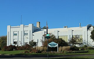
Polk County is a county in the U.S. state of Wisconsin. As of the 2010 census, the population was 44,205. Its county seat is Balsam Lake. The county was created in 1853.

Burnett County is a county located in the U.S. state of Wisconsin. As of the 2020 census, the population was 16,526. Its county seat is Siren, with the majority of county governmental services located at the Burnett County Government Center. The county was created in 1856 and organized in 1865.

The Ice Age Trail is a National Scenic Trail stretching 1,200 miles (1,900 km) in the state of Wisconsin in the United States. The trail is administered by the National Park Service, and is constructed and maintained by private and public agencies including the Ice Age Trail Alliance, a non-profit and member-volunteer based organization with local chapters.

The St. Croix River is a tributary of the Mississippi River, approximately 169 miles (272 km) long, in the U.S. states of Wisconsin and Minnesota. The lower 125 miles (201 km) of the river form the border between Wisconsin and Minnesota. The river is a National Scenic Riverway under the protection of the National Park Service. A hydroelectric plant at St. Croix Falls supplies power to the Minneapolis–St. Paul metropolitan area.

St. Croix Falls is a city in Polk County, Wisconsin, United States. The population was 2,133 at the 2010 census. The city is located within the Town of St. Croix Falls.

The Apple River is a 77.5-mile-long (124.7 km) tributary of the St. Croix River in northwestern Wisconsin in the United States. Via the St. Croix, it is part of the watershed of the Mississippi River.
The Willard Munger State Trail is a system of recreational trails between Hinckley, Minnesota and Duluth, Minnesota. There are three segments to the trail, Hinckley to Duluth Segment, Alex Laveau Memorial Trail, and Matthew Lourey State Trail.

The Saint Croix National Scenic Riverway is a federally protected system of riverways located in eastern Minnesota and northwestern Wisconsin. It protects 252 miles (406 km) of river, including the St. Croix River, and the Namekagon River, as well as adjacent land along the rivers. The St. Croix National Scenic Riverway is one of the original eight National Wild and Scenic Rivers, largely as a result of legislation by senators Walter Mondale of Minnesota and Gaylord Nelson of Wisconsin. The largest scenic riverway east of the Mississippi River, it lies within parts of eight counties in Wisconsin: Bayfield, Burnett, Douglas, Pierce, Polk, St. Croix, Sawyer, and Washburn; and three in Minnesota: Chisago, Pine, and Washington.
State Trunk Highway 35 is a Wisconsin state highway running north–south across western Wisconsin. It is 412.15 miles in length, and is the longest state highway in Wisconsin. Portions of WIS 35 are part of the Great River Road.
The Gateway State Trail is a multi-use recreational rail trail in the U.S. state of Minnesota, running 18 miles (29 km) from Saint Paul to Pine Point Regional Park in Stillwater. It runs through urban landscapes of eastern Saint Paul in Ramsey County and rural farmland and forests in Washington County. It was designated a National Recreation Trail in 2002.

Wisconsin, a state in the Midwestern United States, has a vast and diverse geography famous for its landforms created by glaciers during the Wisconsin glaciation 17 thousand years ago. The state can be generally divided into five geographic regions—Lake Superior Lowland, Northern Highland, Central Plain, Eastern Ridges & Lowlands, and Western Upland. The southwestern part of the state, which was not covered by glaciers during the most recent ice age, is known as the Driftless Area. The Wisconsin glaciation formed the Wisconsin Dells, Devil's Lake, and the Baraboo Range. A number of areas are protected in the state, including Devil's Lake State Park, the Apostle Islands National Lakeshore, and the Chequamegon–Nicolet National Forest.
The Nemadji State Forest is a state forest located primarily in Pine County, Minnesota. A small portion of the forest extends into neighboring Carlton County. The eastern perimeter of the forest borders the state of Wisconsin. It is managed by the Minnesota Department of Natural Resources. Gray wolves, white-tailed deer, and eagles are present in the forest.
The Trade River is a 50.8-mile-long (81.8 km) tributary of the St. Croix River in northwestern Wisconsin in the United States. In its history, it has been known by the names "Atanwa" or "Ottoway" River, both of which are Anglicized versions of an Ojibwe language word meaning "trade". Beneath the mouth of the Trade River, the St. Croix River was once known as the Grave-marker River.
Cloverton is an unincorporated community in New Dosey Township, Pine County, Minnesota, United States.

Markville is an unincorporated community in Arna Township, Pine County, Minnesota, United States, located along the Saint Croix River.

There are a variety of schema for dividing Wisconsin into regions.