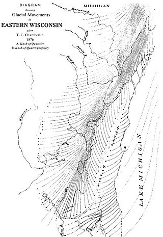
The Ice Age Trail is a National Scenic Trail stretching 1,200 miles (1,900 km) in the state of Wisconsin in the United States. The trail is administered by the National Park Service, and is constructed and maintained by private and public agencies including the Ice Age Trail Alliance, a non-profit and member-volunteer based organization with local chapters. It became an official unit of the National Park System in 2023.

The Elroy-Sparta State Trail is a 32.5-mile (52.3 km) Wisconsin State rail trail between Elroy and Sparta, Wisconsin. Considered to be the first rail trail when it opened in 1967, it was designed for foot, bicycle, equestrian and light motorized traffic. Designated a multi-use trail, it offers recreational access to the routes and is open to the public. The trail is part of the larger Wisconsin bike trail system operated by the state of Wisconsin. It passes through rural scenery and three tunnels. It is one of six connecting trails in west-central Wisconsin. It was added to the Rails-to-Trails Conservancy hall of Fame in September 2008. It is one of the most popular trails in Wisconsin.
The Sugar River State Trail is a 24-mile (39 km) long, 265-acre (107 ha), recreation rail trail in Wisconsin.

Kettle Moraine is a large moraine in the state of Wisconsin, United States. It stretches from Walworth County in the south to Kewaunee County in the north. It has also been referred to as the Kettle Range and, in geological texts, as the Kettle Interlobate Moraine.

The Kettle Moraine State Forest is a state forest in southeastern Wisconsin. The chief feature of the reserve is the Kettle Moraine, a highly glaciated area. The area contains very hilly terrain and glacial landforms, such as kettles, kames and eskers. The 56,000-acre (23,000 ha) forest is divided into two large and three small units, which are spread across a hundred miles.

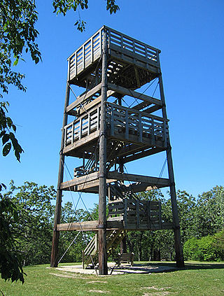
Lapham Peak is a Wisconsin state park located in the Kettle Moraine State Forest. It is just south of Delafield and seven miles (11 km) west of Waukesha. The park entrance is two miles (3 km) north of the Glacial Drumlin State Trail.

The Ozaukee - Sheboygan Interurban Trail is a roughly 40-mile (64 km) long rail trail in Ozaukee, and Sheboygan Counties, in Wisconsin. The south end of the trail is in Milwaukee County but only runs 1 mile through the county.

Horicon Marsh is a marsh located in northern Dodge and southern Fond du Lac counties of Wisconsin. It is the site of both a national and a state wildlife refuge. The silted-up glacial lake is the largest freshwater cattail marsh in the United States.

The Wisconsin Department of Natural Resources (WDNR) is a government agency of the U.S. state of Wisconsin charged with conserving and managing Wisconsin's natural resources. The Wisconsin Natural Resources Board has the authority to set policy for the WDNR. The WDNR is led by the Secretary, who is appointed by the Governor of Wisconsin. The WDNR develops regulations and guidance in accordance with laws passed by the Wisconsin Legislature. It administers wildlife, fish, forests, endangered resources, air, water, waste, and other issues related to natural resources. The central office of the WDNR is located in downtown Madison, near the state capitol.

The Military Ridge State Trail is a 40-mile-long (64 km) recreational rail trail in Wisconsin.

Rock Lake is a lake in Southeast Wisconsin, United States.

The Badger State Trail is a 40-mile (64 km) rail trail in south central Wisconsin. The trail leads from the Wisconsin – Illinois state line to Madison passing through, from south to north, Monroe, Monticello, Belleville and Fitchburg. Near Monticello, the trail passes through the 1,200-foot (370 m) long, unlit Stewart Tunnel constructed in 1887. The trail was officially opened July 8, 2007.

The Kettle Moraine Scenic Drive is a designated scenic route in southeastern Wisconsin that links the two units of the Kettle Moraine State Forest. The route traverses through scenic and historic areas, including landscape shaped by glaciers from the latest ice age, known as the Wisconsin glaciation.

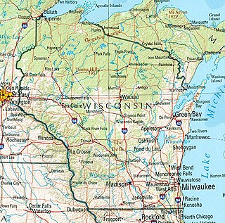
Wisconsin, a state in the Midwestern United States, has a vast and diverse geography famous for its landforms created by glaciers during the Wisconsin glaciation 17,000 years ago. The state can be generally divided into five geographic regions—Lake Superior Lowland, Northern Highland, Central Plain, Eastern Ridges & Lowlands, and Western Upland. The southwestern part of the state, which was not covered by glaciers during the most recent ice age, is known as the Driftless Area. The Wisconsin glaciation formed the Wisconsin Dells, Devil's Lake, and the Baraboo Range. A number of areas are protected in the state, including Devil's Lake State Park, the Apostle Islands National Lakeshore, and the Chequamegon–Nicolet National Forest.

Potawatomi State Park is a 1,225-acre (496 ha) Wisconsin state park northwest of the city of Sturgeon Bay, Wisconsin in the Town of Nasewaupee. It is located in Door County along Sturgeon Bay, a bay within the bay of Green Bay. Potawatomi State Park was established in 1928.

The Glacial Drumlin State Trail is a multipurpose rail trail in the U.S. State of Wisconsin. It stretches 52 miles (84 km) from Waukesha to Cottage Grove. The trail travels through or near the Wisconsin communities of Cottage Grove, Deerfield, London, Lake Mills, Jefferson, Helenville, Sullivan, Dousman, Genesee, Wales, and Waukesha. In Lake Mills, it crosses Rock Lake on one of its many old railroad bridges. The trail was opened in 1986 and follows the old Chicago and North Western Railway (C&NW) Madison–Milwaukee mainline.

Cycling in Minnesota is a popular form of recreation, commuting, and competitive sport that has grown in prominence over the years. It has been a popular activity in the state since the late 19th century.

The La Crosse River State Trail is a 22-mile (35 km) rail trail between Sparta and Onalaska, Wisconsin. It is designed for foot, bicycle, equestrian or light motorized traffic. It is designated as a multiuse trail, offering recreational access to the routes, and is open to the public. The trail runs parallel to the La Crosse River.
The Eisenbahn State Trail is a multi-purpose trail designated as a park by the Wisconsin Department of Natural Resources. The trail is maintained by the counties through which it transgresses, Washington and Fond du Lac counties. The trail extends 25 miles, from the village of Eden in the north to Rusco Road, south of West Bend. The trail follows the route of the former Fox Valley Railroad.

The New Berlin Trail is a 7-mile (11 km) shared-use path in Waukesha County, Wisconsin. It follows a former interurban route and a set of We Energies power lines.


