
The Yarra River or historically, the Yarra Yarra River, is a perennial river in south-central Victoria, Australia.

Docklands, also known as Melbourne Docklands, is an inner-city suburb in Melbourne, Victoria, Australia, 2 km (1.2 mi) west of Melbourne's Central Business District, located within the City of Melbourne local government area. Docklands recorded a population of 15,495 at the 2021 census.
Abbotsford is an inner-city suburb in Melbourne, Victoria, Australia, 2 km (1.2 mi) north-east of Melbourne's Central Business District, located within the City of Yarra local government area. Abbotsford recorded a population of 9,088 at the 2021 census.

Fitzroy North is an inner-city suburb in Melbourne, Victoria, Australia, 4 km (2.5 mi) north-east of the Melbourne central business district, located within the Cities of Merri-bek and Yarra local government areas. Fitzroy North recorded a population of 12,781 at the 2021 census.

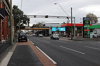
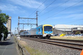
Merri railway station is a commuter railway station on the Mernda line, serving the north-eastern Melbourne suburb of Northcote in Victoria, Australia. Merri is an unstaffed status ground structure station featuring two side platforms. It opened on 8 October 1889 as Northcote before the station was given its current name Merri on 10 December 1906.

The Inner Circle Line was a steam era suburban railway line in Melbourne, Australia. It served the inner-northern suburbs of Parkville, Carlton North, Fitzroy North and Fitzroy. At its closure, it ran from Royal Park station on the Upfield line in the west to a triangular junction with Rushall and Merri stations on today's Mernda line in the east. There was also a branch line to Fitzroy that opened at the same time.
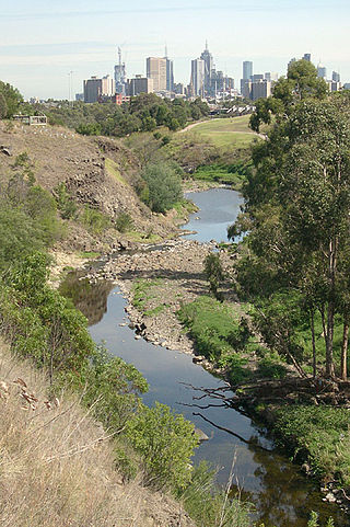
The Merri Creek is a waterway in southern parts of Victoria, Australia which flows through the northern suburbs of Melbourne. It begins near Wallan and flows south for 70 km until joining the Yarra River at Dights Falls. The area where the creek meets the river was traditionally the location for large gatherings of the Wurundjeri people and is suspected to have been the location for one of the earliest land treaties in Australia between Indigenous Australians and European settlers.
The Upfield Shared Path is a shared use path for cyclists and pedestrians, which follows Upfield railway line through the inner northern suburbs of Melbourne, Victoria, Australia.

Brunswick East is an inner-city suburb in Melbourne, Victoria, Australia, 5 km (3.1 mi) north of Melbourne's Central Business District, located within the City of Merri-bek local government area. Brunswick East recorded a population of 13,279 at the 2021 census.

The Moonee Ponds Creek is a creek and major tributary of the Yarra River running through urban Melbourne, Victoria, Australia from northern to inner suburbs. In 2004 a reporter for The Age described it as "arguably the most abused tributary of the Yarra River, and part of the true underside of Melbourne".
The Moonee Ponds Creek Trail is a shared use path for cyclists and pedestrians, which follows the Moonee Ponds Creek through the northern suburbs of Melbourne, Victoria, Australia.

The Maribyrnong River Trail is a shared use path for cyclists and pedestrians, which follows the Maribyrnong River through the north western suburbs of Melbourne, Victoria, Australia.

The Merri Creek Trail is a shared use path for cyclists and pedestrians that follows the Merri Creek through the northern suburbs of Melbourne, Victoria, Australia.
The Hobsons Bay Coastal Trail is a shared use path for cyclists and pedestrians, which follows the coast line of Hobsons Bay in the inner western suburbs in Melbourne, Victoria, Australia. The trail forms part of the western half of the Bayside Trail which encircles Port Phillip. It runs from the west side of the Westgate bridge, south and along the coast, finishing at the Skeleton Creek Trail in Sanctuary Lakes.

The M80 Trail is a shared-use path for cyclists and pedestrians that bridges the northern suburbs and follows the Western Ring Road/Metropolitan Ring Road (M80) freeway in Melbourne, Australia.
Melbourne West Province was an electorate of the Victorian Legislative Council from 1904 until 2006.

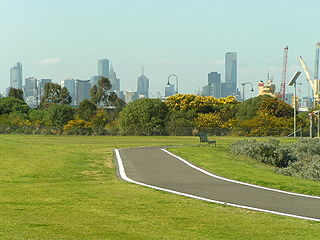
The Main Yarra Trail, also known as the Yarra Trail is a shared-use path for cyclists and pedestrians, which follows the Yarra River through the northeastern suburbs of Melbourne, Victoria, Australia.
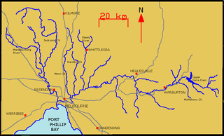
The Yarra River is a river in East-Central Victoria, Australia that flows through the city of Melbourne. This article contains explanations and lists of the river's tributaries and other geographic features. The river flows atop layers of silt that built up within an ancient river valley around 10,000-15,000 years ago.

East Bourke Boroughs was an electoral district of the Legislative Assembly in the Australian state of Victoria from 1859 to 1904.


