Plenty River Trail

Last updated

Plenty River Trail
Length12.3km
Location Melbourne, Victoria, Australia
Cycling details
Trail difficultyMedium
Surface Gravel, concrete and bitumen
HillsLarge hill between Yarra River Trail and the Plenty River
Connecting transport
Train(s) Greensborough station
Tram(s)None
Bus Route 563 Bus

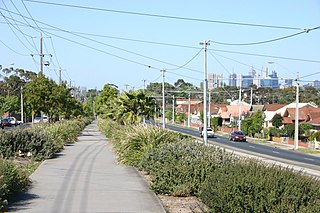
The Plenty River Trail is a shared use path for cyclists and pedestrians, which follows the Plenty River through the suburbs of Greensborough and Lower Plenty in Melbourne, Victoria, Australia. [1] [2] [3]

Shared use path form of infrastructure that supports multiple recreation and transportation opportunities, such as walking, bicycling, inline skating and people in wheelchairs

A shared-use path or mixed-use path is a form of infrastructure that supports multiple recreation and transportation opportunities, such as walking, bicycling, inline skating and people in wheelchairs. Motorcycles and mopeds are normally prohibited. A shared-use path typically has a surface that is asphalt, concrete or firmly packed crushed aggregate. In the U.S., the 1999 AASHTO Guide for the Development of Bicycle Facilities defines a shared-use path as being physically separated from motor vehicular traffic with an open space or barrier. Shared-use paths differ from exclusive bikeways in that shared-use paths are designed to include pedestrians even if the primary anticipated users are cyclists. Some shared paths have been built as rail trails.

Cycling riding a bicycle

Cycling, also called biking or bicycling, is the use of bicycles for transport, recreation, exercise or sport. People engaged in cycling are referred to as "cyclists", "bikers", or less commonly, as "bicyclists". Apart from two-wheeled bicycles, "cycling" also includes the riding of unicycles, tricycles, quadracycles, recumbent and similar human-powered vehicles (HPVs).

Pedestrian person traveling on foot

A pedestrian is a person travelling on foot, whether walking or running. In modern times, the term usually refers to someone walking on a road or pavement, but this was not the case historically.

Contents

The last major gap in the trail was eliminated by the completion of a footbridge across the river, south of the Heidelberg Golf Club, in March 2007. The trail now runs all the way from the Yarra River to the Greensborough Bypass and points further north.

Footbridge bridge designed for pedestrians and in some cases cyclists, animal traffic and horse riders, rather than vehicular traffic

A footbridge is a bridge designed solely for pedestrians. While the primary meaning for a bridge is a structure which links "two points at a height above the ground", a footbridge can also be a lower structure, such as a boardwalk, that enables pedestrians to cross wet, fragile, or mashy land. Bridges range from stepping stones–possibly the earliest man-made structure to "bridge" water–to elaborate steel structures. Another early bridge would have been simply a fallen tree. In some cases a footbridge can be both functional and a beautiful work of art.

The trail is badly signed but provides a pleasant environment.

Following the path

Although there is a sign near the most northerly bend of Punkerri Circuit which declares this as the end of the Trail, the actual track starts further north off an easement, at the most northerly bend of Plenty River Drive, 120 m from Acworth Court. When the path reaches the signed end point, it is well-defined but somewhat rough, narrow and overgrown.

Not far down the path is a bus stop, which surprisingly can be found in this heavily-treed area. Further along, past a pipe bridge and 1.6 km later, the Greensborough Bypass bridge spans the valley. On the east side of the road a path goes up to a goat track, which can be used to access the Western Ring Road Trail. The Western Ring Road Trail passes across the bridge on the bridge's north side.

The Western Ring Road Trail is a shared use path for cyclists and pedestrians that bridges the northern suburbs and follows the Western Ring Road freeway in Melbourne, Australia. It intercepts many other paths making possible a large variety of circuits for the recreational cyclist.

Leaving the bridge behind, the path gradually improves and arrives 1 km later at a footbridge. Paths run off in all directions on both sides of the footbridge. Just continue across the footbridge and continue straight ahead across Kalparrin Ave and along the north side of the Whatmough Park oval.

On the far side of the oval is a suspension footbridge. There are no signs here. The rule in this case, is always to do a very sharp right turn immediately after crossing the bridge, regardless of from what direction one arrives. Do not go straight ahead.

The path goes under Main Street and 800 m later arrives at an apparent dead end at the end of a small street - Bicton Street. Turn right (west) and head along Bicton Street. The path resumes at its far end.

Continuing leads to an athletics track, complete with the characteristic red brick colored track. Skirt round the east side of the track and cross a small footbridge on its south side. 2 km later another footbridge appears (near Allima Court). There are no signs here and its possible to lose the trail; maintain a NE - SW direction.

Sport of athletics Sports involving running, jumping, throwing, and walking

Athletics is a collection of sporting events that involve competitive running, jumping, throwing, and walking. The most common types of athletics competitions are track and field, road running, cross country running, and race walking.

Past a stand of large Monkey Puzzle trees and further on to the old Lower Plenty Road iron bridge, built on bluestone supports. Cross the bridge, turn right and go past the Heidelberg golf course and over the final and newest footbridge.

<i>Araucaria araucana</i> species of plant

Araucaria araucana is an evergreen tree growing to 1–1.5 m (3–5 ft) in diameter and 30–40 m (100–130 ft) in height. It is native to central and southern Chile and western Argentina. Araucaria araucana is the hardiest species in the conifer genus Araucaria. Because of the prevalence of similar species in ancient prehistory, it is sometimes called a living fossil. It is also the national tree of Chile. Its conservation status was changed to Endangered by the IUCN in 2013 due to the dwindling population caused by logging, forest fires, and grazing.

The trail moves into a more open area above the Plenty river where horses are kept. The trail goes up and up, past the large transmitter antenna, past the old grain silos in the distance and affords excellent views of the immediate area. It overlooks the ancient floodplain surrounding the confluence of the Plenty and Yarra Rivers.

Horse Domesticated four-footed mammal from the equine family

The horse is one of two extant subspecies of Equus ferus. It is an odd-toed ungulate mammal belonging to the taxonomic family Equidae. The horse has evolved over the past 45 to 55 million years from a small multi-toed creature, Eohippus, into the large, single-toed animal of today. Humans began domesticating horses around 4000 BC, and their domestication is believed to have been widespread by 3000 BC. Horses in the subspecies caballus are domesticated, although some domesticated populations live in the wild as feral horses. These feral populations are not true wild horses, as this term is used to describe horses that have never been domesticated, such as the endangered Przewalski's horse, a separate subspecies, and the only remaining true wild horse. There is an extensive, specialized vocabulary used to describe equine-related concepts, covering everything from anatomy to life stages, size, colors, markings, breeds, locomotion, and behavior.

Transmitter Electronic device that emits radio waves

In electronics and telecommunications a transmitter or radio transmitter is an electronic device which produces radio waves with an antenna. The transmitter itself generates a radio frequency alternating current, which is applied to the antenna. When excited by this alternating current, the antenna radiates radio waves.

Antenna (radio) electrical device which converts electric power into radio waves, and vice versa

In radio engineering, an antenna is the interface between radio waves propagating through space and electric currents moving in metal conductors, used with a transmitter or receiver. In transmission, a radio transmitter supplies an electric current to the antenna's terminals, and the antenna radiates the energy from the current as electromagnetic waves. In reception, an antenna intercepts some of the power of a radio wave in order to produce an electric current at its terminals, that is applied to a receiver to be amplified. Antennas are essential components of all radio equipment.

Finally the trail drops about 30 m to the floor of the Yarra valley, to meet with the Yarra River Trail.

Connections

Western Ring Road Trail in the north and Yarra River Trail in the south.

North end at 37°40′56″S145°06′44″E / 37.682318°S 145.112187°E / -37.682318; 145.112187 . South end at 37°45′01″S145°05′34″E / 37.750189°S 145.092719°E / -37.750189; 145.092719 .

Related Research Articles

Moonee Ponds Creek Trail shared use path following the Moonee Ponds Creek in Melbourne, Victoria, Australia

The Moonee Ponds Creek Trail is a shared use path for cyclists and pedestrians, which follows the Moonee Ponds Creek through the northern suburbs of Melbourne, Victoria, Australia.

Capital City Trail

The Capital City Trail is a shared use path in Melbourne, Victoria, Australia, which circles the city centre and some inner eastern and northern suburbs. It is 29km in length, and mostly consists of sections of other trails, such as the Merri Creek Trail, Main Yarra Trail, Moonee Ponds Creek Trail and Inner Circle Rail Trail.
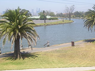
Diamond Creek Trail

The Diamond Creek Trail is a shared use path for cyclists and pedestrians, which follows Diamond Creek through the north eastern outer suburbs of Melbourne, Victoria, Australia.

Merri Creek Trail

The Merri Creek Trail is a shared use path for cyclists and pedestrians that follows the Merri Creek through the northern suburbs of Melbourne, Victoria, Australia.

Gardiners Creek Trail

The Gardiners Creek Trail is a shared use path for cyclists and pedestrians, which follows Gardiners Creek through the eastern suburbs of Melbourne, Victoria, Australia.

Outer Circle Trail

The Outer Circle Trail, also known as the Anniversary Trail, Anniversary Outer Circle Trail, or even the Outer Circle Anniversary Trail, is a shared use path for cyclists and pedestrians, which partly follows the Alamein Line through the inner eastern suburbs of Melbourne, Victoria, Australia.

Darebin Creek Trail

The Darebin Creek Trail is a shared use path for cyclists and pedestrians which follows Darebin Creek in the inner and outer northern suburbs of Melbourne, Victoria, Australia.
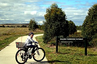
Craigieburn Bypass Trail

The Craigieburn Bypass Trail, is a shared use path for cyclists and pedestrians in the outer northern suburbs of Melbourne, Victoria, Australia. In 2008 it was given the local name of the Galada Tamboore Pathway - Wurundjeri for "creek waterhole" or "stream waterhole" - as it goes past the Craigieburn, Cooper street and Galada Tamboore grasslands which are all nationally significant for their plains grassland and riparian habitat for endangered and vulnerable native fauna and flora, including the critically endangered Golden Sun Moth.

Hobsons Bay Coastal Trail

The Hobsons Bay Coastal Trail is a shared use path for cyclists and pedestrians, which follows the coast line of Hobsons Bay in the inner western suburbs in Melbourne, Victoria, Australia. The trail forms part of the western half of the Bayside Trail which encircles Port Phillip. It runs from the west side of the Westgate bridge, south and along the coast, finishing at the Skeleton Creek Trail in Sanctuary Lakes.

The Laverton Creek Trail is a shared use path for cyclists and pedestrians, which follows Laverton Creek in the outer western suburbs of Laverton and Altona in Melbourne, Victoria, Australia.

Mullum Mullum Creek Trail

The Mullum Mullum Creek Trail is a shared use path for cyclists and pedestrians, which follows Mullum Mullum Creek in the outer eastern suburbs in Melbourne, Victoria, Australia.

The River Gum Walk Trail is a shared use path for cyclists and pedestrians in the suburb of Rosanna, an inner northern suburb of Melbourne, Victoria, Australia.

The Ruffey Creek Trail is a shared use path for cyclists and pedestrians, which follows Ruffey Creek in the inner eastern suburbs of Templestowe and Doncaster in Melbourne, Victoria, Australia.
Sandridge Trail

The Sandridge Trail is a shared-use path for cyclists and pedestrians located in the inner southern suburb of Port Melbourne in Melbourne, Victoria, Australia.

St Georges Road Trail

The St Georges Road Trail is a shared use path for cyclists and pedestrians, which follows Cheddar and St Georges Road in the inner northern suburbs of Reservoir, Preston and Thornbury in Melbourne, Victoria, Australia.

The Tarralla Creek Trail is a shared use path for cyclists and pedestrians, which follows Tarralla Creek, in the outer eastern suburb of Croydon in Melbourne, Victoria, Australia. It is part of the Carrum to Warburton trail and Bayswater to Lilydale link.

The Werribee River Trail is a shared use path for cyclists and pedestrians, which follows Werribee River in the outer western suburb of Werribee in Melbourne, Victoria, Australia.

Bay Trail shared use path for cyclists and pedestrians which follows the coastline of Port Phillip Bay through the south-eastern suburbs of Melbourne, Victoria, Australia

The Bay Trail is a shared use path for cyclists and pedestrians which follows the coastline of Port Phillip Bay through the south-eastern suburbs of Melbourne, Victoria, Australia.

Main Yarra Trail

The Yarra Trail is a shared use path for cyclists and pedestrians, which follows the Yarra River through the north eastern suburbs of Melbourne, Victoria, Australia.

References