
Laverton established in 1886, is a suburb of Melbourne, Victoria, Australia, 17 km (11 mi) south-west of Melbourne's Central Business District, located within the Cities of Hobsons Bay and Wyndham local government areas. Laverton recorded a population of 4,760 at the 2021 census.

The Capital City Trail is a shared use path in Melbourne, Victoria, Australia, which circles the city centre and some inner eastern and northern suburbs. It is 29 km in length, and mostly consists of sections of other trails, such as the Merri Creek Trail, Main Yarra Trail, Moonee Ponds Creek Trail and Inner Circle Rail Trail.

The Maribyrnong River Trail is a shared use path for cyclists and pedestrians, which follows the Maribyrnong River through the north western suburbs of Melbourne, Victoria, Australia.

The Diamond Creek Trail is a shared-use path for cyclists and pedestrians, running along Diamond Creek through the north-eastern outer suburbs of Melbourne, Victoria, Australia.

The Merri Creek Trail is a shared use path for cyclists and pedestrians that follows the Merri Creek through the northern suburbs of Melbourne, Australia.

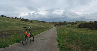
The Federation Trail is a 23-kilometre-long (14 mi) shared use path for cyclists and pedestrians, which mainly follows the heritage-listed Main Outfall Sewer through the western suburbs of Melbourne, Victoria, Australia. There are three bridges spanning across major arterial roads, as well as button-activated traffic light crossings at most other major road-trail intersections.
The Broadmeadows Valley Trail is a shared use path for cyclists and pedestrians in the outer northern suburbs of Melbourne, Victoria, Australia.

The Darebin Creek Trail is a shared use path for cyclists and pedestrians which follows Darebin Creek in the inner and outer northern suburbs of Melbourne, Victoria, Australia.
The Ferndale Park Trail is a shared use path for cyclists and pedestrians in the suburb of Glen Iris, an inner eastern suburb of Melbourne, Victoria.
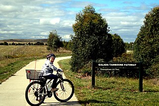
The Craigieburn Bypass Trail, is a shared use path for cyclists and pedestrians in the outer northern suburbs of Melbourne, Victoria, Australia. In 2008 it was given the local name of the Galada Tamboore Pathway - Wurundjeri for "creek waterhole" or "stream waterhole" - as it goes past the Craigieburn, Cooper street and Galada Tamboore grasslands which are all nationally significant for their plains grassland and riparian habitat for endangered and vulnerable native fauna and flora, including the critically endangered Golden Sun Moth.
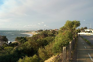
The Hobsons Bay Coastal Trail is a shared use path for cyclists and pedestrians, which follows the coast line of Hobsons Bay in the inner western suburbs in Melbourne, Victoria, Australia. The trail forms part of the western half of the Bayside Trail which encircles Port Phillip. It runs from the west side of the Westgate bridge, south and along the coast, finishing at the Skeleton Creek Trail in Sanctuary Lakes.

The Kororoit Creek Trail is a shared use path for cyclists and pedestrians, which follows the Kororoit Creek in the inner western suburbs of Melbourne, Victoria, Australia.
The Ruffey Creek Trail is a shared use path for cyclists and pedestrians, which follows Ruffey Creek in the inner eastern suburbs of Templestowe and Doncaster in Melbourne, Victoria, Australia.
The Skeleton Creek Trail is a shared use path for cyclists and pedestrians, which follows Skeleton Creek as it passes through the outer south western suburbs of Point Cook and Altona Meadows in Melbourne, Victoria, Australia.
The Northern Pipe Trail, is a shared-use path for cyclists and pedestrians that follows Cheddar and St Georges Roads in the northern suburbs of Reservoir, Preston and Thornbury in Melbourne, Victoria, Australia.

The M80 Trail is a shared-use path for cyclists and pedestrians that bridges the northern suburbs and follows the Western Ring Road/Metropolitan Ring Road (M80) freeway in Melbourne, Australia.
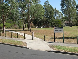
The Gawler Chain Trail is a shared use path for cyclists and pedestrians in the inner eastern suburb of Mont Albert in Melbourne, Victoria, Australia.

The Main Yarra Trail, also known as the Yarra Trail is a shared-use path for cyclists and pedestrians, which follows the Yarra River through the northeastern suburbs of Melbourne, Victoria, Australia.
The Truganina Coastal Parklands are located 15 km west of Melbourne CBD, on the shores of Port Phillip Bay, stretching from Altona to Altona Meadows and adjacent to the Cheetham Wetlands and the Point Cook Coastal Park. They were formed through the 'recycling' of more than 300 hectares of parks and former industrial land and are now the largest cluster of parks on Port Phillip Bay, interlinked by cycling and walking trails and featuring a surprisingly high diversity and abundance of landscapes, natural environment and recreational areas, including beachside recreation, picnic & barbecue facilities, grassfields and wildlife conservation areas. The wetlands form part of the Cheetham and Altona Important Bird Area.
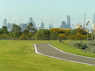
The Bay Trail is a shared use path for cyclists and pedestrians which follows the coastline of Port Phillip Bay through the south-eastern suburbs of Melbourne, Victoria, Australia.