
Box Hill North is a suburb of Melbourne, Victoria, Australia, 14 km east from Melbourne's Central Business District, located within the City of Whitehorse local government area. Box Hill North recorded a population of 12,337 at the 2021 census.

The Gardiners Creek Trail is a shared use path for cyclists and pedestrians, which follows Gardiners Creek through the eastern suburbs of Melbourne, Victoria, Australia.

Koonung Creek is a small tributary of the Yarra River in Melbourne's east. The creek originates in Nunawading near Springvale Road, and flows to join the Yarra at the border between Ivanhoe East, Bulleen and Balwyn North. The place the two waterways meet forms the borders between these suburbs. Bushy Creek is a tributary to the creek, joining near Elgar Park in Mont Albert North. A shared use path follows the course of the creek, known as the Koonung Creek Trail.

The Scotchmans Creek Trail is a shared use path for cyclists and pedestrians, which follows Scotchmans Creek through the eastern suburbs of Melbourne, Victoria, Australia.

The Blind Creek Trail, in the outer eastern suburbs of Melbourne, in the Australian state of Victoria, is a shared-use path for cyclists and pedestrians, which follows the Blind Creek from the Dandenong Creek Trail in Wantirna South to the Ringwood - Belgrave Rail Trail in Boronia.
The Broadmeadows Valley Trail is a shared use path for cyclists and pedestrians in the outer northern suburbs of Melbourne, Victoria, Australia.

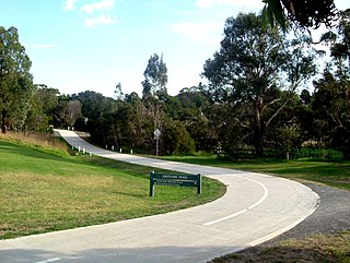
The Bushy Creek Trail is a shared use path for cyclists and pedestrians in the inner eastern suburb of Box Hill North in Melbourne, Victoria, Australia.
The Greengully Trail is a shared use path for cyclists and pedestrians in the inner eastern suburb of Templestowe in Melbourne, Victoria, Australia.
The Hallam Bypass Trail is a shared use path for cyclists and pedestrians running along the Hallam Bypass between Doveton and Berwick in the outer eastern suburbs of Melbourne, Victoria, Australia. The trail was completed in 2003.

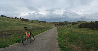
The Koonung Creek Trail, also known as the Koonung Trail, is a shared use path for cyclists and pedestrians, which follows Koonung Creek in the eastern suburbs of Melbourne, Victoria, Australia. The trail also follows the course of the Eastern Freeway as it too, follows the course of the Koonung Creek, and has good connections to on-road paths.
The Edgars Creek Trail is a shared use path for cyclists and pedestrians in the suburb of Thomastown, an inner northern suburb of Melbourne, Victoria.
The Maroondah Aqueduct Trail is a shared use path which follows the disused Maroondah Aqueduct through the outer eastern suburbs of Eltham and Research in Melbourne, Victoria, Australia.

The Mullum Mullum Creek Trail is a shared use path for cyclists and pedestrians, which follows Mullum Mullum Creek in the outer eastern suburbs in Melbourne, Victoria, Australia. The Mullum Mullum Creek Trail extends from the Eastlink Trail at Sherbrook Park to Highland Avenue in Croydon.
The Plenty River Trail is a shared use path for cyclists and pedestrians, which follows the Plenty River through the suburbs of Greensborough and Lower Plenty in Melbourne, Victoria, Australia.
The Ruffey Creek Trail is a shared use path for cyclists and pedestrians, which follows Ruffey Creek in the inner eastern suburbs of Templestowe and Doncaster in Melbourne, Victoria, Australia.

The M80 Trail is a shared-use path for cyclists and pedestrians that bridges the northern suburbs and follows the Western Ring Road/Metropolitan Ring Road (M80) freeway in Melbourne, Australia.
The Wurundjeri Walk Trail is a shared use path for cyclists and pedestrians in the inner eastern suburbs of Blackburn South and Forest Hill in Melbourne, Victoria, Australia.

The Syndal Heatherdale Pipe Reserve Trail is a shared use path for cyclists and pedestrians, which follows the Syndal to Heatherdale pipe reserve in the eastern suburbs of Melbourne, Victoria, Australia.

The Main Yarra Trail, also known as the Yarra Trail is a shared-use path for cyclists and pedestrians, which follows the Yarra River through the northeastern suburbs of Melbourne, Victoria, Australia.
The EastLink Trail is a shared use path for cyclists and pedestrians in the outer eastern/southeastern suburbs of Melbourne, Victoria, Australia. The trail gets its name from the north-south EastLink tollway, along which it follows for most of its length from Ringwood to Dandenong, until it joins the Dandenong Creek Trail near the Dandenong Bypass bridge at the tri-suburban junction between Dandenong, Dandenong South and Keysborough.
