
Eltham is a suburb of Melbourne, Victoria, Australia, 20 km north-east of the Central Business District, located within the Shire of Nillumbik local government area. Eltham recorded a population of 18,847 at the 2021 census.

Greensborough is a suburb of Melbourne, Victoria, Australia, 17 km (11 mi) north-east from Melbourne's Central Business District, located within the City of Banyule and Shire of Nillumbik local government areas. Greensborough recorded a population of 21,070 at the 2021 census.

The Moonee Ponds Creek Trail is a shared use path for cyclists and pedestrians, which follows the Moonee Ponds Creek through the northern suburbs of Melbourne, Victoria, Australia.

The Capital City Trail is a shared use path in Melbourne, Victoria, Australia, which circles the city centre and some inner eastern and northern suburbs. It is 29km in length, and mostly consists of sections of other trails, such as the Merri Creek Trail, Main Yarra Trail, Moonee Ponds Creek Trail and Inner Circle Rail Trail.

The Maribyrnong River Trail is a shared use path for cyclists and pedestrians, which follows the Maribyrnong River through the north western suburbs of Melbourne, Victoria, Australia.

Westerfolds Park is a metropolitan park situated in Templestowe, an eastern suburb of Melbourne, Australia.

Mullum Mullum Creek is a creek in the outer eastern suburbs of Melbourne, Victoria, Australia. It is the main watercourse of the Mullum Mullum Valley, a tributary of the Yarra River and Yarra Valley. For tens of thousands of years it was used as a food and tool source sustainably by the Wurundjeri people, Indigenous Australians of the Kulin nation, who spoke variations of the Woiwurrung language group.

The Gardiners Creek Trail is a shared use path for cyclists and pedestrians, which follows Gardiners Creek through the eastern suburbs of Melbourne, Victoria, Australia.

The Dandenong Creek Trail is a shared use path for cyclists and pedestrians, which follows Dandenong Creek through the outer eastern and south-eastern suburbs of Melbourne, Victoria, Australia.
The Outer Circle Trail, also known as the Anniversary Trail, is a shared use path for cyclists and pedestrians, which partly follows the Alamein Line through the inner eastern suburbs of Melbourne, Victoria, Australia.

The Scotchmans Creek Trail is a shared use path for cyclists and pedestrians, which follows Scotchmans Creek through the eastern suburbs of Melbourne, Victoria, Australia.

The Bushy Creek Trail is a shared use path for cyclists and pedestrians in the inner eastern suburb of Box Hill North in Melbourne, Victoria, Australia.
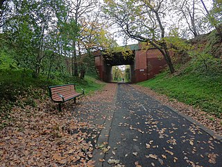
The Maroondah Aqueduct Trail is a shared use path which follows the disused Maroondah Aqueduct through the outer eastern suburbs of Eltham and Research in Melbourne, Victoria, Australia.

The Mullum Mullum Creek Trail is a shared use path for cyclists and pedestrians, which follows Mullum Mullum Creek in the outer eastern suburbs in Melbourne, Victoria, Australia.The Mullum Mullum Creek Trail extends from the Eastlink Trail at Sherbrook Park to Highland Avenue in Croydon.
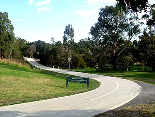
The Plenty River Trail is a shared use path for cyclists and pedestrians, which follows the Plenty River through the suburbs of Greensborough and Lower Plenty in Melbourne, Victoria, Australia.
The Werribee River Trail is a shared use path for cyclists and pedestrians, which follows Werribee River in the outer western suburb of Werribee in Melbourne, Victoria, Australia.

The Main Yarra Trail, also known as the Yarra Trail is a shared-use path for cyclists and pedestrians, which follows the Yarra River through the northeastern suburbs of Melbourne, Victoria, Australia.
The EastLink Trail is a shared use path for cyclists and pedestrians in the outer eastern/southeastern suburbs of Melbourne, Victoria, Australia. The trail gets its name from the north-south EastLink tollway, along which it follows for most of its length from Ringwood to Dandenong, until it joins the Dandenong Creek Trail near the Dandenong Bypass bridge at the tri-suburban junction between Dandenong, Dandenong South and Keysborough.
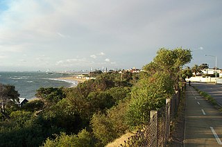
The Bay Trail is a shared use path for cyclists and pedestrians which follows the coastline of Port Phillip Bay through the south-eastern suburbs of Melbourne, Victoria, Australia.
