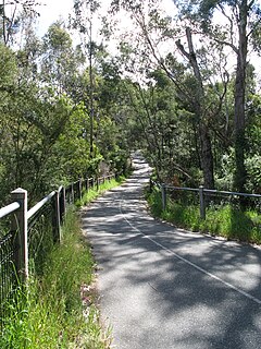
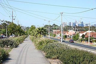
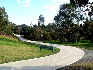
| Syndal Heatherdale Pipe Reserve Trail | |
|---|---|
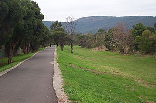
 The trail near Highbury Road | |
| Length | About 10.3 km |
| Location | Melbourne, Victoria, Australia |
| Cycling details | |
| Trail difficulty | Difficult |
| Surface | lined concrete path 1/2 goat track[ citation needed ] |
| Hills | Hilly in the north end |
| Connecting transport | |
| Train(s) | Heatherdale, Syndal |
| Tram(s) | None |
The Syndal Heatherdale Pipe Reserve Trail is a shared use path for cyclists and pedestrians, which follows the Syndal to Heatherdale pipe reserve in the eastern suburbs of Melbourne, Victoria, Australia. [1] [2] [3]

Cycling, also called biking or bicycling, is the use of bicycles for transport, recreation, exercise or sport. People engaged in cycling are referred to as "cyclists", "bikers", or less commonly, as "bicyclists". Apart from two-wheeled bicycles, "cycling" also includes the riding of unicycles, tricycles, quadracycles, recumbent and similar human-powered vehicles (HPVs).

A pedestrian is a person travelling on foot, whether walking or running. In some communities, those travelling using tiny wheels such as roller skates, skateboards, and scooters, as well as wheelchair users are also included as pedestrians. In modern times, the term usually refers to someone walking on a road or pavement, but this was not the case historically.
Syndal is a Locality in the Melbourne suburbs of Glen Waverley and Mount Waverley in Victoria, Australia around the intersection of High Street Road and Blackburn Road. It is in the local government area of the City of Monash. From the intersection down to Syndal railway station on Coleman Parade, is the Syndal Shopping Centre. This strip is a highly populated commercial area encompassing a number of diverse local interest stores including several take-away food shops, a laundromat, a bridal store, a dry cleaner and many others in between.
Contents
The trail is navigable from one end to the other but in many sections there is only a few formal sections of path- currently between Highbury Road and Ballantyne Street. Monash Council has released a tender for construction of the section from Highbury Road to High Street Road, while Whitehorse Council is currently planning for construction of the path from Mahoneys Road to Norma Road. Bicycle Victoria sees this as an important route, linking the Syndal railway station with the Tally Ho business park on Burwood highway, as part of an ongoing demand for a fully integrated transport strategy in Victoria [4] and is campaigning for improvements to the trail. [5]

Syndal railway station is located on the Glen Waverley line in Victoria, Australia. It serves the eastern Melbourne suburb of Glen Waverley, opening on 5 May 1930.

Burwood East is a suburb of Melbourne, Victoria, Australia, located 16 km east of Melbourne's Central Business District. Its local government area is the City of Whitehorse. At the 2011 Census, Burwood East had a population of 10,141.