
EastLink is a tolled section of the M3 freeway linking a large area through the eastern and south-eastern suburbs of Melbourne, Australia.

Mullum Mullum Creek is a creek in the outer eastern suburbs of Melbourne, Victoria, Australia. It is the main watercourse of the Mullum Mullum Valley, a tributary of the Yarra River and Yarra Valley. For tens of thousands of years it was used as a food and tool source sustainably by the Wurundjeri people, Indigenous Australians of the Kulin nation, who spoke variations of the Woiwurrung language group.

The Gardiners Creek Trail is a shared use path for cyclists and pedestrians, which follows Gardiners Creek through the eastern suburbs of Melbourne, Victoria, Australia.

The Dandenong Creek Trail is a shared use path for cyclists and pedestrians, which follows Dandenong Creek through the outer eastern and south-eastern suburbs of Melbourne, Victoria, Australia.

The Dandenong Creek is an urban creek of the Port Phillip catchment, located in the eastern and south-eastern Greater Melbourne region of the Australian east coast state of Victoria. The creek descends approximately 550 metres (1,800 ft) over its course of 53 kilometres (33 mi) before joining the Eumemmerring Creek to form the Patterson River and eventually draining into the Beaumaris Bay.

The Scotchmans Creek Trail is a shared use path for cyclists and pedestrians, which follows Scotchmans Creek through the eastern suburbs of Melbourne, Victoria, Australia.

The Blind Creek Trail, in the outer eastern suburbs of Melbourne, in the Australian state of Victoria, is a shared-use path for cyclists and pedestrians, which follows the Blind Creek from the Dandenong Creek Trail in Wantirna South to the Ringwood - Belgrave Rail Trail in Boronia.

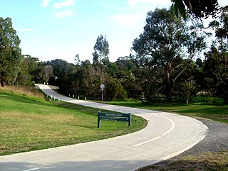
The Ringwood to Belgrave Rail Trail is a shared use path for cyclists and pedestrians that follows the Belgrave railway line from the Mullum Mullum Creek Trail in Ringwood to Belgrave railway station in Belgrave, in the outer eastern suburbs of Melbourne, Victoria, Australia.

The Bushy Creek Trail is a shared use path for cyclists and pedestrians in the inner eastern suburb of Box Hill North in Melbourne, Victoria, Australia.
The Ferndale Park Trail is a shared use path for cyclists and pedestrians in the suburb of Glen Iris, an inner eastern suburb of Melbourne, Victoria.
The Ferny Creek Trail is a shared use path for cyclists and pedestrians, which follows Ferny and Corhanwarrabul Creeks through the suburbs of Knoxfield and Ferntree Gully in Melbourne, Victoria, Australia.
The Greengully Trail is a shared use path for cyclists and pedestrians in the inner eastern suburb of Templestowe in Melbourne, Victoria, Australia.
The Hallam Bypass Trail is a shared use path for cyclists and pedestrians running along the Hallam Bypass between Doveton and Berwick in the outer eastern suburbs of Melbourne, Victoria, Australia. The trail was completed in 2003.

The Koonung Creek Trail, also known as the Koonung Trail, is a shared use path for cyclists and pedestrians, which follows Koonung Creek in the eastern suburbs of Melbourne, Victoria, Australia. The trail also follows the course of the Eastern Freeway as it too, follows the course of the Koonung Creek, and has good connections to on-road paths.

The Kororoit Creek Trail is a shared use path for cyclists and pedestrians, which follows the Kororoit Creek in the inner western suburbs of Melbourne, Victoria, Australia.

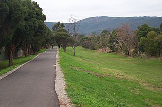
The Mullum Mullum Creek Trail is a shared use path for cyclists and pedestrians, which follows Mullum Mullum Creek in the outer eastern suburbs in Melbourne, Victoria, Australia. The Mullum Mullum Creek Trail extends from the Eastlink Trail at Sherbrook Park to Highland Avenue in Croydon.

The Syndal Heatherdale Pipe Reserve Trail is a shared use path for cyclists and pedestrians, which follows the Syndal to Heatherdale pipe reserve in the eastern suburbs of Melbourne, Victoria, Australia.

The Main Yarra Trail, also known as the Yarra Trail is a shared-use path for cyclists and pedestrians, which follows the Yarra River through the northeastern suburbs of Melbourne, Victoria, Australia.
The EastLink Trail is a shared use path for cyclists and pedestrians in the outer eastern/southeastern suburbs of Melbourne, Victoria, Australia. The trail gets its name from the north-south EastLink tollway, along which it follows for most of its length from Ringwood to Dandenong, until it joins the Dandenong Creek Trail near the Dandenong Bypass bridge at the tri-suburban junction between Dandenong, Dandenong South and Keysborough.
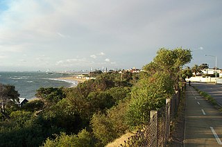
The Bay Trail is a shared use path for cyclists and pedestrians which follows the coastline of Port Phillip Bay through the south-eastern suburbs of Melbourne, Victoria, Australia.