Blind Creek Trail

Last updated

Blind Creek Trail
Blind Creek Trail.jpg
The Blind Creek Trail near Scoresby Road in Ferntree Gully.
Length11.5 km
Location Melbourne, Victoria, Australia
DifficultyEasy
Hazards Some blind corners, a handful of road crossings, damaged path surface in some areas
Surface Mostly asphalt, minor concrete sections
HillsMinor hill near the Dandenong Creek Trail
ParkingShepherd Road, Glen Waverley
Nortons Park, Wantirna South
Collier Reserve, Wantirna South
Westfield Knox, Wantirna South
Lewis Park, Wantirna South
Fairpark Reserve, Ferntree Gully
Boronia Tennis Club, Ferntree Gully
Tim Neville Arboretum, Ferntree Gully
Blind Creek Trail
Start point at 37°53′07″S145°11′46″E / 37.885239°S 145.196011°E / -37.885239; 145.196011
End point at 37°52′20″S145°17′24″E / 37.872150°S 145.290132°E / -37.872150; 145.290132
Major intersections only
km
BSicon fKBHFa.svg
0.0
Dandenong Creek Trail, Wantirna South
BSicon fTEEl.svg
BSicon fdCONTfq.svg
2.1
to George Street, EastLink Trail
BSicon dRP2q.svg
BSicon fSKRZ-G2u.svg
BSicon dRP2q.svg
2.2
George Street, EastLink AUS Alphanumeric Route M3.svg
BSicon fdCONTgq.svg
BSicon fTEEr.svg
3.0
to High Street Road (eastbound, south side)
BSicon dWASSERq.svg
BSicon fWBRUCKE2.svg
BSicon dWASSERq.svg
3.1
Blind Creek
BSicon fdCONTgq.svg
BSicon fTEEr.svg
3.1
to High Street Road (westbound, south side)
BSicon dRP2q.svg
BSicon fSKRZ-G2u.svg
BSicon dRP2q.svg
3.1
High Street Road Australian state route 24.svg
BSicon fTEEl.svg
BSicon fdCONTfq.svg
3.2
to High Street Road (north side)
BSicon fTEEl.svg
BSicon fdCONTfq.svg
4.2
to Timothy Drive (west side)
BSicon dRP2q.svg
BSicon fSKRZ-G2u.svg
BSicon dRP2q.svg
4.3
Timothy Drive
BSicon fTEEl.svg
BSicon fdCONTfq.svg
4.4
to Timothy Drive (east side)
BSicon fTEEl.svg
BSicon fdCONTfq.svg
5.2
Burwood Highway Trail (south side)
BSicon dRP2q.svg
BSicon fSKRZ-G2u.svg
BSicon dRP2q.svg
5.2
Burwood Highway Australian state route 26.svg
BSicon fTEEl.svg
BSicon fdCONTfq.svg
5.3
Burwood Highway Trail (north side)
BSicon fdCONTgq.svg
BSicon fTEEr.svg
5.4
Stud Road Trail (southbound)
BSicon fTEEl.svg
BSicon fdCONTfq.svg
5.5
Stud Road Trail (northbound)
BSicon dRP2q.svg
BSicon fBHF.svg
BSicon RP2q.svg
BSicon dRP2q.svg
5.5
Stud Road Australian state route 9.svg
BSicon fdCONTgq.svg
BSicon fTEEr.svg
5.6
to Stud Road
(southbound, east side)
Westfield Knox
BSicon fdCONTgq.svg
BSicon fTEEr.svg
6.1
to Westfield Knox
BSicon fTEEl.svg
BSicon fdCONTfq.svg
6.3
to Lewis Park (west side), Coleman Road
BSicon fTEEl.svg
BSicon fdCONTfq.svg
6.9
to Knox Skate Park
BSicon fdCONTgq.svg
BSicon fTEEr.svg
7.2
to Lewis Road (west side)
BSicon fTEEl.svg
BSicon fdCONTfq.svg
7.2
to Lewis Park (east side), Coleman Road
BSicon dRP2q.svg
BSicon fSKRZ-G2u.svg
BSicon dRP2q.svg
7.3
Lewis Road
BSicon fTEEl.svg
BSicon fdCONTfq.svg
7.3
to Lewis Road (east side)
BSicon dWASSERq.svg
BSicon fWBRUCKE2.svg
BSicon dWASSERq.svg
7.8
Blind Creek
BSicon fdCONTgq.svg
BSicon fTEEr.svg
8.3
Scoresby Road Trail,
to Scoresby Road
(west side)
BSicon dRP2q.svg
BSicon fSKRZ-G2u.svg
BSicon dRP2q.svg
8.4
Scoresby Road Australian state route 7.svg
BSicon fdCONTgq.svg
BSicon fTEEr.svg
8.4
to Scoresby Road (east side)
BSicon fdCONTgq.svg
BSicon fTEEr.svg
8.5
to Scoresby Road (east side)
BSicon dRP2q.svg
BSicon RP2q.svg
BSicon fSTR.svg
BSicon dRP2q.svg
9.0
Manuka Drive
BSicon dRP2q.svg
BSicon RP2q.svg
BSicon fSTR.svg
BSicon dRP2q.svg
9.4
Rankin Road
BSicon dRP2q.svg
BSicon RP2q.svg
BSicon fSTR.svg
BSicon dRP2q.svg
10.3
Wattletree Road
BSicon fdCONTgq.svg
BSicon fTEEr.svg
10.8
to Dorset Road (west side)
BSicon dRP2q.svg
BSicon fSKRZ-G2u.svg
BSicon dRP2q.svg
10.9
Dorset Road Australian state route 5.svg
BSicon fdCONTgq.svg
BSicon fKRZ.svg
BSicon fdCONTfq.svg
10.9
to Dorset Road (
northbound, east side
southbound, east side
)
BSicon fdCONTgq.svg
BSicon fTEEr.svg
11.1
to Tim Neville Arboretum, Francis Lane
BSicon dRP2q.svg
BSicon RP2q.svg
BSicon fSTR.svg
BSicon dRP2q.svg
11.2
Briar Street
BSicon dRP2q.svg
BSicon RP2q.svg
BSicon fSTR.svg
BSicon dRP2q.svg
11.4
Sycamore Crescent
BSicon dRP2q.svg
BSicon fSKRZ-G2u.svg
BSicon dRP2q.svg
11.4
Belgrave railway line
BSicon fKBHFe.svg
11.5
Ringwood - Belgrave Rail Trail, Ferntree Gully
km

The Blind Creek Trail, in the outer eastern suburbs of Melbourne, in the Australian state of Victoria, [1] [2] [3] is a shared-use path for cyclists and pedestrians, which follows the Blind Creek from the Dandenong Creek Trail in Wantirna South to the Ringwood - Belgrave Rail Trail in Boronia.

Contents

This trail is one of the major shared use trails which runs through the City of Knox and runs past Westfield Knox and the Tim Neville Arboretum along its 11.5 km route. During November 2008, directional signage was installed along most of the path to assist users in guiding themselves to their desired destinations.

An interactive map of the trail as well as others in the Melbourne area is available here.

Following the Path

Travelling from the Ringwood - Belgrave Rail Trail to the Dandenong Creek Trail heading west, the trail begins 1.2 km north of Ferntree Gully Station, at a train line underpass on the Ringwood - Belgrave Rail Trail. It goes through the underpass.

Traveling downhill and in a westerly direction, the trail soon passes the Tim Neville Arboretum and continues on without navigational difficulty to Scoresby Road. It passes through a light industrial area and then follows the wall of Melbourne Water's retarding basin to the immediate north of Westfield Knox. Passing by the centre's car parks, it comes to a halt at Stud Road near Burwood Highway.

On the west side of Stud Road the path restarts by one of the many pieces of art dedicated to Hubert Opperman, that are found in the City of Knox. It heads south east and pass under Burwood Highway.

After 2.2 km, the path reaches High Street Road just to the east of EastLink. Crossing High Street Road to the south, access is made available by the pedestrian crossing or the road underpass. The latter is sometimes swamped. It heads left (east) to continue on the trail. Going west at High Street Road leads to the EastLink Trail on the far side (west side) of the tollway. One kilometre south of High Street Road, the Blind Creek Trail heads west and goes under the tollway and under the EastLink Trail. It continues on the path that leads to Norton Lane.

The St Pauls missionary college is straight ahead. It turns left (south) down Nortons Lane and picks up the trail at the end of the lane. Three hundred and thirty metres west from here is the Dandenong Creek Trail intersection. This junction is badly signed in all directions, so it pays to review this point before heading out.

Connections

The trail meets the Dandenong Creek Trail in the west and the Belgrave Rail Trail in the east. A decrepit path along Scoresby Road leads to the Ferny Creek Trail to the south. Another path beside Stud Road leads to the Dandenong Creek Trail to the north, via Waldheim Road.

West end at 37°53′07″S145°11′46″E / 37.885239°S 145.196011°E / -37.885239; 145.196011 . East end at 37°52′20″S145°17′24″E / 37.872150°S 145.290132°E / -37.872150; 145.290132 .

Related Research Articles

<span class="mw-page-title-main">EastLink (Melbourne)</span> Tollway in Melbourne, Australia

EastLink is a tolled section of the M3 freeway linking a large area through the eastern and south-eastern suburbs of Melbourne, Australia.

<span class="mw-page-title-main">Ferntree Gully, Victoria</span> Suburb of Melbourne, Victoria, Australia

Ferntree Gully is a suburb in Melbourne, Victoria, Australia, at the foothills of the Dandenong Ranges, 30 km east of Melbourne's Central Business District, located within the City of Knox local government area. Ferntree Gully recorded a population of 27,398 at the 2021 census.

Wantirna is a suburb in Melbourne, Victoria, Australia, 24 km east of Melbourne's Central Business District, located within the City of Knox local government area. Wantirna recorded a population of 14,237 at the 2021 census.

<span class="mw-page-title-main">Upwey, Victoria</span> Suburb of Melbourne, Victoria, Australia

Upwey is a suburb of Melbourne, Victoria, Australia, 33 kilometres (21 mi) east from Melbourne's central business district, located within the Shire of Yarra Ranges local government area. Upwey recorded a population of 6,818 at the 2021 census.

<span class="mw-page-title-main">Mullum Mullum Creek</span> Creek in Victoria, Australia

Mullum Mullum Creek is a creek in the outer eastern suburbs of Melbourne, Victoria, Australia. It is the main watercourse of the Mullum Mullum Valley, a tributary of the Yarra River and Yarra Valley. For tens of thousands of years it was used as a food and tool source sustainably by the Wurundjeri people, Indigenous Australians of the Kulin nation, who spoke variations of the Woiwurrung language group.

<span class="mw-page-title-main">Gardiners Creek Trail</span>

The Gardiners Creek Trail is a shared use path for cyclists and pedestrians, which follows Gardiners Creek through the eastern suburbs of Melbourne, Victoria, Australia.

<span class="mw-page-title-main">Dandenong Creek Trail</span> Suburban trail in Melbourne, Australia

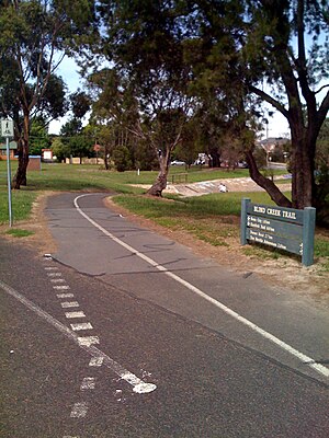
The Dandenong Creek Trail is a shared use path for cyclists and pedestrians, which follows Dandenong Creek through the outer eastern and south-eastern suburbs of Melbourne, Victoria, Australia.

<span class="mw-page-title-main">Koomba Park</span> Park in Wantirna, Australia

Koomba Park is one of the parks comprising the Dandenong Valley Parklands in the eastern suburbs of Melbourne, Australia. It consists of 92 hectares of which 33 hectares are publicly accessible, and is bounded by Dandenong Creek, Boronia Road, EastLink, Mountain Highway and Burwood Highway in a clockwise direction. It is managed primarily by VicRoads and Parks Victoria. The park opened in December 1981, and its land was previously used for cattle grazing and apple orchards. The surrounding area is still used for grazing. There are three major power transmission lines running through the park: Rowville-Templestowe Single Circuit Southern, and Rowville-Ringwood.

<span class="mw-page-title-main">Dandenong Creek</span> Urban creek in Melbourne, Australia

The Dandenong Creek is an urban creek of the Port Phillip catchment, located in the eastern and south-eastern Greater Melbourne region of the Australian east coast state of Victoria. The creek descends approximately 550 metres (1,800 ft) over its course of 53 kilometres (33 mi) before joining the Eumemmerring Creek to form the Patterson River and eventually draining into the Beaumaris Bay.

<span class="mw-page-title-main">Scotchmans Creek Trail</span>

The Scotchmans Creek Trail is a shared use path for cyclists and pedestrians, which follows Scotchmans Creek through the eastern suburbs of Melbourne, Victoria, Australia.

<span class="mw-page-title-main">Ringwood to Belgrave Rail Trail</span> Rail trail in Victoria, Australia

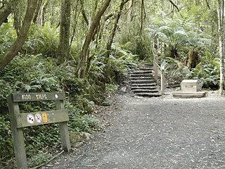
The Ringwood to Belgrave Rail Trail is a shared use path for cyclists and pedestrians that follows the Belgrave railway line from the Mullum Mullum Creek Trail in Ringwood to Belgrave railway station in Belgrave, in the outer eastern suburbs of Melbourne, Victoria, Australia.

<span class="mw-page-title-main">Ferny Creek Trail</span>

The Ferny Creek Trail is a shared use path for cyclists and pedestrians, which follows Ferny and Corhanwarrabul Creeks through the suburbs of Knoxfield and Ferntree Gully in Melbourne, Victoria, Australia.

The Hallam Bypass Trail is a shared use path for cyclists and pedestrians running along the Hallam Bypass between Doveton and Berwick in the outer eastern suburbs of Melbourne, Victoria, Australia. The trail was completed in 2003.

<span class="mw-page-title-main">Mullum Mullum Creek Trail</span> Shared use path for cyclists and pedestrians in Melbourne, Victoria, Australia

The Mullum Mullum Creek Trail is a shared use path for cyclists and pedestrians, which follows Mullum Mullum Creek in the outer eastern suburbs in Melbourne, Victoria, Australia. The Mullum Mullum Creek Trail extends from the Eastlink Trail at Sherbrook Park to Highland Avenue in Croydon.

The Ruffey Creek Trail is a shared use path for cyclists and pedestrians, which follows Ruffey Creek in the inner eastern suburbs of Templestowe and Doncaster in Melbourne, Victoria, Australia.

The Tarralla Creek Trail is a shared use path for cyclists and pedestrians, which follows Tarralla Creek, in the outer eastern suburb of Croydon in Melbourne, Victoria, Australia. It is part of the Carrum to Warburton trail and Bayswater to Lilydale link.

<span class="mw-page-title-main">Syndal Heatherdale Pipe Reserve Trail</span>

The Syndal Heatherdale Pipe Reserve Trail is a shared use path for cyclists and pedestrians, which follows the Syndal to Heatherdale pipe reserve in the eastern suburbs of Melbourne, Victoria, Australia.

The Ringwood Bypass is a short stretch of road extending from EastLink to Maroondah Highway in Melbourne, Australia. It allows the Maroondah Highway to bypass Eastland Shopping Centre, in the eastern Melbourne suburb of Ringwood.

<span class="mw-page-title-main">EastLink Trail</span> Suburban trail in Melbourne, Australia

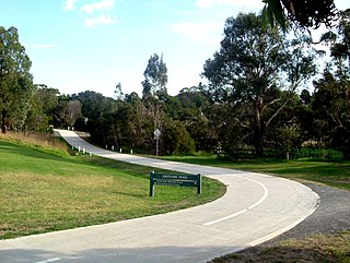
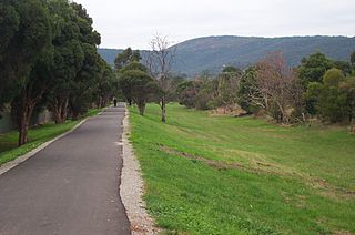
The EastLink Trail is a shared use path for cyclists and pedestrians in the outer eastern/southeastern suburbs of Melbourne, Victoria, Australia. The trail gets its name from the north-south EastLink tollway, along which it follows for most of its length from Ringwood to Dandenong, until it joins the Dandenong Creek Trail near the Dandenong Bypass bridge at the tri-suburban junction between Dandenong, Dandenong South and Keysborough.

<span class="mw-page-title-main">Box Hill to Ringwood Rail Trail</span>

The Box Hill to Ringwood Rail Trail is a shared use path that runs alongside the Belgrave and Lilydale Lines in the east of Melbourne, Australia. The route serves a total of seven railway stations. The bike path is incomplete, as the section between Blackburn and Laburnum is yet to be constructed.

References

  1. VicRoads - Bicycle Facilities Map Archived 2007-02-19 at the Wayback Machine
  2. Melbourne and Geelong's shared paths in Google Maps
  3. "Melbourne and Geelong's shared paths in Google Earth". Archived from the original on 12 October 2016. Retrieved 13 June 2007.