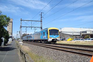
The Upfield Shared Path is a shared use path for cyclists and pedestrians, which follows Upfield railway line through the inner northern suburbs of Melbourne, Victoria, Australia.

The Moonee Ponds Creek Trail is a shared use path for cyclists and pedestrians, which follows the Moonee Ponds Creek through the northern suburbs of Melbourne, Victoria, Australia.

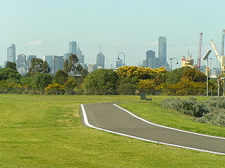
The Capital City Trail is a shared use path in Melbourne, Victoria, Australia, which circles the city centre and some inner eastern and northern suburbs. It is 29 km in length, and mostly consists of sections of other trails, such as the Merri Creek Trail, Main Yarra Trail, Moonee Ponds Creek Trail and Inner Circle Rail Trail.

The Maribyrnong River Trail is a shared use path for cyclists and pedestrians, which follows the Maribyrnong River through the north western suburbs of Melbourne, Victoria, Australia.

The Merri Creek Trail is a shared use path for cyclists and pedestrians that follows the Merri Creek through the northern suburbs of Melbourne, Australia.

The Gardiners Creek Trail is a shared use path for cyclists and pedestrians, which follows Gardiners Creek through the eastern suburbs of Melbourne, Victoria, Australia.

The Dandenong Creek Trail is a shared use path for cyclists and pedestrians, which follows Dandenong Creek through the outer eastern and south-eastern suburbs of Melbourne, Victoria, Australia.

The Federation Trail is a 23-kilometre-long (14 mi) shared use path for cyclists and pedestrians, which mainly follows the heritage-listed Main Outfall Sewer through the western suburbs of Melbourne, Victoria, Australia. There are three bridges spanning across major arterial roads, as well as button-activated traffic light crossings at most other major road-trail intersections.

The Darebin Creek Trail is a shared use path for cyclists and pedestrians which follows Darebin Creek in the inner and outer northern suburbs of Melbourne, Victoria, Australia.
The Ferndale Park Trail is a shared use path for cyclists and pedestrians in the suburb of Glen Iris, an inner eastern suburb of Melbourne, Victoria.
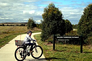
The Craigieburn Bypass Trail, is a shared use path for cyclists and pedestrians in the outer northern suburbs of Melbourne, Victoria, Australia. In 2008 it was given the local name of the Galada Tamboore Pathway - Wurundjeri for "creek waterhole" or "stream waterhole" - as it goes past the Craigieburn, Cooper street and Galada Tamboore grasslands which are all nationally significant for their plains grassland and riparian habitat for endangered and vulnerable native fauna and flora, including the critically endangered Golden Sun Moth.
The Hallam Bypass Trail is a shared use path for cyclists and pedestrians running along the Hallam Bypass between Doveton and Berwick in the outer eastern suburbs of Melbourne, Victoria, Australia. The trail was completed in 2003.
The Hobsons Bay Coastal Trail is a shared use path for cyclists and pedestrians, which follows the coast line of Hobsons Bay in the inner western suburbs in Melbourne, Victoria, Australia. The trail forms part of the western half of the Bayside Trail which encircles Port Phillip. It runs from the west side of the Westgate bridge, south and along the coast, finishing at the Skeleton Creek Trail in Sanctuary Lakes.

The Kororoit Creek Trail is a shared use path for cyclists and pedestrians, which follows the Kororoit Creek in the inner western suburbs of Melbourne, Victoria, Australia.
The Laverton Creek Trail is a shared use path for cyclists and pedestrians, which follows Laverton Creek in the outer western suburbs of Laverton and Altona in Melbourne, Victoria, Australia.
The Werribee River Trail is a shared use path for cyclists and pedestrians, which follows Werribee River in the outer western suburb of Werribee in Melbourne, Victoria, Australia.

The Main Yarra Trail, also known as the Yarra Trail is a shared-use path for cyclists and pedestrians, which follows the Yarra River through the northeastern suburbs of Melbourne, Victoria, Australia.
The EastLink Trail is a shared use path for cyclists and pedestrians in the outer eastern/southeastern suburbs of Melbourne, Victoria, Australia. The trail gets its name from the north-south EastLink tollway, along which it follows for most of its length from Ringwood to Dandenong, until it joins the Dandenong Creek Trail near the Dandenong Bypass bridge at the tri-suburban junction between Dandenong, Dandenong South and Keysborough.

The Cheetham Wetlands are 420 hectares of artificial and natural lagoons, created on old salt works land on the western shores of Port Phillip Bay, Australia. The wetlands are approximately 20 kilometres (12 mi) southwest of Melbourne, and sit within the Municipal Councils of Hobsons Bay and Wyndham City.
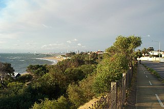
The Bay Trail is a shared use path for cyclists and pedestrians which follows the coastline of Port Phillip Bay through the south-eastern suburbs of Melbourne, Victoria, Australia.