Related Research Articles
The City of Kingston is a local government area in Victoria, Australia in the south-eastern suburbs of Melbourne, its northern boundary lying approximately 15 km from the Melbourne city centre along the north-eastern shorelines of Port Phillip. It covers an area of 91 km² and has an estimated population of 163,431 people.

Carrum Downs is a suburb of Melbourne, Victoria, Australia, 36 km south-east of Melbourne's Central Business District, located within the City of Frankston local government area. Carrum Downs recorded a population of 20,711 at the 2016 Census.
Aspendale is a suburb in Melbourne, Victoria, Australia, 27 km south-east from Melbourne's central business district. Its local government area is the City of Kingston. At the 2016 census, Aspendale had a population of 6,940.

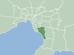
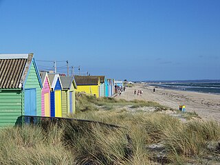
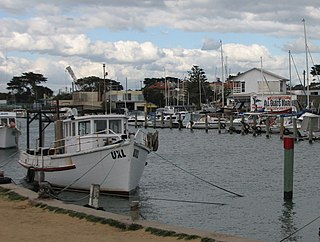
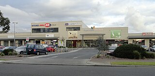
Carrum is a suburb in Melbourne, Victoria, Australia, 33 km (21 mi) south-east from Melbourne's central business district. Its local government area is the City of Kingston. At the 2016 census, Carrum had a population of 3,980.
Edithvale is a suburb in Melbourne, Victoria, Australia, 28 km south-east from Melbourne's central business district. Its local government area is the City of Kingston. At the 2016 census, Edithvale had a population of 5,806.
Mordialloc is a beachside suburb in Melbourne, Victoria, Australia, 24 km south-east of Melbourne's central business district. Its local government area is the City of Kingston. At the 2016 census, Mordialloc had a population of 8,166.

Mordialloc railway station is located on the Frankston line in Victoria, Australia. It serves the south-eastern Melbourne suburb of Mordialloc, and opened on 19 December 1881.

Aspendale railway station is located on the Frankston line in Victoria, Australia. It serves the south-eastern Melbourne suburb of Aspendale, opening in April 1891 as Aspendale Park Racecourse, and was renamed Aspendale on 1 August 1905.
Aspendale Gardens is a suburb in Melbourne, Victoria, Australia, 27 km south-east of Melbourne's central business district. Its local government area is the City of Kingston. According to the 2016 census, Aspendale Gardens had a population of 6,530.
The Frankston railway line is a 42.7km commuter rail passenger train service in Melbourne, Victoria. It operates between Flinders Street in the Melbourne central business district and Frankston through the south-eastern suburbs including Richmond, South Yarra, Armadale, Malvern, Caulfield East, Glen Huntly, Ormond, McKinnon, Bentleigh, Moorabbin, Cheltenham, Mentone, Parkdale, Mordialloc, Aspendale, Edithvale, Chelsea, Bonbeach, Carrum, Seaford, and Frankston. The line continues on to Stony Point as the non electrified Stony Point line from Frankston, however, there are no through services between Stony Point and the City. It is operated by Metro Trains Melbourne and is part of the Public Transport Victoria metropolitan rail network. Between Caulfield and the city, the Frankston line acts as a de facto local service whilst Pakenham/Cranbourne line trains run express.

Patterson Lakes is located in outer south-east Melbourne in Victoria, Australia. The canal suburb is located 35 km southeast of Melbourne's central business district. Its local government area is the City of Kingston. In the 2016 census, Patterson Lakes had a population of 7,564.

The Maribyrnong River Trail is a shared use path for cyclists and pedestrians, which follows the Maribyrnong River through the north western suburbs of Melbourne, Victoria, Australia.

Waterways is a residential suburb located in Melbourne's south 25 km south of the Melbourne CBD. Originally a housing development, it is just east of Mordialloc. It is Australia's only suburb that's 20% parkland and 40% water. Over 46 hectares of wildlife sanctuary were artificially created in and around the swampy marshlands of Mordialloc Creek.
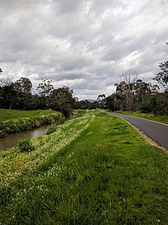
The Dandenong Creek Trail is a shared use path for cyclists and pedestrians, which follows Dandenong Creek through the outer eastern and south-eastern suburbs of Melbourne, Victoria, Australia.

The Scotchmans Creek Trail is a shared use path for cyclists and pedestrians, which follows Scotchmans Creek through the eastern suburbs of Melbourne, Victoria, Australia.
The Mornington Peninsula Nepean Football League is an Australian rules football competition, governed by the AFL South East. The MPNFL contains teams near the south eastern region of Melbourne, Victoria, Australia. At the end of the 2017 season, the competition was restructured from a geographical to a divisional structure, with promotion/ relegation. It contains two divisions with 22 teams in all, 10 in Division 1 and 12 in Division 2.

The Bay Trail is a shared use path for cyclists and pedestrians which follows the coastline of Port Phillip Bay through the south-eastern suburbs of Melbourne, Victoria, Australia.

Port Phillip is a bay in Victoria, Australia. It has many beaches, most of which are flat, shallow and long, with very small breaks making swimming quite safe. This attracts many tourists, mostly families, to the beaches of Port Phillip during the summer months and school holidays. Water sports such as body boarding and surfing are easy or simple, except in extreme weather conditions.
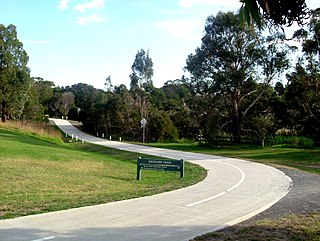
The EastLink Trail is a shared use path for cyclists and pedestrians, which follows the EastLink tollway for most of its length from Ringwood to Dandenong, in the outer eastern suburbs of Melbourne, Victoria, Australia.
The Edithvale-Seaford Wetlands are a group of two principally freshwater swamps, totalling 261 hectares, lying in the suburbs of Aspendale, Edithvale, Chelsea Heights, and Seaford in south-eastern Melbourne, Victoria, Australia. Together they form the Edithvale-Seaford Wetlands Ramsar Site. With the nearby Eastern Treatment Plant, they form the Carrum Wetlands Important Bird Area.
References
- ↑ "Relation: Long Beach Trail (1350453)". OpenStreetMap. Retrieved 19 January 2020.
- ↑ "Mordialloc Beaumaris Conservation League – Minutes – 6th November 2019 | Mordialloc Beaumaris Conservation League Inc" . Retrieved 19 January 2020.