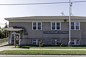
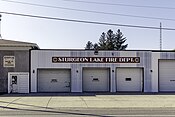
Sturgeon Lake, Minnesota

Last updated

Sturgeon Lake
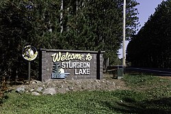
Welcome To Sturgeon Lake sign.jpg
Welcome To Sturgeon Lake sign
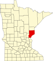
Pine County Minnesota Incorporated and Unincorporated areas Sturgeon Lake Highlighted.svg
Location of the city of Sturgeon Lake
within Pine County, Minnesota
Coordinates: 46°23′11″N92°49′27″W / 46.38639°N 92.82417°W / 46.38639; -92.82417
Country United States
State Minnesota
County Pine
IncorporatedAugust 2, 1889 [1]
Government
  MayorTodd Danelski [2]
Area
[3]
  Total3.80 sq mi (9.83 km2)
  Land3.77 sq mi (9.76 km2)
  Water0.03 sq mi (0.07 km2)
Elevation
[4]
1,053 ft (321 m)
Population
 (2020)
  Total436
  Density115.68/sq mi (44.67/km2)
   Demonym
Sturgeon Laker
Time zone UTC-6 (Central (CST))
  Summer (DST) UTC-5 (CDT)
ZIP code
55783
Area code 218
FIPS code 27-63220 [5]
GNIS feature ID2395993 [4]

Sturgeon Lake is a city in Pine County, Minnesota, United States. The population was 439 at the 2010 census. [6]

Contents

Interstate 35, County Road 46, and County 61 (Main Street) are three of the main routes in the community.

Geography

According to the United States Census Bureau, the city has a total area of 3.69 square miles (9.56 km2), of which 3.66 square miles (9.48 km2) is land and 0.03 square miles (0.08 km2) is water. [7]

Demographics

Historical population
CensusPop.Note
1910 183
1920 20813.7%
1930 2101.0%
1940 2152.4%
1950 189−12.1%
1960 151−20.1%
1970 16710.6%
1980 22232.9%
1990 2303.6%
2000 34750.9%
2010 43926.5%
2020 436−0.7%
U.S. Decennial Census [8]

2010 census

As of the census [9] of 2010, there were 439 people, 167 households, and 115 families living in the city. The population density was 119.9 inhabitants per square mile (46.3/km2). There were 258 housing units at an average density of 70.5 per square mile (27.2/km2). The racial makeup of the city was 96.6% White, 0.5% Asian, 0.2% Pacific Islander, 1.4% from other races, and 1.4% from two or more races. Hispanic or Latino of any race were 1.8% of the population.

There were 167 households, of which 37.1% had children under the age of 18 living with them, 54.5% were married couples living together, 12.0% had a female householder with no husband present, 2.4% had a male householder with no wife present, and 31.1% were non-families. 22.2% of all households were made up of individuals, and 10.2% had someone living alone who was 65 years of age or older. The average household size was 2.63 and the average family size was 3.17.

The median age in the city was 36.4 years. 30.8% of residents were under the age of 18; 5.9% were between the ages of 18 and 24; 27.6% were from 25 to 44; 22.1% were from 45 to 64; and 13.7% were 65 years of age or older. The gender makeup of the city was 50.8% male and 49.2% female.

2000 census

As of the census [5] of 2000, there were 347 people, 132 households, and 88 families living in the city. The population density was 99.8 inhabitants per square mile (38.5/km2). There were 151 housing units at an average density of 43.4 per square mile (16.8/km2). The racial makeup of the city was 99.14% White, 0.58% Native American, and 0.29% from two or more races. Hispanic or Latino of any race were 0.58% of the population.

There were 132 households, out of which 34.1% had children under the age of 18 living with them, 53.8% were married couples living together, 11.4% had a female householder with no husband present, and 32.6% were non-families. 25.0% of all households were made up of individuals, and 7.6% had someone living alone who was 65 years of age or older. The average household size was 2.63 and the average family size was 3.21.

In the city, the population was spread out, with 28.8% under the age of 18, 8.6% from 18 to 24, 30.8% from 25 to 44, 21.3% from 45 to 64, and 10.4% who were 65 years of age or older. The median age was 33 years. For every 100 females, there were 94.9 males. For every 100 females age 18 and over, there were 100.8 males.

The median income for a household in the city was $36,875, and the median income for a family was $41,389. Males had a median income of $28,750 versus $25,000 for females. The per capita income for the city was $15,501. About 13.3% of families and 15.3% of the population were below the poverty line, including 19.1% of those under age 18 and none of those age 65 or over.
Notable people

Related Research Articles

Moose Lake Township is a township in Carlton County, Minnesota, United States. The population was 956 as of the 2000 census. Moose Lake Township was named from Moose Lake and Moose Head Lake.

Silver Township is a township in Carlton County, Minnesota, United States. The population was 389 as of the 2000 census. Silver Township took its name from Silver Creek.

<span class="mw-page-title-main">East Gull Lake, Minnesota</span> City in Minnesota, United States

East Gull Lake is a city in Cass County, Minnesota, United States. The population was 986 at the 2020 census. The nearest semi-urban area is that of Brainerd and Baxter. It is part of the Brainerd Micropolitan Statistical Area. East Gull Lake is in Central Minnesota's Brainerd Lakes Area and takes its name from the largest lake within its borders, Gull Lake.

<span class="mw-page-title-main">Lake Shore, Minnesota</span> City in Minnesota, United States

Lake Shore is a city in Cass County, Minnesota, United States. The population was 1,056 at the 2020 census. It is part of the Brainerd Micropolitan Statistical Area.

<span class="mw-page-title-main">Jenkins, Minnesota</span> City in Minnesota, United States

Jenkins is a city in Crow Wing County, Minnesota, United States. The population was 430 at the 2010 census. It is part of the Brainerd Micropolitan Statistical Area.

<span class="mw-page-title-main">Twin Lakes, Freeborn County, Minnesota</span> City in Minnesota, United States

Twin Lakes is a city in Freeborn County, Minnesota, United States, near Albert Lea. The population was 134 at the 2020 census.

<span class="mw-page-title-main">Lake Bronson, Minnesota</span> City in Minnesota, United States

Lake Bronson is a city in Kittson County, Minnesota, United States. The population was 178 at the 2020 census. Lake Bronson State Park is nearby.

<span class="mw-page-title-main">Vergas, Minnesota</span> City in Minnesota, United States

Vergas is a city in northern Otter Tail County, Minnesota, United States. The population was 348 at the 2020 census.

<span class="mw-page-title-main">Denham, Minnesota</span> City in Minnesota, United States

Denham is a city in Pine County, Minnesota, United States. The population was 37 at the 2020 census.

<span class="mw-page-title-main">Kerrick, Minnesota</span> City in Minnesota, United States

Kerrick is a city in Pine County, Minnesota, United States. The population was 65 at the 2010 census.

Sturgeon Lake Township is a township in Pine County, Minnesota, United States. The population was 409 at the 2000 census.

<span class="mw-page-title-main">Alango Township, St. Louis County, Minnesota</span> Township in Minnesota, United States

Alango Township is a township in Saint Louis County, Minnesota, United States. The population was 258 at the 2010 census. Saint Louis County Roads 22 and 25 are two of the main routes in the township. Heino Road and Samuelson Road also pass through the township. Cook is nearby.

Balkan Township is a township in Saint Louis County, Minnesota, United States. The township was named after the Balkan Mountains. The population was 832 at the 2010 census.

French Township is a township in Saint Louis County, Minnesota, United States. The population was 567 at the 2010 census.

<span class="mw-page-title-main">Hoyt Lakes, Minnesota</span> City in Minnesota, United States

Hoyt Lakes is a city in Saint Louis County, Minnesota. The population was 2,017 at the time of the 2010 census.

Sturgeon Township is a township in Saint Louis County, Minnesota, United States. The population was 140 at the 2010 census.

<span class="mw-page-title-main">Winton, Minnesota</span> City in Minnesota, United States

Winton is a city in Saint Louis County, Minnesota, United States. The population was 172 at the 2010 census. The city is home to a small hydroelectric dam on the edge of Garden Lake, one of 11 stations owned by Minnesota Power.

<span class="mw-page-title-main">Federal Dam, Minnesota</span> City in Minnesota, United States

Federal Dam is a city in Cass County, Minnesota, United States, near Leech Lake. The population was 110 at the 2010 census. It is part of the Brainerd Micropolitan Statistical Area.

<span class="mw-page-title-main">Fifty Lakes, Minnesota</span> City in Minnesota, United States

Fifty Lakes is a city in Crow Wing County, Minnesota, United States. The population was 387 at the 2010 census. It is part of the Brainerd Micropolitan Statistical Area.

<span class="mw-page-title-main">Minnesota Lake, Minnesota</span> City in Minnesota, United States

Minnesota Lake is a city in Blue Earth and Faribault counties in the State of Minnesota. The population was 661 at the 2020 census. The bulk of the city is in Faribault County; a small part extends into Blue Earth County.

References

  1. "Guide to Sturgeon Lake Minnesota". Lakes n Woods.
  2. "Welcome to Pine County, MN". Pine County Minnesota Official.
  3. "2020 U.S. Gazetteer Files". United States Census Bureau. Retrieved July 24, 2022.
  4. 1 2 U.S. Geological Survey Geographic Names Information System: Sturgeon Lake, Minnesota
  5. 1 2 "U.S. Census website". United States Census Bureau . Retrieved January 31, 2008.
  6. "2010 Census Redistricting Data (Public Law 94-171) Summary File". American FactFinder. U.S. Census Bureau, 2010 Census. Retrieved April 23, 2011.[ dead link ]
  7. "US Gazetteer files 2010". United States Census Bureau. Archived from the original on January 25, 2012. Retrieved November 13, 2012.
  8. "Census of Population and Housing". Census.gov. Retrieved June 4, 2015.
  9. "U.S. Census website". United States Census Bureau . Retrieved November 13, 2012.