
Newport News is an independent city in the U.S. state of Virginia. As of the 2010 census, the population was 180,719. In 2019, the population was estimated to be 179,225, making it the fifth-most populous city in Virginia.

Monroe County is located in the Arkansas Delta in the U.S. state of Arkansas. The county is named for James Monroe, the fifth President of the United States. Created as Arkansas's 20th county on November 2, 1829, Monroe County is home to two incorporated town and three incorporated cities, including Clarendon, the county seat, and Brinkley, the most populous city. The county is also the site of numerous unincorporated communities and ghost towns.

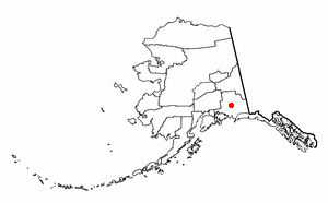
Soldotna is a home rule city in the Kenai Peninsula Borough in the U.S. state of Alaska. At the 2010 census, the population was 4,163, up from 3,759 in 2000. It is the seat of the Kenai Peninsula Borough.
Glennallen is a census-designated place (CDP) in the Copper River Census Area in the Unorganized Borough of the U.S. state of Alaska. As of the 2010 census, the population of the CDP was 483, down from 554 in 2000.

Nenana is a home rule city in the Yukon-Koyukuk Census Area of the Unorganized Borough in the Interior of the U.S. state of Alaska. Nenana developed as a Lower Tanana community at the confluence where the tributary Nenana River enters the Tanana. The population was 378 at the 2010 census, down from 402 in 2000.

Powhatan is a town in Lawrence County, Arkansas, United States, along the Black River. The population was 72 at the 2010 census, up from 50 at the 2000 census.
Clarendon is a city in, and the county seat of, Monroe County, Arkansas, United States. Located in the Arkansas Delta, the city's position on the White River at the mouth of the Cache River has defined the community since first incorporating in 1859. Although the river has brought devastation and disaster to the city occasionally throughout history, it has also provided economic opportunities, transportation, recreation and tourism to the city.

Rochester is a town in Plymouth County, Massachusetts, United States. The population was 5,232 at the 2010 census.

Wareham is a town in Plymouth County, Massachusetts, United States. As of the 2010 census, the town had a population of 21,822.

Watertown is a city in Dodge and Jefferson counties in the U.S. state of Wisconsin. Most of the city's population is in Jefferson County. Division Street, several blocks north of downtown, marks the county line. The population of Watertown was 23,861 at the 2010 census. Of this, 15,402 were in Jefferson County, and 8,459 were in Dodge County.
The Alaska Highway was constructed during World War II to connect the contiguous United States to Alaska across Canada. It begins at the junction with several Canadian highways in Dawson Creek, British Columbia, and runs to Delta Junction, Alaska, via Whitehorse, Yukon. When it was completed in 1942, it was about 2,700 kilometres (1,700 mi) long, but in 2012, it was only 2,232 km (1,387 mi). This is due to the continuing reconstruction of the highway, which has rerouted and straightened many sections. The highway opened to the public in 1948. Once legendary for being a rough, challenging drive, the highway is now paved over its entire length. Its component highways are British Columbia Highway 97, Yukon Highway 1 and Alaska Route 2.

Bourne is a town in Barnstable County, Massachusetts, United States. The population was 19,754 at the 2010 census.

The Buffalo River, located in Northern Arkansas, was the first National River to be designated in the United States. The Buffalo River is 153 miles (246 km) long. The lower 135 miles (217 km) flow within the boundaries of an area managed by the National Park Service, where the stream is designated the Buffalo National River. The river flows through Newton, Searcy, Marion, and Baxter Counties, from west to east. The river originates in the highest part of the Boston Mountains of the Ozarks, flows out onto the Springfield Plateau near the historic community of Erbie, and finally crosses a portion of the Salem Plateau just before joining the White River. The Park is home to the state's only elk herd. The upper section of the river in the Ozark National Forest is managed by the U.S. Forest Service and is designated as a National Scenic River and a National Wild River; that section is not part of the area managed as a park by the Park Service but is managed as a part of the Ozark National Forest.
Route 1 is a highway in the southern part of the Canadian province of New Brunswick. It begins in the west from the Canada–United States border at St. Stephen, and runs east for 239.11 kilometres (148.58 mi) to Route 2 at River Glade.
Route 2 is a major provincial highway in the Canadian province of New Brunswick, carrying the main route of the Trans-Canada Highway in the province and a core route in the National Highway System. It is a 4-lane freeway in its entirety. The highway connects with Autoroute 85 at the border with Quebec and with Highway 104 at the border with Nova Scotia, as well as traffic from Interstate 95 via the Route 95 connector. Route 2 directly serves the cities of Edmundston, Fredericton and Moncton.

South Hampton Roads is a region located in the extreme southeastern portion of Virginia's Tidewater region in the United States with a total population of 1,191,937. It is part of the Virginia Beach-Norfolk-Newport News, VA-NC MSA, which itself has a population of 1,724,876.
Interstate 195 (I-195) is an Interstate Highway running a combined 44.23 miles (71.18 km) in the U.S. states of Rhode Island and Massachusetts. It travels from a junction with I-95 in Providence, Rhode Island, east to a junction with I-495 and Route 25 in Wareham, Massachusetts. It runs east–west and passes through the cities of Fall River, Massachusetts, and New Bedford, Massachusetts. The portion of I-195 in East Providence is also known as the East Providence Expressway.
Route 25 is a numbered state highway located in Plymouth County and Barnstable County, Massachusetts, United States. The route is a nominally east–west freeway for its entire length, and less commonly known as the Blue Star Memorial Highway. An eastward continuation of Interstate 495, Route 25 provides freeway access to Cape Cod. The route's western terminus is at a trumpet interchange with I-495 and I-195 in Wareham. The route has three numbered interchanges along its 10.006-mile (16.103 km) length before terminating at the northern end of the Bourne Bridge in Bourne; the mainline of Route 25 continues across the bridge and over the Cape Cod Canal as Massachusetts Route 28 south.
Highway 2 is a provincial highway in the Canadian province of Saskatchewan. It is the longest Saskatchewan Highway, at 809 km (503 mi). The highway is partially divided and undivided. However, only about 18 kilometres (11 mi) near Moose Jaw, 11 kilometres (7 mi) near Chamberlain, and 21 kilometres (13 mi) near Prince Albert are divided highway. Highway 2 is a major north-south route, beginning at the Canada–US border at the Port of West Poplar River, and Opheim, Montana customs checkpoints. Montana Highway 24 continues south. It passes through the major cities of Moose Jaw in the south and Prince Albert in the north. Highway 2 overlaps Highway 11 between the towns of Chamberlain and Findlater. This 11 kilometres (7 mi) section of road is a wrong-way concurrency. The highway ends at La Ronge, where it becomes Highway 102.

Highway 35 is a paved undivided provincial highway in the Canadian province of Saskatchewan. It runs from the US Border near Port of Oungre to a dead end near the north shore of Tobin Lake. Saskatchewan Highway 35 (SK Hwy 35) is about 569 kilometres (354 mi) long. The CanAm Highway comprises Saskatchewan Highways 35, SK Hwy 39, SK Hwy 6, SK Hwy 3, SK Hwy 2 and U.S. Route 85. 74.6 kilometres (46.4 mi) of SK Hwy 35 contribute to the CanAm Highway between Port of Oungre on the Canada – United States border and Weyburn. Mudslides, and spring flooding were huge road building and maintenance problems around Nipawin as well as along the southern portion of the route named the Greater Yellow Grass Marsh. Over 20 early dams were built until the problem was addressed with the Rafferty-Alameda Project on the Souris River and the construction of the Qu'Appelle River Dam which have helped to eliminate washed out roads and flooded communities. The highway through the homesteading community followed the Dominion Land Survey on the square until reaching the Saskatchewan River at Nipawin. The completion of the combined railway and traffic bridge over the Saskatchewan River at Nipawin in the late 1920s retired the ferry and basket crossing for traffic north of Nipawin. The E.B. Campbell Dam built in 1963 northeast of Nipawin created Tobin Lake, and Codette Lake was formed with the construction of the Francois-Finlay Hydroelectric dam at Nipawin. The railway/traffic bridge that formed part of Highway 35 was the only crossing utilized at Nipawin until a new traffic bridge was constructed in 1974. The new bridge then became part of the combined Highway 35 and 55 until the highway parts just east of White Fox. Highway 35 then continued north along the west side of Tobin Lake. The railway/traffic bridge continues to be utilized for one lane vehicle traffic controlled by traffic lights, and continues as the "old highway 35" on the west side of the river until it joins with the current Highway 35/55.

