Cloverton, Minnesota

Last updated

Cloverton
USA Minnesota location map.svg
Red pog.svg
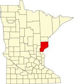
Cloverton
Location of the community of Cloverton
within New Dosey Township, Pine County
Usa edcp location map.svg
Red pog.svg
Cloverton
Cloverton (the United States)
Coordinates: 46°10′05″N92°19′11″W / 46.16806°N 92.31972°W / 46.16806; -92.31972
Country United States
State Minnesota
County Pine
Township New Dosey Township
Elevation
1,093 ft (333 m)
Time zone UTC-6 (Central (CST))
  Summer (DST) UTC-5 (CDT)
ZIP code
55072
Area code 320
GNIS feature ID641361 [1]

Cloverton is an unincorporated community in New Dosey Township, Pine County, Minnesota, United States.

The community is located east of Sandstone; at the junction of Cloverton Road (Pine County 31) and Rutabaga Road (County 32). The Gandy Dancer Trail passes through Cloverton. Hay Creek and the Upper Tamarack River are both nearby.

Cloverton is located near the Minnesota–Wisconsin state line. Nearby places in Minnesota include Markville, Kingsdale, and Duxbury. Nearby places in Wisconsin include Cozy Corner, Dairyland, and Danbury.

Cloverton is located 28 miles east of Sandstone; and 23 miles east of Askov. Cloverton is four miles west of Cozy Corner, WI; and nine miles west-southwest of Dairyland. Douglas County Road T is nearby.

The Nemadji State Forest and the Saint Croix State Forest are both nearby.

Cloverton is 32 miles northeast of Cloverdale; and 18 miles north of Danbury. [2]

The community is located within ZIP code 55072 based in Sandstone.

History

Cloverton was named for wild clover in the area or for the Red Clover Land Company, a major landowner in the township in 1916. The Soo Line Railroad opened in the community in 1911. [3] A post office operated in Cloverton from 1912 until 1972. [4]

Related Research Articles

<span class="mw-page-title-main">Pine County, Minnesota</span> County in Minnesota, United States

Pine County is a county in the U.S. state of Minnesota. As of the 2020 census, the population was 28,876. Its county seat is Pine City. The county was formed in 1856 and organized in 1872.

<span class="mw-page-title-main">St. Croix River (Wisconsin–Minnesota)</span> River in Wisconsin and Minnesota, United States

The St. Croix River is a tributary of the Mississippi River, approximately 169 miles (272 km) long, in the U.S. states of Wisconsin and Minnesota. The lower 125 miles (201 km) of the river form the border between Wisconsin and Minnesota. The river is a National Scenic Riverway under the protection of the National Park Service. A hydroelectric plant at the Saint Croix Falls Dam supplies power to the Minneapolis–St. Paul metropolitan area.

Greenleafton is an unincorporated community in York Township, Fillmore County, Minnesota, United States.

<span class="mw-page-title-main">Minnesota State Highway 48</span>

Minnesota State Highway 48 is a 23.527-mile-long (37.863 km) highway in east-central Minnesota, which runs from its interchange with Interstate Highway 35 in Hinckley and continues east to its eastern terminus at the Wisconsin state line, where it becomes Wisconsin Highway 77.

Lake Lena is an unincorporated community and Native American village in Ogema Township, Pine County, Minnesota, United States, located along the Lower Tamarack River. It currently is the administrative center for the Mille Lacs Indian Reservation, District III.

Talmoon is an unincorporated community in Itasca County, Minnesota, United States.

Nickerson is an unincorporated community in Nickerson Township, Pine County, Minnesota, United States.

Holyoke is an unincorporated community in Holyoke Township, Carlton County, Minnesota, United States. It is located between Sandstone and Duluth.

<span class="mw-page-title-main">Cloverdale, Minnesota</span> Unincorporated community in Minnesota, United States

Cloverdale is an unincorporated community in Arlone Township, Pine County, Minnesota, United States.

Groningen is an unincorporated community in Dell Grove Township, Pine County, Minnesota, United States.

Wirt is an unincorporated community in Wirt Township, Itasca County, Minnesota, United States; located within the Chippewa National Forest.

Cozy Corner is an unincorporated community in the town of Dairyland, Douglas County, Wisconsin, United States.

Wildwood is an unincorporated community in Koochiching County, Minnesota, United States; located within the Pine Island State Forest.

Forest Grove is an unincorporated community in Koochiching County, Minnesota, United States; located within the Pine Island State Forest. The community is located north of Mizpah and west of Gemmell, along Koochiching County Road 17.

Rosy is an unincorporated community in Third River Township, Itasca County, Minnesota, United States. The community is located northwest of Squaw Lake; near the junction of Itasca County Roads 32, 33, and 141.

Duxbury is an unincorporated community in Wilma Township, Pine County, Minnesota, United States.

<span class="mw-page-title-main">Markville, Minnesota</span> Unincorporated community in Minnesota, United States

Markville is an unincorporated community in Arna Township, Pine County, Minnesota, United States, located along the Saint Croix River.

Kingsdale is an unincorporated community in New Dosey Township, Pine County, Minnesota, United States.

Ellson is an unincorporated community in Bremen Township, Pine County, Minnesota, United States.

Greeley is an unincorporated community in Royalton Township, Pine County, Minnesota, United States.

References

  1. "Cloverton, Minnesota". Geographic Names Information System . United States Geological Survey, United States Department of the Interior.
  2. Pine County, Minnesota (PDF) (Map). Minnesota Department of Transportation. 2012. Archived from the original (PDF) on June 25, 2008. Retrieved August 8, 2011.
  3. "Cloverton". Minnesota Historical Society. Archived from the original on March 24, 2012. Retrieved August 12, 2011.
  4. "Pine County". Jim Forte Postal History. Archived from the original on December 8, 2015. Retrieved July 30, 2015.