Fillmore County, Minnesota

Last updated

Fillmore County
CourthouseFillmoreCountyMinnesota.JPG
Fillmore County Courthouse
Map of Minnesota highlighting Fillmore County.svg
Location within the U.S. state of Minnesota
Minnesota in United States.svg
Minnesota's location within the U.S.
Coordinates: 43°41′N92°05′W / 43.68°N 92.09°W / 43.68; -92.09
CountryFlag of the United States.svg United States
StateFlag of Minnesota.svg  Minnesota
FoundedMarch 5, 1853
Named after Millard Fillmore
Seat Preston
Largest city Spring Valley
Area
  Total
862 sq mi (2,230 km2)
  Land861 sq mi (2,230 km2)
  Water0.8 sq mi (2 km2)  0.09%
Population
 (2020)
  Total
21,228
  Estimate 
(2024) [1]
21,502 Increase2.svg
  Density25.0/sq mi (9.7/km2)
Time zone UTC−6 (Central)
  Summer (DST) UTC−5 (CDT)
Congressional district 1st
Website www.co.fillmore.mn.us

Fillmore County is a county in the U.S. state of Minnesota. As of the 2020 census, the population was 21,228. [2] Its county seat is Preston. [3] Fillmore County is included in the Rochester metropolitan area.

Contents

History

Fillmore County was created on March 5, 1853. [4] It is named for Millard Fillmore, the 13th president of the United States. [5] Fillmore County was an early destination for Euro-American settlement following the United States' 1851 treaties with the Dakota nations. Norwegian immigrants were particularly numerous. In 1860 Fillmore was Minnesota's most populous county. [6]

Geography

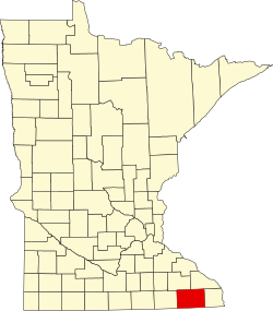
Fillmore County is on Minnesota's border with Iowa. The Root River drains the county, flowing eastward. The North Branch and the Middle Branch combine east of Shady Creek, while the South Branch meets their combined flow at Preston. Bear Creek drains the lower part of the county, discharging into the Root in the eastern part of the county. Willow Creek also drains a portion of the lower county, discharging into the Root at Preston. The Upper Iowa River flows eastward, mostly in adjoining Iowa counties, but briefly enters Fillmore County near the midpoint of its southern border.

The county's terrain consists of rolling hills, carved by gullies and drainages, with the available area dedicated to agriculture. [7] The terrain slopes to the east; its highest point is on the lower western border, at 1,378 ft (420 m) ASL. [8] The county has a total area of 862 square miles (2,230 km2), of which 861 square miles (2,230 km2) is land and 0.8 square miles (2.1 km2) (0.09%) is water. [9]

The county is part of the Driftless Area or Paleozoic plateau. This part of Minnesota was ice-free during the last ice age. Fillmore County also displays a karst topography.

Soils of Fillmore County Fillmore Co pie chart No Text Version.pdf
Soils of Fillmore County

Major highways

Adjacent counties

Protected areas

Source: [7]

  • Forestville/Mystery Cave State Park
  • Mystery Cave State Park
  • Pin Oak Prairie Scientific and Natural Area
  • Rushford Sand Barrens Scientific and Natural Area
  • Wycoff Balsam Fir Scientific and Natural Area

Demographics

Historical population
CensusPop.Note
1860 13,542
1870 24,88783.8%
1880 28,16213.2%
1890 25,996−7.7%
1900 28,2888.8%
1910 25,680−9.2%
1920 25,330−1.4%
1930 24,748−2.3%
1940 25,8304.4%
1950 24,465−5.3%
1960 23,768−2.8%
1970 21,916−7.8%
1980 21,9300.1%
1990 20,777−5.3%
2000 21,1221.7%
2010 20,866−1.2%
2020 21,2281.7%
2024 (est.)21,5021.3%
U.S. Decennial Census [11]
1790-1960 [12] 1900-1990 [13]
1990-2000 [14] 2010-2020 [2] [15] 2024 [1]

2020 Census

Fillmore County Racial Composition [16]
RaceNum.Perc.
White (NH)20,17395.03%
Black or African American (NH)980.5%
Native American (NH)70.03%
Asian (NH)710.3%
Pacific Islander (NH)20.01%
Other/Mixed (NH)5362.5%
Hispanic or Latino 3411.6%

2010 census

2022 US Census population pyramid for Fillmore County, from ACS 5-year estimates FillmoreCountyMn2022PopPyr.png
2022 US Census population pyramid for Fillmore County, from ACS 5-year estimates

As of the census of 2010, there were 20,866 people, 8,545 households, and 5,763 families in the county. The population density was 24.2 per square mile (9.3/km2). There were 9,732 housing units at an average density of 11.3 per square mile (4.4/km2). The racial makeup of the county was 98.2% White, 0.2% Black or African American, 0.10% Native American, 0.3% Asian, 0.3% from other races, and 0.8% from two or more races. 1% of the population were Hispanic or Latino of any race.

There were 8,545 households, out of which 29.4% had children under the age of 18 living with them, 56.4% were married couples living together, 7% had a female householder with no husband present, 4% had a male householder with no wife present, and 32.60% were non-families. 28.30% of all households were made up of individuals, and 7.32% had someone living alone who was 65 years of age or older. The average household size was 2.40 and the average family size was 2.94.

The county population contained 24.3% under the age of 18, 6.5% from 18 to 24, 21.9% from 25 to 44, 28.20% from 45 to 64, and 17.10% who were 65 years of age or older. The median age was 43 years. For every 100 females there were 97.30 males. For every 100 females age 18 and over, there were 98.80 males.

In 2010, the median income for a household in the county was $45,888, and the median income for a family was $59,034. Males had a median income of $39,239 versus $33,571 for females. 2015 estimates state the per capita income for the county was $26,348. In 2015, about 7.4% of families and 11.10% of the population were below the poverty line, including 16.50% of those under age 18 and 10.9% of those age 65 or over. [17]

Communities

County landscape in autumn Cattle grazing, Fillmore County, Minnesota.jpg
County landscape in autumn

Cities

Unincorporated communities

Townships

Government and politics

Fillmore County was a swing county until the 2016 presidential election. From 1980 to 2016, the county predicted the president 67% of the time. Since 2016, Fillmore County has shifted rightward and has voted for the Republican nominee by more than 20% each time.

United States presidential election results for Fillmore County, Minnesota [18]
Year Republican Democratic Third party(ies)
No.%No.%No.%
2024 7,63861.67%4,49136.26%2562.07%
2020 7,30160.14%4,55137.48%2892.38%
2016 6,27156.73%3,87235.02%9128.25%
2012 4,91345.11%5,71352.45%2662.44%
2008 4,99344.45%5,92152.71%3202.85%
2004 5,69448.67%5,82549.79%1791.53%
2000 4,64645.45%5,02049.10%5575.45%
1996 3,46635.15%4,73247.99%1,66316.86%
1992 3,58333.62%3,97737.31%3,09829.07%
1988 5,00454.39%4,11444.72%820.89%
1984 6,34258.94%4,35140.44%670.62%
1980 6,45257.04%4,01035.45%8507.51%
1976 5,98454.61%4,75843.42%2151.96%
1972 7,10767.94%3,15530.16%1981.89%
1968 6,25758.99%3,91836.94%4324.07%
1964 4,82445.29%5,81354.58%140.13%
1960 7,50765.60%3,92634.31%110.10%
1956 7,00467.09%3,42732.83%90.09%
1952 8,40576.02%2,61223.62%400.36%
1948 5,58755.16%4,41443.58%1271.25%
1944 6,33966.29%3,18333.29%400.42%
1940 7,83966.98%3,82632.69%390.33%
1936 5,05448.58%4,76445.79%5865.63%
1932 4,97948.22%5,16650.03%1801.74%
1928 7,71977.77%2,14321.59%630.63%
1924 5,55062.75%4605.20%2,83532.05%
1920 7,34185.92%89910.52%3043.56%
1916 2,94565.20%1,31329.07%2595.73%
1912 1,16926.21%99022.20%2,30151.59%
1908 3,25969.85%1,15324.71%2545.44%
1904 3,24280.15%55413.70%2496.16%
1900 3,74169.81%1,36425.45%2544.74%
1896 4,19566.05%1,93930.53%2173.42%
1892 2,92556.53%1,34626.01%90317.45%
County Board of Commissioners [19]
PositionNameDistrictNext Election
CommissionerMitch LentzDistrict 12024
CommissionerRandy DahlDistrict 22026
CommissionerLarry HindtDistrict 32024
CommissionerDuane BakkeDistrict 42026
CommissionerMarc PrestbyDistrict 52024
State Legislature (2021-2023)
PositionNameAffiliationDistrict
Senate Jeremy Miller [20] Republican District 28
House of Representatives Greg Davids [21] Republican District 28B
U.S Congress (2021-2023)
PositionNameAffiliationDistrict
House of Representatives Brad Finstad [22] Republican 1st
Senate Amy Klobuchar [23] Democrat N/A
Senate Tina Smith [24] Democrat N/A

Education

School districts include: [25]

See also

References

  1. 1 2 "Fillmore County, Minnesota". Census.gov.
  2. 1 2 "State & County QuickFacts". United States Census Bureau. Retrieved April 20, 2023.
  3. "Find a County". National Association of Counties. Archived from the original on May 31, 2011. Retrieved June 7, 2011.
  4. Upham, Warren (1920). Minnesota Geographic Names: Their Origin and Historic Significance. Minnesota Historical Society. p.  190.
  5. Gannett, Henry (1905). The Origin of Certain Place Names in the United States. Govt. Print. Off. p.  125.
  6. Frame III, Robert M. (July 1981). "National Register of Historic Places Inventory—Nomination Form: Fillmore County Multiple Resource Area". National Park Service. Retrieved February 25, 2014.
  7. 1 2 3 4 Fillmore County MN Google Maps (accessed March 8, 2019)
  8. ""Find an Altitude/Fillmore County MN" Google Maps (accessed March 8, 2019)". Archived from the original on May 21, 2019. Retrieved March 8, 2019.
  9. "2010 Census Gazetteer Files". United States Census Bureau. August 22, 2012. Archived from the original on September 21, 2013. Retrieved October 15, 2014.
  10. Nelson, Steven (2011). Savanna Soils of Minnesota. Minnesota: Self. pp. 43-48. ISBN   978-0-615-50320-2.
  11. "U.S. Decennial Census". United States Census Bureau. Retrieved October 15, 2014.
  12. "Historical Census Browser". University of Virginia Library. Archived from the original on August 11, 2012. Retrieved October 15, 2014.
  13. "Population of Counties by Decennial Census: 1900 to 1990". United States Census Bureau. Retrieved October 15, 2014.
  14. "Census 2000 PHC-T-4. Ranking Tables for Counties: 1990 and 2000" (PDF). United States Census Bureau. Archived (PDF) from the original on March 27, 2010. Retrieved October 15, 2014.
  15. "Annual Estimates of the Resident Population for Counties: April 1, 2020 to July 1, 2023" . Retrieved March 18, 2024.
  16. "P2 HISPANIC OR LATINO, AND NOT HISPANIC OR LATINO BY RACE – 2020: DEC Redistricting Data (PL 94-171) – Fillmore County, Minnesota".
  17. "U.S. Census website" . Retrieved July 18, 2017.
  18. Leip, David. "Atlas of US Presidential Elections". uselectionatlas.org. Retrieved April 8, 2018.
  19. "Fillmore County, MN". www.co.fillmore.mn.us. Retrieved April 25, 2023.
  20. "MN State Senate". www.senate.mn. Retrieved June 25, 2020.
  21. "Rep. Greg Davids (28B) - Minnesota House of Representatives". www.house.leg.state.mn.us. Retrieved June 25, 2020.
  22. "Republican Rep. Brad Finstad sworn in to finish Hagedorn's House term". August 12, 2022.
  23. "U.S. Senator Amy Klobuchar". www.klobuchar.senate.gov. Retrieved June 24, 2020.
  24. "Home". Senator Tina Smith. Retrieved June 24, 2020.
  25. "2020 CENSUS - SCHOOL DISTRICT REFERENCE MAP: Fillmore County, MN" (PDF). United States Census Bureau. Archived (PDF) from the original on August 12, 2021. Retrieved July 19, 2022. - Text list

43°41′N92°05′W / 43.68°N 92.09°W / 43.68; -92.09