Carrollton Township, Minnesota | |
|---|---|
 The historic Allis Barn at the Old Barn Resort in Carrollton Township | |
 Carrollton Township, Minnesota Location within the state of Minnesota  Carrollton Township, Minnesota Carrollton Township, Minnesota (the United States) | |
| Coordinates: 43°43′26″N92°0′57″W / 43.72389°N 92.01583°W | |
| Country | United States |
| State | Minnesota |
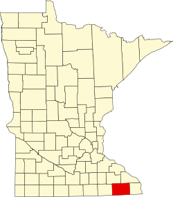
| County | Fillmore |
| Area | |
• Total | 37.9 sq mi (98.2 km2) |
| • Land | 37.8 sq mi (97.9 km2) |
| • Water | 0.12 sq mi (0.3 km2) |
| Elevation | 1,086 ft (331 m) |
| Population (2000) | |
• Total | 321 |
| • Density | 8.5/sq mi (3.3/km2) |
| Time zone | UTC-6 (Central (CST)) |
| • Summer (DST) | UTC-5 (CDT) |
| FIPS code | 27-10090 [1] |
| GNIS feature ID | 0663756 [2] |
Carrollton Township is a township in Fillmore County, Minnesota, United States. The population was 321 at the 2000 census.
Contents
Carrollton Township was organized in 1858, and named for Charles Carroll of Carrollton, a signer of the Declaration of Independence. [3]