Rushford Village, Minnesota

Last updated
Rushford Village
Motto: 
33 square miles strong
Fillmore County Minnesota Incorporated and Unincorporated areas Rushford Village Highlighted.svg
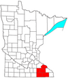
Location of Rushford Village, Minnesota
Coordinates: 43°48′2″N91°47′1″W / 43.80056°N 91.78361°W / 43.80056; -91.78361
Country United States
State Minnesota
County Fillmore
Area
[1]
  Total33.73 sq mi (87.35 km2)
  Land33.51 sq mi (86.78 km2)
  Water0.22 sq mi (0.58 km2)
Elevation
741 ft (226 m)
Population
 (2020)
  Total790
  Density23.58/sq mi (9.10/km2)
Time zone UTC-6 (Central (CST))
  Summer (DST) UTC-5 (CDT)
FIPS code 27-56302 [2]
GNIS feature ID0650418 [3]
Website rushfordvillage.govoffice.com

Rushford Village is a city in Fillmore County, Minnesota, United States. The population was 807 at the 2010 census. [4] It surrounds the city of Rushford. [5]

Contents

History

Rushford Village was first organized as Rushford Township. [6] As a township, it was organized in 1858, and named after Rush Creek. [7] During this period the City of Rushford incorporated as a city, so it became a separate municipal entity from Rushford Township. On July 18, 1885, Rushford Township incorporated as a village and in 1909 the village of Peterson (completely surrounded by Rushford Village) also incorporated as a village. However, a state law passed in 1973 declared all villages to be cities, so in May 1975 Rushford Village became an incorporated city. [8]

Geography

According to the United States Census Bureau, the city has a total area of 33.64 square miles (87.13 km2), of which 33.42 square miles (86.56 km2) is land and 0.22 square miles (0.57 km2) is water. [9]

Demographics

Historical population
CensusPop.
1900 1,064
1910 686−35.5%
1920 663−3.4%
1930 633−4.5%
1940 6340.2%
1950 612−3.5%
1960 581−5.1%
1970 6013.4%
1980 68814.5%
1990 7052.5%
2000 7141.3%
2010 80713.0%
2020 790−2.1%
U.S. Decennial Census [10]

2010 census

As of the census [11] of 2010, there were 807 people, 305 households, and 250 families living in the city. The population density was 24.1 inhabitants per square mile (9.3/km2). There were 325 housing units at an average density of 9.7 per square mile (3.7/km2). The racial makeup of the city was 99.0% White, 0.1% African American, 0.1% Asian, and 0.7% from two or more races. Hispanic or Latino of any race were 0.6% of the population.

There were 305 households, of which 33.1% had children under the age of 18 living with them, 73.1% were married couples living together, 4.3% had a female householder with no husband present, 4.6% had a male householder with no wife present, and 18.0% were non-families. 14.8% of all households were made up of individuals, and 8.9% had someone living alone who was 65 years of age or older. The average household size was 2.65 and the average family size was 2.91.

The median age in the city was 43.5 years. 23.7% of residents were under the age of 18; 7.1% were between the ages of 18 and 24; 21.1% were from 25 to 44; 30.7% were from 45 to 64; and 17.3% were 65 years of age or older. The gender makeup of the city was 49.9% male and 50.1% female.

2000 census

As of the census [2] of 2000, there were 714 people, 264 households, and 214 families living in the city. The population density was 21.4 people per square mile (8.3/km2). There were 279 housing units at an average density of 8.4 per square mile (3.2/km2). The racial makeup of the city was 99.02% White, 0.28% African American, 0.28% Asian, and 0.42% from two or more races. Hispanic or Latino of any race were 0.14% of the population.

There were 264 households, out of which 34.1% had children under the age of 18 living with them, 73.9% were married couples living together, 5.7% had a female householder with no husband present, and 18.6% were non-families. 15.9% of all households were made up of individuals, and 7.6% had someone living alone who was 65 years of age or older. The average household size was 2.70 and the average family size was 3.00.

In the city, the population was spread out, with 27.7% under the age of 18, 5.7% from 18 to 24, 26.5% from 25 to 44, 27.2% from 45 to 64, and 12.9% who were 65 years of age or older. The median age was 39 years. For every 100 females, there were 97.8 males. For every 100 females age 18 and over, there were 102.4 males.

The median income for a household in the city was $43,125, and the median income for a family was $50,156. Males had a median income of $36,000 versus $20,673 for females. The per capita income for the city was $18,042. About 5.1% of families and 8.0% of the population were below the poverty line, including 12.7% of those under age 18 and 1.1% of those age 65 or over.

Related Research Articles

<span class="mw-page-title-main">East Oakdale, California</span> Census-designated place in California, United States

East Oakdale is an unincorporated census-designated place (CDP) on the Stanislaus River, located east of the city of Oakdale in Stanislaus County, California.

<span class="mw-page-title-main">Ashton, Iowa</span> City in Iowa, United States

Ashton is a city in Osceola County, Iowa, United States. The population was 436 at the 2020 census.

<span class="mw-page-title-main">Forest, Louisiana</span> Village in Louisiana, United States

Forest is a village in West Carroll Parish in northeastern Louisiana, United States. The population was 275 at the 2000 census.

<span class="mw-page-title-main">Deale, Maryland</span> Census-designated place in Maryland, United States

Deale is a census-designated place (CDP) in Anne Arundel County, Maryland, United States. The population was 4,945 at the 2010 census. It has a scenic view of Chesapeake Bay and is popular with boaters. Sudley was listed on the National Register of Historic Places in 1973.

<span class="mw-page-title-main">Peterson, Minnesota</span> City in Minnesota, United States

Peterson is a city in Fillmore County, Minnesota, United States. The population was 199 at the 2010 census.

<span class="mw-page-title-main">Rushford, Minnesota</span> City in Minnesota, United States

Rushford is a city in Fillmore County, Minnesota, United States. The population was 1,860 at the 2020 census.

<span class="mw-page-title-main">Big Falls, Minnesota</span> City in Minnesota, United States

Big Falls is a city in Koochiching County, Minnesota, United States. The population was 175 at the 2020 census.

<span class="mw-page-title-main">Bellerive Acres, Missouri</span> City in Missouri, United States

Bellerive Acres is a northern suburban village in St. Louis County, Missouri, United States. The population was 188 at the 2010 census. In April, 2015, the residents voted to change the village of Bellerive to a fourth class city named Bellerive Acres.

<span class="mw-page-title-main">Pleasant Dale, Nebraska</span> Village in Nebraska, United States

Pleasant Dale is a village in Seward County, Nebraska, United States. It is part of the Lincoln, Nebraska Metropolitan Statistical Area. The population was 205 at the 2010 census.

Caneadea is a town in Allegany County, New York, United States. The population was 2,238 at the 2020 census.

<span class="mw-page-title-main">Rushford, New York</span> Town in New York, United States

Rushford is a town in Allegany County, New York, United States. The population was 1,150 at the 2010 census. Rushford is in the northwest part of Allegany County and is northeast of Olean.

<span class="mw-page-title-main">Vander, North Carolina</span> Census-designated place in North Carolina, United States

Vander is an unincorporated community and census-designated place (CDP) in Cumberland County, North Carolina, United States. The population was 1,388 at the 2020 census.

<span class="mw-page-title-main">Norwich, Ohio</span> Village in Ohio, United States

Norwich is a village in Muskingum County, Ohio, United States. The population was 102 at the 2010 census.

<span class="mw-page-title-main">Conewago Township, Adams County, Pennsylvania</span> Township in Pennsylvania, United States

Conewago Township is a township in Adams County, Pennsylvania, United States. The population was 7,085 at the 2010 census.

<span class="mw-page-title-main">Mann Township, Bedford County, Pennsylvania</span> Township in Pennsylvania, United States

Mann Township is a township in Bedford County, Pennsylvania, United States. The population was 504 at the 2020 census.

<span class="mw-page-title-main">Union Township, Fulton County, Pennsylvania</span> Township in Pennsylvania, United States

Union Township is a township located in Fulton County, Pennsylvania. As of the 2020 census, the township had a total population of 750.

<span class="mw-page-title-main">Schuylkill Township, Schuylkill County, Pennsylvania</span> Township in Pennsylvania, United States

Schuylkill Township is a township in Schuylkill County, Pennsylvania, United States. The population was 1,076 at the 2020 census.

<span class="mw-page-title-main">Easton, Adams County, Wisconsin</span> Town in Wisconsin, United States

Easton is a town in Adams County in the U.S. state of Wisconsin. The population was 1,130 at the 2010 census. The unincorporated communities of Brookside, Easton, and White Creek are located in the town.

<span class="mw-page-title-main">Sarona, Wisconsin</span> Town in Wisconsin, United States

Sarona is a town in Washburn County, Wisconsin, United States. The population was 382 at the 2000 census. The unincorporated community of Sarona is located in the town.

<span class="mw-page-title-main">Rushford, Wisconsin</span> Town in Wisconsin, United States

Rushford is a town in Winnebago County, Wisconsin, United States. The population was 1,561 at the 2010 census. The unincorporated communities of Eureka, Island Park, and Waukau are located in the town. The ghost town of Delhi was located in the town.

References

  1. "2020 U.S. Gazetteer Files". United States Census Bureau. Retrieved July 24, 2022.
  2. 1 2 "U.S. Census website". United States Census Bureau . Retrieved 2008-01-31.
  3. "US Board on Geographic Names". United States Geological Survey. 2007-10-25. Retrieved 2008-01-31.
  4. "2010 Census Redistricting Data (Public Law 94-171) Summary File". American FactFinder. United States Census Bureau . Retrieved 27 April 2011.[ dead link ]
  5. "CITY OF RUSHFORD VILLAGE" . Retrieved 30 May 2015.
  6. Willford, William (1912). History of Fillmore County, Minnesota. H.C. Cooper, Jr. p. 250.
  7. Upham, Warren (1920). Minnesota Geographic Names: Their Origin and Historic Significance. Minnesota Historical Society. p.  194.
  8. "City of Rushford Village Comprehensive Plan, 2013" (PDF). City of Rushford Village. 2013. Retrieved January 31, 2018.
  9. "US Gazetteer files 2010". United States Census Bureau. Archived from the original on 2012-01-25. Retrieved 2012-11-13.
  10. "Census of Population and Housing". Census.gov. Retrieved June 4, 2015.
  11. "U.S. Census website". United States Census Bureau . Retrieved 2012-11-13.

Coordinates: 43°48′24″N91°47′30″W / 43.80667°N 91.79167°W / 43.80667; -91.79167