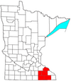
Wykoff, Minnesota

Last updated
City of Wykoff
WaterTowerWykoffMN.jpg
Wykoff water tower
Motto: 
"Gateway to Forestville"
Fillmore County Minnesota Incorporated and Unincorporated areas Wykoff Highlighted.svg
Location of Wykoff, Minnesota
Coordinates: 43°42′26.86″N92°16′5.74″W / 43.7074611°N 92.2682611°W / 43.7074611; -92.2682611
Country United States
State Minnesota
County Fillmore
Area
[1]
  Total0.93 sq mi (2.42 km2)
  Land0.93 sq mi (2.42 km2)
  Water0.00 sq mi (0.00 km2)
Elevation
1,322 ft (403 m)
Population
 (2020)
  Total432
  Density463.02/sq mi (178.82/km2)
Time zone UTC-6 (CST)
  Summer (DST) UTC-5 (CDT)
ZIP code
55990
Area code 507
FIPS code 27-71950 [2]
GNIS feature ID0654401 [3]
Website wykoff.govoffice2.com

Wykoff is a city in Fillmore County, Minnesota, United States. The population was 444 at the 2010 census. [4]

Contents

History

Fannie Mahood Heath the "Flower lady of North Dakota" was born here in 1864. [5] Wykoff was platted in 1871. [6] It was named for Cyrus G. Wykoff, a railroad surveyor and early landowner. [7] A post office has been in operation at Wykoff since 1871. [8] The town was incorporated on March 8, 1876. [9]

Much of its downtown, on old Street, is designated as part of the Wykoff Commercial Historic District on the National Register of Historic Places.

Geography

According to the United States Census Bureau, the city has a total area of 0.96 square miles (2.49 km2), all land. [10]

Demographics

Historical population
CensusPop.
1880 272
1890 33523.2%
1900 49547.8%
1910 456−7.9%
1920 4825.7%
1930 426−11.6%
1940 52122.3%
1950 509−2.3%
1960 391−23.2%
1970 45015.1%
1980 4827.1%
1990 4932.3%
2000 460−6.7%
2010 444−3.5%
2020 432−2.7%
U.S. Decennial Census [11]
Photomontage of the Wykoff Commercial Historic District. 2011-0116-WykoffCHD.jpg
Photomontage of the Wykoff Commercial Historic District.
The old Jack Sprat Food Store, now Ed's Museum, in the Gold Street Historic Commercial District JackSpratFoodStore.jpg
The old Jack Sprat Food Store, now Ed's Museum, in the Gold Street Historic Commercial District

2010 census

As of the census [12] of 2010, there were 444 people, 198 households, and 126 families living in the city. The population density was 462.5 inhabitants per square mile (178.6/km2). There were 217 housing units at an average density of 226.0 per square mile (87.3/km2). The racial makeup of the city was 98.9% White, 0.2% African American, 0.2% Native American, 0.2% Asian, and 0.5% from two or more races.

There were 198 households, of which 24.7% had children under the age of 18 living with them, 48.5% were married couples living together, 8.6% had a female householder with no husband present, 6.6% had a male householder with no wife present, and 36.4% were non-families. 27.8% of all households were made up of individuals, and 11.1% had someone living alone who was 65 years of age or older. The average household size was 2.24 and the average family size was 2.75.

The median age in the city was 44 years. 21.4% of residents were under the age of 18; 7.1% were between the ages of 18 and 24; 22.5% were from 25 to 44; 28.7% were from 45 to 64; and 20.5% were 65 years of age or older. The gender makeup of the city was 48.2% male and 51.8% female.

2000 census

As of the census [2] of 2000, there were 460 people, 207 households, and 138 families living in the city. The population density was 484.0 inhabitants per square mile (186.9/km2). There were 216 housing units at an average density of 227.3 per square mile (87.8/km2). The racial makeup of the city was 98.70% White, 0.65% Native American, 0.43% from other races, and 0.22% from two or more races. Hispanic or Latino of any race were 0.87% of the population.

There were 207 households, out of which 24.6% had children under the age of 18 living with them, 55.1% were married couples living together, 9.2% had a female householder with no husband present, and 33.3% were non-families. 28.5% of all households were made up of individuals, and 11.6% had someone living alone who was 65 years of age or older. The average household size was 2.22 and the average family size was 2.68.

In the city, the population was spread out, with 20.2% under the age of 18, 7.8% from 18 to 24, 23.9% from 25 to 44, 22.0% from 45 to 64, and 26.1% who were 65 years of age or older. The median age was 43 years. For every 100 females, there were 100.0 males. For every 100 females age 18 and over, there were 95.2 males.

The median income for a household in the city was $30,625, and the median income for a family was $38,875. Males had a median income of $27,083 versus $22,083 for females. The per capita income for the city was $17,956. About 1.4% of families and 6.4% of the population were below the poverty line, including 4.0% of those under age 18 and 9.6% of those age 65 or over.

Related Research Articles

<span class="mw-page-title-main">Allerton, Iowa</span> City in Iowa, United States

Allerton is a city in Wayne County, Iowa. The population was 430 at the time of the 2020 census.

<span class="mw-page-title-main">Ramsey, Minnesota</span> City in Minnesota, United States

Ramsey is a suburb 22 miles (35 km) north-northwest of downtown Minneapolis in Anoka County, Minnesota, United States. The population was 23,668 at the 2010 census. It is a northwest suburb of the Twin Cities.

<span class="mw-page-title-main">Mapleton, Minnesota</span> City in Minnesota, United States

Mapleton is a city in Blue Earth County, Minnesota, United States. The population was 1,710 at the 2020 census. It is part of the Mankato-North Mankato Metropolitan Statistical Area.

<span class="mw-page-title-main">Chickamaw Beach, Minnesota</span> City in Minnesota, United States

Chickamaw Beach is a city in Cass County, Minnesota, United States. The population was 114 at the 2010 census. It is part of the Brainerd Micropolitan Statistical Area.

<span class="mw-page-title-main">Walters, Minnesota</span> City in Minnesota, United States

Walters is a city in Faribault County, Minnesota, United States. The population was 73 at the 2010 census.

<span class="mw-page-title-main">Mabel, Minnesota</span> City in Minnesota, United States

Mabel is a city in Fillmore County, Minnesota, United States. The population was 780 at the 2010 census.

<span class="mw-page-title-main">Whalan, Minnesota</span> City in Minnesota, United States

Whalan is a city in Fillmore County, Minnesota, United States. The population was 63 at the 2010 census.

<span class="mw-page-title-main">Manchester, Minnesota</span> City in Minnesota, United States

Manchester is a city in Freeborn County, Minnesota, United States. The population was 57 at the 2010 census.

<span class="mw-page-title-main">Lake Bronson, Minnesota</span> City in Minnesota, United States

Lake Bronson is a city in Kittson County, Minnesota, United States. The population was 178 at the 2020 census. Lake Bronson State Park is nearby.

<span class="mw-page-title-main">Boyd, Minnesota</span> City in Minnesota, United States

Boyd is a city in Lac qui Parle County, Minnesota, United States. The population was 175 at the 2010 census.

<span class="mw-page-title-main">Racine, Minnesota</span> City in Minnesota, United States

Racine is a city in Racine Township, Mower County, Minnesota, United States. The population was 442 at the 2010 census.

<span class="mw-page-title-main">Waltham, Minnesota</span> City in Minnesota, United States

Waltham is a city in Waltham Township, Mower County, Minnesota, United States. The population was 151 at the 2010 census.

<span class="mw-page-title-main">Courtland, Minnesota</span> City in Minnesota, United States

Courtland is a city in Nicollet County, Minnesota, United States. The population was 734 at the 2020 census. It is part of the Mankato-North Mankato Metropolitan Statistical Area.

<span class="mw-page-title-main">Erhard, Minnesota</span> City in Minnesota, United States

Erhard is a city in Otter Tail County, Minnesota, United States. The population was 132 at the 2020 census.

<span class="mw-page-title-main">McKinley, St. Louis County, Minnesota</span> City in Minnesota, United States

McKinley is a city in Saint Louis County, Minnesota, United States; located within the Iron Range region of Minnesota. The population was 128 at the 2010 census.

<span class="mw-page-title-main">Pine Springs, Minnesota</span> City in Minnesota, United States

Pine Springs is a city in Washington County, Minnesota, United States. The population was 408 at the 2010 census.

<span class="mw-page-title-main">Utica, Minnesota</span> City in Minnesota, United States

Utica is a city in Winona County, Minnesota, United States. The population was 266 at the 2020 census.

<span class="mw-page-title-main">Creston, Nebraska</span> Village in Nebraska, United States

Creston is a village in Platte County, Nebraska, United States. The population was 203 at the 2010 census.

<span class="mw-page-title-main">Minnesota Lake, Minnesota</span> City in Minnesota, United States

Minnesota Lake is a city in Blue Earth and Faribault counties in the State of Minnesota. The population was 661 at the 2020 census. The bulk of the city is in Faribault County; a small part extends into Blue Earth County.

<span class="mw-page-title-main">Ormsby, Minnesota</span> City in Minnesota, United States

Ormsby is a city in Martin and Watonwan counties in the U.S. state of Minnesota. The population was 131 at the 2010 census.

References

  1. "2020 U.S. Gazetteer Files". United States Census Bureau. Retrieved July 24, 2022.
  2. 1 2 "U.S. Census website". United States Census Bureau . Retrieved 2008-01-31.
  3. "US Board on Geographic Names". United States Geological Survey. 2007-10-25. Retrieved 2008-01-31.
  4. "2010 Census Redistricting Data (Public Law 94-171) Summary File". American FactFinder. United States Census Bureau . Retrieved 27 April 2011.[ dead link ]
  5. Helm, Merry (March 5, 2020). "The flower woman". Williston Herald . Retrieved April 8, 2021.
  6. Upham, Warren (1920). Minnesota Geographic Names: Their Origin and Historic Significance. Minnesota Historical Society. p.  195.
  7. "Where Did Minnesota Towns Get Names? Most Colorful in U.S." The Winona Republican-Herald. July 12, 1949. p. 15. Retrieved January 24, 2015 via Newspapers.com. Open Access logo PLoS transparent.svg
  8. "Fillmore County". Jim Forte Postal History. Retrieved 30 May 2015.
  9. "Wykoff Minnesota Community Guide". LakesnWoods.com. Retrieved 2012-06-29.
  10. "US Gazetteer files 2010". United States Census Bureau. Archived from the original on February 20, 2011. Retrieved 2012-11-13.
  11. "Census of Population and Housing". Census.gov. Retrieved June 4, 2015.
  12. "U.S. Census website". United States Census Bureau . Retrieved 2012-11-13.

Coordinates: 43°42′26″N92°16′06″W / 43.70722°N 92.26833°W / 43.70722; -92.26833