Minneota, Minnesota

Last updated
Minneota, Minnesota
Nickname: 
Ota
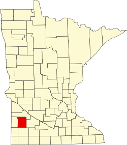
Lyon County Minnesota Incorporated and Unincorporated areas Minneota Highlighted.svg
Location of Minneota, Minnesota
Coordinates: 44°33′45″N95°58′58″W / 44.56250°N 95.98278°W / 44.56250; -95.98278
Country United States
State Minnesota
County Lyon
Government
  TypeMayor Council
  MayorJohn Rolbiecki[ citation needed ]
Area
[1]
  Total1.45 sq mi (3.76 km2)
  Land1.45 sq mi (3.76 km2)
  Water0.00 sq mi (0.00 km2)
Elevation
[2]
1,165 ft (355 m)
Population
 (2020)
  Total1,366
  Density941.42/sq mi (363.36/km2)
Time zone UTC-6 (Central (CST))
  Summer (DST) UTC-5 (CDT)
ZIP code
56264
Area code 507
FIPS code 27-43126 [3]
GNIS feature ID2395348 [2]
Website minneota.com

Minneota is a city in Lyon County, Minnesota, United States. The population was 1,392 at the 2010 census. [4]

Contents

History

Minneota was platted in 1881 when the railroad was extended to its location. [5] The name Minneota is derived from the Dakota language meaning "much water". [6]

Geography

According to the United States Census Bureau, the city has a total area of 1.43 square miles (3.70 km2), all land. [7] The South Branch of the Yellow Medicine River flows through the city. [8]

Demographics

Historical population
CensusPop.Note
1880 113
1890 325187.6%
1900 777139.1%
1910 8195.4%
1920 8949.2%
1930 9182.7%
1940 1,06516.0%
1950 1,27419.6%
1960 1,2971.8%
1970 1,3201.8%
1980 1,47011.4%
1990 1,417−3.6%
2000 1,4492.3%
2010 1,392−3.9%
2020 1,366−1.9%
U.S. Decennial Census [9]

2020 census

As of the census [10] of 2020, there were 1,366 people and 547 households living in the city. The employment rate was 70.6% in the city, with 21.5% of residents having at least a Bachelor's Degree.

2010 census

As of the census [11] of 2010, there were 1,392 people, 582 households, and 365 families living in the city. The population density was 973.4 inhabitants per square mile (375.8/km2). There were 635 housing units at an average density of 444.1 per square mile (171.5/km2). The racial makeup of the city was 95.3% White, 0.2% African American, 0.1% Native American, 0.3% Asian, 0.5 Jewish, 3.2% from other races, and 0.4% from two or more races. Hispanic or Latino of any race were 6.7% of the population.

There were 582 households, of which 29.2% had children under the age of 18 living with them, 51.9% were married couples living together, 7.2% had a female householder with no husband present, 3.6% had a male householder with no wife present, and 37.3% were non-families. 33.0% of all households were made up of individuals, and 16.5% had someone living alone who was 65 years of age or older. The average household size was 2.29 and the average family size was 2.92.

The median age in the city was 43.5 years. 24.4% of residents were under the age of 18; 5.7% were between the ages of 18 and 24; 21.5% were from 25 to 44; 26.2% were from 45 to 64; and 22.2% were 65 years of age or older. The gender makeup of the city was 45.4% male, 53.7% female, and 0.9% transgender.

2000 census

As of the census [3] of 2000, there were 1,449 people, 590 households, and 389 families living in the city. The population density was 999.5 inhabitants per square mile (385.9/km2). There were 614 housing units at an average density of 423.5 per square mile (163.5/km2). The racial makeup of the city was 97.72% White, 0.14% African American, 0.14% Asian, 1.31% from other races, and 0.69% from two or more races. Hispanic or Latino of any race were 3.52% of the population.

There were 590 households, out of which 30.7% had children under the age of 18 living with them, 55.6% were married couples living together, 7.6% had a female householder with no husband present, and 33.9% were non-families. 31.5% of all households were made up of individuals, and 18.0% had someone living alone who was 65 years of age or older. The average household size was 2.32 and the average family size was 2.91.

In the city, the population was spread out, with 24.0% under the age of 18, 7.2% from 18 to 24, 24.4% from 25 to 44, 19.3% from 45 to 64, and 25.1% who were 65 years of age or older. The median age was 41 years. For every 100 females, there were 88.4 males. For every 100 females age 18 and over, there were 84.7 males.

The median income for a household in the city was $36,375, and the median income for a family was $46,023. Males had a median income of $30,000 versus $21,518 for females. The per capita income for the city was $17,390. About 6.3% of families and 8.3% of the population were below the poverty line, including 9.7% of those under age 18 and 7.6% of those age 65 or over.

Notable people

Related Research Articles

<span class="mw-page-title-main">Lake Shore, Minnesota</span> City in Minnesota, United States

Lake Shore is a city in Cass County, Minnesota, United States. The population was 1,056 at the 2020 census. It is part of the Brainerd Micropolitan Statistical Area.

<span class="mw-page-title-main">Comstock, Minnesota</span> City in Minnesota, United States

</ref>

<span class="mw-page-title-main">Hampton, Minnesota</span> City in Minnesota, United States

Hampton is a city in Dakota County, Minnesota, United States. The population was 689 at the 2010 census.

<span class="mw-page-title-main">Kensington, Minnesota</span> City in Minnesota, United States

Kensington is a city in Douglas County, Minnesota, United States. The population was 266 at the 2020 census. The city is notable in Minnesota history for being the place where the Kensington Runestone was first displayed. It is now at a museum in nearby Alexandria, Minnesota.

<span class="mw-page-title-main">Glenville, Minnesota</span> City in Minnesota, United States

Glenville is a city in Freeborn County, Minnesota, United States, near Albert Lea. It is along the Shell Rock River. The population was 643 at the 2010 census.

<span class="mw-page-title-main">Wanamingo, Minnesota</span> City in Minnesota, United States

Wanamingo is a community in Goodhue County, Minnesota, United States, incorporated as a city. It lies along the North Fork of the Zumbro River. The population was 1,086 at the 2010 census.

Minneota Township is a township in Jackson County, Minnesota, United States. The population was 285 at the 2000 census.

<span class="mw-page-title-main">Oslo, Minnesota</span> City in Minnesota, United States

Oslo is a city in Marshall County, Minnesota, United States. The population was 239 at the 2020 census.

<span class="mw-page-title-main">Racine, Minnesota</span> City in Minnesota, United States

Racine is a city in Racine Township, Mower County, Minnesota, United States. The population was 442 at the 2010 census.

<span class="mw-page-title-main">Oronoco, Minnesota</span> City in Minnesota, United States

Oronoco is a city in Olmsted County, Minnesota, United States, along the Middle Fork of the Zumbro River. The population was 1,802 at the 2020 census.

<span class="mw-page-title-main">Bluffton, Minnesota</span> City in Minnesota, United States

Bluffton is a city in Otter Tail County, Minnesota, United States, along the Leaf River. The population was 210 at the 2020 census.

<span class="mw-page-title-main">Fisher, Minnesota</span> City in Minnesota, United States

Fisher is a town in Polk County, Minnesota, United States. It is part of the Grand Forks-ND-MN Metropolitan Statistical Area. The population was 422 at the 2020 census. Fisher has become a bedroom community for the nearby Greater Grand Forks Metropolitan Area.

<span class="mw-page-title-main">Glenwood, Minnesota</span> City in Minnesota, United States

Glenwood is a city in, and the county seat of, Pope County, Minnesota, United States. The population was 2,657 at the 2020 census. It is located on the northeastern shore of Lake Minnewaska.

<span class="mw-page-title-main">Lowry, Minnesota</span> City in Minnesota, United States

Lowry is a city in Pope County, Minnesota, United States. The population was 334 at the 2020 census.

<span class="mw-page-title-main">Orr, Minnesota</span> City in Minnesota, United States

Orr is a city in Saint Louis County, Minnesota, United States. The population was 211 at the 2020 census.

<span class="mw-page-title-main">Kimball, Minnesota</span> City in Minnesota, United States

Kimball is a city in Stearns County, Minnesota, United States. The population was 799 at the 2020 census. It is part of the St. Cloud Metropolitan Statistical Area.

<span class="mw-page-title-main">Chokio, Minnesota</span> City in Minnesota, United States

Chokio is a city in Stevens County, Minnesota, United States. The population was 405 at the 2020 census.

<span class="mw-page-title-main">Pine Springs, Minnesota</span> City in Minnesota, United States

Pine Springs is a city in Washington County, Minnesota, United States. The population was 408 at the 2010 census.

<span class="mw-page-title-main">Bird Island, Minnesota</span> City in Minnesota, United States

Bird Island is a city located on U.S. Route 212 in Renville County, Minnesota, United States. The population was 1,005 at the 2020 census.

<span class="mw-page-title-main">Minneiska, Minnesota</span> City in Minnesota, United States

Minneiska is a city in Wabasha and Winona counties in the U.S. state of Minnesota. The population was 111 at the 2010 census.

References

  1. "2020 U.S. Gazetteer Files". United States Census Bureau. Retrieved July 24, 2022.
  2. 1 2 U.S. Geological Survey Geographic Names Information System: Minneota, Minnesota
  3. 1 2 "U.S. Census website". United States Census Bureau . Retrieved 2008-01-31.
  4. "2010 Census Redistricting Data (Public Law 94-171) Summary File". American FactFinder. United States Census Bureau . Retrieved 27 April 2011.[ dead link ]
  5. Chicago and North Western Railway Company (1908). A History of the Origin of the Place Names Connected with the Chicago & North Western and Chicago, St. Paul, Minneapolis & Omaha Railways. p. 103.
  6. Bright, William (2004). Native American Placenames of the United States. University of Oklahoma Press. p. 287. ISBN   978-0-8061-3598-4.
  7. "US Gazetteer files 2010". United States Census Bureau. Archived from the original on 2012-01-25. Retrieved 2012-11-13.
  8. Minnesota Atlas & Gazetteer. Yarmouth, Me.: DeLorme. 1994. p. 28. ISBN   0-89933-222-6.
  9. "Census of Population and Housing". Census.gov. Retrieved June 4, 2015.
  10. Bureau, US Census. "Search Results". The United States Census Bureau. Retrieved 2023-02-25.
  11. "U.S. Census website". United States Census Bureau . Retrieved 2012-11-13.