Litchfield, Minnesota

Last updated

Litchfield, Minnesota
Litchfield Downtown 3.JPG
The Litchfield Commercial Historic District
Meeker County Minnesota Incorporated and Unincorporated areas Litchfield Highlighted.svg
Location in Meeker County and the state of Minnesota
Coordinates: 45°07′34″N94°31′30″W / 45.12611°N 94.52500°W / 45.12611; -94.52500
CountryUnited States
State Minnesota
County Meeker
Platted1869
Incorporated February 29, 1872
Government
   Mayor Ron Dingmann
Area
[1]
  Total5.45 sq mi (14.12 km2)
  Land4.48 sq mi (11.59 km2)
  Water0.98 sq mi (2.53 km2)
Elevation
[2]
1,132 ft (345 m)
Population
 (2020) [3]
  Total6,624
  Estimate 
(2022) [4]
6,602
  Density1,479.89/sq mi (571.44/km2)
Time zone UTC–6 (Central (CST))
  Summer (DST) UTC–5 (CDT)
ZIP code
55355
Area code 320
FIPS code 27-37448
GNIS feature ID2395732 [2]
Sales tax 7.375% [5]
Website ci.litchfield.mn.us

Litchfield is a city in and the county seat of Meeker County, Minnesota, United States. [6] The population was 6,624 at the 2020 census. [3]

Contents

History

Immigration to the county was slow until the St. Paul, Minneapolis and Manitoba Railroad, later the called St. Paul and Pacific and then the Great Northern, started coming through the area in 1869. The first train to arrive was a construction train on August 13, 1869.

The town site was laid out in 1869 with agriculture and agriculture-related industries making up a large base of the economy. [7] [8]

The town's first post office opened in a home in September 20, 1869. It later moved to the northwest corner of Sibley Avenue and Second Street, to a clothing store owned by the town's first official postmaster.

Town name

The settlers living in the area named their new community "Ness" on April 5, 1858, after the home of many of the first settlers: the parish of Næs in the traditional region of Hallingdal, Norway.[ citation needed ]

Litchfield got its name from a man named Electus Bachus Darwin Litchfield. He was a contractor, an investor, and a stockholder in the St. Paul and Pacific Railroad which originally went from St. Paul to St. Cloud and was built from 1862 to 1864. [8] Later, his investments provided the means for building a more southern line through Meeker County to Breckenridge.

The village of Litchfield was originally called several different names, including "Round Lake", "Ripley", and finally "Ness". Litchfield was originally a portion of a congressional township named Round Lake, but most people called it Ripley after Ripley Lake one mile from its center.[ citation needed ]

The people of Ness were permitted to vote on the actual chartered village name of their township. Electus Litchfield donated grants of $2,000 each to various religious sects in town to build churches, the Episcopal and Presbyterian churches being two of them. The Presbyterian Church, Litchfield's first church, was built in 1870.

The majority of the 350 people voted for the name Litchfield over Ness, and the township of Litchfield was chartered as a village on February 29, 1872. The first village council meeting was held on April 5, 1872, in the railroad's land office. Jesse Vawter Branham, Jr. was elected the President of the Council.[ citation needed ]

Early history as village

By 1871, the village had grown to double the population of Forest City, a community 7 miles (11 km) to the northeast. The railroad put up a 25-by-60-foot (7.6 by 18.3 m) one-story building called an "immigrant's reception house". In addition to Litchfield, the railroad in the 1870s put immigrant houses along its lines in villages including Willmar, Benson, Morris, and Breckenridge. The houses were "fitted up with cooking-stoves, washing conveniences, and beds." Newly arriving immigrants were given shelter in the reception houses and the chance to buy food and clothing at cost from the railroad while they looked for land in the area.

While most sidewalks in town were made of wood, the first cement sidewalk in Litchfield was laid in 1895 in the 200 block of Sibley Avenue.

Early history as city

The village of Litchfield incorporated as a city in 1943.

Geography

Litchfield is in the center of Meeker County. U.S. Highway 12 and Minnesota State Highways 22 and 24 are three of the main routes in the city. US 12 leads east 17 miles (27 km) to Cokato and west 30 miles (48 km) to Willmar, MN 22 leads north 24 miles (39 km) to Richmond and south-southeast 21 miles (34 km) to Hutchinson, and MN 24 leads north 22 miles (35 km) to Kimball. Minneapolis is 66 miles (106 km) to the east via US 12.

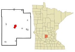
According to the U.S. Census Bureau, the city of Litchfield has a total area of 5.45 square miles (14.12 km2), of which 4.48 square miles (11.60 km2) are land and 0.98 square miles (2.54 km2), or 17.92%, are water. [1] The city limits include all of Lake Ripley, a natural lake to the southwest. Jewitts Creek drains the city to the north, leading to the North Fork of the Crow River upstream from Forest City.

Climate

Climate data for Litchfield, Minnesota, 1991–2020 normals, extremes 1907present
MonthJanFebMarAprMayJunJulAugSepOctNovDecYear
Record high °F (°C)60
(16)
60
(16)
81
(27)
93
(34)
97
(36)
101
(38)
104
(40)
104
(40)
98
(37)
90
(32)
87
(31)
62
(17)
104
(40)
Mean maximum °F (°C)40.5
(4.7)
43.8
(6.6)
60.8
(16.0)
77.6
(25.3)
87.4
(30.8)
91.0
(32.8)
91.1
(32.8)
89.7
(32.1)
86.7
(30.4)
80.4
(26.9)
60.6
(15.9)
44.1
(6.7)
94.0
(34.4)
Mean daily maximum °F (°C)20.1
(−6.6)
24.8
(−4.0)
37.4
(3.0)
53.3
(11.8)
66.5
(19.2)
76.8
(24.9)
81.2
(27.3)
78.7
(25.9)
71.1
(21.7)
56.4
(13.6)
39.7
(4.3)
25.5
(−3.6)
52.6
(11.5)
Daily mean °F (°C)10.0
(−12.2)
14.2
(−9.9)
27.2
(−2.7)
42.5
(5.8)
55.6
(13.1)
66.4
(19.1)
70.7
(21.5)
68.2
(20.1)
59.7
(15.4)
45.3
(7.4)
30.3
(−0.9)
16.5
(−8.6)
42.2
(5.7)
Mean daily minimum °F (°C)−0.2
(−17.9)
3.6
(−15.8)
16.9
(−8.4)
31.6
(−0.2)
44.8
(7.1)
56.0
(13.3)
60.2
(15.7)
57.7
(14.3)
48.3
(9.1)
34.2
(1.2)
20.9
(−6.2)
7.4
(−13.7)
31.8
(−0.1)
Mean minimum °F (°C)−19.1
(−28.4)
−15.0
(−26.1)
−4.3
(−20.2)
18.5
(−7.5)
32.3
(0.2)
44.0
(6.7)
50.9
(10.5)
48.1
(8.9)
34.0
(1.1)
21.1
(−6.1)
5.4
(−14.8)
−12.2
(−24.6)
−22.0
(−30.0)
Record low °F (°C)−37
(−38)
−37
(−38)
−32
(−36)
−1
(−18)
19
(−7)
26
(−3)
41
(5)
37
(3)
23
(−5)
11
(−12)
−17
(−27)
−34
(−37)
−37
(−38)
Average precipitation inches (mm)0.78
(20)
0.78
(20)
1.48
(38)
2.65
(67)
3.72
(94)
4.58
(116)
3.81
(97)
4.08
(104)
3.04
(77)
2.56
(65)
1.35
(34)
0.95
(24)
29.78
(756)
Average snowfall inches (cm)9.3
(24)
6.7
(17)
7.7
(20)
3.4
(8.6)
0.0
(0.0)
0.0
(0.0)
0.0
(0.0)
0.0
(0.0)
0.0
(0.0)
0.3
(0.76)
6.8
(17)
6.5
(17)
40.7
(104.36)
Average precipitation days (≥ 0.01 in)4.83.44.46.97.98.58.47.37.55.74.24.073.0
Average snowy days (≥ 0.1 in)4.93.12.41.00.10.00.00.00.00.22.44.018.1
Source 1: NOAA [9]
Source 2: National Weather Service [10]

Demographics

Historical population
CensusPop.Note
1870 353
1880 1,250254.1%
1890 1,89951.9%
1900 2,28020.1%
1910 2,3332.3%
1920 2,79019.6%
1930 2,8803.2%
1940 3,92036.1%
1950 4,60817.6%
1960 5,07810.2%
1970 5,2623.6%
1980 5,90412.2%
1990 6,0412.3%
2000 6,5628.6%
2010 6,5740.2%
2020 6,6240.8%
2022 (est.)6,602 [11] −0.3%
U.S. Decennial Census [12]
2020 Census [3]

2010 census

As of the census of 2010, there were 6,726 people, 2,747 households, and 1,749 families residing in the city. The population density was 1,518.3 inhabitants per square mile (586.2/km2). There were 2,930 housing units at an average density of 661.4 per square mile (255.4/km2). The racial makeup of the city was 95.8% White, 0.5% African American, 0.1% Native American, 0.1% Asian, 2.6% from other races, and 0.8% from two or more races. Hispanic or Latino of any race were 7.2% of the population.

There were 2,747 households, of which 30.8% had children under the age of 18 living with them, 48.4% were married couples living together, 10.7% had a female householder with no husband present, 4.6% had a male householder with no wife present, and 36.3% were non-families. 32.0% of all households were made up of individuals, and 16.1% had someone living alone who was 65 years of age or older. The average household size was 2.37 and the average family size was 2.98.

The median age in the city was 39.6 years. 24.9% of residents were under the age of 18; 7.3% were between the ages of 18 and 24; 23.9% were from 25 to 44; 25.6% were from 45 to 64; and 18.4% were 65 years of age or older. The gender makeup of the city was 48.8% male and 51.2% female.

Notable people

Historic sites

Related Research Articles

<span class="mw-page-title-main">Wright County, Minnesota</span> County in Minnesota, United States

Wright County is a county in the East Central part of the U.S. state of Minnesota. As of the 2020 census, the population was 141,337. Its county seat is Buffalo. The county was founded in 1855. Wright County is part of the Minneapolis-St. Paul-Bloomington, MN-WI Metropolitan Statistical Area. In terms of population, Wright County is the tenth-largest county in Minnesota and the fastest growing.

<span class="mw-page-title-main">Swift County, Minnesota</span> County in Minnesota, United States

Swift County is a county in the U.S. state of Minnesota. As of the 2020 census, the population was 9,838. Its county seat is Benson.

<span class="mw-page-title-main">Meeker County, Minnesota</span> County in Minnesota, United States

Meeker County is a county in the U.S. state of Minnesota. As of the 2020 census, the population was 23,400. Its county seat is Litchfield.

<span class="mw-page-title-main">Crow Wing County, Minnesota</span> County in Minnesota, United States

Crow Wing County is a county in the East Central part of the U.S. state of Minnesota. As of the 2020 census, the population was 66,123. Its county seat is Brainerd. The county was formed in 1857, and was organized in 1870.

<span class="mw-page-title-main">Bethlehem, Connecticut</span> Town in Connecticut, United States

Bethlehem is a town in Litchfield County, Connecticut, United States. The population was 3,385 at the 2020 census, down from 3,607 at the 2010 census. The town is part of the Naugatuck Valley Planning Region. The town center is a historic district and a census-designated place (CDP).

<span class="mw-page-title-main">Mount Sterling, Kentucky</span> City in Kentucky, United States

Mount Sterling, often written as Mt. Sterling, is a home rule-class city in Montgomery County, Kentucky, United States. The population was 7,558 as of the 2020 census, up from 6,895 in 2010. It is the county seat of Montgomery County and the principal city of the Mount Sterling micropolitan area.

<span class="mw-page-title-main">Lake Crystal, Minnesota</span> City in Minnesota, United States

Lake Crystal is a city in Blue Earth County, Minnesota, United States, established in 1869. The population was 2,539 at the 2020 census. It is part of the Mankato-North Mankato Metropolitan Statistical Area.

<span class="mw-page-title-main">Brainerd, Minnesota</span> City in Minnesota, United States

Brainerd is a city and the county seat of Crow Wing County, Minnesota, United States. Its population was 14,395 at the 2020 census. Brainerd straddles the Mississippi River several miles upstream from its confluence with the Crow Wing River, having been founded as a site for a railroad crossing above the confluence. Brainerd is the principal city of the Brainerd Micropolitan Area, a micropolitan area covering Cass and Crow Wing counties and with a combined population of 96,189 at the 2020 census. The city is well known for being the partial setting of the 1996 film Fargo.

<span class="mw-page-title-main">Hokah, Minnesota</span> City in Minnesota, United States

Hokah is a city in Houston County, Minnesota, United States. The population was 580 at the 2010 census. Hokah is located near the confluence of the Root and Mississippi rivers, opposite La Crosse, Wisconsin.

<span class="mw-page-title-main">Cosmos, Minnesota</span> City in Minnesota, United States

Cosmos is a city in Meeker County, Minnesota, United States, along the South Fork of the Crow River. The population was 507 at the 2020 census.

<span class="mw-page-title-main">Darwin, Minnesota</span> City in Minnesota, United States

Darwin is a city in Meeker County, Minnesota, United States. The population was 348 at the 2020 census.

<span class="mw-page-title-main">Dassel, Minnesota</span> City in Minnesota, United States

Dassel is a city in Meeker County, Minnesota, United States. The population was 1,472 at the 2020 census.

<span class="mw-page-title-main">Grove City, Minnesota</span> City in Minnesota, United States

Grove City is a city in Meeker County, Minnesota, United States. The population was 624 at the 2020 census.

<span class="mw-page-title-main">Kingston, Minnesota</span> City in Minnesota, United States

Kingston is a city in Meeker County, Minnesota, United States, located along the North Fork of the Crow River. The population was 184 at the 2020 census.

Litchfield Township is a township in Meeker County, Minnesota, United States. The population was 808 at the 2000 census. The township includes most of the city of Litchfield, except for a small protrusion northeast into Forest City Township and another small one due east into Darwin Township.

<span class="mw-page-title-main">Watkins, Minnesota</span> City in Minnesota, United States

Watkins is a city in Meeker County, Minnesota, United States. The population was 991 at the 2020 census.

<span class="mw-page-title-main">Pine City, Minnesota</span> City in Minnesota, United States

Pine City is a city in and the county seat of Pine County, in east central Minnesota, United States. The population was 3,130 at the 2020 census. Part of the city is on the Mille Lacs Indian Reservation. Founded as a railway town, it soon became a logging community and the surrounding lakes made it a resort town. Today, it is in part as a commuter town for people working in the Minneapolis–Saint Paul metropolitan area.

<span class="mw-page-title-main">Cedar Mills, Minnesota</span> City in Minnesota, United States

Cedar Mills is a city in Meeker County, Minnesota, United States. The population was 62 at the 2020 census.

<span class="mw-page-title-main">Eden Valley, Minnesota</span> City in Minnesota, United States

Eden Valley is a city in Meeker and Stearns counties in the U.S. state of Minnesota. The population was 1,027 at the 2020 census. Most of Eden Valley is in Meeker County; the Stearns County portion is part of the St. Cloud Metropolitan Statistical Area.

Manannah is an unincorporated community in Manannah Township, Meeker County, Minnesota, United States. The community is located near the junction of Meeker County Roads 3 and 30. Nearby places include Eden Valley, Grove City, Paynesville, and Litchfield. State Highways 4 and 22 are also in the immediate area.

References

  1. 1 2 "2023 U.S. Gazetteer Files: Minnesota". United States Census Bureau. Retrieved January 22, 2024.
  2. 1 2 U.S. Geological Survey Geographic Names Information System: Litchfield, Minnesota
  3. 1 2 3 "P1. Race – Litchfield city, Minnesota: 2020 DEC Redistricting Data (PL 94-171)". U.S. Census Bureau. Retrieved January 22, 2024.
  4. "Growth in U.S. Population Shows Early Indication of Recovery Amid COVID-19 Pandemic". www.census.gov. Retrieved April 14, 2023.
  5. "Litchfield (MN) sales tax rate" . Retrieved January 11, 2024.
  6. "Find a County". National Association of Counties. Retrieved June 7, 2011.
  7. Halvorson, Darlene (1984). Meeker County Memories. Litchfield, Minnesota: Meeker County Historical Society. p. 105.
  8. 1 2 WPA Guide to Minnesota. Saint Paul, Minnesota: Minnesota Historical Society. 1985 [1938]. p. 385. ISBN   0873517121.
  9. "U.S. Climate Normals Quick Access – Station: Litchfield, MN". National Oceanic and Atmospheric Administration. Retrieved May 13, 2023.
  10. "NOAA Online Weather Data – NWS Minneapolis". National Weather Service. Retrieved May 13, 2023.
  11. "City and Town Population Totals: 2020-2021". United States Census Bureau. June 8, 2022. Retrieved June 13, 2022.
  12. United States Census Bureau. "Census of Population and Housing" . Retrieved October 28, 2014.
  13. "Meeker Co Museum & G.A.R. Hall". Meeker Co Museum & G.A.R. Hall. Retrieved August 12, 2018.
  14. "The Henry Ames House | Minnesota Bricks". www.mnbricks.com. January 15, 2011. Retrieved August 12, 2018.
  15. "Home". Litchfield Opera House. Retrieved August 12, 2018.
  16. "Little Red Schoolhouse District 59 | Litchfield, MN". www.littleredschool.org. Retrieved August 12, 2018.
  17. "Manannah church to find new home at fair". www.paynesvillearea.com. Retrieved August 12, 2018.
  18. "Historic Ness Lutheran Church". Forgotten Minnesota. December 22, 2015. Retrieved August 12, 2018.
  19. "Trinity Episcopal Church, Litchfield, MN". Episcopal Church. June 13, 2011. Retrieved August 12, 2018.