Jackson, Minnesota

Last updated

Jackson, Minnesota
CourthouseJacksonCountyMinnesota2007.JPG
Motto: 
"Come Grow With Us"
Jackson County Minnesota Incorporated and Unincorporated areas Jackson Highlighted.svg
Location of Jackson
within Jackson County and state of Minnesota
Coordinates: 43°37′15″N94°59′19″W / 43.62083°N 94.98861°W / 43.62083; -94.98861
Country Flag of the United States.svg  United States
State Flag of Minnesota.svg  Minnesota
County Jackson
Government
  TypeMayor  Council
  Mayor Marcus Polz
Area
[1]
  Total5.22 sq mi (13.53 km2)
  Land5.19 sq mi (13.45 km2)
  Water0.03 sq mi (0.08 km2)
Elevation
[2]
1,312 ft (400 m)
Population
 (2020)
  Total3,323
  Density640.15/sq mi (247.14/km2)
Time zone UTC-6 (Central (CST))
  Summer (DST) UTC-5 (CDT)
ZIP code
56143
Area code 507
FIPS code 27-31562 [3]
GNIS feature ID2395448 [2]
Website cityofjacksonmn.com

Jackson is a city and county seat of Jackson County, Minnesota, United States. [4] The population was 3,299 at the 2010 census. [5]

Contents

History

For centuries, many indigenous peoples called this area home, including the Cheyenne, Ioway, and Dakota tribes. In 1851, the Treaty of Traverse des Sioux opened the region to white settlement in exchange for payments from the government.

Jackson was originally called Springfield, and under the latter name was laid out in 1856. [6] The first settlers in what is now Jackson County - William, George, and Charles Wood - established a trading post near the Des Moines River, around the same time. A post office called Jackson has been in operation since 1858. [7]

On March 26, 1857 the Wahpekute Dakota Chief Inkpaduta and his band attacked the settlement heading north after the Spirit Lake Massacre. There were 11 able bodied men in Springfield and three men, three children and one woman died as a result. Lost to the raiders were 12 horses, dry goods, lead and powder. The sole survivor of the Spirit Lake attack was 14 year old Abbie Gardner and was present. Terrified of a possible second attack, the beleaguered survivors abandoned the area.

Two months later, the Minnesota State Legislature organized the area into a county, naming it after Saint Paul merchant Henry Jackson. The temporary county seat was located at the townsite of Springfield, now renamed Jackson. The area was still depopulated, however, and resettlement was slow due to continued hostility. In August 1862, the Dakota, angry at late payments from the government, skirmished with settlers; one such skirmish compelled some Dakota leaders to attack government buildings in the Minnesota River, starting the US-Dakota War. By August 24, the effects of the war had reached Jackson County. Warriors raided a community of Norwegian immigrants in Belmont Township north of Jackson, killing thirteen and wounding three. As in 1857, the remaining settlers fled, leaving Jackson County depopulated once more.

After the Civil War, resettlement in Jackson County began again. A stockade was built on the east side of the river, encouraging further immigration. These immigrants primarily came from Northern and Central Europe. They built their homes from native timber and prairie sod. Life remained difficult; there were no wagon roads, no bridges, no churches, and only one school that served the community. The threat of attack remained, and the region was susceptible to numerous disasters including prairie fire, severe blizzards, crop failures, and plagues of grasshoppers. Despite such hardship, these hardy, courageous pioneers survived and helped establish the prosperous agricultural and industrial community that Jackson is today. [8]

Geography

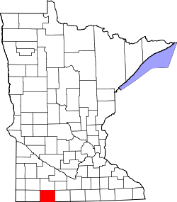
According to the United States Census Bureau, the city has a total area of 4.60 square miles (11.91 km2), of which 4.58 square miles (11.86 km2) is land and 0.02 square miles (0.05 km2) is water. [9]

The city lies along Interstate 90, which runs east to west the entire width of southern Minnesota. Interstate 90 and U.S. Highway 71 are two of the main routes in the city. Jackson is located near the center of the county of the same name. To the south is the Iowa Lakes region, which comprises Spirit Lake, West Okoboji Lake and several other small lakes.

Demographics

Historical population
CensusPop.Note
1880 501
1890 72043.7%
1900 1,756143.9%
1910 1,9078.6%
1920 2,14412.4%
1930 2,2062.9%
1940 2,84028.7%
1950 3,31316.7%
1960 3,3701.7%
1970 3,5505.3%
1980 3,7977.0%
1990 3,559−6.3%
2000 3,501−1.6%
2010 3,299−5.8%
2020 3,3230.7%
U.S. Decennial Census

2010 census

As of the census [10] of 2010, there were 3,299 people, 1,489 households, and 856 families living in the city. The population density was 720.3 inhabitants per square mile (278.1/km2). There were 1,635 housing units at an average density of 357.0 per square mile (137.8/km2). The racial makeup of the city was 93.3% White, 0.5% African American, 0.4% Native American, 3.4% Asian, 0.8% from other races, and 1.6% from two or more races. Hispanic or Latino of any race were 1.8% of the population.

There were 1,489 households, of which 27.2% had children under the age of 18 living with them, 42.6% were married couples living together, 10.3% had a female householder with no husband present, 4.5% had a male householder with no wife present, and 42.5% were non-families. 37.9% of all households were made up of individuals, and 16.1% had someone living alone who was 65 years of age or older. The average household size was 2.17 and the average family size was 2.84.

The median age in the city was 40.8 years. 22.7% of residents were under the age of 18; 8.4% were between the ages of 18 and 24; 23.1% were from 25 to 44; 26.4% were from 45 to 64; and 19.3% were 65 years of age or older. The gender makeup of the city was 48.4% male and 51.6% female.

2000 census

As of the census [3] of 2000, there were 3,501 people, 1,487 households, and 887 families living in the city. The population density was 921.7 inhabitants per square mile (355.9/km2). There were 1,659 housing units at an average density of 436.8 per square mile (168.6/km2). The racial makeup of the city was 94.03% White, 0.26% African American, 0.17% Native American, 4.03% Asian, 0.77% from other races, and 0.74% from two or more races. Hispanic or Latino of any race were 1.51% of the population.

There were 1,487 households, out of which 27.2% had children under the age of 18 living with them, 49.0% were married couples living together, 7.9% had a female householder with no husband present, and 40.3% were non-families. 36.3% of all households were made up of individuals, and 16.5% had someone living alone who was 65 years of age or older. The average household size was 2.24 and the average family size was 2.93.

In the city, the population was spread out, with 23.3% under the age of 18, 9.5% from 18 to 24, 24.5% from 25 to 44, 20.5% from 45 to 64, and 22.2% who were 65 years of age or older. The median age was 40 years. For every 100 females, there were 94.2 males. For every 100 females age 18 and over, there were 89.8 males.

The median income for a household in the city was $33,452, and the median income for a family was $42,553. Males had a median income of $30,503 versus $21,676 for females. The per capita income for the city was $18,444. About 4.6% of families and 11.1% of the population were below the poverty line, including 17.4% of those under age 18 and 9.4% of those age 65 or over.

Historic sites

Economy

Though largely a farming community, Jackson has a large industrial park with such businesses as: AGCO, Last-Deck, USF Holland, New Fashion Pork, HitchDoc, and Pioneer. AGCO and Challenger tractors are manufactured in Jackson.

Government

Jackson is located in Minnesota's 1st congressional district, represented by Republican Brad Finstad. At the state level, Jackson is located in Senate District 22, represented by Republican Doug Magnus, and in House District 22B, represented by Republican Brian Pfarr. [11]

Transportation

The city-owned Jackson Municipal Airport is located 2.3 miles (3.7 km) north of Jackson's central business district. [12]

Media

Television

ChannelCallsignAffiliationBrandingSubchannelsOwner
(Virtual)ChannelProgramming
2.1K22MY-D
(KTCA Translator)
PBS TPT 22.2 Minnesota Channel Cooperative Television Association of Southern Minnesota
2.4 PBS Kids
4.1K35IZ-D CBS WCCO 44.2 Start TV Cooperative Television Association of Southern Minnesota
17.1 Youtoo America
18.1 Laff
5.1K17MY-D
(KSTP Translator)
ABC 5 Eyewitness News5.7 Heroes & Icons Cooperative Television Association of Southern Minnesota
5.2K29LV-D
(KSTC Translator)
Ind.45 TV5.3 MeTV Cooperative Television Association of Southern Minnesota
5.4 Antenna TV
5.6 This TV
9.2K34NU-D
(WFTC Translator)
Ind.FOX 9 Plus9.3 Movies! Cooperative Television Association of Southern Minnesota
9.1 FOX
11.4K19HZ-D
(KARE Translator)
NBC KARE 1111.5 Court TV Cooperative Television Association of Southern Minnesota
11.6 True Crime Network
11.7 Quest
16.1K23FO-DCoop TV16.2 The Action Channel Cooperative Television Association of Southern Minnesota
16.3 Heartland
16.4AMG TV
16.5 Biz TV
23.5 Grit
23.1K28OI-D
(WUCW Translator)
CW CW 2323.2 Comet Cooperative Television Association of Southern Minnesota
23.3 Charge!
23.4 TBD
41.1K30KQ-D
(KPXM Translator)
ION ION41.2 Qubo Cooperative Television Association of Southern Minnesota
41.3 Ion Plus
41.4ION Shop
41.5 QVC
41.6 HSN

Notable people

Related Research Articles

<span class="mw-page-title-main">Moody County, South Dakota</span> County in South Dakota, United States

Moody County is a county in the U.S. state of South Dakota, United States. The population was 6,336 at the 2020 census. Its county seat is Flandreau. The county is named for Gideon C. Moody.

<span class="mw-page-title-main">Grant County, South Dakota</span> County in South Dakota, United States

Grant County is a county in the U.S. state of South Dakota. As of the 2020 census, the population was 7,556. The county seat is Milbank. The county was founded in 1873 and organized in 1878. It is named for Ulysses S. Grant, 18th President of the United States.

<span class="mw-page-title-main">Longville, Minnesota</span> City in Minnesota, United States

Longville is a city in Cass County, Minnesota, United States. The population was 156 at the 2010 census. The city was named after its founder, Jim Long. It is roughly four hours north of the Twin Cities. It is part of the Brainerd Micropolitan Statistical Area. Minnesota State Highway 84 serves as a main route in the community, and Minnesota State Highway 200 is nearby. Longville is home to Longville Municipal Airport.

<span class="mw-page-title-main">New Trier, Minnesota</span> City in Minnesota, United States

New Trier is a city in Dakota County, Minnesota, United States. The population was 112 at the 2010 census. Minnesota Highway 50 serves as a main route in the community.

<span class="mw-page-title-main">Randolph, Minnesota</span> City in Minnesota, United States

Randolph is a city in Dakota County, Minnesota, United States. The population was 436 at the 2010 census.

<span class="mw-page-title-main">Minnetrista, Minnesota</span> City in Minnesota, United States

Minnetrista is a city in Hennepin County, Minnesota, United States. It is located about 23 miles (37 km) west of Minneapolis. Although it is part of the Minneapolis–Saint Paul metropolitan area, the largely rural Minnetrista has agricultural activity involving corn, soybeans, hay, and horses. In addition to farmland and woods, the city is home to several lakes, including part of Lake Minnetonka, the state's ninth-biggest. The city's population was 6,384 at the 2010 census. Minnetrista's name originates in the Dakota language, in which minne means "water" and trista means "crooked".

<span class="mw-page-title-main">Isanti, Minnesota</span> City in the United States

Isanti is a city in Isanti County, Minnesota, United States. The population was 6,804 at the 2020 census. The name Isanti is composed of two Dakota words: isan ("knife") and ati ("camp"), and refers to the Santee Dakota people.

<span class="mw-page-title-main">Heron Lake, Minnesota</span> City in Minnesota, United States

Heron Lake is a city in Jackson County, Minnesota, United States. The population was 698 at the 2010 census.

<span class="mw-page-title-main">Lakefield, Minnesota</span> City in Minnesota, United States

Lakefield is a city in Jackson County, Minnesota, United States. The population was 1,694 at the 2010 census.

<span class="mw-page-title-main">Flensburg, Minnesota</span> City in Minnesota, United States

Flensburg is a city in Morrison County, Minnesota, United States. The population was 216 at the 2020 census.

<span class="mw-page-title-main">Starbuck, Minnesota</span> City in Minnesota, United States

Starbuck is a city in Pope County, Minnesota, United States. The population was 1,365 at the 2020 census. The city is on the western shore of Lake Minnewaska.

<span class="mw-page-title-main">Dakota, Minnesota</span> City in Minnesota, United States

Dakota is a city in Winona County, Minnesota, United States. The population was 295 at the 2020 census.

<span class="mw-page-title-main">Sandy Township, Pennsylvania</span> Township in Pennsylvania, United States

Sandy Township is a township in Clearfield County, Pennsylvania, United States. The population was 11,852 at the 2020 census.

<span class="mw-page-title-main">Clear Lake, South Dakota</span> City in South Dakota, United States

Clear Lake is a city in and the county seat of Deuel County, South Dakota, United States. The population was 1,218 at the 2020 census.

<span class="mw-page-title-main">Big Stone City, South Dakota</span> City in South Dakota, United States

Big Stone City is a city in the northeastern corner of Grant County, South Dakota, United States, that lies between the southern tip of Big Stone Lake and the northern bank of the Whetstone River, and is adjacent to the city of Ortonville, Minnesota. The population was 412 at the 2020 census.

<span class="mw-page-title-main">Kadoka, South Dakota</span> City in South Dakota, United States

Kadoka is a city in, and the county seat of, Jackson County, South Dakota, United States. The population was 543 at the 2020 census. The town occupies about 2.3 square miles.

<span class="mw-page-title-main">Flandreau, South Dakota</span> City in South Dakota, United States

FlandreauFLAN-droo is a city in and county seat of Moody County, South Dakota, United States. The population was 2,372 at the 2020 census. It was named in honor of Charles Eugene Flandrau, a judge in the territory and state of Minnesota. He is credited with saving the community of New Ulm, Minnesota, from destruction during conflict with the Sioux tribe in 1862.

<span class="mw-page-title-main">Minnesota Lake, Minnesota</span> City in Minnesota, United States

Minnesota Lake is a city in Blue Earth and Faribault counties in the State of Minnesota. The population was 661 at the 2020 census. The bulk of the city is in Faribault County; a small part extends into Blue Earth County.

<span class="mw-page-title-main">Redwood Falls, Minnesota</span> City in the United States

Redwood Falls is a city in Redwood County, located along the Redwood River near its confluence with the Minnesota River, in the U.S. state of Minnesota. The population was 5,102 at the 2020 census. It is the county seat.

<span class="mw-page-title-main">Shakopee, Minnesota</span> City in Minnesota, United States

Shakopee is a city in and the county seat of Scott County, Minnesota, United States. It is located southwest of Minneapolis. Sited on the south bank bend of the Minnesota River, Shakopee and nearby suburbs comprise the southwest portion of Minneapolis-Saint Paul, the sixteenth-largest metropolitan area in the United States, with 3.7 million people. The population was 43,698 at the 2020 census.

References

  1. "2020 U.S. Gazetteer Files". United States Census Bureau. Retrieved July 24, 2022.
  2. 1 2 U.S. Geological Survey Geographic Names Information System: Jackson, Minnesota
  3. 1 2 "U.S. Census website". United States Census Bureau . Retrieved January 31, 2008.
  4. "Find a County". National Association of Counties. Archived from the original on May 31, 2011. Retrieved June 7, 2011.
  5. "2010 Census Redistricting Data (Public Law 94-171) Summary File". American FactFinder. United States Census Bureau . Retrieved April 27, 2011.[ dead link ]
  6. Upham, Warren (1920). Minnesota Geographic Names: Their Origin and Historic Significance. Minnesota Historical Society. p.  262.
  7. "Jackson County". Jim Forte Postal History. Retrieved July 13, 2015.
  8. "Our History". Jackson Chamber.
  9. "US Gazetteer files 2010". United States Census Bureau. Archived from the original on January 12, 2012. Retrieved November 13, 2012.
  10. "U.S. Census website". United States Census Bureau . Retrieved November 13, 2012.
  11. "Minnesota House of Representatives District 22B".
  12. FAA Airport Form 5010 for MJQ PDF . Federal Aviation Administration. Effective 30 June 2011.
  13. "Grottum, Bjarne Elgar "B.E."". Legislators Past and Present. Minnesota Legislative Reference Library. Retrieved June 8, 2012.
  14. "Gary Amdahl | Playwrights' Center". pwcenter.org. Retrieved October 20, 2023.
  15. "Office of the President". www.dbq.edu. Retrieved October 20, 2023.
  16. "Jesuit Priest Walter Halloran". Washington Post. ISSN   0190-8286 . Retrieved October 20, 2023.
  17. "Flygare, Willis H. (1936-1981) | Chemistry at Illinois".
  18. "Lee Aase". Jarrard Inc. Retrieved October 20, 2023.