Carlton, Minnesota

Last updated

Carlton
Carlton Courthouse 002.JPG
Carlton County Minnesota Incorporated and Unincorporated areas Carlton Highlighted.svg
Location of the city of Carlton
within Carlton County, Minnesota
Coordinates: 46°39′50″N92°25′30″W / 46.66389°N 92.42500°W / 46.66389; -92.42500
CountryUnited States
State Minnesota
County Carlton
Founded1881
Area
[1]
  Total4.00 sq mi (10.37 km2)
  Land3.77 sq mi (9.76 km2)
  Water0.23 sq mi (0.60 km2)
Elevation
1,083 ft (330 m)
Population
 (2020) [2]
  Total948
  Estimate 
(2022) [3]
965
  Density251.53/sq mi (97.12/km2)
Time zone UTC-6 (Central (CST))
  Summer (DST) UTC-5 (CDT)
ZIP code
55718
Area code 218
FIPS code 27-10018 [4]
GNIS feature ID0640914 [5]
Website cityofcarlton.com

Carlton is a city in Carlton County, Minnesota, United States. The population was 948 at the 2020 census. [2] It is the county seat of Carlton County. The town sits on the northwestern edge of Jay Cooke State Park. [6]

Contents

Minnesota State Highways 45 and 210 and County Roads 1 and 3 are four of Carlton's main routes. It is five miles south of Cloquet and 21 miles southwest of Duluth.

History

In 1870, the Northern Pacific Railroad finished a stretch of track that linked Duluth to St. Paul. Temporary shacks were erected for the workmen at the place that was soon known as "Northern Pacific Junction". In 1881, this settlement was incorporated as Carlton. It takes its name from former State Senator Reuben B. Carlton. [7]

Thomson merged with Carlton in 2015. [8]

Geography

According to the United States Census Bureau, the city has an area of 2.27 square miles (5.88 km2), of which 2.06 square miles (5.34 km2) is land and 0.21 square miles (0.54 km2) is water. [9]

The Saint Louis River is nearby. Carlton is the home of Black Bear Casino Resort.

Thomson Dam, Thomson Reservoir, and Jay Cooke State Park are also nearby, and the Willard Munger Bicycle Trail runs through the city of Carlton.

Demographics

Historical population
CensusPop.Note
1880 168
1890 612264.3%
1900 449−26.6%
1910 59733.0%
1920 70017.3%
1930 687−1.9%
1940 7001.9%
1950 652−6.9%
1960 86232.2%
1970 8842.6%
1980 862−2.5%
1990 9237.1%
2000 810−12.2%
2010 8626.4%
2020 94810.0%
2022 (est.)965 [3] 1.8%
U.S. Decennial Census [10]
2020 Census [2]

2010 census

As of the census of 2010, there were 862 people, 337 households, and 175 families living in the city. The population density was 418.4 inhabitants per square mile (161.5/km2). There were 355 housing units at an average density of 172.3 per square mile (66.5/km2). The racial makeup of the city was 92.0% White, 0.5% African American, 4.3% Native American, 0.3% Asian, 0.5% from other races, and 2.4% from two or more races. Hispanic or Latino of any race were 1.5% of the population.

There were 337 households, of which 24.3% had children under the age of 18 living with them, 35.6% were married couples living together, 11.3% had a female householder with no husband present, 5.0% had a male householder with no wife present, and 48.1% were non-families. 43.3% of all households were made up of individuals, and 25.8% had someone living alone who was 65 years of age or older. The average household size was 2.09 and the average family size was 2.82.

The median age in the city was 44.2 years. 18% of residents were under the age of 18; 7.6% were between the ages of 18 and 24; 25.2% were from 25 to 44; 21.4% were from 45 to 64; and 27.7% were 65 years of age or older. The gender makeup of the city was 44.8% male and 55.2% female.

2000 census

As of the census of 2000, there were 810 people, 306 households, and 179 families living in the city. The population density was 393.8 inhabitants per square mile (152.0/km2). There were 325 housing units at an average density of 158.0 per square mile (61.0/km2). The racial makeup of the city was 95.19% White, 3.46% Native American, 0.12% from other races, and 1.23% from two or more races. Hispanic or Latino of any race were 0.62% of the population. 25.1% were of German, 15.3% Norwegian, 12.4% Finnish, 9.8% Swedish, 6.0% Polish and 5.5% Irish ancestry according to Census 2000.

There were 306 households, out of which 26.2% had children under the age of 18 living with them, 43.1% were married couples living together, 11.1% had a female householder with no husband present, and 41.5% were non-families. 37.3% of all households were made up of individuals, and 23.5% had someone living alone who was 65 years of age or older. The average household size was 2.22 and the average family size was 2.93.

In the city, the population was spread out, with 20.5% under the age of 18, 7.4% from 18 to 24, 24.2% from 25 to 44, 19.8% from 45 to 64, and 28.1% who were 65 years of age or older. The median age was 44. For every 100 females, there were 93.3 males. For every 100 females 18 and over, there were 89.4 males.

The median income for a household in the city was $31,477, and the median income for a family was $44,792. Males had a median income of $32,614 versus $21,167 for females. The per capita income for the city was $15,586. About 6.3% of families and 9.7% of the population were below the poverty line, including 13.1% of those under 18 and 8.8% of those 65 or over.

Festival

Carlton Daze is the name of the city of Carlton's celebration that is usually held annually in late July.

Education

Most of Carlton is in the Carlton School District while a small section is in the Esko Public School District. [11]

Related Research Articles

<span class="mw-page-title-main">Norphlet, Arkansas</span> City in Arkansas, United States

Norphlet is a city in Union County, Arkansas, United States. As of the 2010 census the population stood at 844.

<span class="mw-page-title-main">Peck, Idaho</span> City in Idaho, United States

Peck is a city in Nez Perce County, Idaho, United States. The population was 197 at the 2010 census. It is part of the Lewiston, ID-WA Metropolitan Statistical Area. Many residents of Peck work in nearby Orofino, Idaho. Additionally, Peck residents attend high school in Orofino since Peck does not have a high school.

<span class="mw-page-title-main">Rosiclare, Illinois</span> City in Illinois, United States

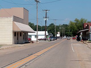
Rosiclare is a city in Hardin County, Illinois, along the Ohio River. The population was 1,160 at the 2010 census, down from 1,213 at the 2000 census.

<span class="mw-page-title-main">Carlton, Kansas</span> City in Dickinson County, Kansas

Carlton is a city in Dickinson County, Kansas, United States. As of the 2020 census, the population of the city was 40.

Leighton Township is a civil township of Allegan County in the U.S. state of Michigan. The population was 7,001 at the 2020 census, up from 4,934 at the 2010 census.

<span class="mw-page-title-main">Honor, Michigan</span> Village in Michigan, United States

Honor is a village in Benzie County of the U.S. state of Michigan. The population was 337 at the 2020 census. The village is located within Homestead Township on U.S. Highway 31 along the Platte River.

<span class="mw-page-title-main">Barnum, Minnesota</span> City in Minnesota, United States

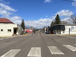
Barnum is a city in Carlton County, Minnesota, United States. The population was 613 at the 2010 census.

<span class="mw-page-title-main">Scanlon, Minnesota</span> City in Minnesota, United States

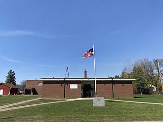
Scanlon is a city in Carlton County, Minnesota, United States. The population was 987 at the 2020 census.

<span class="mw-page-title-main">Thomson, Minnesota</span> Former City in Minnesota, United States

Thomson was a city in Carlton County, Minnesota, United States, located along the Saint Louis River. The population was 159 at the 2010 census.

<span class="mw-page-title-main">Wrenshall, Minnesota</span> City in Minnesota, United States

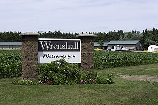
Wrenshall is a city in Carlton County, Minnesota, United States. It was originally a brickyard. The population was 428 at the 2020 census. Wrenshall is located just south of Jay Cooke State Park.

<span class="mw-page-title-main">Wright, Minnesota</span> City in Minnesota, United States

Wright is a city in Carlton County, Minnesota, United States. The population was 127 at the 2010 census.

<span class="mw-page-title-main">Denham, Minnesota</span> City in Minnesota, United States

Denham is a city in Pine County, Minnesota, United States. The population was 37 at the 2020 census.

Arrowhead Township is a township in Saint Louis County, Minnesota, United States. The population was 223 at the 2010 census.

Fine Lakes Township is a township in Saint Louis County, Minnesota, United States. The population was 134 at the 2010 census.

Prairie Lake Township is a township in Saint Louis County, Minnesota, United States. The population was 50 at the 2010 census.

<span class="mw-page-title-main">Yamhill, Oregon</span> City in Oregon, United States

Yamhill is a city in Yamhill County, Oregon, United States. Located in the northern part of the county, it is situated at the intersection of Oregon Route 47 and Oregon Route 240. The population was 1,147 at the 2020 census. Originally named North Yamhill, it was incorporated under that name by the Oregon Legislative Assembly on February 20, 1891.

<span class="mw-page-title-main">Perry Township, Armstrong County, Pennsylvania</span> Township in Pennsylvania, United States

Perry Township is a township that is located in Armstrong County, Pennsylvania, United States. The population was 367 at the time of the 2020 census, an increase over the figure of 352 that was tabulated in 2010.

<span class="mw-page-title-main">Vanderbilt, Pennsylvania</span> Borough in Pennsylvania, United States

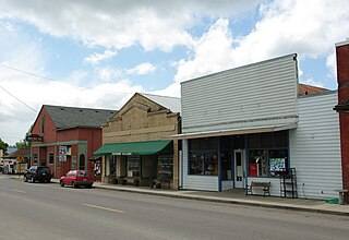
Vanderbilt is a borough in Fayette County, Pennsylvania, United States. The population was 414 at the 2020 census, a decline from the figure of 476 tabulated in 2010. The town is named for the railroad tycoon Cornelius Vanderbilt and is served by the Connellsville Area School District.

<span class="mw-page-title-main">Girard, Texas</span> Census-designated place in Texas, United States of America

Girard is an unincorporated community and census-designated place (CDP) in Kent County, Texas, United States. The population was 50 at the 2010 census.

<span class="mw-page-title-main">Reliance, Wyoming</span> CDP in Wyoming, United States

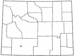
Reliance is a census-designated place (CDP) in Sweetwater County, Wyoming, United States. The population was 714 at the 2010 census.

References

  1. "2020 U.S. Gazetteer Files". United States Census Bureau. Retrieved July 24, 2022.
  2. 1 2 3 "Explore Census Data". United States Census Bureau . Retrieved November 22, 2023.
  3. 1 2 "City and Town Population Totals: 2020-2022". United States Census Bureau. November 22, 2023. Retrieved November 22, 2023.
  4. "U.S. Census website". United States Census Bureau . Retrieved January 31, 2008.
  5. "US Board on Geographic Names". United States Geological Survey. October 25, 2007. Retrieved January 31, 2008.
  6. "Find a County". National Association of Counties. Archived from the original on May 31, 2011. Retrieved June 7, 2011.
  7. Upham, Warren (1920). Minnesota Geographic Names: Their Origin and Historic Significance. Minnesota Historical Society. p.  74.
  8. "Boundary Changes". Archived from the original on August 18, 2017. Retrieved November 13, 2016.
  9. "US Gazetteer files 2010". United States Census Bureau. Archived from the original on July 2, 2012. Retrieved November 13, 2012.
  10. United States Census Bureau. "Census of Population and Housing" . Retrieved June 4, 2015.
  11. "2020 CENSUS - SCHOOL DISTRICT REFERENCE MAP: Carlton County, MN" (PDF). United States Census Bureau. Archived (PDF) from the original on August 5, 2021. Retrieved August 4, 2021.

46°39′50″N92°25′30″W / 46.66389°N 92.42500°W / 46.66389; -92.42500