Silver Brook Township, Carlton County, Minnesota

Last updated
Silver Brook Township, Minnesota
USA Minnesota location map.svg
Red pog.svg
Silver Brook Township, Minnesota
Location within the state of Minnesota
Usa edcp location map.svg
Red pog.svg
Silver Brook Township, Minnesota
Silver Brook Township, Minnesota (the United States)
Coordinates: 46°36′32″N92°22′20″W / 46.60889°N 92.37222°W / 46.60889; -92.37222 Coordinates: 46°36′32″N92°22′20″W / 46.60889°N 92.37222°W / 46.60889; -92.37222
Country United States
State Minnesota
County Carlton
Area
  Total20.1 sq mi (51.9 km2)
  Land20.0 sq mi (51.8 km2)
  Water0.0 sq mi (0.1 km2)
Elevation
997 ft (304 m)
Population
 (2000)
  Total609
  Density30.4/sq mi (11.7/km2)
Time zone UTC-6 (Central (CST))
  Summer (DST) UTC-5 (CDT)
FIPS code 27-60268 [1]
GNIS feature ID0665612 [2]

Silver Brook Township is a township in Carlton County, Minnesota, United States. The population was 609 as of the 2000 census. [3]

Contents

Geography

According to the United States Census Bureau, the township has a total area of 20.0 square miles (51.9 km2), of which 20.0 square miles (51.9 km2) is land and 0.04 square miles (0.1 km2) (0.20%) is water.

The city of Wrenshall is located entirely within Silver Brook Township geographically but is a separate entity.

Major highway

Adjacent townships

Cemeteries

The township contains MacCabee Cemetery.

Demographics

As of the census [1] of 2000, there were 609 people, 209 households, and 173 families residing in the township. The population density was 30.4 inhabitants per square mile (11.7/km2). There were 220 housing units at an average density of 11.0/sq mi (4.2/km2). The racial makeup of the township was 97.37% White, 0.16% African American, 1.31% Native American, 0.16% Asian, and 0.99% from two or more races. Hispanic or Latino of any race were 0.16% of the population. 24.9% were of German, 17.6% Swedish, 15.0% Norwegian, 8.3% Finnish and 5.1% Polish ancestry according to Census 2000.

There were 209 households, out of which 39.2% had children under the age of 18 living with them, 74.6% were married couples living together, 3.3% had a female householder with no husband present, and 17.2% were non-families. 13.9% of all households were made up of individuals, and 5.7% had someone living alone who was 65 years of age or older. The average household size was 2.91 and the average family size was 3.13.

In the township the population was spread out, with 28.2% under the age of 18, 7.7% from 18 to 24, 27.6% from 25 to 44, 25.5% from 45 to 64, and 11.0% who were 65 years of age or older. The median age was 37 years. For every 100 females, there were 103.0 males. For every 100 females age 18 and over, there were 105.2 males.

The median income for a household in the township was $51,875, and the median income for a family was $55,139. Males had a median income of $41,111 versus $30,625 for females. The per capita income for the township was $18,535. About 1.1% of families and 2.5% of the population were below the poverty line, including 4.2% of those under age 18 and none of those age 65 or over.

Related Research Articles

<span class="mw-page-title-main">Custer Township, Antrim County, Michigan</span> Civil township in Michigan, United States

Custer Township is a civil township of Antrim County in the U.S. state of Michigan. The population was 1,136 at the 2010 census.

<span class="mw-page-title-main">Ironwood Charter Township, Michigan</span> Charter township in Michigan, United States

Ironwood Charter Township is a charter township of Gogebic County in the U.S. state of Michigan. The population was 2,333 at the 2010 census. The city of Ironwood borders on the south, but the two are administered autonomously.

<span class="mw-page-title-main">Crystal Falls Township, Michigan</span> Civil township in Michigan, United States

Crystal Falls Township is a civil township of Iron County in the Upper Peninsula of the U.S. state of Michigan. As of the 2000 census, the township population was 1,722. The city of Crystal Falls is located in the southern portion of the township, but is administratively autonomous.

<span class="mw-page-title-main">Conway Township, Michigan</span> Civil township in Michigan, United States

Conway Township is a civil township of Livingston County in the U.S. state of Michigan. The population was 3,546 at the 2010 census, an increase of 814 from the 2000 census.

Fairgrove Township is a civil township of Tuscola County in the U.S. state of Michigan. The population was 1,579 at the 2010 Census. The village of Fairgrove is located within the township, as well as the southern half of the village of Akron.

Blackhoof Township is a township in Carlton County, Minnesota, United States. The population was 753 as of the 2000 census. The township took its name from the Blackhoof River.

Holyoke Township is a township in Carlton County, Minnesota, United States. The population was 179 as of the 2000 census.

<span class="mw-page-title-main">Wrenshall, Minnesota</span> City in Minnesota, United States

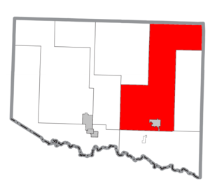
Wrenshall is a city in Carlton County, Minnesota, United States. It was originally a brickyard. The population was 428 at the 2020 census. Wrenshall is located just south of Jay Cooke State Park.

Wrenshall Township is a township in Carlton County, Minnesota, United States. The population was 326 at the 2000 census. Wrenshall Township was named for C. C. Wrenshall, a railroad official.

Meadow Brook Township is a township in Cass County, Minnesota, United States. The population was 183 as of the 2000 census. Meadow Brook Township took its name from a stream where a schoolhouse once stood.

Riverton Township is a township in Clay County, Minnesota, United States. The population was 462 at the 2000 census.

Pelican Township is a township in Crow Wing County, Minnesota, United States. The population was 400 at the 2000 census. This township was named from Pelican Lake.

Hayward Township is a township in Freeborn County, Minnesota, United States. The population was 438 at the 2000 census.

Henrietta Township is a township in Hubbard County, Minnesota, United States. The population was 1,582 at the 2000 census.

Western Township is a township in Otter Tail County, Minnesota, United States. The population was 142 at the 2000 census.

Crosby Township is a township in Pine County, Minnesota, United States. The population was 97 at the 2000 census.

Kingman Township is a township in Renville County, Minnesota, United States. The population was 252 at the 2000 census.

Poplar Grove Township is a township in Roseau County, Minnesota, United States. The population was 80 at the 2000 census.

<span class="mw-page-title-main">Franklin Township, Erie County, Pennsylvania</span> Township in Pennsylvania, United States

Franklin Township is a township in Erie County, Pennsylvania, United States. As of the 2020 census, the township population was 1,512, which is down from the population of 1,633 in 2010.

Elba Township is a civil township of Lapeer County in the U.S. state of Michigan. The population was 5,250 at the 2010 Census.

References

  1. 1 2 "U.S. Census website". United States Census Bureau . Retrieved 2008-01-31.
  2. "US Board on Geographic Names". United States Geological Survey. 2007-10-25. Retrieved 2008-01-31.
  3. "U.S. Census website" . Retrieved 2009-01-02.