Miloma | |
|---|---|
 Miloma in 2014 | |
 Miloma  Miloma | |
| Coordinates: 43°45′46″N95°22′06″W / 43.76278°N 95.36833°W | |
| Country | United States |
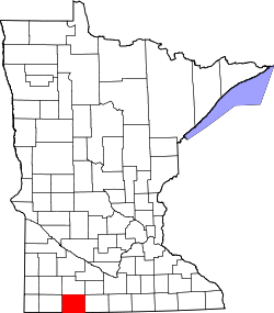
| State | Minnesota |
| County | Jackson |
| Township | La Crosse |
| Elevation | 1,431 ft (436 m) |
| Time zone | UTC-6 (Central (CST)) |
| • Summer (DST) | UTC-5 (CDT) |
| Area code | 507 |
| GNIS feature ID | 654830 [1] |
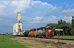
Miloma is an unincorporated community located in Jackson County, Minnesota, United States at latitude 43.763 and longitude -95.368 (Miloma Panoramio Photos). The elevation is 1,427 feet. Miloma appears on the Heron Lake U.S. Geological Survey Map. [2]