Fish Lake | |
|---|---|
 Fish Lake  Fish Lake | |
| Coordinates: 43°50′19″N95°02′49″W / 43.83861°N 95.04694°W | |
| Country | United States |
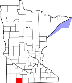
| State | Minnesota |
| County | Jackson |
| Township | Christiania |
| Area | |
• Total | 1.25 sq mi (3.24 km2) |
| • Land | 0.92 sq mi (2.37 km2) |
| • Water | 0.34 sq mi (0.87 km2) |
| Elevation | 1,427 ft (435 m) |
| Population (2020) | |
• Total | 75 |
| • Density | 82/sq mi (31.7/km2) |
| Time zone | UTC-6 (Central (CST)) |
| • Summer (DST) | UTC-5 (CDT) |
| Area code | 507 |
| GNIS feature ID | 2583776 [2] |
Fish Lake is a census-designated place and unincorporated community in Christiania Township, Jackson County, Minnesota, United States. Its population was 51 as of the 2010 census. [3] Its former name was Swastika Beach. [4]