Hampton Township, Dakota County, Minnesota

Last updated

Hampton Township
USA Minnesota location map.svg
Red pog.svg
Hampton Township
Location within the state of Minnesota
Usa edcp location map.svg
Red pog.svg
Hampton Township
Hampton Township (the United States)
Coordinates: 44°36′9″N92°59′17″W / 44.60250°N 92.98806°W / 44.60250; -92.98806
Country United States
State Minnesota
County Dakota
Area
  Total34.3 sq mi (88.8 km2)
  Land34.3 sq mi (88.8 km2)
  Water0.0 sq mi (0.0 km2)
Elevation
1,001 ft (305 m)
Population
 (2000)
  Total986
  Density28.8/sq mi (11.1/km2)
Time zone UTC-6 (Central (CST))
  Summer (DST) UTC-5 (CDT)
ZIP code
55031
Area code(s) 651 and 507
FIPS code 27-26882 [1]
GNIS feature ID0664386 [2]

Hampton Township is a township in Dakota County, Minnesota, United States. The population was 986 at the 2000 census.

Contents

Hampton Township was organized in 1858, and named after Hampton, Connecticut, the birthplace of an early settler. [3]

Geography

According to the United States Census Bureau, the township has a total area of 34.3 square miles (89 km2), all land.

The city of Hampton and the city of New Trier are both geographically within Hampton Township but are a separate entities.

Demographics

Historical population
CensusPop.Note
1860 475
1870 93095.8%
1880 805−13.4%
1890 725−9.9%
1900 604−16.7%
1910 6253.5%
1920 578−7.5%
1930 518−10.4%
1940 5312.5%
1950 512−3.6%
1960 511−0.2%
1970 59516.4%
1980 84842.5%
1990 8662.1%
2000 98613.9%
2010 903−8.4%
U.S. Decennial Census [4]

As of the census [1] of 2000, there were 986 people, 320 households, and 261 families residing in the township. The population density was 28.8 inhabitants per square mile (11.1/km2). There were 322 housing units at an average density of 9.4/sq mi (3.6/km2). The racial makeup of the township was 98.78% White, 0.20% African American, 0.61% Native American, 0.20% Asian, and 0.20% from two or more races.

There were 320 households, out of which 43.8% had children under the age of 18 living with them, 75.9% were married couples living together, 3.1% had a female householder with no husband present, and 18.4% were non-families. 12.5% of all households were made up of individuals, and 3.1% had someone living alone who was 65 years of age or older. The average household size was 3.08 and the average family size was 3.42.

In the township the population was spread out, with 32.2% under the age of 18, 7.2% from 18 to 24, 30.5% from 25 to 44, 22.1% from 45 to 64, and 8.0% who were 65 years of age or older. The median age was 36 years. For every 100 females, there were 105.8 males. For every 100 females age 18 and over, there were 102.7 males.

The median income for a household in the township was $62,292, and the median income for a family was $68,750. Males had a median income of $46,500 versus $31,023 for females. The per capita income for the township was $25,576. About 0.8% of families and 2.2% of the population were below the poverty line, including 1.6% of those under age 18 and 2.4% of those age 65 or over.

Related Research Articles

Wagner Township is a township in Aitkin County, Minnesota, United States. The population was 332 as of the 2010 census.

White Pine Township is a township in Aitkin County, Minnesota, United States. The population was 34 as of the 2010 census.

<span class="mw-page-title-main">Hampton, Minnesota</span> City in Minnesota, United States

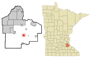
Hampton is a city in Dakota County, Minnesota, United States. The population was 689 at the 2010 census.

Kiester Township is a township in Faribault County, Minnesota, United States. The population was 320 at the 2000 census.

Prescott Township is a township in Faribault County, Minnesota, United States. The population was 222 at the 2000 census.

Verona Township is a township in Faribault County, Minnesota, United States. The population was 391 at the 2000 census.

Warsaw Township is a township in Goodhue County, Minnesota, United States. The population was 603 at the 2000 census.

Lake George Township is a township in Hubbard County, Minnesota, United States. The population was 307 at the 2020 census. The unincorporated community and census-designated place of Lake George is located within the township.

Bowstring Township is a township in Itasca County, Minnesota, United States. The population was 230 at the 2010 census.

Lone Pine Township is a township in Itasca County, Minnesota, United States. The population was 410 at the 2010 census.

Marcell Township is a township in Itasca County, Minnesota, United States. The population was 467 at the 2010 census.

Sand Lake Township is a township in Itasca County, Minnesota, United States. The population was 146 at the 2010 census.

Lanesburgh Township is a township in Le Sueur County, Minnesota, United States. The population was 2,074 at the 2000 census.

Sodus Township is a township in Lyon County, Minnesota, United States. The population was 282 at the 2000 census.

Racine Township is a township in Mower County, Minnesota, United States. The population was 445 at the time of the 2000 census. The largest town in the township is Racine with a population of 442 as of the 2010 census.. All other area in the township is unincorporated.

<span class="mw-page-title-main">Collegeville Township, Stearns County, Minnesota</span> Township in Minnesota, United States

Collegeville Township is a township in Stearns County, Minnesota, United States. The population was 3,343 at the 2010 census.

Millwood Township is a township in Stearns County, Minnesota, United States. The population was 972 at the 2010 census. The township includes the city of St. Rosa.

Huntersville Township is a township in Wadena County, Minnesota, United States. The population was 128 at the 2000 census. The unincorporated place also called Huntersville is located in this township, at the junction of County Roads 18 and 25. Most of Huntersville State Forest is located within this township as well.

Maple Lake Township is a township in Wright County, Minnesota, United States. The population was 2,128 at the 2000 census.

<span class="mw-page-title-main">Litchfield Township, Bradford County, Pennsylvania</span> Township in Pennsylvania, United States

Litchfield Township is a township in Bradford County, Pennsylvania, United States. It is part of Northeastern Pennsylvania. As of the 2010 census it had a population of 1,320.

References

  1. 1 2 "U.S. Census website". United States Census Bureau . Retrieved January 31, 2008.
  2. "US Board on Geographic Names". United States Geological Survey. October 25, 2007. Retrieved January 31, 2008.
  3. Upham, Warren (1920). Minnesota Geographic Names: Their Origin and Historic Significance. Minnesota Historical Society. p.  165.
  4. "Census of Population and Housing". Census.gov. Retrieved May 19, 2019.