
Dakota County is the third-most populous county in the U.S. state of Minnesota, located in the east central portion of the state. As of the 2020 census, the population was 439,882. The population of Dakota County was estimated to be 442,038 in 2021. The county seat is Hastings. Dakota County is named for the Dakota Sioux tribal bands who inhabited the area. The name is recorded as "Dahkotah" in the United States Census records until 1851. Dakota County is included in the Minneapolis–St. Paul–Bloomington, MN–WI Metropolitan Statistical Area, the sixteenth largest metropolitan area in the United States with about 3.64 million residents. The largest city in Dakota County is the city of Lakeville, the eleventh-largest city in Minnesota and sixth-largest Twin Cities suburb. The county is bordered by the Minnesota and Mississippi Rivers on the north, and the state of Wisconsin on the east.

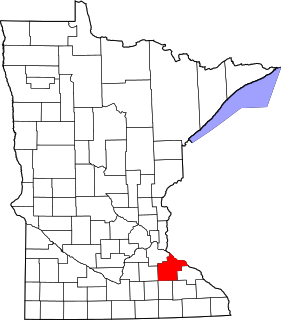
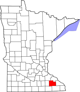
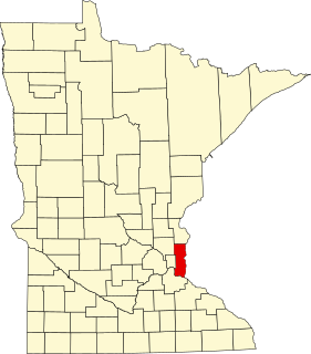
Inver Grove Heights is a city in Dakota County, Minnesota, United States. The population was 35,801 at the 2020 census. The city was formed on March 9, 1965, with the merger of the village of Inver Grove and Inver Grove Township.
Mae A. Schunk is a politician and educator from Minnesota who served as the 45th lieutenant governor of Minnesota from 1999 to 2003. Elected on the same ticket as Jesse Ventura in the historic upset election of 1998 Minnesota gubernatorial election, she became the first Reform Party member elected as lieutenant governor of any state.

CHS Inc. is a Fortune 500 secondary cooperative owned by United States agricultural cooperatives, farmers, ranchers, and thousands of preferred stock holders. Based in Inver Grove Heights, Minnesota, it owns and operates various food processing and wholesale, farm supply, financial services and retail businesses, It also distributes Cenex brand fuel in 19 Midwestern and Western states, which is one of the largest c-store networks in North America. It is a co-owner of Ventura Foods, a vegetable oil processor.
Minnesota State Highway 110 (MN 110) was a short 5.245-mile-long (8.441 km) connector highway in Minnesota, which ran from an interchange with State Highway 55 in Mendota Heights to an interchange with Interstate 494 in Inver Grove Heights, south of downtown Saint Paul.
Freeman House or variations such as Freeman Farm may refer to:

Joseph Atkins is a Minnesota attorney and former member of the Minnesota House of Representatives. A member of the Minnesota Democratic–Farmer–Labor Party (DFL), he represented District 52B, which included portions of Dakota County in the southeastern Twin Cities metropolitan area.

Inver is a small village in County Donegal, Ireland. It lies on the N56 National secondary road midway between Killybegs to the west and Donegal Town to the east. It is also a civil parish in the historic barony of Banagh.

This is a list of the National Register of Historic Places listings in Dakota County, Minnesota. It is intended to be a complete list of the properties and districts on the National Register of Historic Places in Dakota County, Minnesota, United States. Dakota County is located in the southeastern part of the U.S. state of Minnesota, bounded on the northeast side by the Upper Mississippi River and on the northwest by the Minnesota River. The locations of National Register properties and districts for which the latitude and longitude coordinates are included below, may be seen in an online map.

This is a list of the National Register of Historic Places listings in Scott County, Minnesota. It is intended to be a complete list of the properties and districts on the National Register of Historic Places in Scott County, Minnesota, United States. The locations of National Register properties and districts for which the latitude and longitude coordinates are included below, may be seen in an online map.

The Samuel Freeman House is a Frank Lloyd Wright house in the Hollywood Hills of Los Angeles, California built in 1923. The house was listed on the National Register of Historic Places in 1971. The house has also been listed as a California Historical Landmark #1011, and as Los Angeles Historic-Cultural Monument #247 in 1981.

This is a list of the National Register of Historic Places listings in Rice County, Minnesota. It is intended to be a complete list of the properties and districts on the National Register of Historic Places in Rice County, Minnesota, United States. The locations of National Register properties and districts for which the latitude and longitude coordinates are included below, may be seen in an online map.
This is a list of the National Register of Historic Places listings in Goodhue County, Minnesota. It is intended to be a complete list of the properties and districts on the National Register of Historic Places in Goodhue County, Minnesota, United States. The locations of National Register properties and districts for which the latitude and longitude coordinates are included below, may be seen in an online map.
This is a list of the National Register of Historic Places listings in Olmsted County, Minnesota. It is intended to be a complete list of the properties and districts on the National Register of Historic Places in Olmsted County, Minnesota, United States. The locations of National Register properties and districts for which the latitude and longitude coordinates are included below, may be seen in an online map.

This is a list of the National Register of Historic Places listings in Redwood County, Minnesota. It is intended to be a complete list of the properties and districts on the National Register of Historic Places in Redwood County, Minnesota, United States. The locations of National Register properties and districts for which the latitude and longitude coordinates are included below, may be seen in an online map.

The Rock Island Swing Bridge was a swing bridge that spanned the Mississippi River between Inver Grove Heights, Minnesota, and St. Paul Park, Minnesota. It was also known as the Newport Rail Bridge, as it had a spur to Newport, Minnesota, and J.A.R. bridge, after previous owners Joan and Al Roman of Chicago. It was one of the few double-decker bridges on the Mississippi, with the top level formerly used for railroad traffic and the bottom level formerly used as a road crossing. It also was one of a few toll bridges in Minnesota, and one of the last remaining ones. It closed to rail traffic in 1980, and road traffic in 1999, when the toll was 75 cents. After closing, the bridge sat dormant in the open position for 10 years before being partially demolished in 2009. It was converted into a recreational pier, which was open to the public on June 11, 2011.

This is a list of the National Register of Historic Places listings in Le Sueur County, Minnesota. It is intended to be a complete list of the properties and districts on the National Register of Historic Places in Le Sueur County, Minnesota, United States. The locations of National Register properties and districts for which the latitude and longitude coordinates are included below, may be seen in an online map.
This is a list of the National Register of Historic Places listings in Washington County, Minnesota. It is intended to be a complete list of the properties and districts on the National Register of Historic Places in Washington County, Minnesota, United States. The locations of National Register properties and districts for which the latitude and longitude coordinates are included below, may be seen in an online map.

This is a list of the National Register of Historic Places listings in Rock County, Minnesota. It is intended to be a complete list of the properties and districts on the National Register of Historic Places in Rock County, Minnesota, United States. The locations of National Register properties and districts for which the latitude and longitude coordinates are included below, may be seen in an online map.
The Simley High School wrestling team, located in Inver Grove Heights, Minnesota, ranked nationally in the top twenty-five for seven of the last ten years. The Scholastic wrestling program was founded by teacher Jim Short. The program secured its first place state title within seven years. The following year, in 1978, Jim Trudeau won the school's first individual state title. In 1987, the team earned its first state championship.


