The Star Tribune is the largest newspaper in Minnesota. It originated as the Minneapolis Tribune in 1867 and the competing Minneapolis Daily Star in 1920. During the 1930s and 1940s Minneapolis's competing newspapers were consolidated, with the Tribune published in the morning and the Star in the evening. They merged in 1982, creating the Star and Tribune, and it was renamed to Star Tribune in 1987. After a tumultuous period in which the newspaper was sold and re-sold and filed for bankruptcy protection in 2009, it was purchased by local businessman Glen Taylor in 2014.

The National Farmers' Bank of Owatonna, Minnesota, United States, is a historic bank building designed by Louis Sullivan, with decorative elements by George Elmslie. It was built in 1908, and was the first of Sullivan's "jewel box" bank designs. The building is clad in red brick with green terra cotta bands, and features two large arches on its street-facing facades. Single-story wings, originally housing bank offices, extend along each side. Internal elements include two stained-glass windows designed by Louis J. Millet, a mural by Oskar Gross, and four immense cast iron electroliers designed by Elmslie and cast by Winslow Brothers Company.

The Soo Line Building is a 19-story residential highrise in Minneapolis, Minnesota which was the tallest commercial building in the city from the time it was completed in 1915 until the 26-story Foshay Tower was built in 1929.
Exchange Bank or Exchange Bank Building may refer to:

1 Wall Street Court is a residential building in the Financial District of Manhattan in New York City. The 15-story building, designed by Clinton and Russell in the Renaissance Revival style, was completed in 1904 at the intersection of Wall, Pearl, and Beaver Streets.

This is a list of the National Register of Historic Places listings in Dakota County, Minnesota. It is intended to be a complete list of the properties and districts on the National Register of Historic Places in Dakota County, Minnesota, United States. Dakota County is located in the southeastern part of the U.S. state of Minnesota, bounded on the northeast side by the Upper Mississippi River and on the northwest by the Minnesota River. The locations of National Register properties and districts for which the latitude and longitude coordinates are included below, may be seen in an online map.

The Fitzpatrick Building in Saint Paul, Minnesota, United States, is an 1890 Queen Anne style commercial building featuring corner turret and pressed-metal relief. It is listed on the National Register of Historic Places.

This is a list of the National Register of Historic Places listings in Stearns County, Minnesota. It is intended to be a complete list of the properties and districts on the National Register of Historic Places in Stearns County, Minnesota, United States. The locations of National Register properties and districts for which the latitude and longitude coordinates are included below, may be seen in an online map.

This is a list of the National Register of Historic Places listings in Redwood County, Minnesota. It is intended to be a complete list of the properties and districts on the National Register of Historic Places in Redwood County, Minnesota, United States. The locations of National Register properties and districts for which the latitude and longitude coordinates are included below, may be seen in an online map.

This is a list of the National Register of Historic Places listings in Winona County, Minnesota. It is intended to be a complete list of the properties and districts on the National Register of Historic Places in Winona County, Minnesota, United States. The locations of National Register properties and districts for which the latitude and longitude coordinates are included below, may be seen in an online map.

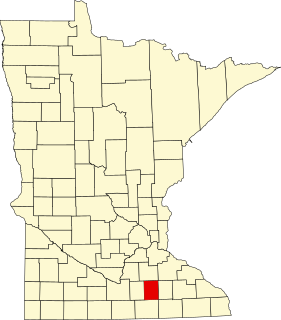
This is a list of the National Register of Historic Places listings in Steele County, Minnesota. It is intended to be a complete list of the properties and districts on the National Register of Historic Places in Steele County, Minnesota, United States. The locations of National Register properties and districts for which the latitude and longitude coordinates are included below, may be seen in an online map.

The Ninth Square Historic District encompasses a historically diverse and well-preserved part of the commercial area of Downtown New Haven, Connecticut. The district is bounded by Church, Court, State, and Crown Streets, and is centered on the intersection of Chapel and Orange Streets. The buildings in the district are mostly late-19th and early 20th commercial buildings, and includes a number of commercial buildings from the first half of the 19th century, a rarity in most of Connecticut's urban downtown areas. The district was listed on the National Register of Historic Places in 1984.

This is a list of the National Register of Historic Places listings in Big Stone County, Minnesota. It is intended to be a complete list of the properties and districts on the National Register of Historic Places in Big Stone County, Minnesota, United States. Latitude and longitude coordinates are provided for many National Register properties and districts; these locations may be seen together in an online map.

This is a list of the National Register of Historic Places listings in Lac qui Parle County, Minnesota. It is intended to be a complete list of the properties and districts on the National Register of Historic Places in Lac qui Parle County, Minnesota, United States. The locations of National Register properties and districts for which the latitude and longitude coordinates are included below, may be seen in an online map.

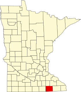
This is a list of the National Register of Historic Places listings in Mower County, Minnesota. It is intended to be a complete list of the properties and districts on the National Register of Historic Places in Mower County, Minnesota, United States. The locations of National Register properties and districts for which the latitude and longitude coordinates are included below, may be seen in an online map.

The Exchange State Bank in Grand Meadow, Minnesota, United States, is a Prairie School style building that was built in 1910. It was designed by architects Purcell & Elmslie. It has also been known as the First American State Bank. It was listed on the National Register of Historic Places in 1975.

Christiania Lutheran Free Church is a historic church in Eureka Township, Minnesota, United States. The church is located at 26690 Highview Avenue approximately nine miles (14 km) southwest of Farmington, Minnesota.

The Milroy State Bank Building is located in the small town of Milroy, Minnesota at the intersection of Superior Street and Euclid Avenue. The building was a former community bank built in 1902 by a group of businessmen from Springfield, Minnesota. It is nearly identical to the Clements State Bank Building in Clements, Minnesota representing the commercial investment of outsiders in a string of towns platted on a new railroad line, the Minnesota Western Branch of Chicago and North Western Railway.

The Western Union Building, formerly known as the Hagerty Block and currently as the Dacotah Prairie Museum, is a historic bank building in Aberdeen, South Dakota. It is individually listed on the National Register of Historic Places and is a contributing property to the Aberdeen Commercial Historic District.


